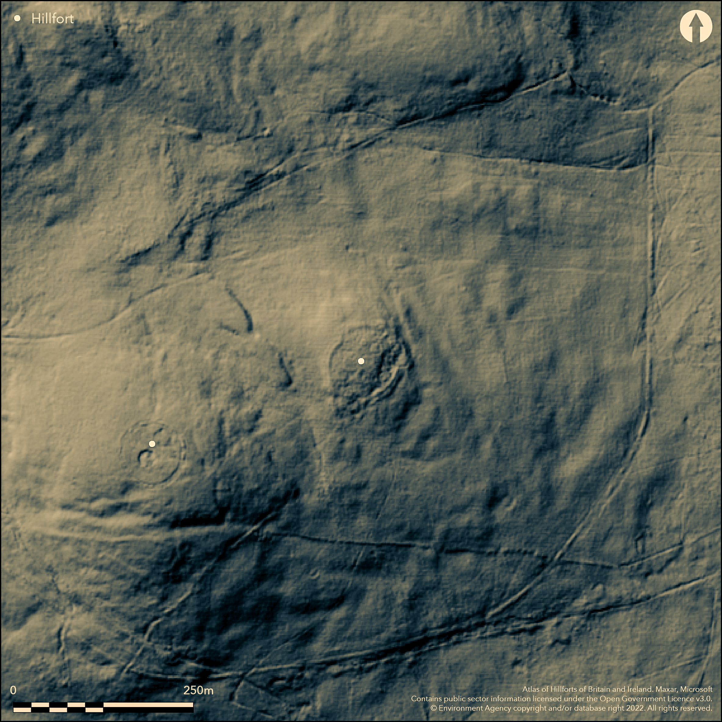
LiDAR 1m DTM Hillshade
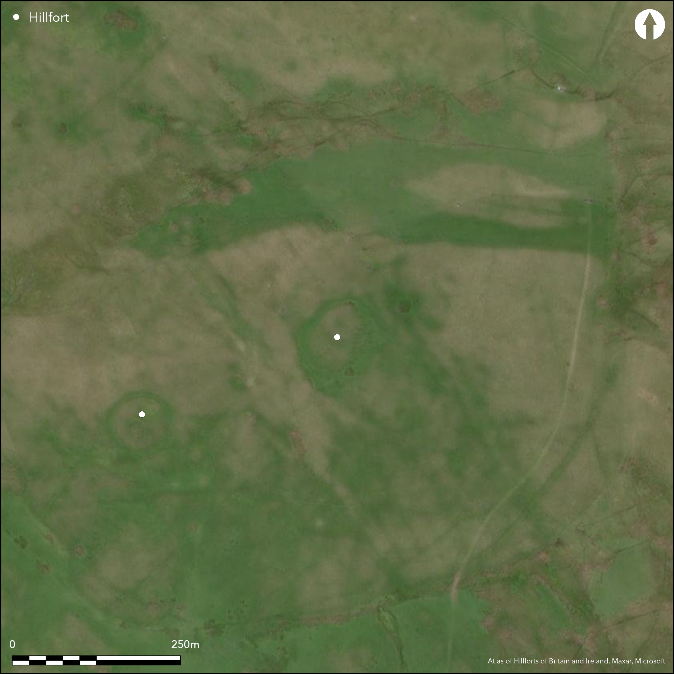
Satellite Imagery
LiDAR 1m DTM Hillshade
Satellite Imagery
Scroll left/right to view further images.
HER: Northumberland 1347 (None)
NMR: NT 91 SE 18 (2305)
SM: 1020254
NGR: NT 9723 1250
X: 397235 Y: 612505 (OSGB36)
Occupying the SE slopes of High Knowes at 360m OD and commanding views to the E, an oval palisaded enclosure of 0.23ha, lying approximately 115m to the NE of High Knowes A (Atlas No 4342). It measures 42m E-W by 65m transversely within a double palisade. Partial excavation in 1962-3 by Newcastle University (Jobey and Tait 1966) investigated the eastern side of the enclosure showing the palisades were set in trenches 1.5m apart and 0.46m wide and deep. An entrance is thought to lie in the SW. At least 19 timber hut circles were recorded surviving as shallow grooves representing slots for timber frames. A number of these were included in the investigation and stonework and a later stone-founded hut was uncovered, probably representing secondary occupation sometime after the use and abandonment of the palisaded enclosure. Small quantities of handmade pottery were recovered. Damaged in places, it now survives as a vegetation mark. It lies in an area of cairnfields and field systems. A prominent linear boundary, interpreted as the boundary bank of a prehistoric farm unit encloses approximately 38.5ha around High Knowes containing High Knowes A and B and what are considered to be associated field systems. The site is recorded as a settlement on 1976 1:10,500 OS mapping and scheduled in 1987.
Citizen Science: ✗
Reliability of Data: Confirmed
Reliability of Interpretation: Unconfirmed
X: -227672 Y: 7441163 (EPSG: 3857)
Longitude: -2.045211183392843 Latitude: 55.406502007120324 (EPSG:4326)
Country: England
Current County or Unitary Authority: Northumberland
Historic County: Northumberland
Current Parish/Community/Council/Townland: Alnham
Some damage has occurred
| Extant | ✓ |
| Cropmark | ✗ |
| Likely Destroyed | ✗ |
Grass moorland
| Woodland | ✗ |
| Commercial Forestry Plantation | ✗ |
| Parkland | ✗ |
| Pasture (Grazing) | ✗ |
| Arable | ✗ |
| Scrub/Bracken | ✗ |
| Bare Outcrop | ✗ |
| Heather/Moorland | ✓ |
| Heath | ✗ |
| Built-up | ✗ |
| Coastal Grassland | ✗ |
| Other | ✗ |
Palisaded enclosure, occupying the SW slopes of High Knowes at 360m OD and commanding views to the E
| Contour Fort | ✗ |
| Partial Contour Fort | ✗ |
| Promontory Fort | ✗ |
| Hillslope Fort | ✓ |
| Level Terrain Fort | ✗ |
| Marsh Fort | ✗ |
| Multiple Enclosure Fort | ✗ |
| Hilltop | ✗ |
| Coastal Promontory | ✗ |
| Inland Promontory | ✗ |
| Valley Bottom | ✗ |
| Knoll/Hillock/Outcrop | ✗ |
| Ridge | ✗ |
| Cliff/Plateau-edge/Scarp | ✗ |
| Hillslope | ✓ |
| Lowland | ✗ |
| Spur | ✗ |
Dominant Topographic Feature: SW slopes of High Knowes
| North | ✗ |
| Northeast | ✗ |
| East | ✗ |
| Southeast | ✓ |
| South | ✗ |
| Southwest | ✗ |
| West | ✗ |
| Northwest | ✗ |
| Level | ✗ |
Altitude: 360.0m
N/A
Overlying stone-founded settlement; small quantities of handmade pottery probably associated with later settlement
Reliability: B - Medium
| Pre 1200BC | ✗ |
| 1200BC - 800BC | ✓ |
| 800BC - 400BC | ✓ |
| 400BC - AD50 | ✓ |
| AD50 - AD400 | ✗ |
| AD400 - AD 800 | ✗ |
| Post AD800 | ✗ |
| Unknown | ✗ |
| Pre Hillfort: | None |
| Post Hillfort: | None |
| Artefactual: | Pottery |
Excavated in 1962-3; field investigations in 1969 and 1976. Recorded on 1976 1:10,500 OS mapping. Scheduled in 1987
| 1st Identified Written Reference (1966): | None |
| Other (1969): | OS Field investigation |
| 1st Identified Map Depiction (1976): | None |
| Other (1976): | OS Field investigation |
| Other (1987): | Scheduled |
| Excavation (None): | None |
At least 19 timber hut circles were recorded surviving as shallow grooves representing slots for timber frames. A number of these were included in the investigation and stonework and a later stone-founded hut was uncovered, probably representing secondary occupation sometime after the use and abandonment of the palisaded enclosure
None
| None | ✓ |
| Spring | ✗ |
| Stream | ✗ |
| Pool | ✗ |
| Flush | ✗ |
| Well | ✗ |
| Other | ✗ |
Single and double ring-grooves and ring-ditch houses
| No Known Features | ✓ |
| Round Stone Structures | ✓ |
| Rectangular Stone Structures | ✗ |
| Curvilinear Platforms | ✗ |
| Other Roundhouse Evidence | ✓ |
| Pits | ✗ |
| Quarry Hollows | ✗ |
| Other | ✗ |
None
| No Known Excavation | ✗ |
| Pits | ✗ |
| Postholes | ✗ |
| Roundhouses | ✓ |
| Rectangular Structures | ✗ |
| Roads/Tracks | ✗ |
| Quarry Hollows | ✗ |
| Other | ✗ |
| Nothing Found | ✗ |
None
| No Known Geophysics | ✓ |
| Pits | ✗ |
| Roundhouses | ✗ |
| Rectangular Structures | ✗ |
| Roads/Tracks | ✗ |
| Quarry Hollows | ✗ |
| Other | ✗ |
| Nothing Found | ✗ |
Probably associated with secondary occupation
| No Known Finds | ✓ |
| Pottery | ✓ |
| Metal | ✗ |
| Metalworking | ✗ |
| Human Bones | ✗ |
| Animal Bones | ✗ |
| Lithics | ✗ |
| Environmental | ✗ |
| Other | ✗ |
None
| APs Not Checked | ✗ |
| None | ✗ |
| Roundhouses | ✓ |
| Rectangular Structures | ✗ |
| Pits | ✗ |
| Postholes | ✗ |
| Roads/Tracks | ✗ |
| Other | ✗ |
An entrance is thought to lie in the SW
| 1: | None |
| 2: | None |
Guard Chambers: ✗
Chevaux de Frise: ✗
| 1. Simple Gap (South west): | None |
Oval palisaded enclosure of 0.23ha. It measures 42m E-W by 65m transversely within a double palisade. Partial excavation in 1962-3 showed the palisades were set 1.5m apart and were 0.46m wide and deep.
| Area 1: | 0.23ha. |
| Total: | 0.23ha. |
Total Footprint Area: Noneha.
None
| ✗ | None |
| ✓ | Damaged but survive as a vegetation mark, palisades |
| NE Quadrant: | 2 |
| SE Quadrant: | 2 |
| SW Quadrant: | 2 |
| NW Quadrant: | 2 |
| Total: | 2 |
| Partial Univallate | ✗ |
| Univallate | ✗ |
| Partial Bivallate | ✗ |
| Bivallate | ✓ |
| Partial Multivallate | ✗ |
| Multivallate | ✗ |
| Unknown | ✗ |
| Partial Univallate | ✗ |
| Univallate | ✗ |
| Partial Bivallate | ✗ |
| Bivallate | ✗ |
| Partial Multivallate | ✗ |
| Multivallate | ✗ |
None
| None | ✗ |
| Earthen Bank | ✗ |
| Stone Wall | ✗ |
| Rubble | ✗ |
| Wall-walk | ✗ |
| Evidence of Timber | ✗ |
| Vitrification | ✗ |
| Other Burning | ✗ |
| Palisade | ✓ |
| Counter Scarp Bank | ✗ |
| Berm | ✗ |
| Unfinished | ✗ |
| Other | ✗ |
None
| None | ✗ |
| Earthen Bank | ✗ |
| Stone Wall | ✗ |
| Murus Duplex | ✗ |
| Timber-framed | ✗ |
| Timber-laced | ✗ |
| Vitrification | ✗ |
| Other Burning | ✗ |
| Palisade | ✓ |
| Counter Scarp Bank | ✗ |
| Berm | ✗ |
| Unfinished | ✗ |
| No Known Excavation | ✗ |
| Other | ✗ |
| ✗ | None |
| ✗ | Palisade trenches |
Number of Ditches: 0
| ✗ | None |
Jobey, G and Tait, J 1966 Excavations on palisaded settlements and cairnfields at Alnham, Northumberland Archaeol Aeliana 4th series 44, 5-48.
Topping, P. and Pearson, T. 1988. The South-East Cheviots Project: A Descriptive Account of the Prehistoric Landscape. Research Department Report Series no. 83-2003. https://www.academia.edu/17310729/-2008-The-South-East-Cheviots-Project-a-descriptive-account-of-the-prehistoric-landscape. Accessed May 2016
Atlas of Hillforts:
Wikidata:
This work is licensed under CC BY-SA 4.0

 and should be cited as:
Lock, Gary and Ralston, Ian. 2024. Atlas of Hillforts of Britain and Ireland. Available at: https://hillforts.arch.ox.ac.uk
Document Version 1.1