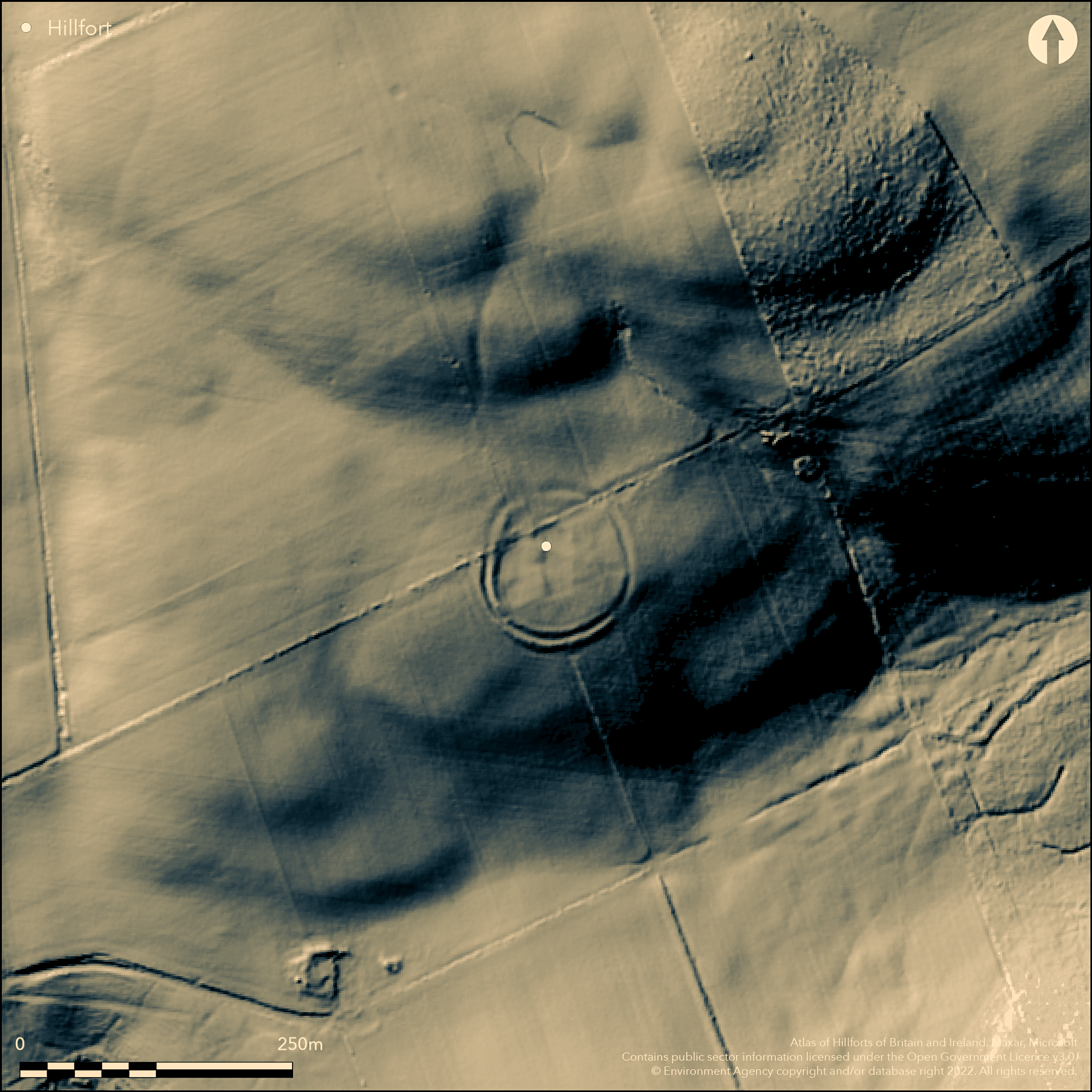
LiDAR 1m DTM Hillshade
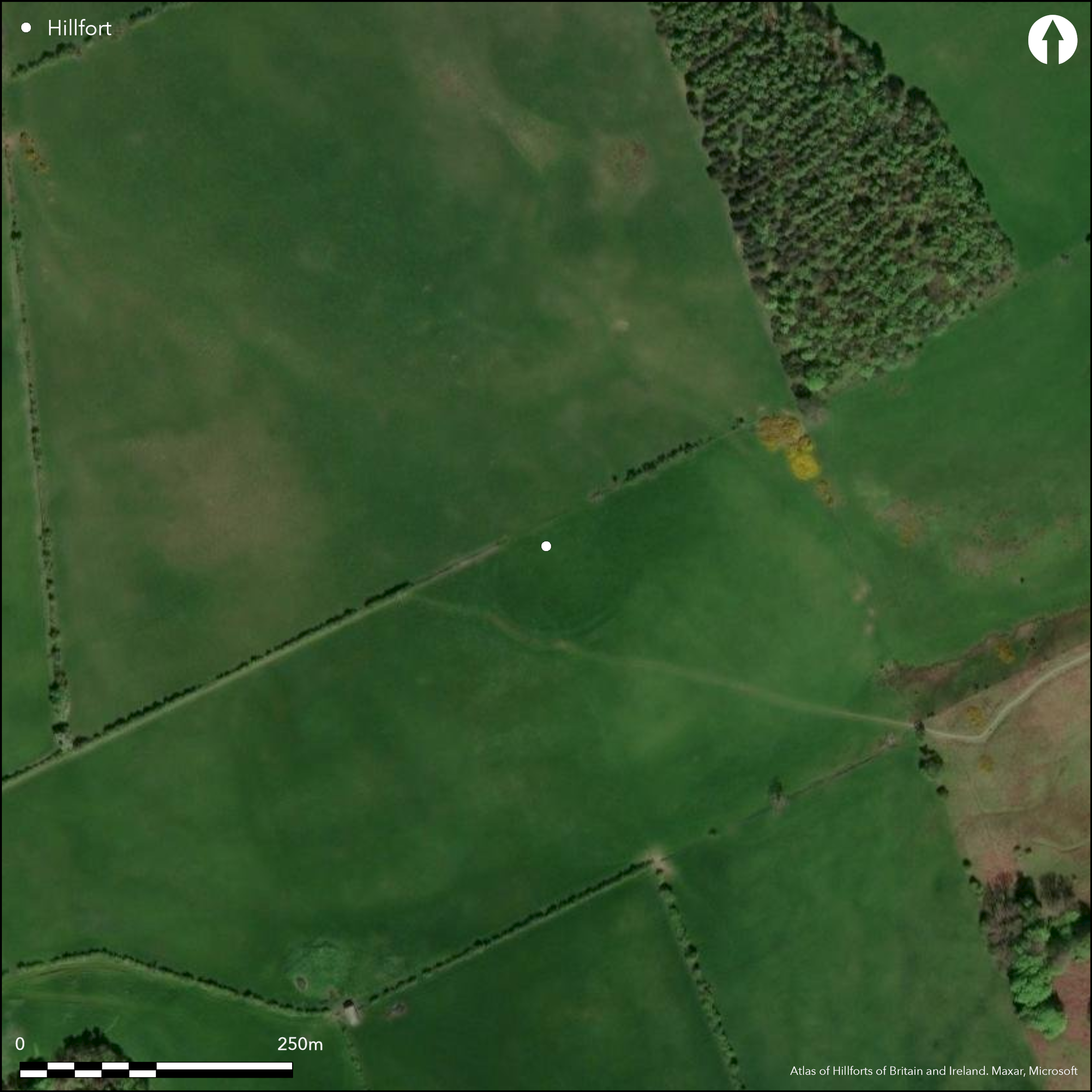
Satellite Imagery
LiDAR 1m DTM Hillshade
Satellite Imagery
Scroll left/right to view further images.
HER: Lake District National Park 1165 (None)
NMR: NY 42 SE 3 (11134)
SM: 1008633
NGR: NY 4512 2435
X: 345120 Y: 524368 (OSGB36)
To the NE of Wreay Farm, on the SE-facing slopes of Soulby Fell at 266m OD, a univallate enclosure, possibly a small hillfort. It measures approximately 65m in diameter enclosing 0.4ha, and is defined by an earth and stone bank 5m wide and 1m high, a ditch 5m wide and 0.5m deep and a counterscarp 5m wide and 2m high. Taylor (1870, 159) reported that the inner enclosure in the S and E had been bounded with blocks of stone but which had by then been taken away for building stone. Two sub-circular platforms approximately 8m in diameter are possibly the remains of house platforms. The location of entrances is not recorded. The site has been partially destroyed by ploughing and survives best in the S and W. Visible as a cropmark in the N on 2014 Google Earth satellite imagery. Scheduled as a defended enclosure, recorded on 1885-1900 OS mapping. Undated. .
Citizen Science: ✗
Reliability of Data: Confirmed
Reliability of Interpretation: Confirmed
X: -317399 Y: 7286826 (EPSG: 3857)
Longitude: -2.8512481627267596 Latitude: 54.61149028623054 (EPSG:4326)
Country: England; None
Current County or Unitary Authority: Cumbria
Historic County: Cumberland
Current Parish/Community/Council/Townland: Matterdale; Dacre
None
| Extant | ✓ |
| Cropmark | ✓ |
| Likely Destroyed | ✗ |
None
| Woodland | ✗ |
| Commercial Forestry Plantation | ✗ |
| Parkland | ✗ |
| Pasture (Grazing) | ✓ |
| Arable | ✗ |
| Scrub/Bracken | ✗ |
| Bare Outcrop | ✗ |
| Heather/Moorland | ✗ |
| Heath | ✗ |
| Built-up | ✗ |
| Coastal Grassland | ✗ |
| Other | ✗ |
A possible hillslope fort lying on the SE facing slopes of Soulby Fell at 266m OD.
| Contour Fort | ✗ |
| Partial Contour Fort | ✗ |
| Promontory Fort | ✗ |
| Hillslope Fort | ✓ |
| Level Terrain Fort | ✗ |
| Marsh Fort | ✗ |
| Multiple Enclosure Fort | ✗ |
| Hilltop | ✗ |
| Coastal Promontory | ✗ |
| Inland Promontory | ✗ |
| Valley Bottom | ✗ |
| Knoll/Hillock/Outcrop | ✗ |
| Ridge | ✗ |
| Cliff/Plateau-edge/Scarp | ✗ |
| Hillslope | ✓ |
| Lowland | ✗ |
| Spur | ✗ |
Dominant Topographic Feature: Hillslope
| North | ✗ |
| Northeast | ✗ |
| East | ✗ |
| Southeast | ✓ |
| South | ✗ |
| Southwest | ✗ |
| West | ✗ |
| Northwest | ✗ |
| Level | ✗ |
Altitude: 226.0m
Parish boundary between Matterdale and Dacre lies 100m to the E
Boundary Type: Parish/Townland
The site is undated
Reliability: D - None
| Pre 1200BC | ✗ |
| 1200BC - 800BC | ✗ |
| 800BC - 400BC | ✗ |
| 400BC - AD50 | ✗ |
| AD50 - AD400 | ✗ |
| AD400 - AD 800 | ✗ |
| Post AD800 | ✗ |
| Unknown | ✓ |
| Pre Hillfort: | None |
| Post Hillfort: | None |
General reference in Taylor 1870, Recorded on 1885-1900 OS mapping. Field investigation in 1968. Scheduled.
| 1st Identified Written Reference (1870): | None |
| Other (1924): | Scheduled |
| Other (1968): | Field investigation |
| 1st Identified Map Depiction (None): | None |
Two sub-circular platforms approximately 8m in diameter are possibly the remains of house platforms
A spring lies outside the enclosure to the NE
| None | ✓ |
| Spring | ✗ |
| Stream | ✗ |
| Pool | ✗ |
| Flush | ✗ |
| Well | ✗ |
| Other | ✗ |
None
| No Known Features | ✓ |
| Round Stone Structures | ✗ |
| Rectangular Stone Structures | ✗ |
| Curvilinear Platforms | ✓ |
| Other Roundhouse Evidence | ✗ |
| Pits | ✗ |
| Quarry Hollows | ✗ |
| Other | ✗ |
None
| No Known Excavation | ✓ |
| Pits | ✗ |
| Postholes | ✗ |
| Roundhouses | ✗ |
| Rectangular Structures | ✗ |
| Roads/Tracks | ✗ |
| Quarry Hollows | ✗ |
| Other | ✗ |
| Nothing Found | ✗ |
None
| No Known Geophysics | ✓ |
| Pits | ✗ |
| Roundhouses | ✗ |
| Rectangular Structures | ✗ |
| Roads/Tracks | ✗ |
| Quarry Hollows | ✗ |
| Other | ✗ |
| Nothing Found | ✗ |
None
| No Known Finds | ✓ |
| Pottery | ✗ |
| Metal | ✗ |
| Metalworking | ✗ |
| Human Bones | ✗ |
| Animal Bones | ✗ |
| Lithics | ✗ |
| Environmental | ✗ |
| Other | ✗ |
None
| APs Not Checked | ✓ |
| None | ✗ |
| Roundhouses | ✗ |
| Rectangular Structures | ✗ |
| Pits | ✗ |
| Postholes | ✗ |
| Roads/Tracks | ✗ |
| Other | ✗ |
The location of entrances is not recorded
| None: | None |
| 2: | None |
Guard Chambers: ✗
Chevaux de Frise: ✗
Univallate enclosure measuring approximately 65m in diameter enclosing 0.4ha. Defined by an earth and stone bank 5m wide and 1m high, a ditch 5m wide and 0.5m deep and a counterscarp 5m wide and 2m high. Taylor (1870, 159) reported that the inner enclosure in the S and E had been bounded with blocks of stone
| Area 1: | 0.4ha. |
| Total: | 0.4ha. |
Total Footprint Area: Noneha.
None
| ✗ | None |
| ✓ | None |
| NE Quadrant: | 1 |
| SE Quadrant: | 1 |
| SW Quadrant: | 1 |
| NW Quadrant: | 1 |
| Total: | 1 |
| Partial Univallate | ✗ |
| Univallate | ✓ |
| Partial Bivallate | ✗ |
| Bivallate | ✗ |
| Partial Multivallate | ✗ |
| Multivallate | ✗ |
| Unknown | ✗ |
| Partial Univallate | ✗ |
| Univallate | ✗ |
| Partial Bivallate | ✗ |
| Bivallate | ✗ |
| Partial Multivallate | ✗ |
| Multivallate | ✗ |
None
| None | ✗ |
| Earthen Bank | ✓ |
| Stone Wall | ✗ |
| Rubble | ✓ |
| Wall-walk | ✗ |
| Evidence of Timber | ✗ |
| Vitrification | ✗ |
| Other Burning | ✗ |
| Palisade | ✗ |
| Counter Scarp Bank | ✓ |
| Berm | ✗ |
| Unfinished | ✗ |
| Other | ✗ |
None
| None | ✗ |
| Earthen Bank | ✗ |
| Stone Wall | ✗ |
| Murus Duplex | ✗ |
| Timber-framed | ✗ |
| Timber-laced | ✗ |
| Vitrification | ✗ |
| Other Burning | ✗ |
| Palisade | ✗ |
| Counter Scarp Bank | ✗ |
| Berm | ✗ |
| Unfinished | ✗ |
| No Known Excavation | ✓ |
| Other | ✗ |
| ✗ | None |
| ✓ | None |
Number of Ditches: 1
| ✗ | None |
Challis A.J. and Harding D.W. 1975. Later prehistory from the Trent to the Tyne; BAR British Series 1 (1974) - 20(ii), 51
Maclean, H. 1912. Caerthannoc or Maidencastle, Soulby Fell. Trans Cumberland and Westmoreland Antiq Arch Soc. new ser.'XII, (1912), 143-6
Taylor, M. W. 1870. On the Vestiges of Celtic Occupation Near Ullswater. Trans Cumberland and Westmorland Antiq Arch Soc . Vol.1 (1870),159-164
Atlas of Hillforts:
Wikidata:
This work is licensed under CC BY-SA 4.0

 and should be cited as:
Lock, Gary and Ralston, Ian. 2024. Atlas of Hillforts of Britain and Ireland. Available at: https://hillforts.arch.ox.ac.uk
Document Version 1.1