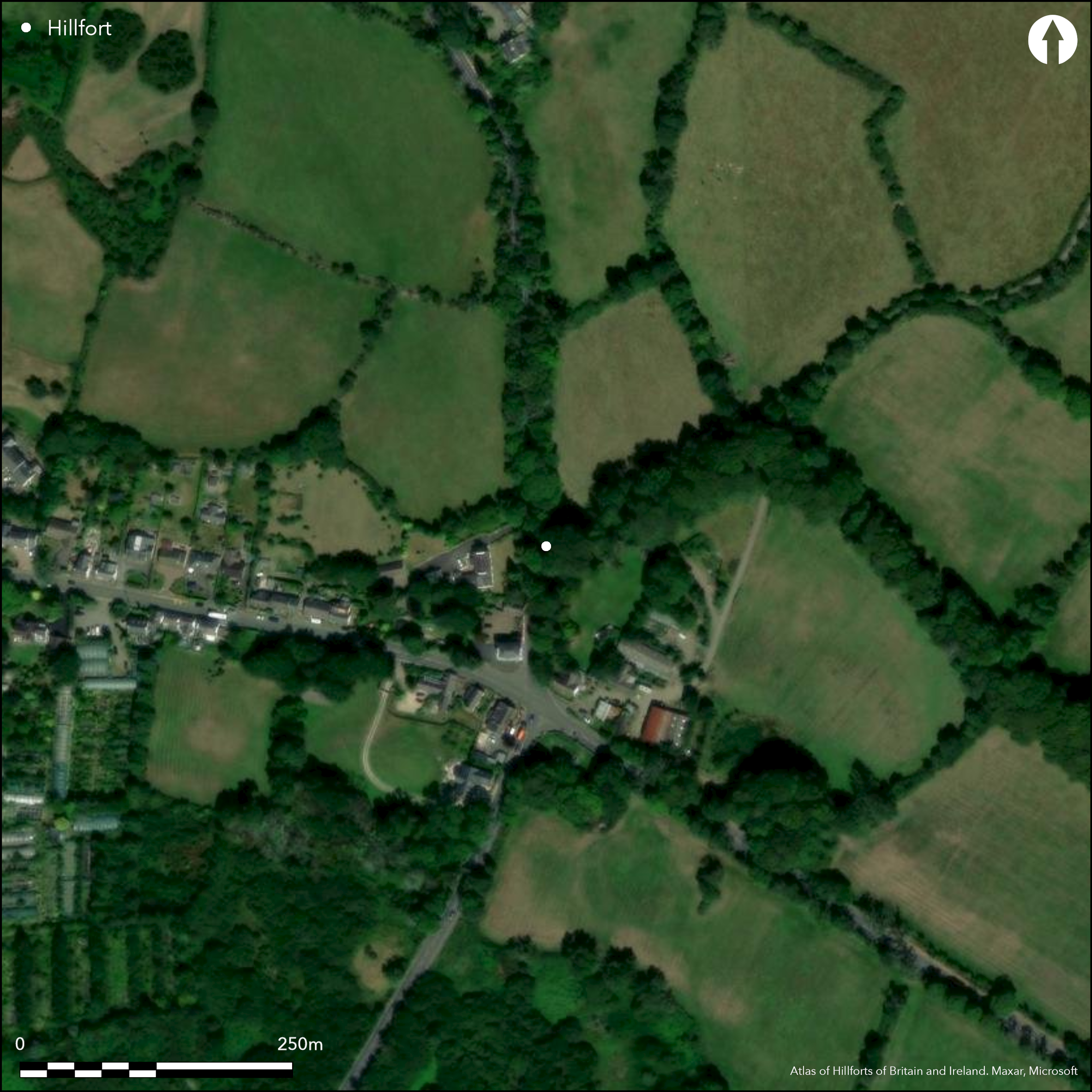
Satellite Imagery
Satellite Imagery
HER: Isle of Man No record found (None)
NMR: None (None)
SM: None
NGR: SC28608180
X: 228626 Y: 481829 (OSGB36)
Small, possible settlement/defended enclosure or level terrain fort, located in lowland, marshy, conditions just above stream and River Neb to S and SW and below higher ground to NE. Slightly sloping to SW. Road cuts through the centre of it. Defined by a raised mound, 33m diameter, with low bank and shallow ditch beyond at c. 47m diameter, with further small bank, and ditch now buried in peat, at c. 80m diameter. Not completed extensive excavation by Gelling 1973-81. Trench cut in SW of site by Centre for Manx Studies, University of Liverpool 2000 and NW interior examined 2010 (Mytum 2014). C14 dates from 2000 and 2010 data of 2nd century BC - 1st century AD initial phase with reoccupation and raising of interior 7th and into 8th century AD (supported by pottery). Gelling identified rebuilt circular structures in centre of site. Evidence of palisades, hearth, postholes, Iron slag, burnt animal bone and charcoal from 2010 excavations. Site rough grass and scrub with trees. Little visible with low banks. Bisected by main road NE-S. On 1st Ed OS map (1885-1900).
Citizen Science: ✗
Reliability of Data: Confirmed
Reliability of Interpretation: Unconfirmed
X: -515300 Y: 7208789 (EPSG: 3857)
Longitude: -4.62901595334227 Latitude: 54.20348968919966 (EPSG:4326)
Country: Isle of Man
Current County or Unitary Authority: Glenfaba
Historic County: Glenfaba
Current Parish/Community/Council/Townland: German
Little visible with very low banks. Bisected by main A3 Castletown to Ramsey road NE-S.
| Extant | ✓ |
| Cropmark | ✗ |
| Likely Destroyed | ✗ |
Rough grass and scrub with trees. Main road.
| Woodland | ✗ |
| Commercial Forestry Plantation | ✗ |
| Parkland | ✗ |
| Pasture (Grazing) | ✗ |
| Arable | ✗ |
| Scrub/Bracken | ✓ |
| Bare Outcrop | ✗ |
| Heather/Moorland | ✗ |
| Heath | ✗ |
| Built-up | ✗ |
| Coastal Grassland | ✗ |
| Other | ✓ |
Small, possible settlement/defended enclosure or level terrain fort, located in lowland, marshy, conditions just above stream and River Neb to S and SW and below higher ground to NE. Slightly sloping to SW.
| Contour Fort | ✗ |
| Partial Contour Fort | ✗ |
| Promontory Fort | ✗ |
| Hillslope Fort | ✗ |
| Level Terrain Fort | ✓ |
| Marsh Fort | ✗ |
| Multiple Enclosure Fort | ✗ |
| Hilltop | ✗ |
| Coastal Promontory | ✗ |
| Inland Promontory | ✗ |
| Valley Bottom | ✗ |
| Knoll/Hillock/Outcrop | ✗ |
| Ridge | ✗ |
| Cliff/Plateau-edge/Scarp | ✗ |
| Hillslope | ✗ |
| Lowland | ✓ |
| Spur | ✗ |
Dominant Topographic Feature: Raised mound.
| North | ✗ |
| Northeast | ✗ |
| East | ✗ |
| Southeast | ✗ |
| South | ✗ |
| Southwest | ✓ |
| West | ✗ |
| Northwest | ✗ |
| Level | ✗ |
Altitude: 49.0m
N/A
Iron Age with early medieval re-use. C14 dates of 2nd century BC - 1st century AD initial phase, with reoccupation and raising of interior 7th and into 8th century AD (supported by pottery).
Reliability: B - Medium
| Pre 1200BC | ✗ |
| 1200BC - 800BC | ✗ |
| 800BC - 400BC | ✗ |
| 400BC - AD50 | ✓ |
| AD50 - AD400 | ✗ |
| AD400 - AD 800 | ✓ |
| Post AD800 | ✗ |
| Unknown | ✗ |
| Pre Hillfort: | None |
| Post Hillfort: | None |
| Artefactual: | Pottery support dates. |
| C14: | 2nd century BC - 1st century AD initial phase with re-occupation and raising of interior 7th and into 8th century AD. |
On 1st Ed OS map (1885-1900). Unfinished extensive excavation by P.S. Gelling 1973-81. Trench cut in SW of site by Centre for Manx Studies, University of Liverpool 2000 and NW interior examined 2010.
| Excavation (2010): | Trench cut in SW of site by Centre for Manx Studies, University of Liverpool 2000 and NW interior examined. |
| Other (2015): | Visited by Hillfort Study Group |
| 1st Identified Map Depiction (None): | None |
| Excavation (None): | P.S. Gelling (unfinished). |
Gelling identified rebuilt circular structures in centre of site. Hearth, postholes, Iron slag, burnt animal bone and charcoal from 2010 excavations.
None
| None | ✓ |
| Spring | ✗ |
| Stream | ✗ |
| Pool | ✗ |
| Flush | ✗ |
| Well | ✗ |
| Other | ✗ |
None
| No Known Features | ✓ |
| Round Stone Structures | ✗ |
| Rectangular Stone Structures | ✗ |
| Curvilinear Platforms | ✗ |
| Other Roundhouse Evidence | ✗ |
| Pits | ✗ |
| Quarry Hollows | ✗ |
| Other | ✗ |
Gelling identified rebuilt circular structures in centre of site. Hearth and postholes from 2010 excavations.
| No Known Excavation | ✗ |
| Pits | ✗ |
| Postholes | ✓ |
| Roundhouses | ✓ |
| Rectangular Structures | ✗ |
| Roads/Tracks | ✗ |
| Quarry Hollows | ✗ |
| Other | ✓ |
| Nothing Found | ✗ |
None
| No Known Geophysics | ✓ |
| Pits | ✗ |
| Roundhouses | ✗ |
| Rectangular Structures | ✗ |
| Roads/Tracks | ✗ |
| Quarry Hollows | ✗ |
| Other | ✗ |
| Nothing Found | ✗ |
Iron slag, burnt animal bone and charcoal.
| No Known Finds | ✗ |
| Pottery | ✓ |
| Metal | ✗ |
| Metalworking | ✓ |
| Human Bones | ✗ |
| Animal Bones | ✓ |
| Lithics | ✗ |
| Environmental | ✓ |
| Other | ✗ |
None
| APs Not Checked | ✓ |
| None | ✗ |
| Roundhouses | ✗ |
| Rectangular Structures | ✗ |
| Pits | ✗ |
| Postholes | ✗ |
| Roads/Tracks | ✗ |
| Other | ✗ |
No details.
| 0: | None |
| 2: | None |
Guard Chambers: ✗
Chevaux de Frise: ✗
Defined by a raised mound, 33m diameter, with low bank and shallow ditch beyond at c. 47m diameter, with further small bank and ditch, now buried in peat, at c. 80m diameter.
| Area 1: | Noneha. |
| Total: | Noneha. |
Total Footprint Area: Noneha.
None
| ✓ | Area not defined. Site possibly phased occupation, but no direct evidence for this. |
| ✓ | None |
| NE Quadrant: | 2 |
| SE Quadrant: | 2 |
| SW Quadrant: | 2 |
| NW Quadrant: | 2 |
| Total: | 2 |
| Partial Univallate | ✗ |
| Univallate | ✗ |
| Partial Bivallate | ✗ |
| Bivallate | ✓ |
| Partial Multivallate | ✗ |
| Multivallate | ✗ |
| Unknown | ✗ |
| Partial Univallate | ✗ |
| Univallate | ✗ |
| Partial Bivallate | ✗ |
| Bivallate | ✗ |
| Partial Multivallate | ✗ |
| Multivallate | ✗ |
None
| None | ✗ |
| Earthen Bank | ✓ |
| Stone Wall | ✗ |
| Rubble | ✗ |
| Wall-walk | ✗ |
| Evidence of Timber | ✗ |
| Vitrification | ✗ |
| Other Burning | ✗ |
| Palisade | ✗ |
| Counter Scarp Bank | ✗ |
| Berm | ✗ |
| Unfinished | ✗ |
| Other | ✗ |
Palisades on top of bank.
| None | ✗ |
| Earthen Bank | ✓ |
| Stone Wall | ✗ |
| Murus Duplex | ✗ |
| Timber-framed | ✗ |
| Timber-laced | ✗ |
| Vitrification | ✗ |
| Other Burning | ✗ |
| Palisade | ✓ |
| Counter Scarp Bank | ✗ |
| Berm | ✗ |
| Unfinished | ✗ |
| No Known Excavation | ✗ |
| Other | ✗ |
| ✗ | None |
| ✓ | None |
Number of Ditches: 2
| ✗ | None |
Herbert, L. 2012. Port y Candas. A Manx site with similarities to Irish ringforts. Manitoba Archaeology, 30, 1-8.
Mytum, H. 2014. Excavations at the Iron Age and Early Medieval Settlement of Port y Candas, German, Proc Isle of Man Nat Antiq Soc, 12.4, 650-665.
Atlas of Hillforts:
Wikidata:
This work is licensed under CC BY-SA 4.0

 and should be cited as:
Lock, Gary and Ralston, Ian. 2024. Atlas of Hillforts of Britain and Ireland. Available at: https://hillforts.arch.ox.ac.uk
Document Version 1.1