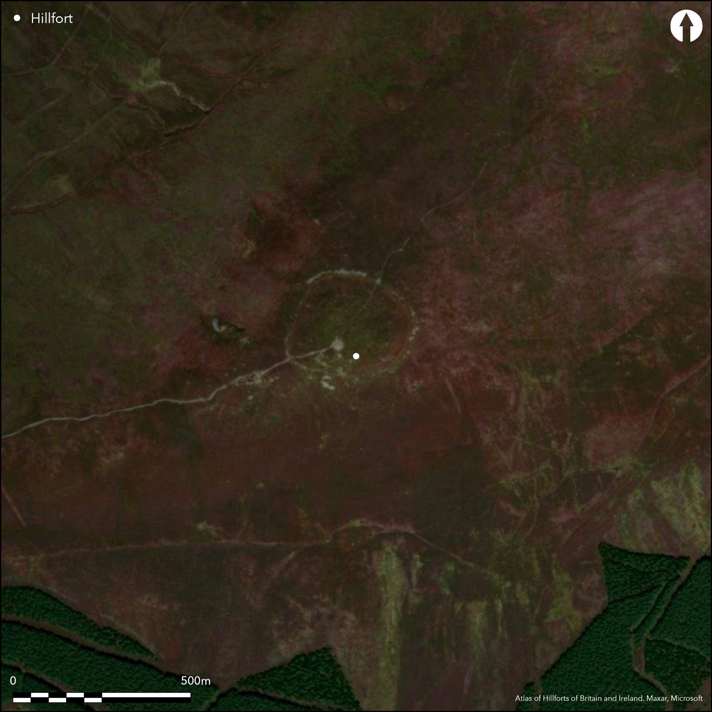
Satellite Imagery
Satellite Imagery
HER: Isle of Man 116 (None)
NMR: SC27NE 10 (30124)
SM: None
NGR: SC258759
X: 225800 Y: 475900 (OSGB36)
Large and commanding and very exposed contour hillfort located on the summit of South Barrule, at 585m O.D. the principal and highest hillfort of the Isle of Man. Very steep or steep surrounding slopes, slightly less on NE. Measures c. 325m N-S by c. 360m E-W, with internal area c. 11.7ha. Defined by two widely spaced ramparts, inner possibly robbed to provide material for outer. Excavations by P.S. Gelling 1960-61 and 1968, including sections through the inner and outer ramparts to N. Outer rampart more substantial, c. 3m wide, composed of large slabs, rubble and turf, with vertical dry-stone face on outside. Inner rampart faint. No outer ditch. Faces still visible where 1961 excavation. Notable for inner rampart strengthened by timber chevaux de frise of four or five rows of posts. The inner line is the greater, with posts almost upright, the outer lines inclined progressively outwards. Slightly inturned gap on ENE possible original main gate with small postern entrance on NW. Gelling found c. 80 circular hut emplacements in the interior, investigating four during his excavations. C.14 date of 523+84 (uncalibrated) came from a second phase hearth in Hut D which was excavated in 1968. This date and the structures in general cannot be directly related to either rampart (Mytum pers. comm. 2015). Quantity of fairly coarse, flat-rimmed and bucket-shaped pottery found, probably late Bronze Age from same hut. Recent LiDar imagery by Centre for Manx Studies, University of Liverpool, suggests a greater number of such structures within the interior with 174 identified. The heather and other moorland vegetation make interpretation difficult. Generally site well-preserved. On 1st Ed. OS map (1867-68).
Citizen Science: ✗
Reliability of Data: Confirmed
Reliability of Interpretation: Confirmed
X: -519735 Y: 7198484 (EPSG: 3857)
Longitude: -4.66886110057022 Latitude: 54.14930758595581 (EPSG:4326)
Country: Isle of Man
Current County or Unitary Authority: Rushen
Historic County: Rushen
Current Parish/Community/Council/Townland: Malew
Generally site well-preserved.
| Extant | ✓ |
| Cropmark | ✗ |
| Likely Destroyed | ✗ |
Moorland with bare rock outcrops.
| Woodland | ✗ |
| Commercial Forestry Plantation | ✗ |
| Parkland | ✗ |
| Pasture (Grazing) | ✗ |
| Arable | ✗ |
| Scrub/Bracken | ✗ |
| Bare Outcrop | ✗ |
| Heather/Moorland | ✓ |
| Heath | ✗ |
| Built-up | ✗ |
| Coastal Grassland | ✗ |
| Other | ✗ |
Large and commanding and very exposed contour hillfort located on the summit of South Barrule, at 585m O.D. the principal and highest hillfort of the Isle of Man. Very steep or steep surrounding slopes, slightly less on NE.
| Contour Fort | ✓ |
| Partial Contour Fort | ✗ |
| Promontory Fort | ✗ |
| Hillslope Fort | ✗ |
| Level Terrain Fort | ✗ |
| Marsh Fort | ✗ |
| Multiple Enclosure Fort | ✗ |
| Hilltop | ✓ |
| Coastal Promontory | ✗ |
| Inland Promontory | ✗ |
| Valley Bottom | ✗ |
| Knoll/Hillock/Outcrop | ✗ |
| Ridge | ✗ |
| Cliff/Plateau-edge/Scarp | ✗ |
| Hillslope | ✗ |
| Lowland | ✗ |
| Spur | ✗ |
Dominant Topographic Feature: Hill top
| North | ✗ |
| Northeast | ✗ |
| East | ✗ |
| Southeast | ✗ |
| South | ✗ |
| Southwest | ✗ |
| West | ✗ |
| Northwest | ✗ |
| Level | ✓ |
Altitude: 586.0m
N/A
C.14 date of 523+84 (uncalibrated) came from a second phase hearth in Hut D which was excavated in 1968. Late Bronze Age pottery.
Reliability: B - Medium
| Pre 1200BC | ✗ |
| 1200BC - 800BC | ✓ |
| 800BC - 400BC | ✓ |
| 400BC - AD50 | ✗ |
| AD50 - AD400 | ✗ |
| AD400 - AD 800 | ✗ |
| Post AD800 | ✗ |
| Unknown | ✗ |
| Pre Hillfort: | None |
| Post Hillfort: | None |
| Artefactual: | Late Bronze Age pottery. |
| C14: | C.14 date of 523+84 (uncalibrated) came from a second phase hearth in Hut D which was excavated in 1968. |
On 1st Ed. OS map (1867-68). Limited excavations by P.S. Gelling 1960-61 and 1968. Recent LiDar survey Centre for Manx Studies, University of Liverpool c. 2013.
| Other (1995): | Visited by Hillfort Study Group |
| Other (2015): | Visited by Hillfort Study Group |
| 1st Identified Map Depiction (None): | OS map. |
| Excavation (None): | P.S. Gelling. |
| LiDAR Survey (None): | Centre for Manx Studies, University of Liverpool. |
Heather makes hut sites difficult to see on site, but some are visible, but show well from air and LiDar. Gelling investigated 4 hut sites. Quantity of fairly coarse, flat-rimmed and bucket-shaped pottery found, probably late Bronze Age from Hut D. Recent LiDar survey found 174 hut sites.
None
| None | ✓ |
| Spring | ✗ |
| Stream | ✗ |
| Pool | ✗ |
| Flush | ✗ |
| Well | ✗ |
| Other | ✗ |
Heather makes hut sites difficult to see, but some are visible.
| No Known Features | ✗ |
| Round Stone Structures | ✗ |
| Rectangular Stone Structures | ✗ |
| Curvilinear Platforms | ✓ |
| Other Roundhouse Evidence | ✗ |
| Pits | ✗ |
| Quarry Hollows | ✗ |
| Other | ✗ |
Gelling investigated 4 hut sites.
| No Known Excavation | ✗ |
| Pits | ✗ |
| Postholes | ✗ |
| Roundhouses | ✓ |
| Rectangular Structures | ✗ |
| Roads/Tracks | ✗ |
| Quarry Hollows | ✗ |
| Other | ✗ |
| Nothing Found | ✗ |
None
| No Known Geophysics | ✓ |
| Pits | ✗ |
| Roundhouses | ✗ |
| Rectangular Structures | ✗ |
| Roads/Tracks | ✗ |
| Quarry Hollows | ✗ |
| Other | ✗ |
| Nothing Found | ✗ |
Quantity of fairly coarse, flat-rimmed and bucket-shaped pottery found, probably late Bronze Age from Hut D.
| No Known Finds | ✗ |
| Pottery | ✓ |
| Metal | ✗ |
| Metalworking | ✗ |
| Human Bones | ✗ |
| Animal Bones | ✗ |
| Lithics | ✗ |
| Environmental | ✗ |
| Other | ✗ |
Hut sites show well from air. Recent LiDar survey found 174 hut sites.
| APs Not Checked | ✗ |
| None | ✗ |
| Roundhouses | ✓ |
| Rectangular Structures | ✗ |
| Pits | ✗ |
| Postholes | ✗ |
| Roads/Tracks | ✗ |
| Other | ✗ |
Slightly inturned gap on ENE possible original main gate with small postern entrance on NW. Notable for inner rampart strengthened by timber chevaux-de-frise of four or five rows of posts. The inner line is the greater, with posts almost upright, the outer lines inclined progressively outwards.
| 2: | None |
| 2: | None |
Guard Chambers: ✗
Chevaux de Frise: ✓
Notable for inner rampart strengthened by timber chevaux de frise of four or five rows of posts. The inner line is the greater, with posts almost upright, the outer lines inclined progressively outwards.
| 1. In-turned (East): | Probable main gate. |
| 2. Simple Gap (North west): | Postern gate. |
Defined by two widely spaced ramparts, inner possibly robbed to provide material for outer. Excavations by P.S. Gelling 1960-61 and 1968, including sections through the inner and outer ramparts to N. Outer rampart more substantial, c. 3m wide, composed of large slabs, rubble and turf, with vertical dry-stone face on outside. Inner rampart faint. No outer ditch. Faces still visible where 1961 excavation.
| Area 1: | 11.7ha. |
| Total: | 11.7ha. |
Total Footprint Area: Noneha.
None
| ✗ | None |
| ✓ | None |
| NE Quadrant: | 2 |
| SE Quadrant: | 2 |
| SW Quadrant: | 2 |
| NW Quadrant: | 2 |
| Total: | 2 |
| Partial Univallate | ✗ |
| Univallate | ✗ |
| Partial Bivallate | ✗ |
| Bivallate | ✓ |
| Partial Multivallate | ✗ |
| Multivallate | ✗ |
| Unknown | ✗ |
| Partial Univallate | ✗ |
| Univallate | ✗ |
| Partial Bivallate | ✗ |
| Bivallate | ✗ |
| Partial Multivallate | ✗ |
| Multivallate | ✗ |
Stone-walled site.
| None | ✗ |
| Earthen Bank | ✗ |
| Stone Wall | ✓ |
| Rubble | ✗ |
| Wall-walk | ✗ |
| Evidence of Timber | ✗ |
| Vitrification | ✗ |
| Other Burning | ✗ |
| Palisade | ✗ |
| Counter Scarp Bank | ✗ |
| Berm | ✗ |
| Unfinished | ✗ |
| Other | ✗ |
Outer rampart more substantial, c. 3m wide, composed of large slabs, rubble and turf, with vertical dry-stone face on outside.
| None | ✗ |
| Earthen Bank | ✗ |
| Stone Wall | ✓ |
| Murus Duplex | ✗ |
| Timber-framed | ✗ |
| Timber-laced | ✗ |
| Vitrification | ✗ |
| Other Burning | ✗ |
| Palisade | ✗ |
| Counter Scarp Bank | ✗ |
| Berm | ✗ |
| Unfinished | ✗ |
| No Known Excavation | ✗ |
| Other | ✗ |
| ✗ | None |
| ✗ | No outer ditch. |
Number of Ditches: 0
| ✗ | None |
Brown, I. 2009. Beacons in the landscape. The hillforts of England and Wales, Oxford: Windgather Press/Oxbow Books.
Gelling, P.S. 1963. Excavations at the hill-fort on South Barrule, Isle of Man , Proc Isle of Man Nat Hist Antiq Soc, 6.3, 313-23.
Gelling, P.S. 1970, The South Barrule hill-fort reconsidered, J Manx Museum, 145,47.
Atlas of Hillforts:
Wikidata:
This work is licensed under CC BY-SA 4.0

 and should be cited as:
Lock, Gary and Ralston, Ian. 2024. Atlas of Hillforts of Britain and Ireland. Available at: https://hillforts.arch.ox.ac.uk
Document Version 1.1