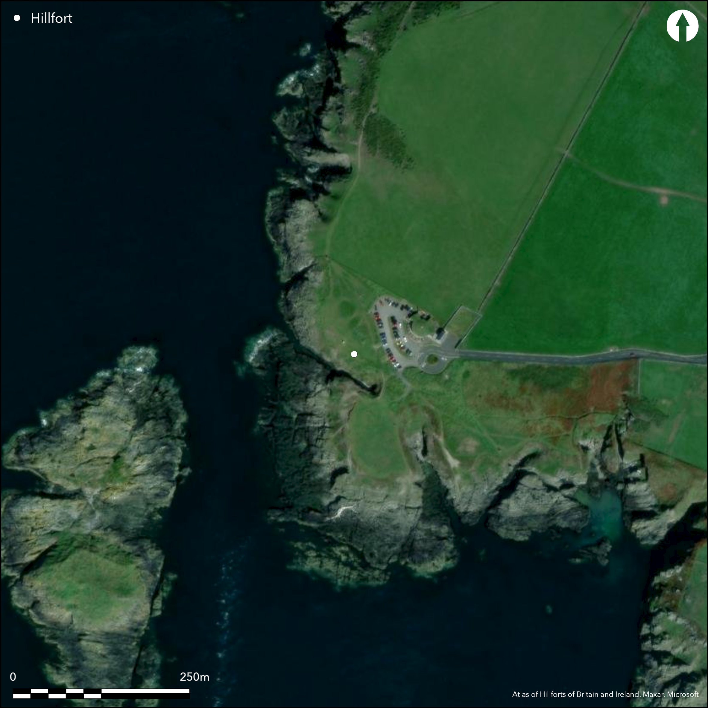
Satellite Imagery
Satellite Imagery
HER: Isle of Man 175 (None)
NMR: None (None)
SM: None
NGR: SC173667
X: 217300 Y: 466700 (OSGB36)
Small coastal promontory fort located on low SSW-facing promontory, only 6m above sea level, opposite Little Sound, Calf Sound and Calf of Man offshore to SW. Steep low rocks to sea on S and W, moderate inland to NE. Overlooked from surrounding land and Burroo Ned fort (Atlas No 3228) to SE. Internal area not defined. Site uses steep rocky drop to Little Sound on SW, W and NW, and small natural gullies (re-entrants) on NE and S act as additional definition. Across the narrow gap remaining on NE series of three banks and ditches cut off the promontory, the landward surrounds higher, the interior falling to sea to W. Of the three banks, the part-destroyed outer is c. 2.9m wide and to 1,6m high internally and to 1.1m high external. It has ditches on both sides, but the outer now shallow and c. 0.3m deep. The medial bank has similar proportions, but the inner bank is ploughed-down and fragmentary. Causeway, 3.3m wide, on NE across ditch between middle and outer ramparts indicate probable original entrance. There are no traces of habitation in interior. Trial trench opened by University of Liverpool 2002 finding slight indications of a causeway and piece of charcoal C14 dated to early medieval Norse period. The inner bank carried a palisade. Typology indicated an Iron Age promontory fort, but the C14 dating shows possible comparisons with other promontory forts with medieval dating: Cronk ny Merriu, Close ny Collagh, Cass ny Hawin and Vowlan. Popular public access site, with 19th century cafe damaging ramparts, now demolished and site restored by Manx Natural Heritage after investigation. New cafe, centre and car park immediately to landward. Amenity coastal grassland, Banks now much lowered. On 1st Ed. OS map (1867-9).
Citizen Science: ✗
Reliability of Data: Confirmed
Reliability of Interpretation: Confirmed
X: -533586 Y: 7182242 (EPSG: 3857)
Longitude: -4.793285848665062 Latitude: 54.06376607206392 (EPSG:4326)
Country: Isle of Man
Current County or Unitary Authority: Rushen
Historic County: Rushen
Current Parish/Community/Council/Townland: Rushen
Public open space site. Banks well-preserved, but susceptible to visitor pressure. Restored by Manx Natural Heritage with interpretation panel. Amenity buildings and car park close by.
| Extant | ✓ |
| Cropmark | ✗ |
| Likely Destroyed | ✗ |
Amenity coastal grassland
| Woodland | ✗ |
| Commercial Forestry Plantation | ✗ |
| Parkland | ✗ |
| Pasture (Grazing) | ✗ |
| Arable | ✗ |
| Scrub/Bracken | ✗ |
| Bare Outcrop | ✗ |
| Heather/Moorland | ✗ |
| Heath | ✗ |
| Built-up | ✗ |
| Coastal Grassland | ✓ |
| Other | ✗ |
Small coastal promontory fort located on low SSW-facing promontory, only 6m above sea level, opposite Little Sound, Calf Sound and Calf of Man offshore to SW. Steep low rocks to sea on S and W, moderate inland to NE. Overlooked from surrounding land.
| Contour Fort | ✗ |
| Partial Contour Fort | ✗ |
| Promontory Fort | ✓ |
| Hillslope Fort | ✗ |
| Level Terrain Fort | ✗ |
| Marsh Fort | ✗ |
| Multiple Enclosure Fort | ✗ |
| Hilltop | ✗ |
| Coastal Promontory | ✓ |
| Inland Promontory | ✗ |
| Valley Bottom | ✗ |
| Knoll/Hillock/Outcrop | ✗ |
| Ridge | ✗ |
| Cliff/Plateau-edge/Scarp | ✗ |
| Hillslope | ✗ |
| Lowland | ✗ |
| Spur | ✗ |
Dominant Topographic Feature: Coastal headland
| North | ✗ |
| Northeast | ✗ |
| East | ✗ |
| Southeast | ✗ |
| South | ✗ |
| Southwest | ✗ |
| West | ✓ |
| Northwest | ✗ |
| Level | ✗ |
Altitude: 6.0m
N/A
Typology indicated an Iron Age promontory fort, but C14 date from charcoal shows early medieval Norse dating, with possible comparisons with other promontory forts with medieval dating: Cronk ny Merriu (Atlas No 3224), Close ny Collagh (Atlas No 3223 ), Cass ny Hawin (Atlas No 3343 ) and Vowlan (Atlas No 4223).
Reliability: B - Medium
| Pre 1200BC | ✗ |
| 1200BC - 800BC | ✗ |
| 800BC - 400BC | ✗ |
| 400BC - AD50 | ✓ |
| AD50 - AD400 | ✗ |
| AD400 - AD 800 | ✓ |
| Post AD800 | ✗ |
| Unknown | ✗ |
| Pre Hillfort: | None |
| Post Hillfort: | None |
| C14: | Early medieval date from charcoal. |
On 1st Ed. OS map (1867-9). Trial trench University of Liverpool 2002.
| Other (1995): | Visited by Hillfort Study Group |
| Excavation (2002): | Trial trench University of Liverpool 2002. |
| Other (2015): | Visited by Hillfort Study Group |
| 1st Identified Map Depiction (None): | OS map. |
Small trench found traces of causeway.
None
| None | ✓ |
| Spring | ✗ |
| Stream | ✗ |
| Pool | ✗ |
| Flush | ✗ |
| Well | ✗ |
| Other | ✗ |
None
| No Known Features | ✓ |
| Round Stone Structures | ✗ |
| Rectangular Stone Structures | ✗ |
| Curvilinear Platforms | ✗ |
| Other Roundhouse Evidence | ✗ |
| Pits | ✗ |
| Quarry Hollows | ✗ |
| Other | ✗ |
Traces of causeway.
| No Known Excavation | ✗ |
| Pits | ✗ |
| Postholes | ✗ |
| Roundhouses | ✗ |
| Rectangular Structures | ✗ |
| Roads/Tracks | ✗ |
| Quarry Hollows | ✗ |
| Other | ✓ |
| Nothing Found | ✗ |
None
| No Known Geophysics | ✓ |
| Pits | ✗ |
| Roundhouses | ✗ |
| Rectangular Structures | ✗ |
| Roads/Tracks | ✗ |
| Quarry Hollows | ✗ |
| Other | ✗ |
| Nothing Found | ✗ |
None
| No Known Finds | ✓ |
| Pottery | ✗ |
| Metal | ✗ |
| Metalworking | ✗ |
| Human Bones | ✗ |
| Animal Bones | ✗ |
| Lithics | ✗ |
| Environmental | ✗ |
| Other | ✗ |
None
| APs Not Checked | ✓ |
| None | ✗ |
| Roundhouses | ✗ |
| Rectangular Structures | ✗ |
| Pits | ✗ |
| Postholes | ✗ |
| Roads/Tracks | ✗ |
| Other | ✗ |
Causeway, 3.3m wide, on NE across ditch between middle and outer ramparts indicate probable original entrance.
| 1: | None |
| 2: | None |
Guard Chambers: ✗
Chevaux de Frise: ✗
| 1. Simple Gap (North east): | Causewayed. |
Across the narrow gap on NE series of three banks and ditches cut off the promontory, the landward surrounds higher, the interior falling to sea to W. Area not determined. Of the three banks, the part-destroyed outer is c. 2.9m wide and to 1,6m high internally and to 1.1m high external. It has ditches on both sides, but the outer now shallow and c. 0.3m deep. The medial bank has similar proportions, but the inner bank is ploughed-down and fragmentary. Palisade on inner bank.
| Area 1: | Noneha. |
| Total: | Noneha. |
Total Footprint Area: Noneha.
None
| ✗ | Area not defined, but below 1ha. |
| ✗ | None |
| NE Quadrant: | 3 |
| SE Quadrant: | 0 |
| SW Quadrant: | 0 |
| NW Quadrant: | 0 |
| Total: | 3 |
| Partial Univallate | ✗ |
| Univallate | ✗ |
| Partial Bivallate | ✗ |
| Bivallate | ✗ |
| Partial Multivallate | ✓ |
| Multivallate | ✗ |
| Unknown | ✗ |
| Partial Univallate | ✗ |
| Univallate | ✗ |
| Partial Bivallate | ✗ |
| Bivallate | ✗ |
| Partial Multivallate | ✗ |
| Multivallate | ✗ |
None
| None | ✗ |
| Earthen Bank | ✓ |
| Stone Wall | ✗ |
| Rubble | ✗ |
| Wall-walk | ✗ |
| Evidence of Timber | ✗ |
| Vitrification | ✗ |
| Other Burning | ✗ |
| Palisade | ✗ |
| Counter Scarp Bank | ✗ |
| Berm | ✗ |
| Unfinished | ✗ |
| Other | ✗ |
Palisade on inner bank.
| None | ✗ |
| Earthen Bank | ✗ |
| Stone Wall | ✗ |
| Murus Duplex | ✗ |
| Timber-framed | ✗ |
| Timber-laced | ✗ |
| Vitrification | ✗ |
| Other Burning | ✗ |
| Palisade | ✓ |
| Counter Scarp Bank | ✗ |
| Berm | ✗ |
| Unfinished | ✗ |
| No Known Excavation | ✗ |
| Other | ✗ |
| ✗ | None |
| ✓ | None |
Number of Ditches: 3
| ✗ | None |
Bersu, G. 1949. A promontory fort on the shore of Ramsey Bay, Isle of Man, Antiq J, XXIX, 62-79.
Atlas of Hillforts:
Wikidata:
This work is licensed under CC BY-SA 4.0

 and should be cited as:
Lock, Gary and Ralston, Ian. 2024. Atlas of Hillforts of Britain and Ireland. Available at: https://hillforts.arch.ox.ac.uk
Document Version 1.1