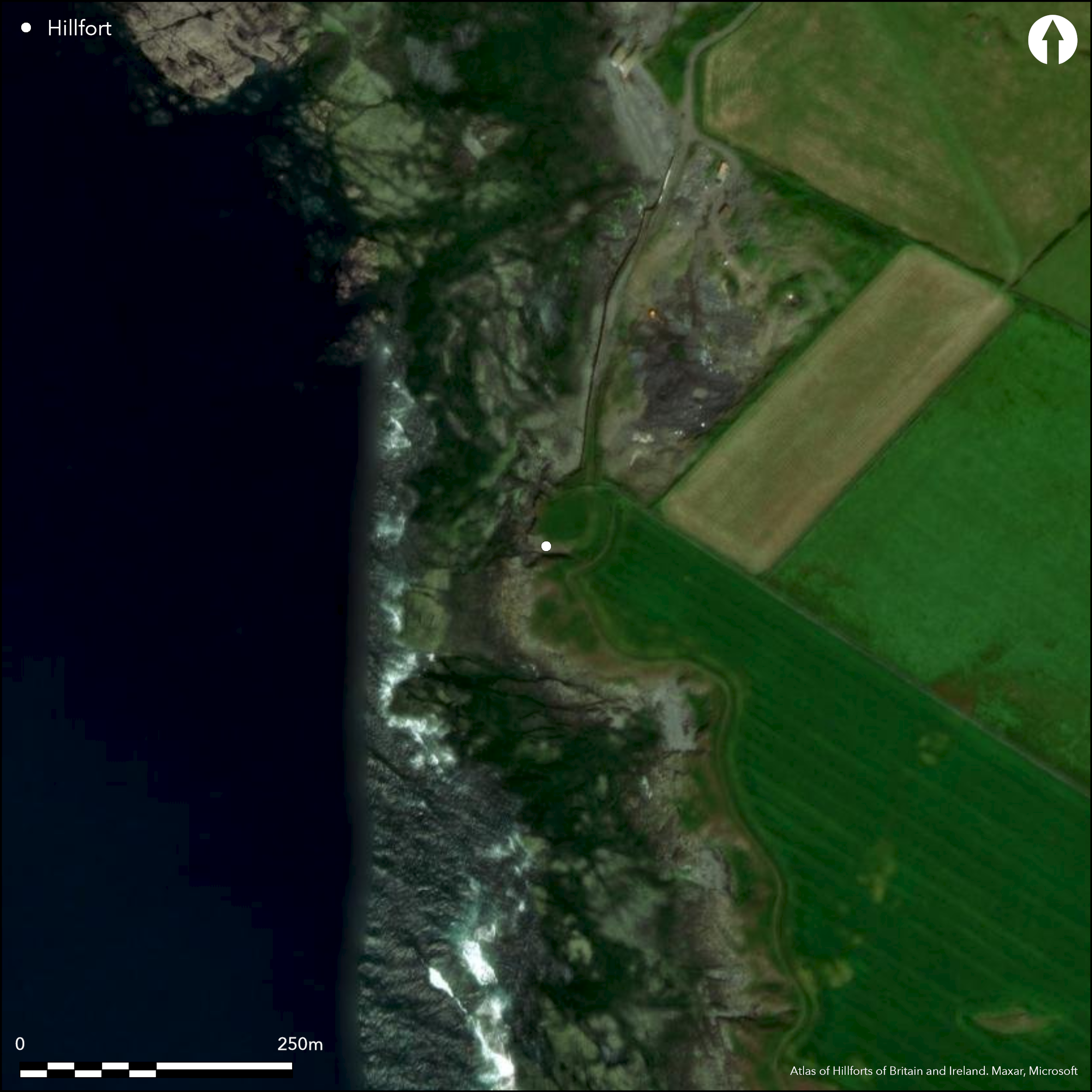
Satellite Imagery
Satellite Imagery
HER: Isle of Man 1062 (None)
NMR: SC26NW 1 (30037)
SM: None
NGR: SC24576709
X: 224570 Y: 467090 (OSGB36)
Impressive small coastal promontory fort located on slight promontory, protected by low cliffs to sea on W, at S end of Poyll Vaaish Bay just S of Castletown on SE of island. Semi-circular shape, with substantial bank and wide and deep rock-cut ditch extending from N around to SE and deep gully to S, with low cliffs to sea on W quadrants. Excavations by P.S. Gelling in 1953-56 showed that rampart on landward side covered earlier stone-fronted one, and on seaward side remains of substantial stone wall; indeed the rampart may have enclosed all of the fort which would make it bigger than its current 0.1ha enclosed. Entrance not defined. Four circular huts in interior, two well-preserved, with stone and rubble walls, central hearths and stone-covered drains beneath the floor, suggest Iron Age occupation contemporary with earliest phase of site, with 1st century BC or 1st century AD finds. These included a La Tene Colchester brooch, from midden overlying Hut 3, glass and jet armlet pieces, unstratified iron pennanular brooch, fragments of crucible containing bronze showing metal working on site. No pottery, but varied faunal remains of cattle, sheep, some pig and horse, chicken, crabs, limpets and hedgehog. After sterile layer in the excavation, early medieval Norse-type longhouse and possible byre found and built when earlier huts in ruins, showing later reoccupation of site. Good coastal grassland. Some erosion on bank, but generally well-preserved. Ploughed up to ditch on E. On 1st Ed. OS map (1868-78).
Citizen Science: ✗
Reliability of Data: Confirmed
Reliability of Interpretation: Confirmed
X: -521260 Y: 7183386 (EPSG: 3857)
Longitude: -4.682557885285395 Latitude: 54.06979450120176 (EPSG:4326)
Country: Isle of Man
Current County or Unitary Authority: Rushen
Historic County: Rushen
Current Parish/Community/Council/Townland: Malew
Some erosion on bank, but generally well-preserved. Ploughed up to ditch on E.
| Extant | ✓ |
| Cropmark | ✗ |
| Likely Destroyed | ✗ |
Coastal grassland.
| Woodland | ✗ |
| Commercial Forestry Plantation | ✗ |
| Parkland | ✗ |
| Pasture (Grazing) | ✗ |
| Arable | ✗ |
| Scrub/Bracken | ✗ |
| Bare Outcrop | ✗ |
| Heather/Moorland | ✗ |
| Heath | ✗ |
| Built-up | ✗ |
| Coastal Grassland | ✓ |
| Other | ✗ |
Small coastal promontory fort located on slight W-facing promontory at S end of Poyll Vaaish Bay just S of Castletown on SE of island.
| Contour Fort | ✗ |
| Partial Contour Fort | ✗ |
| Promontory Fort | ✓ |
| Hillslope Fort | ✗ |
| Level Terrain Fort | ✗ |
| Marsh Fort | ✗ |
| Multiple Enclosure Fort | ✗ |
| Hilltop | ✗ |
| Coastal Promontory | ✓ |
| Inland Promontory | ✗ |
| Valley Bottom | ✗ |
| Knoll/Hillock/Outcrop | ✗ |
| Ridge | ✗ |
| Cliff/Plateau-edge/Scarp | ✗ |
| Hillslope | ✗ |
| Lowland | ✗ |
| Spur | ✗ |
Dominant Topographic Feature: Slight coastal promontory
| North | ✗ |
| Northeast | ✗ |
| East | ✗ |
| Southeast | ✗ |
| South | ✗ |
| Southwest | ✗ |
| West | ✓ |
| Northwest | ✗ |
| Level | ✗ |
Altitude: 10.0m
N/A
Four circular huts in interior, two well-preserved, with stone and rubble walls, central hearths and stone-covered drains beneath the floor, suggest Iron Age occupation contemporary with earliest phase of site, with 1st century BC or 1st century AD finds. Later Norse-type longhouse built when earlier huts in ruins.
Reliability: C - Low
| Pre 1200BC | ✗ |
| 1200BC - 800BC | ✗ |
| 800BC - 400BC | ✗ |
| 400BC - AD50 | ✓ |
| AD50 - AD400 | ✓ |
| AD400 - AD 800 | ✓ |
| Post AD800 | ✗ |
| Unknown | ✗ |
| Pre Hillfort: | None |
| Post Hillfort: | None |
| Artefactual: | First century BC or first century AD finds. |
| Morphology/Earthwork/Typology: | Early medieval norse-type longhouse, possible fifth or sixth century AD. |
On 1st Ed. OS map (1868-78). Excavation P.S. Gelling 1953-6. Field survey J. Woodcock 1999. Field visit University of Liverpool 2010.
| Other (1995): | Visited by Hillfort Study Group |
| Other (1999): | Field survey J. Woodcock |
| Other (2010): | Field visit University of Liverpool 2010. |
| Other (2015): | Visited by Hillfort Study Group |
| 1st Identified Map Depiction (None): | OS map. |
| Excavation (None): | P.S. Gelling. |
Finds included a La Tene Colchester brooch, from midden overlying Hut 3, glass and jet armlet pieces, unstratified iron pennanular brooch, fragments of crucible containing bronze showing metal working on site. No pottery, but varied faunal remains of cattle, sheep, some pig anf horse, chicken, crabs, limpets and hedgehog.
None
| None | ✓ |
| Spring | ✗ |
| Stream | ✗ |
| Pool | ✗ |
| Flush | ✗ |
| Well | ✗ |
| Other | ✗ |
None
| No Known Features | ✓ |
| Round Stone Structures | ✗ |
| Rectangular Stone Structures | ✗ |
| Curvilinear Platforms | ✗ |
| Other Roundhouse Evidence | ✗ |
| Pits | ✗ |
| Quarry Hollows | ✗ |
| Other | ✗ |
Four round huts, one 6.7m diameter. Early medieval Norse-type longhouse
| No Known Excavation | ✗ |
| Pits | ✗ |
| Postholes | ✗ |
| Roundhouses | ✓ |
| Rectangular Structures | ✓ |
| Roads/Tracks | ✗ |
| Quarry Hollows | ✗ |
| Other | ✗ |
| Nothing Found | ✗ |
None
| No Known Geophysics | ✓ |
| Pits | ✗ |
| Roundhouses | ✗ |
| Rectangular Structures | ✗ |
| Roads/Tracks | ✗ |
| Quarry Hollows | ✗ |
| Other | ✗ |
| Nothing Found | ✗ |
Finds included a La Tene Colchester brooch, from midden overlying Hut 3, glass and jet armlet pieces, unstratified iron pennanular brooch, fragments of crucible containing bronze showing metal working on site. No pottery, but varied faunal remains of cattle, sheep, some pig anf horse, chicken, crabs, limpets and hedgehog.
| No Known Finds | ✗ |
| Pottery | ✗ |
| Metal | ✓ |
| Metalworking | ✓ |
| Human Bones | ✗ |
| Animal Bones | ✓ |
| Lithics | ✓ |
| Environmental | ✗ |
| Other | ✓ |
None
| APs Not Checked | ✓ |
| None | ✗ |
| Roundhouses | ✗ |
| Rectangular Structures | ✗ |
| Pits | ✗ |
| Postholes | ✗ |
| Roads/Tracks | ✗ |
| Other | ✗ |
Entrance not defined.
| 0: | None |
| 2: | None |
Guard Chambers: ✗
Chevaux de Frise: ✗
Semi-circular shape, with substantial bank and wide and deep rock-cut ditch extending from N around to SE and deep gully to S, wit h low cliffs to sea on W quadrants. Excavations by P.S. Gelling in 1953-6 showed that rampart on landward side covered earlier stone-fronted one, and on seaward side remains of substantial stone wall; indeed the rampart may have enclosed all of the fort.
| Area 1: | 0.1ha. |
| Total: | 0.1ha. |
Total Footprint Area: Noneha.
None
| ✗ | None |
| ✗ | None |
| NE Quadrant: | 1 |
| SE Quadrant: | 1 |
| SW Quadrant: | 0 |
| NW Quadrant: | 0 |
| Total: | 1 |
| Partial Univallate | ✓ |
| Univallate | ✗ |
| Partial Bivallate | ✗ |
| Bivallate | ✗ |
| Partial Multivallate | ✗ |
| Multivallate | ✗ |
| Unknown | ✗ |
| Partial Univallate | ✗ |
| Univallate | ✗ |
| Partial Bivallate | ✗ |
| Bivallate | ✗ |
| Partial Multivallate | ✗ |
| Multivallate | ✗ |
None
| None | ✗ |
| Earthen Bank | ✓ |
| Stone Wall | ✗ |
| Rubble | ✗ |
| Wall-walk | ✗ |
| Evidence of Timber | ✗ |
| Vitrification | ✗ |
| Other Burning | ✗ |
| Palisade | ✗ |
| Counter Scarp Bank | ✗ |
| Berm | ✗ |
| Unfinished | ✗ |
| Other | ✗ |
Excavations by P.S. Gelling in 1953-6 showed that rampart on landward side covered earlier stone-fronted one, and on seaward side remains of substantial stone wall; indeed the rampart may have enclosed all of the fort.
| None | ✗ |
| Earthen Bank | ✓ |
| Stone Wall | ✓ |
| Murus Duplex | ✗ |
| Timber-framed | ✗ |
| Timber-laced | ✗ |
| Vitrification | ✗ |
| Other Burning | ✗ |
| Palisade | ✗ |
| Counter Scarp Bank | ✗ |
| Berm | ✗ |
| Unfinished | ✗ |
| No Known Excavation | ✗ |
| Other | ✗ |
| ✗ | None |
| ✓ | Deep rock-cut ditch. |
Number of Ditches: 1
| ✗ | None |
Bersu, G. 1949. A promontory fort on the shore of Ramsey Bay, Isle of Man, Antiq J, XXIX, 62-79.
Gelling, P.S. 1958. Close ny Chollagh an Iron Age fort at Scarlett, Isle of Man, Proc Prehist Soc, 24, 85-100.
Atlas of Hillforts:
Wikidata:
This work is licensed under CC BY-SA 4.0

 and should be cited as:
Lock, Gary and Ralston, Ian. 2024. Atlas of Hillforts of Britain and Ireland. Available at: https://hillforts.arch.ox.ac.uk
Document Version 1.1