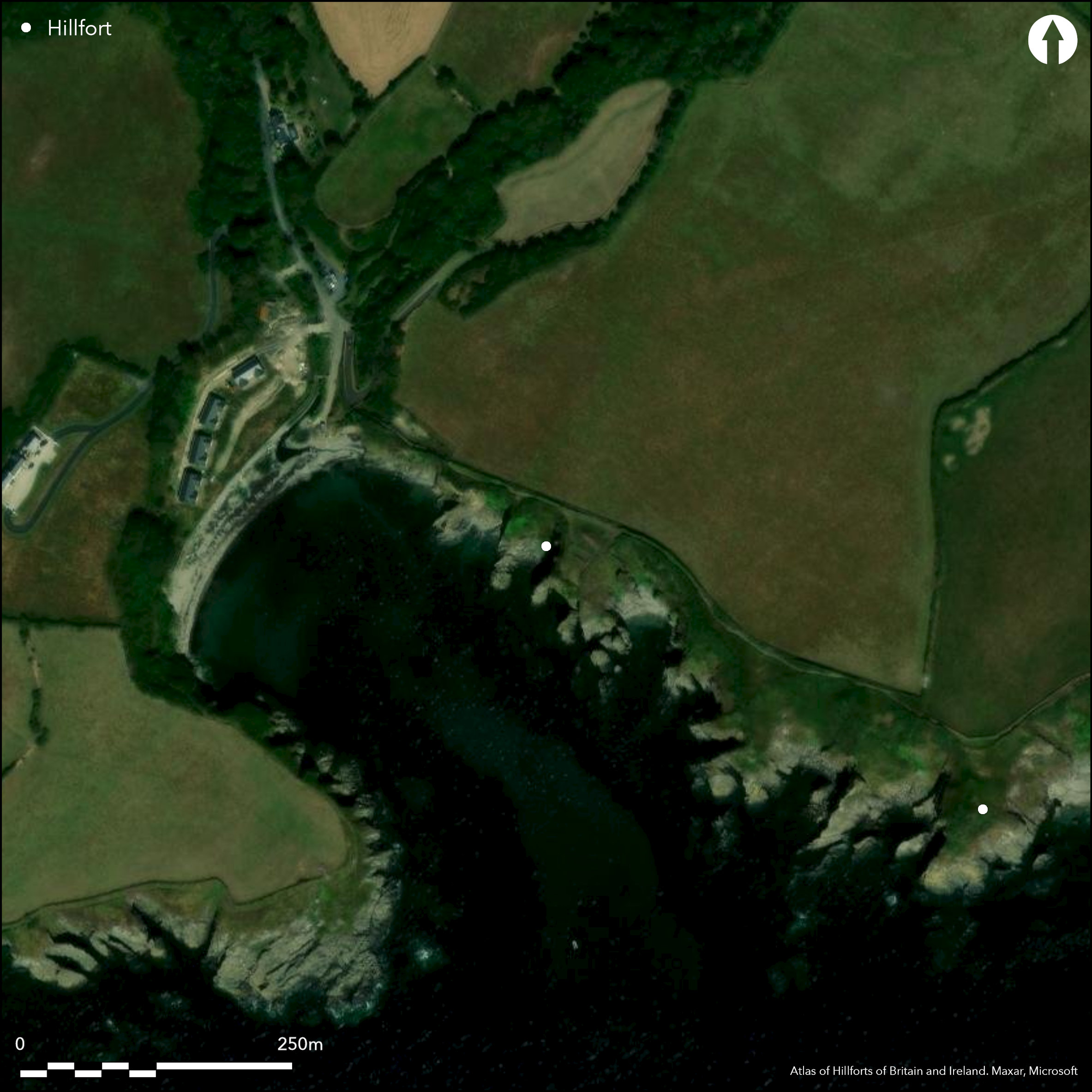
Satellite Imagery
Satellite Imagery
HER: Isle of Man 1068 (None)
NMR: SC37SW 29 (30784)
SM: None
NGR: SC31727048
X: 231720 Y: 470480 (OSGB36)
Small coastal promontory fort located on SW-facing, rocky promontory on NE side, and overlooking beach and mouth of stream flowing down Glen Grenhaugh, of Port Grenahugh to W of Santon Head on SE coast of island. Just along coast (247m) to NW of Purt ny Ceebagh (Atlas No 4216). Precipitous sea cliffs on SE, SW and NW, with very narrow neck landward to NE. Internal area not defined due to loss through erosion. Here substantial bank to 2.3m internal and to 3m external height, and broad ditch, to 5m wide and 1m deep, cut off the promontory, the latest of c. three phases, with earlier one or two palisades. Typical Viking-form longhouse, 11m long by 4.3m wide, now with turf-capped walls, c. 1.2m high NE-SW roughly parallel to bank. P.S. Gelling cut section through bank, ditch and longhouse 1950-2 finding evidence for these palisade trenches under the rampart, one packed with stone around the posts and construction indicated the phases mentioned. Rampart may have been revetted with timber on inside as he found another trench next to bank. Inside was row of deep postholes parallel to bank, possibly holding walkway. He found longhouse to have three-aisled floor plan indicative of ledges or benches along long and possibly W walls and potboilers with red/brown staining on floor suggesting burning. Later entrance cut through house E wall before abandoned. Traces of entrance to fort on Gelling's plan, but now seem eroded away. Lintel graves have been found in the vicinity. Coastal grassland. Coastal erosion, but features very visible. In Manx National Heritage care. On 1st Ed. OS map (1868) as 'tumulus' (in error for bank).
Citizen Science: ✗
Reliability of Data: Confirmed
Reliability of Interpretation: Confirmed
X: -509320 Y: 7189615 (EPSG: 3857)
Longitude: -4.575295353675604 Latitude: 54.10261794403249 (EPSG:4326)
Country: Isle of Man
Current County or Unitary Authority: Middle
Historic County: Middle
Current Parish/Community/Council/Townland: Santon
Coastal erosion, but features very visible. In Manx National Heritage care.
| Extant | ✓ |
| Cropmark | ✗ |
| Likely Destroyed | ✓ |
Rocky coastal grassland.
| Woodland | ✗ |
| Commercial Forestry Plantation | ✗ |
| Parkland | ✗ |
| Pasture (Grazing) | ✗ |
| Arable | ✗ |
| Scrub/Bracken | ✗ |
| Bare Outcrop | ✗ |
| Heather/Moorland | ✗ |
| Heath | ✗ |
| Built-up | ✗ |
| Coastal Grassland | ✓ |
| Other | ✗ |
Small coastal promontory fort located on SW-facing, rocky promontory on NE side, and overlooking beach and mouth of stream flowing down Glen Grenhaugh, of Port Grenahugh to W of Santon Head on SE coast of island.
| Contour Fort | ✗ |
| Partial Contour Fort | ✗ |
| Promontory Fort | ✓ |
| Hillslope Fort | ✗ |
| Level Terrain Fort | ✗ |
| Marsh Fort | ✗ |
| Multiple Enclosure Fort | ✗ |
| Hilltop | ✗ |
| Coastal Promontory | ✓ |
| Inland Promontory | ✗ |
| Valley Bottom | ✗ |
| Knoll/Hillock/Outcrop | ✗ |
| Ridge | ✗ |
| Cliff/Plateau-edge/Scarp | ✗ |
| Hillslope | ✗ |
| Lowland | ✗ |
| Spur | ✗ |
Dominant Topographic Feature: Coastal promontory.
| North | ✗ |
| Northeast | ✗ |
| East | ✗ |
| Southeast | ✗ |
| South | ✗ |
| Southwest | ✓ |
| West | ✗ |
| Northwest | ✗ |
| Level | ✗ |
Altitude: 15.0m
N/A
Probably Iron Age origin with later Viking longhouse reoccupation.
Reliability: C - Low
| Pre 1200BC | ✗ |
| 1200BC - 800BC | ✗ |
| 800BC - 400BC | ✗ |
| 400BC - AD50 | ✓ |
| AD50 - AD400 | ✗ |
| AD400 - AD 800 | ✓ |
| Post AD800 | ✗ |
| Unknown | ✗ |
| Pre Hillfort: | None |
| Post Hillfort: | None |
| Morphology/Earthwork/Typology: | Probably Iron Age origin with later Viking longhouse. |
On 1st Ed. OS map (1868) as 'tumulus' (in error for bank). Excavation P.S. Gelling 1950-2. Ordnance Survey investigation 1955. Field survey J. Woodcock 1999. Site visit University of Liverpool 2010, 2011.
| 1st Identified Map Depiction (1868): | OS map. |
| Other (1955): | Ordnance Survey investigation. |
| Other (1995): | Visited by Hillfort Study Group |
| Other (1999): | Field survey J. Woodcock. |
| Other (2015): | Visited by Hillfort Study Group |
| Excavation (None): | P.S. Gelling. |
| Other (None): | Site visit University of Liverpool. |
Viking-type longhouse excavated and clearly visible. Potboilers. broken quern fragments and quartzite cobble.
None
| None | ✓ |
| Spring | ✗ |
| Stream | ✗ |
| Pool | ✗ |
| Flush | ✗ |
| Well | ✗ |
| Other | ✗ |
Viking-type longhouse clearly visible.
| No Known Features | ✗ |
| Round Stone Structures | ✗ |
| Rectangular Stone Structures | ✗ |
| Curvilinear Platforms | ✗ |
| Other Roundhouse Evidence | ✗ |
| Pits | ✗ |
| Quarry Hollows | ✗ |
| Other | ✓ |
Viking-type longhouse.
| No Known Excavation | ✗ |
| Pits | ✗ |
| Postholes | ✗ |
| Roundhouses | ✗ |
| Rectangular Structures | ✓ |
| Roads/Tracks | ✗ |
| Quarry Hollows | ✗ |
| Other | ✗ |
| Nothing Found | ✗ |
None
| No Known Geophysics | ✓ |
| Pits | ✗ |
| Roundhouses | ✗ |
| Rectangular Structures | ✗ |
| Roads/Tracks | ✗ |
| Quarry Hollows | ✗ |
| Other | ✗ |
| Nothing Found | ✗ |
Potboilers. Broken quern fragments and quartzite cobble.
| No Known Finds | ✗ |
| Pottery | ✗ |
| Metal | ✗ |
| Metalworking | ✗ |
| Human Bones | ✗ |
| Animal Bones | ✗ |
| Lithics | ✓ |
| Environmental | ✗ |
| Other | ✓ |
None
| APs Not Checked | ✓ |
| None | ✗ |
| Roundhouses | ✗ |
| Rectangular Structures | ✗ |
| Pits | ✗ |
| Postholes | ✗ |
| Roads/Tracks | ✗ |
| Other | ✗ |
Original entrance probably lost to coastal erosion.
| 0: | None |
| 2: | None |
Guard Chambers: ✗
Chevaux de Frise: ✗
Substantial bank to 2.3m internal and to 3m external height, and broad ditch, to 5m wide and 1m deep, cut off the promontory on NE, the latest of c. three phases, with earlier one or two palisades. P.S. Gelling cut section through bank, ditch and longhouse 1950-2 finding evidence for these palisade trenches under the rampart, one packed with stone around the posts and construction indicated the phases mentioned. Rampart may have been revetted with timber on inside as he found another trench next to bank. Inside was row of deep postholes parallel to bank, possibly holding walkway.
| Area 1: | Noneha. |
| Total: | Noneha. |
Total Footprint Area: Noneha.
None
| ✓ | Area not defined. Bank and ditch latest of c. three phases, with earlier one or two palisades found by excavation. |
| ✗ | None |
| NE Quadrant: | 1 |
| SE Quadrant: | 0 |
| SW Quadrant: | 0 |
| NW Quadrant: | 0 |
| Total: | 1 |
| Partial Univallate | ✓ |
| Univallate | ✗ |
| Partial Bivallate | ✗ |
| Bivallate | ✗ |
| Partial Multivallate | ✗ |
| Multivallate | ✗ |
| Unknown | ✗ |
| Partial Univallate | ✗ |
| Univallate | ✗ |
| Partial Bivallate | ✗ |
| Bivallate | ✗ |
| Partial Multivallate | ✗ |
| Multivallate | ✗ |
None
| None | ✗ |
| Earthen Bank | ✓ |
| Stone Wall | ✗ |
| Rubble | ✗ |
| Wall-walk | ✗ |
| Evidence of Timber | ✗ |
| Vitrification | ✗ |
| Other Burning | ✗ |
| Palisade | ✗ |
| Counter Scarp Bank | ✗ |
| Berm | ✗ |
| Unfinished | ✗ |
| Other | ✗ |
P.S. Gelling cut section through bank, ditch and longhouse 1950-2 finding evidence for these palisade trenches under the rampart, one packed with stone around the posts and construction indicated the phases mentioned. Rampart may have been revetted with timber on inside as he found another trench next to bank. Inside was row of deep postholes parallel to bank, possibly holding walkway.
| None | ✗ |
| Earthen Bank | ✓ |
| Stone Wall | ✗ |
| Murus Duplex | ✗ |
| Timber-framed | ✓ |
| Timber-laced | ✗ |
| Vitrification | ✗ |
| Other Burning | ✗ |
| Palisade | ✓ |
| Counter Scarp Bank | ✗ |
| Berm | ✗ |
| Unfinished | ✗ |
| No Known Excavation | ✗ |
| Other | ✓ |
| ✗ | None |
| ✓ | Good ditch visible. |
Number of Ditches: 1
| ✗ | None |
Gelling, P.S. 1952. Excavation of a Promontory Fort at Port Grenaugh, Santon, Proc Isle of Man Nat Antiq Soc, 5.3, 307-315.
Atlas of Hillforts:
Wikidata:
This work is licensed under CC BY-SA 4.0

 and should be cited as:
Lock, Gary and Ralston, Ian. 2024. Atlas of Hillforts of Britain and Ireland. Available at: https://hillforts.arch.ox.ac.uk
Document Version 1.1