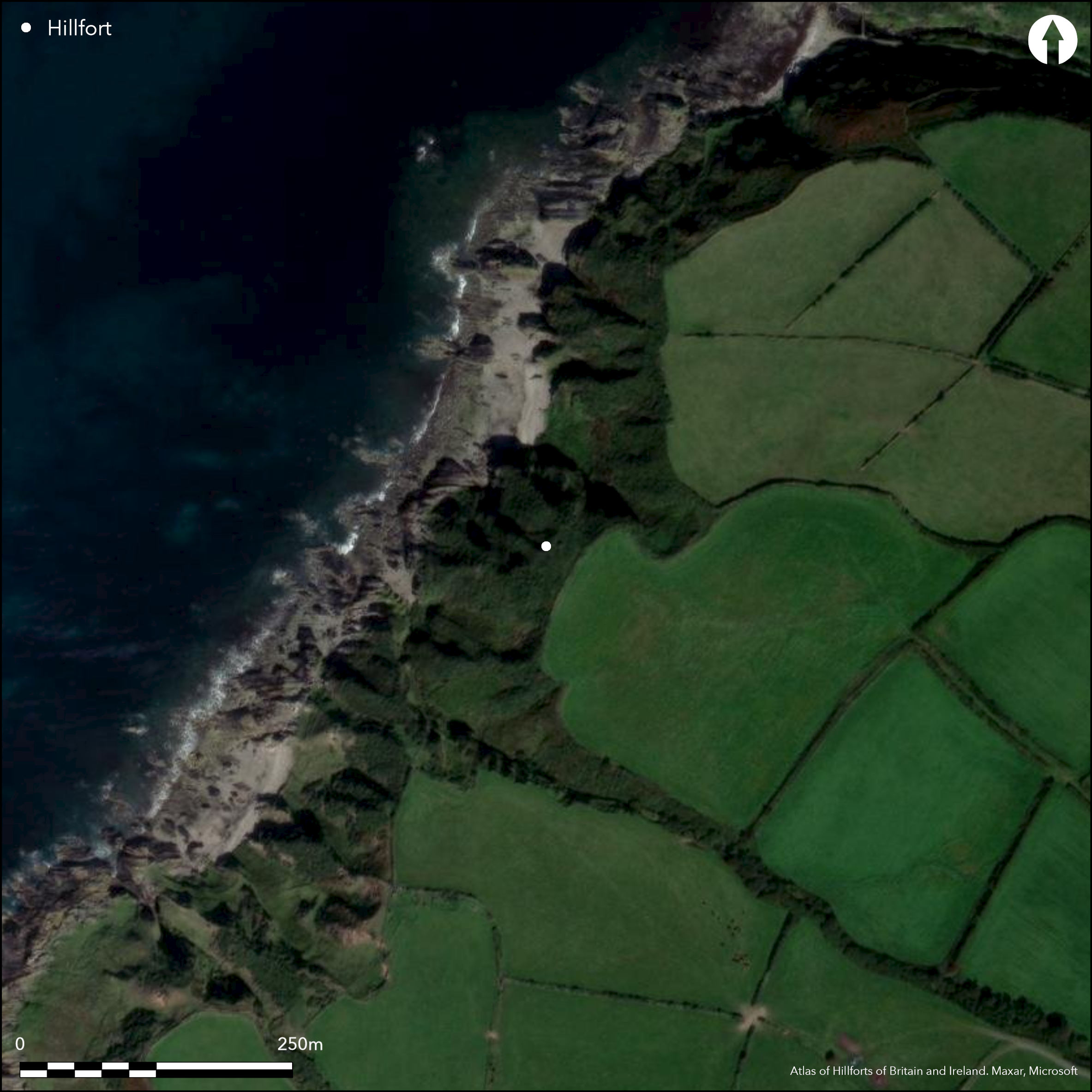
Satellite Imagery
Satellite Imagery
HER: Isle of Man 991 (None)
NMR: None (None)
SM: None
NGR: SC22357968
X: 222350 Y: 479680 (OSGB36)
Small coastal promontory fort located on NW-facing promontory just N of small stream flowing onto sea on W, its upper reaches delineated by small glen of Lag ny Traagh, S of Glenmaye on W coast of island. Just to N of Borrane, Ballelby fort (Atlas No 4202). Separated from farmland on E by hedge. Measures c. 18m by 12m, with area estimated at 0.02ha. Protected by precipitous slopes on W and steep slopes to re-entrants on N and S, and when visited by Ordnance Survey 1956 bank and ditch visible cutting off the unprotected E neck of promontory from re-entrant to re-entrant. State and dimensions of bank unclear now because of total cover of gorse and thorn scrub, but OS measured bank to 1m wide at top with inner height of 2.8m and 3m external, ditch c. 5m wide and 0.8m deep. No entrance visible. Unlike variety of type IOM coastal promontory forts, interior same level as surrounds and to compensate had stronger than usual bank, with no trace of habitation. Ditch still visible but investigation hampered by dense scrub. Minimal investigations, undated. On 1st Ed. OS map (1869).
Citizen Science: ✗
Reliability of Data: Confirmed
Reliability of Interpretation: Confirmed
X: -525857 Y: 7204712 (EPSG: 3857)
Longitude: -4.723852131847661 Latitude: 54.182060465811695 (EPSG:4326)
Country: Isle of Man
Current County or Unitary Authority: Glenfaba
Historic County: Glenfaba
Current Parish/Community/Council/Townland: Patrick
Bank eroding. Separated from farmland on E by hedge. Ditch still visible but investigation hampered by dense scrub.
| Extant | ✓ |
| Cropmark | ✗ |
| Likely Destroyed | ✗ |
Totally overgrown - thorn and gorse.
| Woodland | ✗ |
| Commercial Forestry Plantation | ✗ |
| Parkland | ✗ |
| Pasture (Grazing) | ✗ |
| Arable | ✗ |
| Scrub/Bracken | ✓ |
| Bare Outcrop | ✗ |
| Heather/Moorland | ✗ |
| Heath | ✗ |
| Built-up | ✗ |
| Coastal Grassland | ✗ |
| Other | ✗ |
Small coastal promontory fort located on NW-facing promontory just N of small stream flowing onto sea on W, its upper reaches delineated by small glen of Lag ny Traagh, S of Glenmaye on W coast of island. Precipitous slopes on W and steep slopes to re-entrants on N and S,
| Contour Fort | ✗ |
| Partial Contour Fort | ✗ |
| Promontory Fort | ✓ |
| Hillslope Fort | ✗ |
| Level Terrain Fort | ✗ |
| Marsh Fort | ✗ |
| Multiple Enclosure Fort | ✗ |
| Hilltop | ✗ |
| Coastal Promontory | ✓ |
| Inland Promontory | ✗ |
| Valley Bottom | ✗ |
| Knoll/Hillock/Outcrop | ✗ |
| Ridge | ✗ |
| Cliff/Plateau-edge/Scarp | ✗ |
| Hillslope | ✗ |
| Lowland | ✗ |
| Spur | ✗ |
Dominant Topographic Feature: Coastal promontory
| North | ✗ |
| Northeast | ✗ |
| East | ✗ |
| Southeast | ✗ |
| South | ✗ |
| Southwest | ✗ |
| West | ✗ |
| Northwest | ✓ |
| Level | ✗ |
Altitude: 15.0m
N/A
None.
Reliability: D - None
| Pre 1200BC | ✗ |
| 1200BC - 800BC | ✗ |
| 800BC - 400BC | ✗ |
| 400BC - AD50 | ✗ |
| AD50 - AD400 | ✗ |
| AD400 - AD 800 | ✗ |
| Post AD800 | ✗ |
| Unknown | ✓ |
| Pre Hillfort: | None |
| Post Hillfort: | None |
On 1st Ed. OS map (1869). Ordnance Survey work 1956, 1957, 1980. Field survey J. Woodcock 1999. Site visit University of Liverpool 2010.
| 1st Identified Map Depiction (1869): | OS map. |
| Other (1999): | Field survey J. Woodcock. |
| Other (2010): | University of Liverpool. |
| Other (None): | OS work. |
None.
None
| None | ✓ |
| Spring | ✗ |
| Stream | ✗ |
| Pool | ✗ |
| Flush | ✗ |
| Well | ✗ |
| Other | ✗ |
None
| No Known Features | ✓ |
| Round Stone Structures | ✗ |
| Rectangular Stone Structures | ✗ |
| Curvilinear Platforms | ✗ |
| Other Roundhouse Evidence | ✗ |
| Pits | ✗ |
| Quarry Hollows | ✗ |
| Other | ✗ |
None
| No Known Excavation | ✓ |
| Pits | ✗ |
| Postholes | ✗ |
| Roundhouses | ✗ |
| Rectangular Structures | ✗ |
| Roads/Tracks | ✗ |
| Quarry Hollows | ✗ |
| Other | ✗ |
| Nothing Found | ✗ |
None
| No Known Geophysics | ✓ |
| Pits | ✗ |
| Roundhouses | ✗ |
| Rectangular Structures | ✗ |
| Roads/Tracks | ✗ |
| Quarry Hollows | ✗ |
| Other | ✗ |
| Nothing Found | ✗ |
None
| No Known Finds | ✓ |
| Pottery | ✗ |
| Metal | ✗ |
| Metalworking | ✗ |
| Human Bones | ✗ |
| Animal Bones | ✗ |
| Lithics | ✗ |
| Environmental | ✗ |
| Other | ✗ |
None
| APs Not Checked | ✓ |
| None | ✗ |
| Roundhouses | ✗ |
| Rectangular Structures | ✗ |
| Pits | ✗ |
| Postholes | ✗ |
| Roads/Tracks | ✗ |
| Other | ✗ |
No entrance visible.
| 0: | None |
| 2: | None |
Guard Chambers: ✗
Chevaux de Frise: ✗
Protected by precipitous slopes on W and steep slopes to re-entrants on N and S, and when visited by Ordnance Survey 1956 bank and ditch visible cutting off the unprotected E neck of promontory from re-entrant to re-entrant. State and dimensions of bank unclear now because of total cover of gorse and thorn scrub, but OS measured bank to 1m wide at top with inner height of 2.8m and 3m external, ditch c. 5m wide and 0.8m deep.
| Area 1: | 0.02ha. |
| Total: | 0.02ha. |
Total Footprint Area: Noneha.
None
| ✗ | Estimated area. |
| ✗ | Quadrants estimated. |
| NE Quadrant: | 1 |
| SE Quadrant: | 1 |
| SW Quadrant: | 0 |
| NW Quadrant: | 0 |
| Total: | 1 |
| Partial Univallate | ✓ |
| Univallate | ✗ |
| Partial Bivallate | ✗ |
| Bivallate | ✗ |
| Partial Multivallate | ✗ |
| Multivallate | ✗ |
| Unknown | ✗ |
| Partial Univallate | ✗ |
| Univallate | ✗ |
| Partial Bivallate | ✗ |
| Bivallate | ✗ |
| Partial Multivallate | ✗ |
| Multivallate | ✗ |
None
| None | ✗ |
| Earthen Bank | ✓ |
| Stone Wall | ✗ |
| Rubble | ✗ |
| Wall-walk | ✗ |
| Evidence of Timber | ✗ |
| Vitrification | ✗ |
| Other Burning | ✗ |
| Palisade | ✗ |
| Counter Scarp Bank | ✗ |
| Berm | ✗ |
| Unfinished | ✗ |
| Other | ✗ |
None
| None | ✗ |
| Earthen Bank | ✗ |
| Stone Wall | ✗ |
| Murus Duplex | ✗ |
| Timber-framed | ✗ |
| Timber-laced | ✗ |
| Vitrification | ✗ |
| Other Burning | ✗ |
| Palisade | ✗ |
| Counter Scarp Bank | ✗ |
| Berm | ✗ |
| Unfinished | ✗ |
| No Known Excavation | ✓ |
| Other | ✗ |
| ✗ | None |
| ✓ | None |
Number of Ditches: 1
| ✗ | None |
No related records
Atlas of Hillforts:
Wikidata:
This work is licensed under CC BY-SA 4.0

 and should be cited as:
Lock, Gary and Ralston, Ian. 2024. Atlas of Hillforts of Britain and Ireland. Available at: https://hillforts.arch.ox.ac.uk
Document Version 1.1