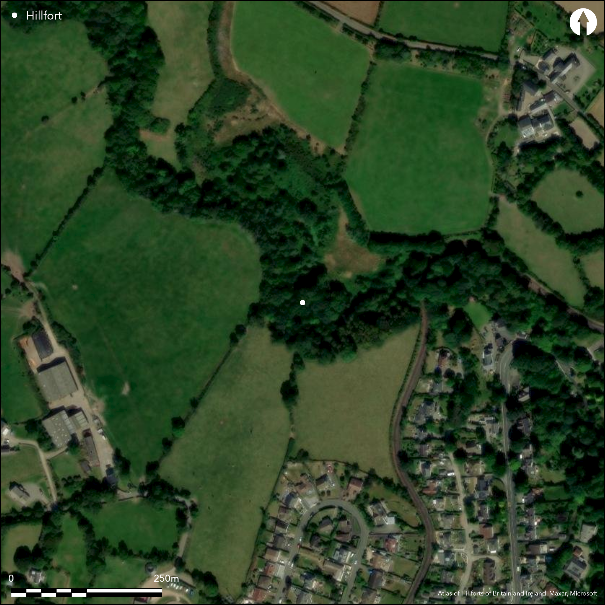
Satellite Imagery
Satellite Imagery
HER: Isle of Man 664 (None)
NMR: None (None)
SM: None
NGR: SC42708169
X: 242700 Y: 481690 (OSGB36)
Possible, small, inland promontory fort, one of few on island, located in strong position on small, isolated, rocky hillock with flat top at c. 76m c. 800m from Garwick Bay and sea on W coast of island. Small, steep-sided, stream loops around site. No details of bank and ditch of fort, but alleged on E cutting off the small neck of land between the N and S slopes of the hill. Shown on 1st Ed. OS map (1868-94). Possible entrance on SW. On top of hill G. Bersu (1967), c. 1941, excavated rectilinear structure, possibly phased, with timber posts and raised floor. Originally thought dwelling, but later a fortified granary or defended dwelling of possible Viking or later date. Well-maintained site.
Citizen Science: ✗
Reliability of Data: Confirmed
Reliability of Interpretation: Unconfirmed
X: -491295 Y: 7209411 (EPSG: 3857)
Longitude: -4.413380867977212 Latitude: 54.20675483711603 (EPSG:4326)
Country: Isle of Man
Current County or Unitary Authority: Garff
Historic County: Garff
Current Parish/Community/Council/Townland: Lonan
No trace of bank and ditch. Site well-maintained with revetted/enclosed stone wall around site, with iron ladder for access.
| Extant | ✗ |
| Cropmark | ✗ |
| Likely Destroyed | ✓ |
Wooded site.
| Woodland | ✓ |
| Commercial Forestry Plantation | ✗ |
| Parkland | ✗ |
| Pasture (Grazing) | ✗ |
| Arable | ✗ |
| Scrub/Bracken | ✗ |
| Bare Outcrop | ✗ |
| Heather/Moorland | ✗ |
| Heath | ✗ |
| Built-up | ✗ |
| Coastal Grassland | ✗ |
| Other | ✗ |
Possible, small, inland promontory fort, one of few on island, located in strong position on small, isolated, rocky hillock with flat top at c. 76m c. 800m from Garwick Bay and sea on W coast of island. Small, steep-sided, stream loops around site.
| Contour Fort | ✗ |
| Partial Contour Fort | ✗ |
| Promontory Fort | ✓ |
| Hillslope Fort | ✗ |
| Level Terrain Fort | ✗ |
| Marsh Fort | ✗ |
| Multiple Enclosure Fort | ✗ |
| Hilltop | ✗ |
| Coastal Promontory | ✗ |
| Inland Promontory | ✓ |
| Valley Bottom | ✗ |
| Knoll/Hillock/Outcrop | ✗ |
| Ridge | ✗ |
| Cliff/Plateau-edge/Scarp | ✗ |
| Hillslope | ✗ |
| Lowland | ✗ |
| Spur | ✗ |
Dominant Topographic Feature: Hillock.
| North | ✗ |
| Northeast | ✗ |
| East | ✗ |
| Southeast | ✗ |
| South | ✗ |
| Southwest | ✗ |
| West | ✗ |
| Northwest | ✗ |
| Level | ✓ |
Altitude: 76.0m
N/A
Possible Iron Age promontory fort, with later reoccupation by Viking or later fortified granary or dwelling.
Reliability: C - Low
| Pre 1200BC | ✗ |
| 1200BC - 800BC | ✗ |
| 800BC - 400BC | ✗ |
| 400BC - AD50 | ✓ |
| AD50 - AD400 | ✗ |
| AD400 - AD 800 | ✓ |
| Post AD800 | ✗ |
| Unknown | ✗ |
| Pre Hillfort: | None |
| Post Hillfort: | None |
| Other: | Excavation of structure, though no dateable finds. |
Shown on 1st Ed. OS map (1868-94). British Association visit 1896. Excavation 1941 (Bersu). Ordnance Survey investigation 1976. Field survey J. Woodcock 1999. Field visit University of Liverpool 2010.
| Other (1896): | British Association visit. |
| Excavation (1941): | None |
| Other (1976): | OS investigation. |
| Other (1999): | Field survey 1999. |
| Other (2010): | Field visit University of Liverpool. |
| 1st Identified Map Depiction (None): | None |
Rectangular structure, with timber posts and raised floor, in interior excavated. No dateable finds.
None
| None | ✓ |
| Spring | ✗ |
| Stream | ✗ |
| Pool | ✗ |
| Flush | ✗ |
| Well | ✗ |
| Other | ✗ |
None
| No Known Features | ✗ |
| Round Stone Structures | ✗ |
| Rectangular Stone Structures | ✓ |
| Curvilinear Platforms | ✗ |
| Other Roundhouse Evidence | ✗ |
| Pits | ✗ |
| Quarry Hollows | ✗ |
| Other | ✗ |
Rectangular structure with timber posts and raised floor in interior.
| No Known Excavation | ✗ |
| Pits | ✗ |
| Postholes | ✓ |
| Roundhouses | ✗ |
| Rectangular Structures | ✓ |
| Roads/Tracks | ✗ |
| Quarry Hollows | ✗ |
| Other | ✗ |
| Nothing Found | ✗ |
None
| No Known Geophysics | ✓ |
| Pits | ✗ |
| Roundhouses | ✗ |
| Rectangular Structures | ✗ |
| Roads/Tracks | ✗ |
| Quarry Hollows | ✗ |
| Other | ✗ |
| Nothing Found | ✗ |
No dateable finds.
| No Known Finds | ✗ |
| Pottery | ✗ |
| Metal | ✗ |
| Metalworking | ✗ |
| Human Bones | ✗ |
| Animal Bones | ✗ |
| Lithics | ✗ |
| Environmental | ✗ |
| Other | ✓ |
None
| APs Not Checked | ✓ |
| None | ✗ |
| Roundhouses | ✗ |
| Rectangular Structures | ✗ |
| Pits | ✗ |
| Postholes | ✗ |
| Roads/Tracks | ✗ |
| Other | ✗ |
Possible entrance on SW.
| None: | Not defined. |
| 2: | None |
Guard Chambers: ✗
Chevaux de Frise: ✗
| 1. Simple Gap (South west): | Gap shown on OS map 1868-94. |
No details of bank and ditch, but alleged on E cutting off the small neck of land between the N and S slopes of the hill.
| Area 1: | Noneha. |
| Total: | Noneha. |
Total Footprint Area: Noneha.
None
| ✗ | Area not defined. |
| ✗ | Probably originally on NE. |
| NE Quadrant: | 1 |
| SE Quadrant: | 0 |
| SW Quadrant: | 0 |
| NW Quadrant: | 0 |
| Total: | 1 |
| Partial Univallate | ✓ |
| Univallate | ✗ |
| Partial Bivallate | ✗ |
| Bivallate | ✗ |
| Partial Multivallate | ✗ |
| Multivallate | ✗ |
| Unknown | ✗ |
| Partial Univallate | ✗ |
| Univallate | ✗ |
| Partial Bivallate | ✗ |
| Bivallate | ✗ |
| Partial Multivallate | ✗ |
| Multivallate | ✗ |
None
| None | ✓ |
| Earthen Bank | ✗ |
| Stone Wall | ✗ |
| Rubble | ✗ |
| Wall-walk | ✗ |
| Evidence of Timber | ✗ |
| Vitrification | ✗ |
| Other Burning | ✗ |
| Palisade | ✗ |
| Counter Scarp Bank | ✗ |
| Berm | ✗ |
| Unfinished | ✗ |
| Other | ✗ |
No evidence of bank an ditch from excavations of building.
| None | ✓ |
| Earthen Bank | ✗ |
| Stone Wall | ✗ |
| Murus Duplex | ✗ |
| Timber-framed | ✗ |
| Timber-laced | ✗ |
| Vitrification | ✗ |
| Other Burning | ✗ |
| Palisade | ✗ |
| Counter Scarp Bank | ✗ |
| Berm | ✗ |
| Unfinished | ✗ |
| No Known Excavation | ✗ |
| Other | ✗ |
| ✗ | None |
| ✗ | Nothing visible. |
Number of Ditches: 0
| ✗ | None |
Bersu, G. 1967. Excavation of The Cashtal, Ballagawne, Garwick, 1941, Proc Isle of Man Nat Antiq Soc, Proc, 7.1, 89-119.
Cubbon, A. M. 1967. The Cashtal, Ballagawne, Garwick. Note on the Preparation of the Report, Proc Isle of Man Nat Antiq Soc, 7.1, 88-9.
Atlas of Hillforts:
Wikidata:
This work is licensed under CC BY-SA 4.0

 and should be cited as:
Lock, Gary and Ralston, Ian. 2024. Atlas of Hillforts of Britain and Ireland. Available at: https://hillforts.arch.ox.ac.uk
Document Version 1.1