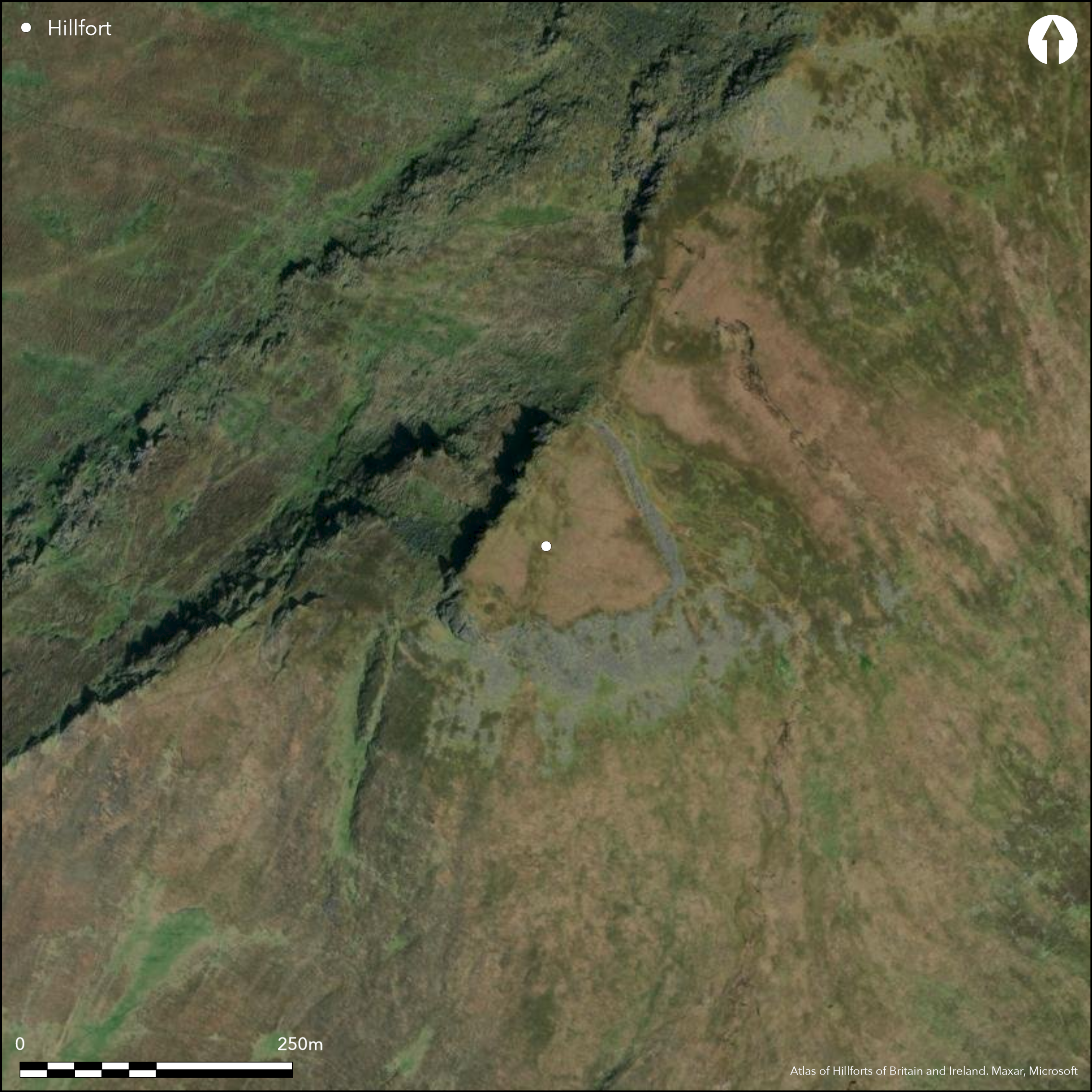
Satellite Imagery
Satellite Imagery
HER: Archaeological Survey of Ireland SMR Database KE046-003 (None)
NMR: KE 046 (None)
SM: None
NGR: None
X: 472643 Y: 606700 (IRENET95)
Caherconree is a triangular shaped inland promontory fort positioned on a W facing spur off the summit of Caherconree Mountain, Co. Kerry. Possibly bivallate, the enclosing elements cut off the E approach. The inner enclosing element survives as a drystone wall 110m long and survives best at its center. A possible outer enclosure comprises a low bank and outer ditch 8 - 10m outside the inner enclosing element. Lynch (1899, 12 - 17) noted that the bank extended the full width of the promontory, however, only a small section to the N is visible today. Two possible original entrances are visible in the inner enclosing element. No evidence for any internal features on the surface, although deep peat deposits likely obscure possible activity. Five circular structures abut the interior and exterior of the inner enclosing wall. A possible stone trough was said to have been found in the interior (Lynch 1910).
Citizen Science: ✗
Reliability of Data: Confirmed
Reliability of Interpretation: Confirmed
X: -1097947 Y: 6835889 (EPSG: 3857)
Longitude: -9.863025934415646 Latitude: 52.197358734796886 (EPSG:4326)
Country: Republic of Ireland; None
Current County or Unitary Authority: Kerry
Historic County: Kerry
Current Parish/Community/Council/Townland: Ballyarkane Oughter, Beheenagh, Gortaleen Mountain
None
| Extant | ✓ |
| Cropmark | ✗ |
| Likely Destroyed | ✗ |
Rough-grazing, common land.
| Woodland | ✗ |
| Commercial Forestry Plantation | ✗ |
| Parkland | ✗ |
| Pasture (Grazing) | ✗ |
| Arable | ✗ |
| Scrub/Bracken | ✗ |
| Bare Outcrop | ✗ |
| Heather/Moorland | ✗ |
| Heath | ✗ |
| Built-up | ✗ |
| Coastal Grassland | ✗ |
| Other | ✓ |
Triangular shaped inland promontory on the WSW facing slope of Caherconree Mountain. Ramparts protect the E approach to the site. The remainder of the hillfort is formed by cliff-face to the N, S and W. Excellent views from the summit.
| Contour Fort | ✗ |
| Partial Contour Fort | ✗ |
| Promontory Fort | ✓ |
| Hillslope Fort | ✗ |
| Level Terrain Fort | ✗ |
| Marsh Fort | ✗ |
| Multiple Enclosure Fort | ✓ |
| Hilltop | ✗ |
| Coastal Promontory | ✗ |
| Inland Promontory | ✓ |
| Valley Bottom | ✗ |
| Knoll/Hillock/Outcrop | ✗ |
| Ridge | ✗ |
| Cliff/Plateau-edge/Scarp | ✓ |
| Hillslope | ✗ |
| Lowland | ✗ |
| Spur | ✓ |
Dominant Topographic Feature: SW facing spur.
| North | ✗ |
| Northeast | ✗ |
| East | ✗ |
| Southeast | ✗ |
| South | ✗ |
| Southwest | ✓ |
| West | ✗ |
| Northwest | ✗ |
| Level | ✗ |
Altitude: 659.0m
Cut by townland boundary of Ballyarkane Oughter and Beheenagh
Boundary Type: Parish/Townland
No dating evidence.
Reliability: D - None
| Pre 1200BC | ✗ |
| 1200BC - 800BC | ✗ |
| 800BC - 400BC | ✗ |
| 400BC - AD50 | ✗ |
| AD50 - AD400 | ✗ |
| AD400 - AD 800 | ✗ |
| Post AD800 | ✗ |
| Unknown | ✓ |
| Pre Hillfort: | None |
| Post Hillfort: | None |
First recorded on 1st edition Ordnance Survey 6 inch mapping.
| 1st Identified Map Depiction (1842): | OSI 6 inch mapping |
| Earthwork Survey (1899): | Lynch (1899) |
| Other (1910): | Lynch (1910) |
Five circular stone structures abut the interior and exterior of the enclosing wall.
None
| None | ✓ |
| Spring | ✗ |
| Stream | ✗ |
| Pool | ✗ |
| Flush | ✗ |
| Well | ✗ |
| Other | ✗ |
None
| No Known Features | ✗ |
| Round Stone Structures | ✓ |
| Rectangular Stone Structures | ✗ |
| Curvilinear Platforms | ✗ |
| Other Roundhouse Evidence | ✗ |
| Pits | ✗ |
| Quarry Hollows | ✗ |
| Other | ✗ |
None
| No Known Excavation | ✓ |
| Pits | ✗ |
| Postholes | ✗ |
| Roundhouses | ✗ |
| Rectangular Structures | ✗ |
| Roads/Tracks | ✗ |
| Quarry Hollows | ✗ |
| Other | ✗ |
| Nothing Found | ✗ |
None
| No Known Geophysics | ✓ |
| Pits | ✗ |
| Roundhouses | ✗ |
| Rectangular Structures | ✗ |
| Roads/Tracks | ✗ |
| Quarry Hollows | ✗ |
| Other | ✗ |
| Nothing Found | ✗ |
Lynch (1910) reports that a possible stone trough was removed from the site in the 19th Century.
| No Known Finds | ✓ |
| Pottery | ✗ |
| Metal | ✗ |
| Metalworking | ✗ |
| Human Bones | ✗ |
| Animal Bones | ✗ |
| Lithics | ✗ |
| Environmental | ✗ |
| Other | ✓ |
NO APPARENT FEATURES
| APs Not Checked | ✗ |
| None | ✓ |
| Roundhouses | ✗ |
| Rectangular Structures | ✗ |
| Pits | ✗ |
| Postholes | ✗ |
| Roads/Tracks | ✗ |
| Other | ✗ |
Two possible original entrances comprising simple gaps in the enclosing elements. These are stone faced at the terminals and some natural erosion has occurred.
| 2: | None |
| 2: | None |
Guard Chambers: ✗
Chevaux de Frise: ✗
| 1. Simple Gap (North east): | Simple gap, stone faced at the terminals. |
| 2. Simple Gap (North east): | Simple gap, stone faced at the terminals. |
A single stone faced wall of Old Red Sandstone blocks. This wall survives to a maximum height of 3m and is approximately 4.5m thick, enclosing an area of 1.22ha. It expands the full width of the promontory. The internal wall-walk comprises three steps and survives in good condition. A stony bank, approximately 0.75m high and 3m wide and an accompanying outer ditch 1.5m wide and 0.5m in depth is positioned 8 - 10m outside the inner enclosing element. This survives at the N but Lynch (1899, 12 - 17) noted it once extended the full width of the promontory.
| Area 1: | 1.01ha. |
| Total: | 1.01ha. |
Total Footprint Area: 1.22ha.
None
| ✗ | None |
| ✗ | None |
| NE Quadrant: | 2 |
| SE Quadrant: | 0 |
| SW Quadrant: | 0 |
| NW Quadrant: | 0 |
| Total: | 2 |
| Partial Univallate | ✗ |
| Univallate | ✗ |
| Partial Bivallate | ✓ |
| Bivallate | ✗ |
| Partial Multivallate | ✗ |
| Multivallate | ✗ |
| Unknown | ✗ |
| Partial Univallate | ✗ |
| Univallate | ✗ |
| Partial Bivallate | ✗ |
| Bivallate | ✗ |
| Partial Multivallate | ✗ |
| Multivallate | ✗ |
None
| None | ✗ |
| Earthen Bank | ✗ |
| Stone Wall | ✓ |
| Rubble | ✗ |
| Wall-walk | ✓ |
| Evidence of Timber | ✗ |
| Vitrification | ✗ |
| Other Burning | ✗ |
| Palisade | ✗ |
| Counter Scarp Bank | ✗ |
| Berm | ✗ |
| Unfinished | ✗ |
| Other | ✗ |
None
| None | ✗ |
| Earthen Bank | ✗ |
| Stone Wall | ✗ |
| Murus Duplex | ✗ |
| Timber-framed | ✗ |
| Timber-laced | ✗ |
| Vitrification | ✗ |
| Other Burning | ✗ |
| Palisade | ✗ |
| Counter Scarp Bank | ✗ |
| Berm | ✗ |
| Unfinished | ✗ |
| No Known Excavation | ✓ |
| Other | ✗ |
| ✗ | None |
| ✗ | None |
Number of Ditches: 0
| ✗ | None |
Cuppage, J. 1986. Corca Dhuibhne: Dingle Peninsula Archaeological Survey. Oidhreacht Chorca Dhuibhne, Dublin.
Lynch, P. 1899. Caherconree, County Kerry. JRSAI, 29, 5 - 17.
Lynch, P. 1910. A relic of Caherconree. JRSAI, 40, 357 - 360.
MacDonogh, S. 1985. A Visitor's Guide to the Dingle Peninsula. Mount Eagle Publications, Dingle.
Redmond, M. 1999. A survey of the promontory forts of the Kerry Peninsulas. Journal of the Kerry Archaeological and Historical Society. 28. 5 - 63.
Atlas of Hillforts:
Wikidata:
This work is licensed under CC BY-SA 4.0

 and should be cited as:
Lock, Gary and Ralston, Ian. 2024. Atlas of Hillforts of Britain and Ireland. Available at: https://hillforts.arch.ox.ac.uk
Document Version 1.1