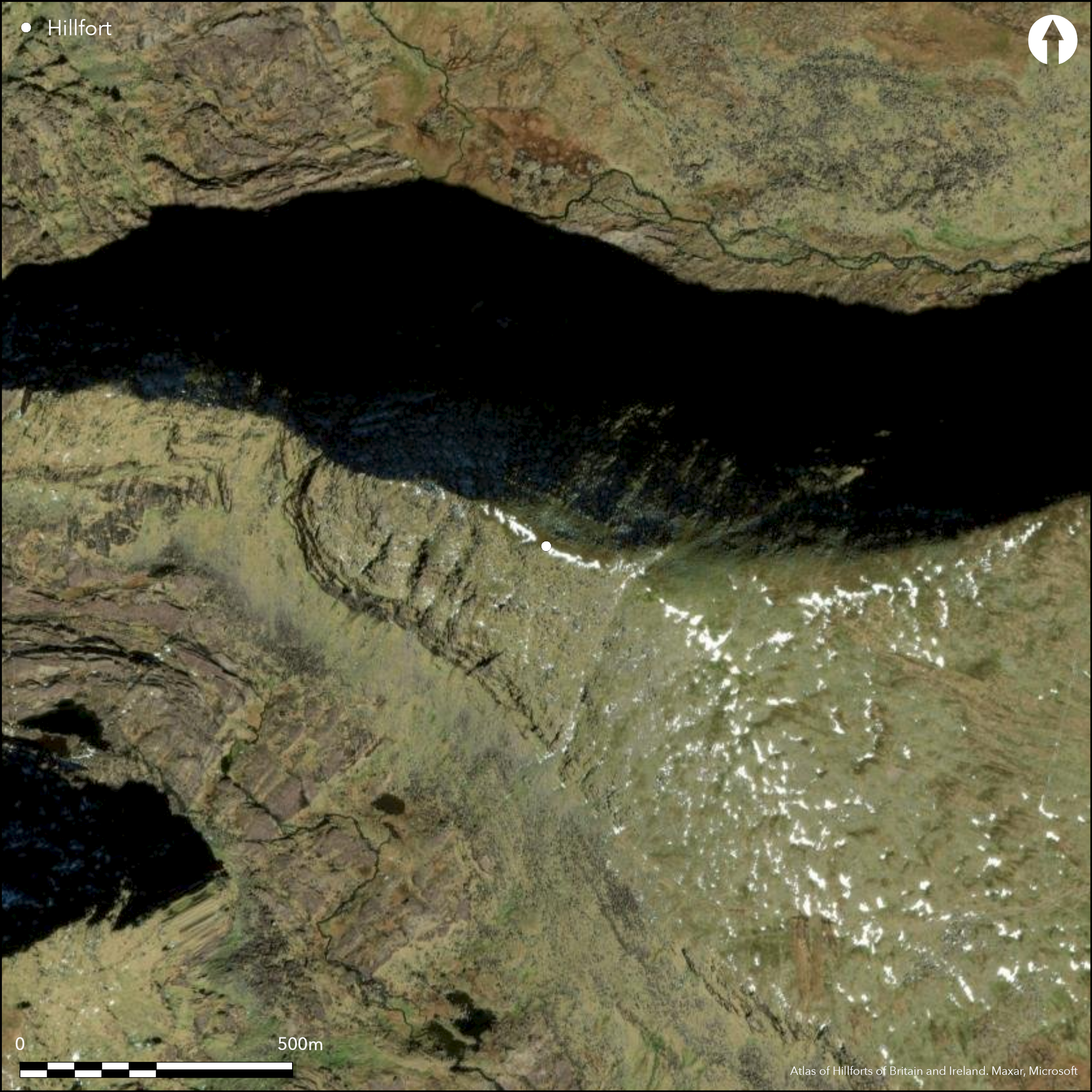
Satellite Imagery
Satellite Imagery
HER: Archaeological Survey of Ireland SMR Database KE034-048 (None)
NMR: KE 034 (None)
SM: None
NGR: None
X: 446981 Y: 611938 (IRENET95)
Inland promontory fort on E _ W running ridge, positioned on E side of Brandon Mountain in the Dingle Peninsula. The triangular promontory narrows to the W and is bounded on the N and S by steep cliffs. Two drystone walls running N _ S define the most accessible approach to the E. The site occupies a total area of 13.4ha. The stone walls are separated by approximately 100m. A single entrance appears in the well preserved outer enclosing element, comprising a simple, stone faced gap, 2m in width. The inner enclosing element is not as well preserved. Simple entrance gap in the inner enclosing element comprises a 9m gap between the faced terminal of the stone bank and northern cliff face.There is no evidence for surface features within the interior of the hillfort. In mountainous terrain, used as common lands for sheep grazing with partial scrub growth within interior. No investigation of the interior has been undertaken. First identified as a hillfort by Raftery (Cuppage 1986, 82).
Citizen Science: ✗
Reliability of Data: Confirmed
Reliability of Interpretation: Confirmed
X: -1139967 Y: 6843253 (EPSG: 3857)
Longitude: -10.240501948728664 Latitude: 52.23788410092391 (EPSG:4326)
Country: Republic of Ireland
Current County or Unitary Authority: Kerry
Historic County: Kerry
Current Parish/Community/Council/Townland: Begagh
Partial destruction of the enclosing elements, presumably for the construction of modern stone walls in the immediate environs.
| Extant | ✓ |
| Cropmark | ✗ |
| Likely Destroyed | ✓ |
In mountainous terrain, used as common lands for sheep grazing.
| Woodland | ✗ |
| Commercial Forestry Plantation | ✗ |
| Parkland | ✗ |
| Pasture (Grazing) | ✗ |
| Arable | ✗ |
| Scrub/Bracken | ✓ |
| Bare Outcrop | ✗ |
| Heather/Moorland | ✗ |
| Heath | ✗ |
| Built-up | ✗ |
| Coastal Grassland | ✗ |
| Other | ✗ |
Large, bivallate inland promontory fort on E _ W running ridge, positioned on E side of Brandon Mountain in the Dingle Peninsula. The triangular promontory narrows to the W and is bounded on the N and S by steep cliffs. The remains of two widely spaced stone walls cut off the E, most accessible side of the promontory. There are panoramic views of Dingle Bay to the S and Tralee Bay to the N. Mount Brandon blocks views to the W. The ridge Faha hillfort is positioned on blends into the mountainous terrain and is hard to distinguish from a distance.
| Contour Fort | ✗ |
| Partial Contour Fort | ✗ |
| Promontory Fort | ✓ |
| Hillslope Fort | ✗ |
| Level Terrain Fort | ✗ |
| Marsh Fort | ✗ |
| Multiple Enclosure Fort | ✓ |
| Hilltop | ✗ |
| Coastal Promontory | ✗ |
| Inland Promontory | ✓ |
| Valley Bottom | ✗ |
| Knoll/Hillock/Outcrop | ✗ |
| Ridge | ✗ |
| Cliff/Plateau-edge/Scarp | ✗ |
| Hillslope | ✗ |
| Lowland | ✗ |
| Spur | ✗ |
Dominant Topographic Feature: Mountain ridge.
| North | ✗ |
| Northeast | ✗ |
| East | ✓ |
| Southeast | ✗ |
| South | ✗ |
| Southwest | ✗ |
| West | ✗ |
| Northwest | ✗ |
| Level | ✗ |
Altitude: 820.0m
N/A
No dating evidence.
Reliability: D - None
| Pre 1200BC | ✗ |
| 1200BC - 800BC | ✗ |
| 800BC - 400BC | ✗ |
| 400BC - AD50 | ✗ |
| AD50 - AD400 | ✗ |
| AD400 - AD 800 | ✗ |
| Post AD800 | ✗ |
| Unknown | ✓ |
| Pre Hillfort: | None |
| Post Hillfort: | None |
No investigation of the interior has been undertaken. First identified as a hillfort by Raftery (Cuppage 1986, 82).
| 1st Identified Map Depiction (1906): | Inner enclosure is partially depicted in second edition OS mapping |
No evidence for any internal features on the surface.
None
| None | ✓ |
| Spring | ✗ |
| Stream | ✗ |
| Pool | ✗ |
| Flush | ✗ |
| Well | ✗ |
| Other | ✗ |
None
| No Known Features | ✓ |
| Round Stone Structures | ✗ |
| Rectangular Stone Structures | ✗ |
| Curvilinear Platforms | ✗ |
| Other Roundhouse Evidence | ✗ |
| Pits | ✗ |
| Quarry Hollows | ✗ |
| Other | ✗ |
None
| No Known Excavation | ✓ |
| Pits | ✗ |
| Postholes | ✗ |
| Roundhouses | ✗ |
| Rectangular Structures | ✗ |
| Roads/Tracks | ✗ |
| Quarry Hollows | ✗ |
| Other | ✗ |
| Nothing Found | ✗ |
None
| No Known Geophysics | ✓ |
| Pits | ✗ |
| Roundhouses | ✗ |
| Rectangular Structures | ✗ |
| Roads/Tracks | ✗ |
| Quarry Hollows | ✗ |
| Other | ✗ |
| Nothing Found | ✗ |
None
| No Known Finds | ✓ |
| Pottery | ✗ |
| Metal | ✗ |
| Metalworking | ✗ |
| Human Bones | ✗ |
| Animal Bones | ✗ |
| Lithics | ✗ |
| Environmental | ✗ |
| Other | ✗ |
NO APPARENT FEATURES
| APs Not Checked | ✗ |
| None | ✓ |
| Roundhouses | ✗ |
| Rectangular Structures | ✗ |
| Pits | ✗ |
| Postholes | ✗ |
| Roads/Tracks | ✗ |
| Other | ✗ |
Two simple gaps in the inner and outer enclosing elements.
| 2: | None |
| 2: | None |
Guard Chambers: ✗
Chevaux de Frise: ✗
| 1. Simple Gap (East): | Simple entrance gap at the center of the outer enclosing element, comprising a 1.6m wide gap with faced terminals (Redmond 1999, 33). |
| 2. Simple Gap (East): | Simple entrance gap in the inner enclosing element. This comprises a 9m gap between the faced terminal of the stone bank and northern cliff face (Redmond 1999, 33). |
The outer wall follows the 762m contour and curves N - S for 134m. The wall is collapsed in places due to natural erosion, but is generally well preserved. It comprises a 7m wide stone bank with faced exterior and is up to 2.1m in height (Redmond 1999, 33). There is some evidence for an internal wall walk comprising 2 steps. The inner enclosing element is approximately 100 - 120m inside the former and is built on a natural rise on the 810m contour. It comprises a collapsed stone bank 2.2m in maximum width and up to 1.95m in height. It extends for a length of approximately 55m.
| Area 1: | 7.56ha. |
| Area 2: | 13.32ha. |
| Total: | 13.32ha. |
Total Footprint Area: 13.46ha.
None
| ✗ | None |
| ✗ | None |
| NE Quadrant: | 2 |
| SE Quadrant: | 2 |
| SW Quadrant: | 0 |
| NW Quadrant: | 0 |
| Total: | 2 |
| Partial Univallate | ✗ |
| Univallate | ✗ |
| Partial Bivallate | ✓ |
| Bivallate | ✗ |
| Partial Multivallate | ✗ |
| Multivallate | ✗ |
| Unknown | ✗ |
| Partial Univallate | ✓ |
| Univallate | ✗ |
| Partial Bivallate | ✗ |
| Bivallate | ✗ |
| Partial Multivallate | ✗ |
| Multivallate | ✗ |
None
| None | ✗ |
| Earthen Bank | ✗ |
| Stone Wall | ✓ |
| Rubble | ✓ |
| Wall-walk | ✓ |
| Evidence of Timber | ✗ |
| Vitrification | ✗ |
| Other Burning | ✗ |
| Palisade | ✗ |
| Counter Scarp Bank | ✗ |
| Berm | ✗ |
| Unfinished | ✗ |
| Other | ✗ |
None
| None | ✗ |
| Earthen Bank | ✗ |
| Stone Wall | ✗ |
| Murus Duplex | ✗ |
| Timber-framed | ✗ |
| Timber-laced | ✗ |
| Vitrification | ✗ |
| Other Burning | ✗ |
| Palisade | ✗ |
| Counter Scarp Bank | ✗ |
| Berm | ✗ |
| Unfinished | ✗ |
| No Known Excavation | ✓ |
| Other | ✗ |
| ✗ | None |
| ✗ | None |
Number of Ditches: 0
| ✗ | None |
Cuppage, J. 1986. Corca Dhuibhne: Dingle Peninsula Archaeological Survey. Oidhreacht Chorca Dhuibhne, Dublin.
MacDonogh, S. 1985. A Visitor's Guide to the Dingle Peninsula. Mount Eagle Publications, Dingle.
Redmond, M. 1999. A survey of the promontory forts of the Kerry Peninsulas. Journal of the Kerry Archaeological and Historical Society. 28. 5 - 63.
Atlas of Hillforts:
Wikidata:
This work is licensed under CC BY-SA 4.0

 and should be cited as:
Lock, Gary and Ralston, Ian. 2024. Atlas of Hillforts of Britain and Ireland. Available at: https://hillforts.arch.ox.ac.uk
Document Version 1.1