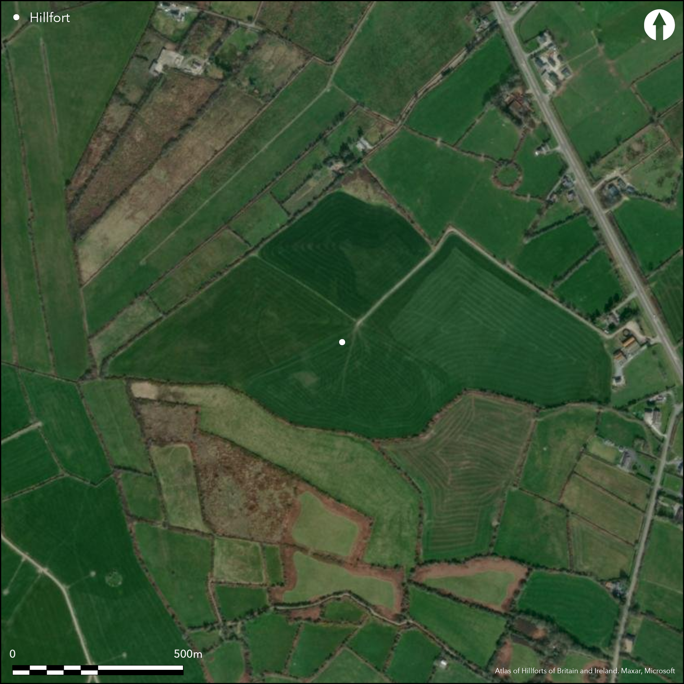
Satellite Imagery
Satellite Imagery
HER: Archaeological Survey of Ireland SMR Database KE039-065 (None)
NMR: KE 039 (None)
SM: None
NGR: None
X: 492288 Y: 608507 (IRENET95)
Multiple enclosure in commanding position at the E edge of the Slieve Mish Mountains. It is situated just off the summit of a low-lying, flat hilltop. The hillfort is oval in shape and bivallate for its entire circuit. The monument has been completely levelled and is only visible in aerial photographs. It occupies a total area of 6.3ha. Excavation and geophysical survey has revealed the enclosing elements comprised earthen banks with external stone revetments. Deep external, rock-cut ditches were also revealed by geophysics and excavation. Geophysical survey has identified an out-turned entrance to the N. No other possible entrances were identified. A number of possible hut structures and two large enclosures were identified in the geophysical survey, as well as post hillfort activity in the form of field boundaries. Radiocarbon dates from basal deposits of the hillfort ditches returned Late Bronze Age dates. The hillfort has been completely levelled and is under pasture. Geophysical survey of the entire monument by O'Driscoll in 2012. Excavation of the enclosing features by O'Brien in 2012.
Citizen Science: ✗
Reliability of Data: Confirmed
Reliability of Interpretation: Confirmed
X: -1066035 Y: 6839599 (EPSG: 3857)
Longitude: -9.576354671615299 Latitude: 52.21778155886439 (EPSG:4326)
Country: Republic of Ireland; None
Current County or Unitary Authority: Kerry
Historic County: Kerry
Current Parish/Community/Council/Townland: Glanbane
Only visible on aerial photographs as a vegetation mark.
| Extant | ✗ |
| Cropmark | ✗ |
| Likely Destroyed | ✓ |
None
| Woodland | ✗ |
| Commercial Forestry Plantation | ✗ |
| Parkland | ✗ |
| Pasture (Grazing) | ✓ |
| Arable | ✗ |
| Scrub/Bracken | ✗ |
| Bare Outcrop | ✗ |
| Heather/Moorland | ✗ |
| Heath | ✗ |
| Built-up | ✗ |
| Coastal Grassland | ✗ |
| Other | ✗ |
Glanbane hillfort in commanding position on the last high point at the E edge of the Sliabh Mish Mountains, overlooking the valley of the River Lee and River Maine to the N, E and S. It follows the contours of the hill on the N and E. The S and W sections of the hillfort are situated on flat terrain. Panoramic views from the summit.
| Contour Fort | ✓ |
| Partial Contour Fort | ✗ |
| Promontory Fort | ✗ |
| Hillslope Fort | ✗ |
| Level Terrain Fort | ✗ |
| Marsh Fort | ✗ |
| Multiple Enclosure Fort | ✓ |
| Hilltop | ✓ |
| Coastal Promontory | ✗ |
| Inland Promontory | ✗ |
| Valley Bottom | ✗ |
| Knoll/Hillock/Outcrop | ✗ |
| Ridge | ✗ |
| Cliff/Plateau-edge/Scarp | ✗ |
| Hillslope | ✗ |
| Lowland | ✗ |
| Spur | ✗ |
Dominant Topographic Feature: Hilltop
| North | ✗ |
| Northeast | ✗ |
| East | ✗ |
| Southeast | ✗ |
| South | ✗ |
| Southwest | ✗ |
| West | ✗ |
| Northwest | ✗ |
| Level | ✓ |
Altitude: 86.0m
The southern section of the hillfort forms the boundary between the townlands of Glanbane and Garraundarragh
Boundary Type: Parish/Townland
Late Bronze Age radiocarbon dates from basal deposits of both inner and outer hillfort ditch.
Reliability: A - High
| Pre 1200BC | ✗ |
| 1200BC - 800BC | ✓ |
| 800BC - 400BC | ✗ |
| 400BC - AD50 | ✗ |
| AD50 - AD400 | ✗ |
| AD400 - AD 800 | ✗ |
| Post AD800 | ✗ |
| Unknown | ✗ |
| Pre Hillfort: | None |
| Post Hillfort: | None |
| C14: | None |
Geophysical survey of the entire monument by O'Driscoll in 2012. Excavation of the enclosing features by O'Brien in 2012.
| Geophysical Survey (2012): | Unpublished report by O'Driscoll (2012) |
| Excavation (2012): | Unpublished excavation by O'Brien (2012) |
Geophysical survey has identified a number of possible structures within the interior. Two large enclosures were identified at the center of the hillfort. One comprises a circular earthen bank 55m in diameter. The second overlay this and consisted of a series of large posts approximately 45m in diameter.
None
| None | ✓ |
| Spring | ✗ |
| Stream | ✗ |
| Pool | ✗ |
| Flush | ✗ |
| Well | ✗ |
| Other | ✗ |
None
| No Known Features | ✓ |
| Round Stone Structures | ✗ |
| Rectangular Stone Structures | ✗ |
| Curvilinear Platforms | ✗ |
| Other Roundhouse Evidence | ✗ |
| Pits | ✗ |
| Quarry Hollows | ✗ |
| Other | ✗ |
Rock-cut hillfort ditches
| No Known Excavation | ✗ |
| Pits | ✗ |
| Postholes | ✗ |
| Roundhouses | ✗ |
| Rectangular Structures | ✗ |
| Roads/Tracks | ✗ |
| Quarry Hollows | ✗ |
| Other | ✓ |
| Nothing Found | ✗ |
Pits and possible structures within the interior. Two large enclosure at centre of the interior.
| No Known Geophysics | ✗ |
| Pits | ✓ |
| Roundhouses | ✓ |
| Rectangular Structures | ✗ |
| Roads/Tracks | ✗ |
| Quarry Hollows | ✗ |
| Other | ✓ |
| Nothing Found | ✗ |
Charcoal throughout ditch fill of inner and outer enclosing elements.
| No Known Finds | ✗ |
| Pottery | ✗ |
| Metal | ✗ |
| Metalworking | ✗ |
| Human Bones | ✗ |
| Animal Bones | ✗ |
| Lithics | ✗ |
| Environmental | ✗ |
| Other | ✓ |
NO APPARENT FEATURES
| APs Not Checked | ✗ |
| None | ✓ |
| Roundhouses | ✗ |
| Rectangular Structures | ✗ |
| Pits | ✗ |
| Postholes | ✗ |
| Roads/Tracks | ✗ |
| Other | ✗ |
Geophysical survey has identified a possible out-turned entrance to the N. Here, the separation between the two enclosing elements narrow from 25 - 30m to approximately 8m and there is a gap of approximately 10m in both enclosing elements.
| 1: | None |
| 2: | None |
Guard Chambers: ✗
Chevaux de Frise: ✗
| 1. Out-turned (North): | None |
Excavation revealed that the enclosing elements comprised two widely spaced banks (separated by approximately 25 - 30m) and accompanying rock-cut ditch features. The banks have both been almost completely destroyed. Excavation revealed that the ditch of the inner enclosure was U-shaped and measured 3.1m wide and 1.35m deep. The ditch associated with the external enclosing elements was also U-shaped measured 2.05m wide and 0.8m deep. Large stones found throughout the fills of both ditches suggest that the external face of both the inner and outer banks were revetted.
| Area 1: | 4.15ha. |
| Area 2: | 6.3ha. |
| Total: | 6.3ha. |
Total Footprint Area: 6.32ha.
None
| ✗ | Inner area is a rough estimate (SH) |
| ✓ | Ramparts now levelled, but geophysical survey has identified that the two enclosing elements formed complete circuits/ |
| NE Quadrant: | 2 |
| SE Quadrant: | 2 |
| SW Quadrant: | 2 |
| NW Quadrant: | 2 |
| Total: | 2 |
| Partial Univallate | ✗ |
| Univallate | ✗ |
| Partial Bivallate | ✗ |
| Bivallate | ✓ |
| Partial Multivallate | ✗ |
| Multivallate | ✗ |
| Unknown | ✗ |
| Partial Univallate | ✗ |
| Univallate | ✓ |
| Partial Bivallate | ✗ |
| Bivallate | ✗ |
| Partial Multivallate | ✗ |
| Multivallate | ✗ |
Geophysics suggests earthen banks with ext stone revetments
| None | ✗ |
| Earthen Bank | ✗ |
| Stone Wall | ✗ |
| Rubble | ✗ |
| Wall-walk | ✗ |
| Evidence of Timber | ✗ |
| Vitrification | ✗ |
| Other Burning | ✗ |
| Palisade | ✗ |
| Counter Scarp Bank | ✗ |
| Berm | ✗ |
| Unfinished | ✗ |
| Other | ✓ |
Banks with external stone revetments and accompanying ditches
| None | ✗ |
| Earthen Bank | ✓ |
| Stone Wall | ✗ |
| Murus Duplex | ✗ |
| Timber-framed | ✗ |
| Timber-laced | ✗ |
| Vitrification | ✗ |
| Other Burning | ✗ |
| Palisade | ✗ |
| Counter Scarp Bank | ✗ |
| Berm | ✗ |
| Unfinished | ✗ |
| No Known Excavation | ✗ |
| Other | ✓ |
| ✗ | None |
| ✓ | None |
Number of Ditches: 2
| ✗ | None |
Connelly, M. 2008. The Prehistoric Settlement of the Lee Valley, Tralee, Co. Kerry: A Landscape Perspective. Unpublished PhD Thesis, University College Cork, Ireland.
O'Brien, W. 2012. Unpublished Excavation Report: Glanbane Hillfort, Co. Kerry. UCC Cork, Dept of Archaeology.
O'Driscoll, J. 2012. Unpublished Geophysical Survey Report: Glanbane Hillfort, Co. Kerry. UCC Cork, Dept of Archaeology.
Atlas of Hillforts:
Wikidata:
This work is licensed under CC BY-SA 4.0

 and should be cited as:
Lock, Gary and Ralston, Ian. 2024. Atlas of Hillforts of Britain and Ireland. Available at: https://hillforts.arch.ox.ac.uk
Document Version 1.1