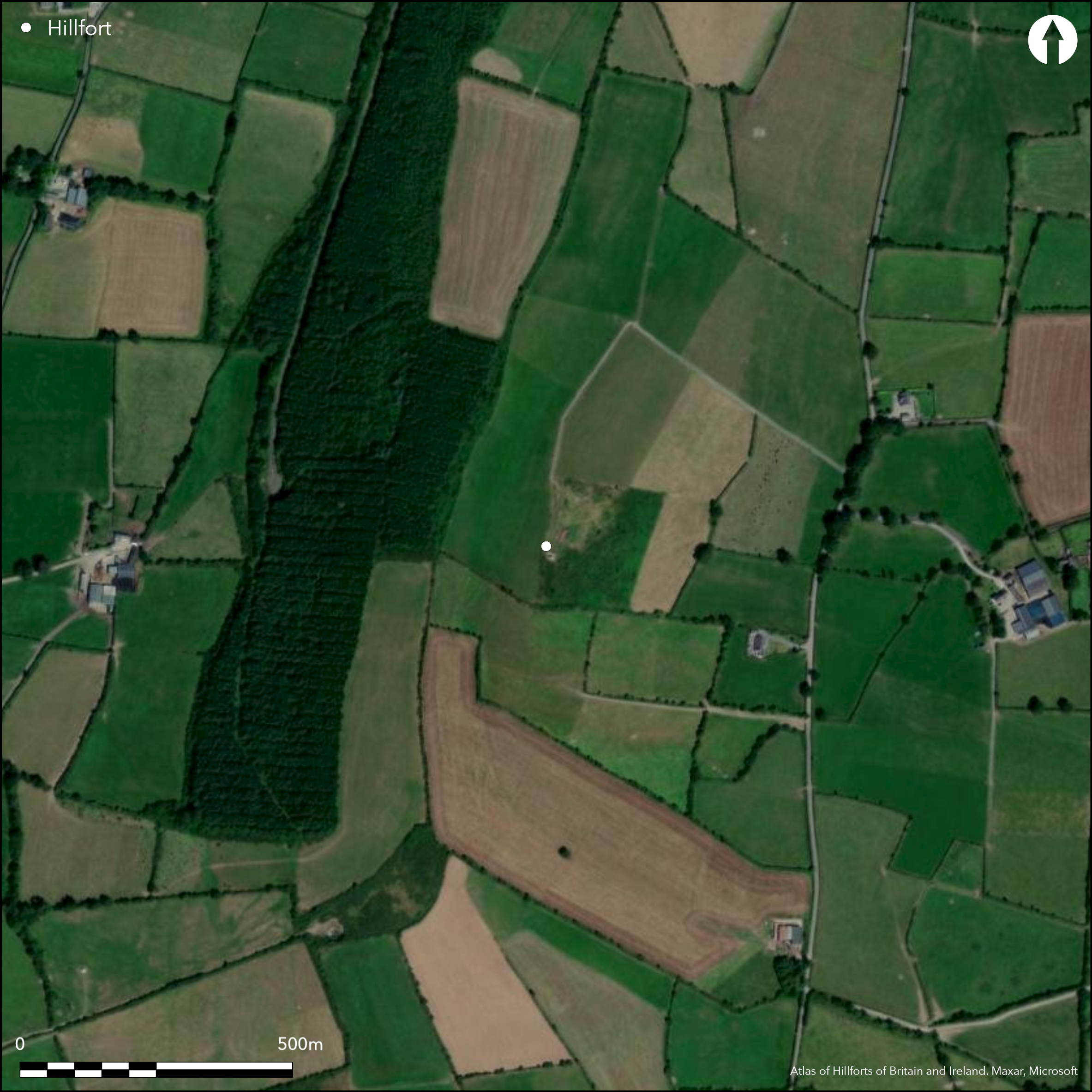
Satellite Imagery
Satellite Imagery
HER: Archaeological Survey of Ireland SMR Database KK010-007001 (None)
NMR: KK 010 (None)
SM: None
NGR: None
X: 647554 Y: 671002 (IRENET95)
Large, widely spaced multivallate enclosure surrounding the summit of Corrandhu Hill, one of three summits in an N - S running ridge overlooking Ballyraggett town. This ridge sits on the W edge of the Castlecomer Hills. The hillfort is draped over the narrow ridge, with the concentric enclosing elements ignoring the steep contours to the E and W of the hill, forming a circle in plan. The site has a total footprint of 8.9ha. Bivallate for its entire circuit with three possible original entrances at NNW and SE identified through geophysics (O'Driscoll 2013). No evidence for any internal features on the surface, pits and a possible hut structure identified in geophysics. Enclosing elements survive as low-rise bank features. Targeted excavation by O'Brien (2013) and geophysical survey by O'Driscoll (2013). Late Bronze Age radiocarbon dates from ditch deposits and palisade features. First written reference by Reverend Carrigan (1905).
Citizen Science: ✗
Reliability of Data: Confirmed
Reliability of Interpretation: Confirmed
X: -812076 Y: 6943867 (EPSG: 3857)
Longitude: -7.295006674150813 Latitude: 52.7879324511933 (EPSG:4326)
Country: Republic of Ireland; None
Current County or Unitary Authority: Kilkenny
Historic County: Kilkenny
Current Parish/Community/Council/Townland: Toor More
The site has been truncated and is visible as a low-rise feature or on aerial photography.
| Extant | ✓ |
| Cropmark | ✗ |
| Likely Destroyed | ✓ |
The W section of the hillfort is under modern commercial forestry plantation. The remainder of the hillfort is used for pasture and has patches of scrub, particularly at the center.
| Woodland | ✗ |
| Commercial Forestry Plantation | ✓ |
| Parkland | ✗ |
| Pasture (Grazing) | ✓ |
| Arable | ✗ |
| Scrub/Bracken | ✓ |
| Bare Outcrop | ✗ |
| Heather/Moorland | ✗ |
| Heath | ✗ |
| Built-up | ✗ |
| Coastal Grassland | ✗ |
| Other | ✗ |
Positioned surrounding the summit of a hill-ridge. The hillfort is draped over either side of a narrow N - S running ridge, with the E and W section of the enclosing elements disregarding the contours of the hill in order to attain a circular plan.
| Contour Fort | ✗ |
| Partial Contour Fort | ✗ |
| Promontory Fort | ✗ |
| Hillslope Fort | ✗ |
| Level Terrain Fort | ✗ |
| Marsh Fort | ✗ |
| Multiple Enclosure Fort | ✓ |
| Hilltop | ✓ |
| Coastal Promontory | ✗ |
| Inland Promontory | ✗ |
| Valley Bottom | ✗ |
| Knoll/Hillock/Outcrop | ✗ |
| Ridge | ✓ |
| Cliff/Plateau-edge/Scarp | ✗ |
| Hillslope | ✗ |
| Lowland | ✗ |
| Spur | ✗ |
Dominant Topographic Feature: Hill ridge.
| North | ✗ |
| Northeast | ✗ |
| East | ✗ |
| Southeast | ✗ |
| South | ✗ |
| Southwest | ✗ |
| West | ✗ |
| Northwest | ✗ |
| Level | ✓ |
Altitude: 253.0m
The W section of the outer enclosing elements are located within Donaghmore townland. The majority of the hillfort is positioned within Toor More townland. The site is near the intersection between the Toor More, Donaghmore and Finnan townland boundaries.
Boundary Type: Parish/Townland
Late Bronze Age dates from the basal fill of the inner and outer enclosing elements and associated palisade features.
Reliability: A - High
| Pre 1200BC | ✗ |
| 1200BC - 800BC | ✓ |
| 800BC - 400BC | ✗ |
| 400BC - AD50 | ✗ |
| AD50 - AD400 | ✗ |
| AD400 - AD 800 | ✗ |
| Post AD800 | ✗ |
| Unknown | ✗ |
| Pre Hillfort: | None |
| Post Hillfort: | None |
| C14: | Late Bronze Age radiocarbon dates from basal ditch deposits. |
Geophysical survey of entire site. Targeted excavation of inner and outer enclosing elements. First written reference by Reverend Carrigan (1905).
| 1st Identified Written Reference (1905): | Reverand Carrigan |
| Geophysical Survey (2013): | O'Driscoll |
| Excavation (2013): | O'Brien (2013) |
No recorded surface features. Geophysical survey has identified only a single possible structure near the possible entrance in the inner enclosing element at the NNW (O'Driscoll 2013). Possible pit features within the interior of the inner enclosing elements apparent in geophysics.
The W side of the hill ridge was heavily water-logged until relatively recently when the current land owner reclaimed this land. The excavated section of the inner ditch was water-logged and produced preserved wood, indicating that this wet area was probably present in prehistory.
| None | ✗ |
| Spring | ✗ |
| Stream | ✗ |
| Pool | ✗ |
| Flush | ✗ |
| Well | ✗ |
| Other | ✓ |
None
| No Known Features | ✓ |
| Round Stone Structures | ✗ |
| Rectangular Stone Structures | ✗ |
| Curvilinear Platforms | ✗ |
| Other Roundhouse Evidence | ✗ |
| Pits | ✗ |
| Quarry Hollows | ✗ |
| Other | ✗ |
No excavation of the interior undertaken.
| No Known Excavation | ✓ |
| Pits | ✗ |
| Postholes | ✗ |
| Roundhouses | ✗ |
| Rectangular Structures | ✗ |
| Roads/Tracks | ✗ |
| Quarry Hollows | ✗ |
| Other | ✗ |
| Nothing Found | ✗ |
A single possible hut structure and pit features identified by geophysics.
| No Known Geophysics | ✗ |
| Pits | ✓ |
| Roundhouses | ✓ |
| Rectangular Structures | ✗ |
| Roads/Tracks | ✗ |
| Quarry Hollows | ✗ |
| Other | ✗ |
| Nothing Found | ✗ |
Preserved wood in ditch deposits.
| No Known Finds | ✗ |
| Pottery | ✗ |
| Metal | ✗ |
| Metalworking | ✗ |
| Human Bones | ✗ |
| Animal Bones | ✗ |
| Lithics | ✗ |
| Environmental | ✓ |
| Other | ✗ |
NO APPARENT FEATURES
| APs Not Checked | ✗ |
| None | ✓ |
| Roundhouses | ✗ |
| Rectangular Structures | ✗ |
| Pits | ✗ |
| Postholes | ✗ |
| Roads/Tracks | ✗ |
| Other | ✗ |
Simple gap in inner enclosure at NNW revealed by geophysics (O'Driscoll 2013). Width of possible entrance not recorded, as field fence prevented continuation of survey in this area. Simple gap in outer enclosure at NNW revealed by geophysics. Width of possible entrance not recorded, as field fence prevented continuation of survey, although the gap is at least 12m wide. Simple gap in outer enclosure to SE revealed by geophysics. Gap is approximately 4.5m wide.
| 3: | None |
| 2: | Two possible entrances revealed by geophysics at NNW of inner and outer enclosure. A single entrance revealed in outer enclosure at SE. |
Guard Chambers: ✗
Chevaux de Frise: ✗
| 1. Simple Gap (North): | None |
| 2. Simple Gap (North): | None |
| 3. Simple Gap (South east): | None |
Multiple enclosure defined by two widely spaced circular enclosing elements separated by 80 - 90 meters. Excavation (O'Brien 2013) and geophysical survey (O'Driscoll 2013) has revealed that the inner and outer enclosing elements consist of banks with external ditches (the inner example being rock-cut) with small palisades abutting the inside of the banks. The inner ditch was approximately 1.4m deep and 2.5m wide. The outer ditch measured 1.2m in depth and 1.8m in width.
| Area 1: | 1.72ha. |
| Area 2: | 8.65ha. |
| Total: | 8.65ha. |
Total Footprint Area: 8.94ha.
None
| ✗ | None |
| ✓ | None |
| NE Quadrant: | 2 |
| SE Quadrant: | 2 |
| SW Quadrant: | 2 |
| NW Quadrant: | 2 |
| Total: | 2 |
| Partial Univallate | ✗ |
| Univallate | ✗ |
| Partial Bivallate | ✗ |
| Bivallate | ✓ |
| Partial Multivallate | ✗ |
| Multivallate | ✗ |
| Unknown | ✗ |
| Partial Univallate | ✗ |
| Univallate | ✓ |
| Partial Bivallate | ✗ |
| Bivallate | ✗ |
| Partial Multivallate | ✗ |
| Multivallate | ✗ |
None
| None | ✗ |
| Earthen Bank | ✓ |
| Stone Wall | ✗ |
| Rubble | ✗ |
| Wall-walk | ✗ |
| Evidence of Timber | ✗ |
| Vitrification | ✗ |
| Other Burning | ✗ |
| Palisade | ✗ |
| Counter Scarp Bank | ✗ |
| Berm | ✗ |
| Unfinished | ✗ |
| Other | ✗ |
Excavation revealed that the banks are largely composed of stone, with external ditches.
| None | ✗ |
| Earthen Bank | ✓ |
| Stone Wall | ✗ |
| Murus Duplex | ✗ |
| Timber-framed | ✗ |
| Timber-laced | ✗ |
| Vitrification | ✗ |
| Other Burning | ✗ |
| Palisade | ✓ |
| Counter Scarp Bank | ✗ |
| Berm | ✗ |
| Unfinished | ✗ |
| No Known Excavation | ✗ |
| Other | ✓ |
| ✗ | None |
| ✓ | The inner ditch is rock cut. |
Number of Ditches: 2
| ✗ | None. |
Condit, T. and Gibbson, M. 1988. Two 'little known' hillforts in Co. Kilkenny. Decies (37), 47 - 54.
Carrigan, Rev. W. 1905. The history and antiquities of the diocese of Ossory. Vol. 2. Kilkenny.
O'Brien, W. 2013. Unpublished excavation report: Toor More, Co. Kilkenny. UCC Cork, Dept of Archaeology.
O'Driscoll, J. 2013. Unpublished geophysical survey report: Toor More, Co. Kilkenny. UCC Cork, Dept of Archaeology.
Atlas of Hillforts:
Wikidata:
This work is licensed under CC BY-SA 4.0

 and should be cited as:
Lock, Gary and Ralston, Ian. 2024. Atlas of Hillforts of Britain and Ireland. Available at: https://hillforts.arch.ox.ac.uk
Document Version 1.1