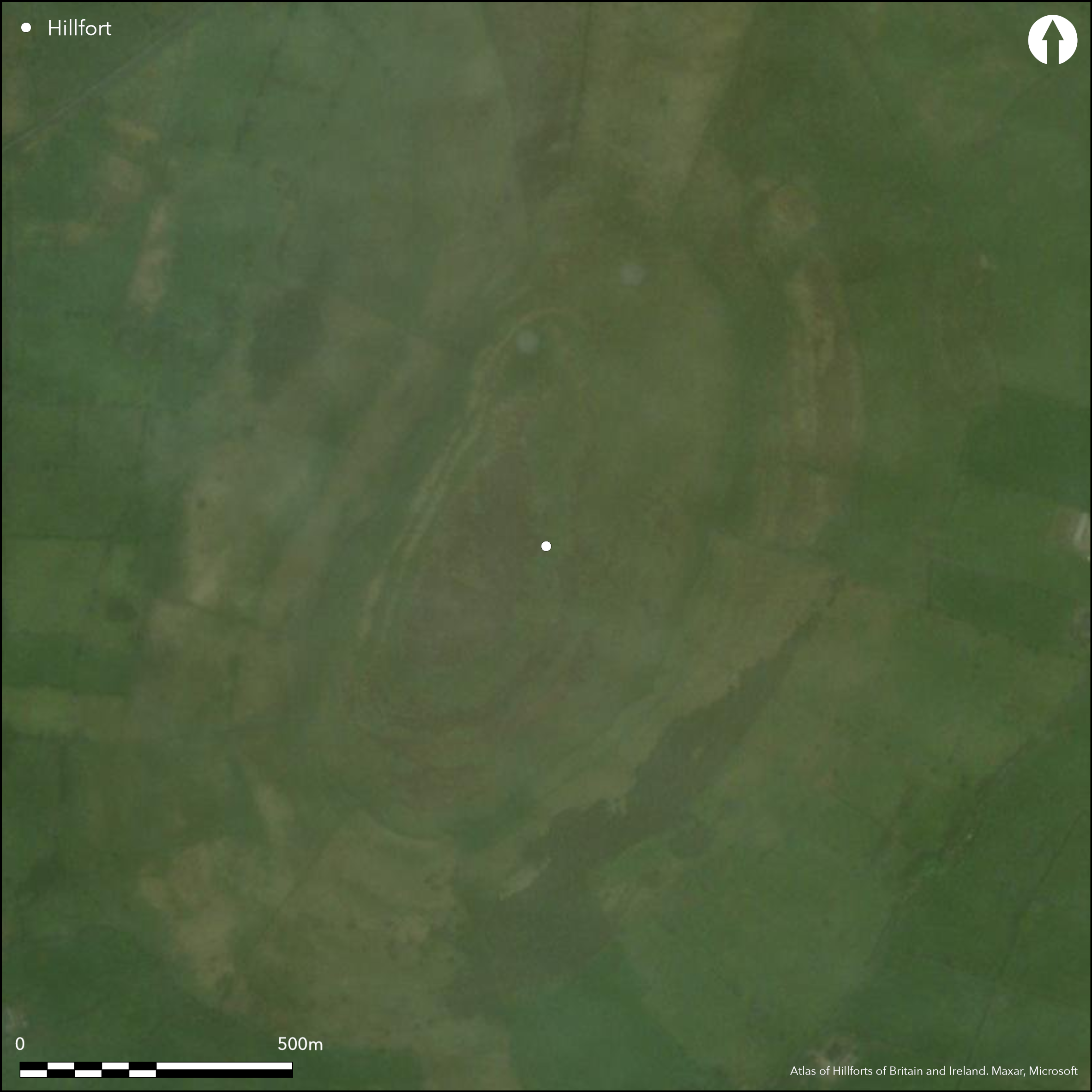
Satellite Imagery
Satellite Imagery
HER: Archaeological Survey of Ireland SMR Database SL032-013001 (None)
NMR: SL 032 (None)
SM: None
NGR: None
X: 555628 Y: 818973 (IRENET95)
Oval shaped multiple enclosure surrounding the flat summit of Knocknashee, a steep, isolated mountain in low-lying terrain. Bivallate at the E and S, the hillfort has a total site footprint of approximately 21.5ha. î R'ordain (1994, 39) has identified a possible entrance feature at the S comprising a gap with a passage-way/corridor. Up to 30 hut structures are visible on the surface and by aerial photography, and are clustered in the sheltered E half of the interior of the hillfort. Two large cairns located within the hillfort to the N could be interpreted as possible passage tombs. A D-shaped enclosure abuts the inner bank of the hillfort. Condit et al. (1991. 61) have suggests that various hollows and 'scoops' within the interior to the S may represent other settlements activity. This monument was survey by Condit et al. (1991) and Egan et al. (2005). Not identified as a hillfort in any historic mapping.
Citizen Science: ✗
Reliability of Data: Confirmed
Reliability of Interpretation: Confirmed
X: -966108 Y: 7192516 (EPSG: 3857)
Longitude: -8.678698205636934 Latitude: 54.11789358974203 (EPSG:4326)
Country: Republic of Ireland; None
Current County or Unitary Authority: Sligo
Historic County: Sligo
Current Parish/Community/Council/Townland: Knocknashee
None
| Extant | ✓ |
| Cropmark | ✗ |
| Likely Destroyed | ✗ |
None
| Woodland | ✗ |
| Commercial Forestry Plantation | ✗ |
| Parkland | ✗ |
| Pasture (Grazing) | ✓ |
| Arable | ✗ |
| Scrub/Bracken | ✗ |
| Bare Outcrop | ✗ |
| Heather/Moorland | ✗ |
| Heath | ✗ |
| Built-up | ✗ |
| Coastal Grassland | ✗ |
| Other | ✗ |
Multiple enclosure surrounding the somewhat flat summit of Knocknashee, a steep, isolated mountain in low-lying terrain. The enclosing elements are positioned on the edge of an abrupt break of slope that marks the edge of this flat area. This topographical feature is very distinct and stands out in the landscape. Panoramic views from the summit.
| Contour Fort | ✓ |
| Partial Contour Fort | ✗ |
| Promontory Fort | ✗ |
| Hillslope Fort | ✗ |
| Level Terrain Fort | ✗ |
| Marsh Fort | ✗ |
| Multiple Enclosure Fort | ✓ |
| Hilltop | ✓ |
| Coastal Promontory | ✗ |
| Inland Promontory | ✗ |
| Valley Bottom | ✗ |
| Knoll/Hillock/Outcrop | ✗ |
| Ridge | ✗ |
| Cliff/Plateau-edge/Scarp | ✗ |
| Hillslope | ✗ |
| Lowland | ✗ |
| Spur | ✗ |
Dominant Topographic Feature: Isolated mountain.
| North | ✗ |
| Northeast | ✗ |
| East | ✗ |
| Southeast | ✗ |
| South | ✗ |
| Southwest | ✗ |
| West | ✗ |
| Northwest | ✗ |
| Level | ✓ |
Altitude: 276.0m
The enclosing elements of the hillfort form the townland of Knocknashee Common. Abutting this townland and the enclosing elements of the hillfort are the townlands of Carrowmore, Lavagh, Carrownawaran, Gortnadrass, Belra and Cashel North.
Boundary Type: Parish/Townland
No dating evidence.
Reliability: D - None
| Pre 1200BC | ✗ |
| 1200BC - 800BC | ✗ |
| 800BC - 400BC | ✗ |
| 400BC - AD50 | ✗ |
| AD50 - AD400 | ✗ |
| AD400 - AD 800 | ✗ |
| Post AD800 | ✗ |
| Unknown | ✓ |
| Pre Hillfort: | Two cairns. |
| Post Hillfort: | None |
Monument survey by Condit et al. (1991) and Egan et al. (2005). Not identified as a hillfort in any historic mapping.
| Other (1990): | Visited by Hillfort Study Group |
| Other (1991): | Monument survey by Condit et al. |
| Other (2005): | Monument survey by Egan et al. |
Up to 30 hut structures are clustered in the E half of the hillfort. Various hollows and 'scoops' within the interior to the S may represent other settlements activity (Condit et al. 1991). Two large cairns at N end of hillfort interior. These may be passage tombs.
None
| None | ✓ |
| Spring | ✗ |
| Stream | ✗ |
| Pool | ✗ |
| Flush | ✗ |
| Well | ✗ |
| Other | ✗ |
30 round stone structures, various hollows and 'scoops' may represent other settlements activity (Condit et al. 1991). Two large cairns at N of hillfort interior.
| No Known Features | ✗ |
| Round Stone Structures | ✓ |
| Rectangular Stone Structures | ✗ |
| Curvilinear Platforms | ✗ |
| Other Roundhouse Evidence | ✗ |
| Pits | ✗ |
| Quarry Hollows | ✓ |
| Other | ✓ |
None
| No Known Excavation | ✓ |
| Pits | ✗ |
| Postholes | ✗ |
| Roundhouses | ✗ |
| Rectangular Structures | ✗ |
| Roads/Tracks | ✗ |
| Quarry Hollows | ✗ |
| Other | ✗ |
| Nothing Found | ✗ |
None
| No Known Geophysics | ✓ |
| Pits | ✗ |
| Roundhouses | ✗ |
| Rectangular Structures | ✗ |
| Roads/Tracks | ✗ |
| Quarry Hollows | ✗ |
| Other | ✗ |
| Nothing Found | ✗ |
None
| No Known Finds | ✓ |
| Pottery | ✗ |
| Metal | ✗ |
| Metalworking | ✗ |
| Human Bones | ✗ |
| Animal Bones | ✗ |
| Lithics | ✗ |
| Environmental | ✗ |
| Other | ✗ |
These feature have been identified and recorded and are visible in aerial photography.
| APs Not Checked | ✗ |
| None | ✗ |
| Roundhouses | ✓ |
| Rectangular Structures | ✗ |
| Pits | ✓ |
| Postholes | ✗ |
| Roads/Tracks | ✗ |
| Other | ✗ |
30m break in outer bank to S. Two linear earthworks at the terminals of the entrance gap are set at right angles to the enclosing elements, creating a 20m long corridor.
| 1: | None |
| 2: | None |
Guard Chambers: ✗
Chevaux de Frise: ✗
| 1. Passage-way/Corridor (South): | None |
Oval area defined by two earthen banks. The inner bank is approximately 4m wide and 1.5m high. It is constructed from a series of quarry hollows immediately inside the inner bank (Condit et al. 1991). The outer bank is apparent at the E and S and is built on a natural terrace. It is concentric with the inner enclosing elements. They are separated by approximately 22m.
| Area 1: | 19.53ha. |
| Area 2: | 21.5ha. |
| Total: | 21.5ha. |
Total Footprint Area: 21.5ha.
None
| ✗ | None |
| ✗ | None |
| NE Quadrant: | 2 |
| SE Quadrant: | 2 |
| SW Quadrant: | 1 |
| NW Quadrant: | 1 |
| Total: | 2 |
| Partial Univallate | ✓ |
| Univallate | ✗ |
| Partial Bivallate | ✓ |
| Bivallate | ✗ |
| Partial Multivallate | ✗ |
| Multivallate | ✗ |
| Unknown | ✗ |
| Partial Univallate | ✗ |
| Univallate | ✓ |
| Partial Bivallate | ✗ |
| Bivallate | ✗ |
| Partial Multivallate | ✗ |
| Multivallate | ✗ |
Quarry hollows.
| None | ✗ |
| Earthen Bank | ✓ |
| Stone Wall | ✗ |
| Rubble | ✗ |
| Wall-walk | ✗ |
| Evidence of Timber | ✗ |
| Vitrification | ✗ |
| Other Burning | ✗ |
| Palisade | ✗ |
| Counter Scarp Bank | ✗ |
| Berm | ✗ |
| Unfinished | ✗ |
| Other | ✓ |
None
| None | ✗ |
| Earthen Bank | ✗ |
| Stone Wall | ✗ |
| Murus Duplex | ✗ |
| Timber-framed | ✗ |
| Timber-laced | ✗ |
| Vitrification | ✗ |
| Other Burning | ✗ |
| Palisade | ✗ |
| Counter Scarp Bank | ✗ |
| Berm | ✗ |
| Unfinished | ✗ |
| No Known Excavation | ✓ |
| Other | ✗ |
| ✗ | None |
| ✗ | Quarry hollows inside inner bank could be viewed as an attempt to create an inner ditch feature. However, the steep fall of ground immediately outside the inner bank would have largely negated the use of an external ditch, and the inner quarry hollows were probably necessary to construct the bank. |
Number of Ditches: 0
| ✗ | None. |
Condit, T., Gibbons, M., Timoney, M.1991. Hillforts in Sligo and Leitrim, Emania, 59 - 62.
Egan, U., Byrne, E. and Sleeman, M. 2005. Archaeological Inventory of County Sligo. Dublin stationary Office.
Atlas of Hillforts:
Wikidata:
This work is licensed under CC BY-SA 4.0

 and should be cited as:
Lock, Gary and Ralston, Ian. 2024. Atlas of Hillforts of Britain and Ireland. Available at: https://hillforts.arch.ox.ac.uk
Document Version 1.1