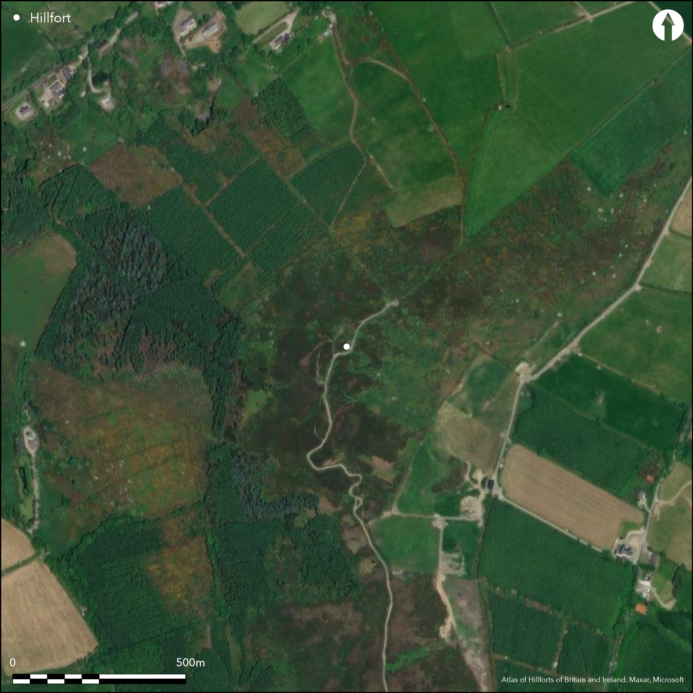
Satellite Imagery
Satellite Imagery
HER: Archaeological Survey of Ireland SMR Database TN019-047 (None)
NMR: TN 019 (None)
SM: None
NGR: None
X: 573422 Y: 679385 (IRENET95)
Irregular shaped contour fort surrounding two summits of Laghtea Hill. The enclosing elements are positioned at the base of a steep incline. In commanding position overlooking the S fording point of Lough Derg and with panoramic views from the summit. Bivallate for the entire perimeter with no enclosing elements at SE. The site has a total foot print of 7.8ha. There is a possible original entrance at the W (Condit 1995, 37). Walking track breaks through enclosing elements at S. Low circular platform with well within interior to the N. No other features visible on the surface. Ramparts survive well throughout, however, heavy overgrowth largely conceals the enclosing elements. First identification and monument survey by Condit (1995). The hillfort is not depicted in any historic mapping.
Citizen Science: ✗
Reliability of Data: Confirmed
Reliability of Interpretation: Confirmed
X: -934495 Y: 6958013 (EPSG: 3857)
Longitude: -8.394715198036696 Latitude: 52.86471468110021 (EPSG:4326)
Country: Republic of Ireland; None
Current County or Unitary Authority: Tipperary
Historic County: Tipperary
Current Parish/Community/Council/Townland: Laghtea
Extant but largely concealed by heavy overgrowth. Modern walking track breaks through enclosing elements at the S and extends to the N summit where a large cross has been erected. Small modern structure has been near the N summit of the interior.
| Extant | ✓ |
| Cropmark | ✗ |
| Likely Destroyed | ✗ |
Commercial forestry plantation abutting enclosing elements at W and SW. Hillfort interior heavily overgrown and under light blanket bog. Large areas of rock outcrop near summits.
| Woodland | ✗ |
| Commercial Forestry Plantation | ✗ |
| Parkland | ✗ |
| Pasture (Grazing) | ✗ |
| Arable | ✗ |
| Scrub/Bracken | ✗ |
| Bare Outcrop | ✗ |
| Heather/Moorland | ✓ |
| Heath | ✗ |
| Built-up | ✗ |
| Coastal Grassland | ✗ |
| Other | ✗ |
Irregular shaped contour fort closely following the natural contours of Laghtea Hill. The enclosing elements are positioned surrounding a steep incline towards two summits. In commanding position overlooking the S fording point of Lough Derg and with panoramic views from the summit.
| Contour Fort | ✓ |
| Partial Contour Fort | ✗ |
| Promontory Fort | ✗ |
| Hillslope Fort | ✗ |
| Level Terrain Fort | ✗ |
| Marsh Fort | ✗ |
| Multiple Enclosure Fort | ✗ |
| Hilltop | ✓ |
| Coastal Promontory | ✗ |
| Inland Promontory | ✗ |
| Valley Bottom | ✗ |
| Knoll/Hillock/Outcrop | ✗ |
| Ridge | ✗ |
| Cliff/Plateau-edge/Scarp | ✗ |
| Hillslope | ✗ |
| Lowland | ✗ |
| Spur | ✗ |
Dominant Topographic Feature: Irregular shaped, steeply sloping hill.
| North | ✗ |
| Northeast | ✗ |
| East | ✗ |
| Southeast | ✗ |
| South | ✗ |
| Southwest | ✗ |
| West | ✗ |
| Northwest | ✗ |
| Level | ✓ |
Altitude: 322.0m
Boundary seperating the townlands of Laghtea and Cloneybrien runs N - S through the center of the hillfort. The S section of the enclosing elements forms the intersection between the two aforementioned townland boundaries and Townlough Upper townland to the S.
Boundary Type: Parish/Townland
No dating evidence.
Reliability: D - None
| Pre 1200BC | ✗ |
| 1200BC - 800BC | ✗ |
| 800BC - 400BC | ✗ |
| 400BC - AD50 | ✗ |
| AD50 - AD400 | ✗ |
| AD400 - AD 800 | ✗ |
| Post AD800 | ✗ |
| Unknown | ✓ |
| Pre Hillfort: | None |
| Post Hillfort: | None |
Survey and first identification of hillfort by Condit in 1995. The hillfort is not depicted in any historic mapping.
| 1st Identified Written Reference (1995): | Condit (1995, 37). |
| Other (1995): | Monument survey by Condit (1995, 37). |
There is a low circular platform approximately 20m in diameter containing a stone-edged well at the N of hillfort interior (Condit 1995, 37). Condit suggests this may be contemporary with the hillfort.
Well within circular platform at N of interior.
| None | ✗ |
| Spring | ✗ |
| Stream | ✗ |
| Pool | ✗ |
| Flush | ✗ |
| Well | ✓ |
| Other | ✗ |
None
| No Known Features | ✓ |
| Round Stone Structures | ✗ |
| Rectangular Stone Structures | ✗ |
| Curvilinear Platforms | ✗ |
| Other Roundhouse Evidence | ✗ |
| Pits | ✗ |
| Quarry Hollows | ✗ |
| Other | ✗ |
None
| No Known Excavation | ✓ |
| Pits | ✗ |
| Postholes | ✗ |
| Roundhouses | ✗ |
| Rectangular Structures | ✗ |
| Roads/Tracks | ✗ |
| Quarry Hollows | ✗ |
| Other | ✗ |
| Nothing Found | ✗ |
None
| No Known Geophysics | ✓ |
| Pits | ✗ |
| Roundhouses | ✗ |
| Rectangular Structures | ✗ |
| Roads/Tracks | ✗ |
| Quarry Hollows | ✗ |
| Other | ✗ |
| Nothing Found | ✗ |
None
| No Known Finds | ✓ |
| Pottery | ✗ |
| Metal | ✗ |
| Metalworking | ✗ |
| Human Bones | ✗ |
| Animal Bones | ✗ |
| Lithics | ✗ |
| Environmental | ✗ |
| Other | ✗ |
NO APPARENT FEATURES
| APs Not Checked | ✗ |
| None | ✓ |
| Roundhouses | ✗ |
| Rectangular Structures | ✗ |
| Pits | ✗ |
| Postholes | ✗ |
| Roads/Tracks | ✗ |
| Other | ✗ |
Simple break in enclosing elements at W is likely an original entrance. Walking track cuts through the enclosing elements at the S is likely to be modern.
| 2: | None |
| 2: | None |
Guard Chambers: ✗
Chevaux de Frise: ✗
| 1. Simple Gap (West): | Break in banks and causeway over ditch. |
Irregular area defined by two earthen banks with an intervening ditch. Inner bank measures 2.5m wide and 0.9m high. The outer bank measures 2.6m wide and 0.5m high. The intervening ditch is approximately 2.5m wide (Condit 1995, 37)
| Area 1: | 7.41ha. |
| Total: | 7.41ha. |
Total Footprint Area: 7.83ha.
None
| ✗ | None |
| ✗ | Condit (1995, 37) suggests the there is no evidence the enclosing elements ever enclosed the SE section of the hill. Here, Condit suggests that the natural steep slopes and outcrops would have formed a natural barrier. |
| NE Quadrant: | 1 |
| SE Quadrant: | 0 |
| SW Quadrant: | 1 |
| NW Quadrant: | 1 |
| Total: | 1 |
| Partial Univallate | ✓ |
| Univallate | ✗ |
| Partial Bivallate | ✗ |
| Bivallate | ✗ |
| Partial Multivallate | ✗ |
| Multivallate | ✗ |
| Unknown | ✗ |
| Partial Univallate | ✗ |
| Univallate | ✗ |
| Partial Bivallate | ✗ |
| Bivallate | ✗ |
| Partial Multivallate | ✗ |
| Multivallate | ✗ |
Earth and stone banks
| None | ✗ |
| Earthen Bank | ✓ |
| Stone Wall | ✗ |
| Rubble | ✗ |
| Wall-walk | ✗ |
| Evidence of Timber | ✗ |
| Vitrification | ✗ |
| Other Burning | ✗ |
| Palisade | ✗ |
| Counter Scarp Bank | ✗ |
| Berm | ✗ |
| Unfinished | ✗ |
| Other | ✗ |
None
| None | ✗ |
| Earthen Bank | ✗ |
| Stone Wall | ✗ |
| Murus Duplex | ✗ |
| Timber-framed | ✗ |
| Timber-laced | ✗ |
| Vitrification | ✗ |
| Other Burning | ✗ |
| Palisade | ✗ |
| Counter Scarp Bank | ✗ |
| Berm | ✗ |
| Unfinished | ✗ |
| No Known Excavation | ✓ |
| Other | ✗ |
| ✗ | None |
| ✓ | Two earth and stone banks with an intervening ditch. |
Number of Ditches: 1
| ✗ | None. |
Condit, T. 1995. Hillfort discoveries near Killaloe, Co. Clare. Archaeology Ireland, 34 - 37.
Atlas of Hillforts:
Wikidata:
This work is licensed under CC BY-SA 4.0

 and should be cited as:
Lock, Gary and Ralston, Ian. 2024. Atlas of Hillforts of Britain and Ireland. Available at: https://hillforts.arch.ox.ac.uk
Document Version 1.1