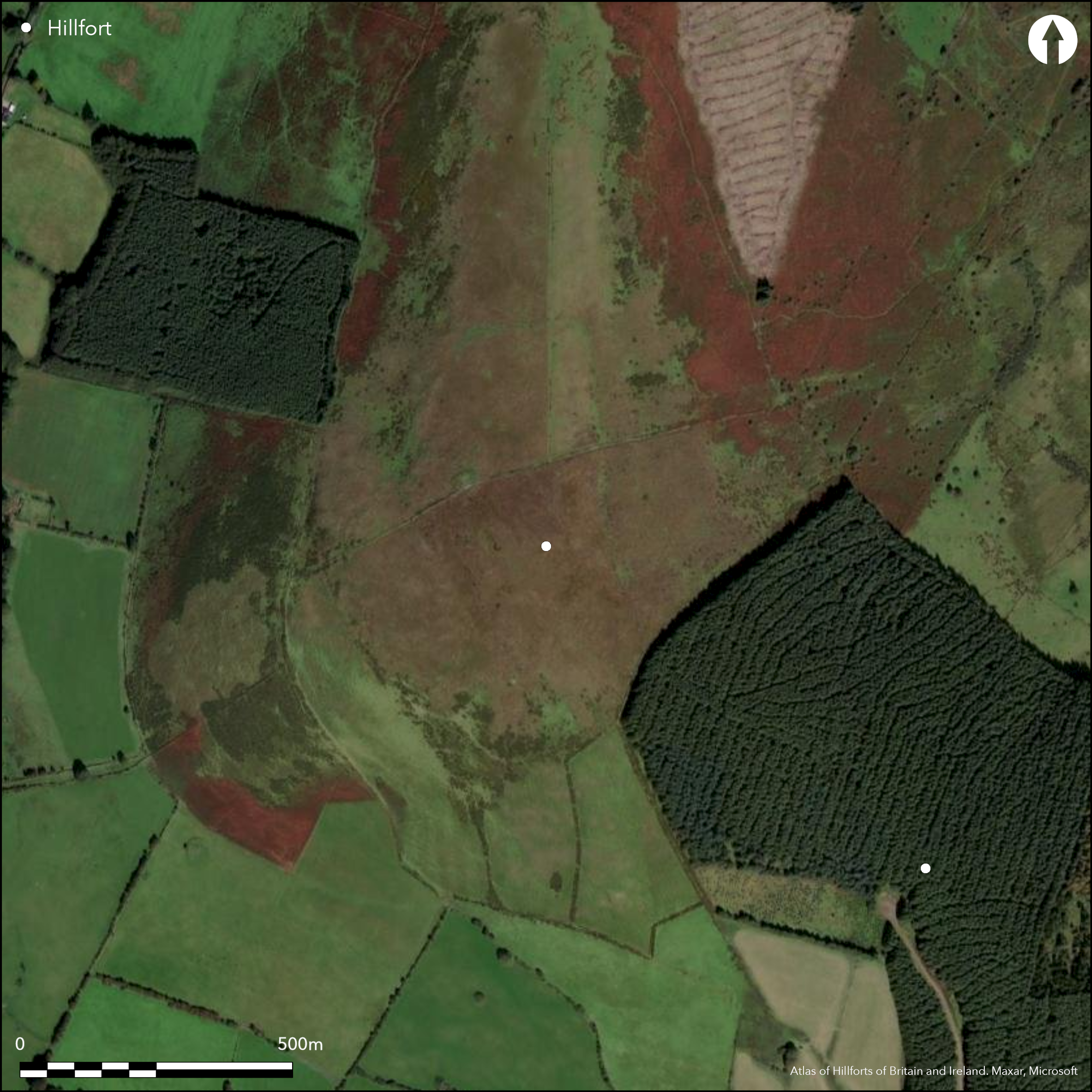
Satellite Imagery
Satellite Imagery
HER: Archaeological Survey of Ireland SMR Database WI027-078002 (None)
NMR: WI 027 (None)
SM: None
NGR: None
X: 691957 Y: 691588 (IRENET95)
Contour fort positioned in commanding position on domed E summit of Spinans Hill at SW edge of Wicklow mountains. Spinans Hill 1 is one of nine hillforts comprising the Baltinglass hillfort cluster. Univallate for its entire circuit and forming a complete circuit, it has a total site footprint of approximately 11.1ha. There are no recorded entrance features. Condit (1992, 20; 1998, 20) has recorded what he interprets as a Neolithic passage tomb cemetery within the interior of the hillfort. This comprises a large central cairn positioned at the summit of the hillfort, surrounded by five smaller examples. The ramparts survive best to the E. Interior heavily overgrown with scrub and heather. First identified by Condit in 1992. Monument survey by Condit in 1998. GPS survey by O'Driscoll in 2014.
Citizen Science: ✗
Reliability of Data: Confirmed
Reliability of Interpretation: Confirmed
X: -738167 Y: 6976926 (EPSG: 3857)
Longitude: -6.631068880568417 Latitude: 52.967163768766106 (EPSG:4326)
Country: Republic of Ireland; None
Current County or Unitary Authority: Wicklow
Historic County: Wicklow
Current Parish/Community/Council/Townland: Ballyhubbock Upper
Under heavy scrub, identified in 1992 by Condit.
| Extant | ✓ |
| Cropmark | ✗ |
| Likely Destroyed | ✗ |
None
| Woodland | ✗ |
| Commercial Forestry Plantation | ✗ |
| Parkland | ✗ |
| Pasture (Grazing) | ✗ |
| Arable | ✗ |
| Scrub/Bracken | ✓ |
| Bare Outcrop | ✗ |
| Heather/Moorland | ✗ |
| Heath | ✗ |
| Built-up | ✗ |
| Coastal Grassland | ✗ |
| Other | ✗ |
Contour fort located in commanding position on domed E summit of Spinans Hill at SW edge of Wicklow mountains. Panoramic views from the summit. The fort strictly follows the contours of the hill. Spinans Hill 1 is one of nine hillforts comprising the Baltinglass hillfort cluster.
| Contour Fort | ✓ |
| Partial Contour Fort | ✗ |
| Promontory Fort | ✗ |
| Hillslope Fort | ✗ |
| Level Terrain Fort | ✗ |
| Marsh Fort | ✗ |
| Multiple Enclosure Fort | ✗ |
| Hilltop | ✓ |
| Coastal Promontory | ✗ |
| Inland Promontory | ✗ |
| Valley Bottom | ✗ |
| Knoll/Hillock/Outcrop | ✗ |
| Ridge | ✗ |
| Cliff/Plateau-edge/Scarp | ✗ |
| Hillslope | ✗ |
| Lowland | ✗ |
| Spur | ✗ |
Dominant Topographic Feature: Spinans Hill.
| North | ✗ |
| Northeast | ✗ |
| East | ✗ |
| Southeast | ✗ |
| South | ✗ |
| Southwest | ✗ |
| West | ✗ |
| Northwest | ✗ |
| Level | ✓ |
Altitude: 409.0m
Center of the hillfort is bisected by the boundary between the townlands of Spinans Hill and Ballyhubbock Upper.
Boundary Type: Parish/Townland
No dating evidence.
Reliability: D - None
| Pre 1200BC | ✗ |
| 1200BC - 800BC | ✗ |
| 800BC - 400BC | ✗ |
| 400BC - AD50 | ✗ |
| AD50 - AD400 | ✗ |
| AD400 - AD 800 | ✗ |
| Post AD800 | ✗ |
| Unknown | ✓ |
| Pre Hillfort: | Possible passage tomb cemetery; Stone axe found on Spinans Hill indicating Neolithic activity on the hill, however, it is unknown if this was discovered within the hillfort (Condit 1992, 20). |
| Post Hillfort: | None |
The monument was only recently discovered by Condit (1992). There is no previous map depiction. Monument survey by Condit in 1998. GPS survey by O'Driscoll in 2014.
| Other (1992): | Monument survey by Condit |
| Other (1998): | Monument survey by Condit |
| Other (2014): | GPS survey by O'Driscoll. |
The interior of this hillfort is overgrown with heather, making identification of low relief ground features difficult. No habitation evidence has been identified within the interior. Condit (1992, 19 _ 20) has recorded six cairns at its centre. A large central cairn positioned at the summit of the hillfort is surrounded by five smaller examples. This group of cairns has been interpreted by Condit (1992, 20; 1998, 20) as a possible passage tomb cemetery. Structural features at the centre of the smaller cairns indicate that these may well be megalithic tombs. Price identified ruined cists in several robbed out smaller cairns (in Corlett and Weaver 2002, 467).
None
| None | ✓ |
| Spring | ✗ |
| Stream | ✗ |
| Pool | ✗ |
| Flush | ✗ |
| Well | ✗ |
| Other | ✗ |
Possible passage tomb cemetery.
| No Known Features | ✗ |
| Round Stone Structures | ✗ |
| Rectangular Stone Structures | ✗ |
| Curvilinear Platforms | ✗ |
| Other Roundhouse Evidence | ✗ |
| Pits | ✗ |
| Quarry Hollows | ✗ |
| Other | ✓ |
None
| No Known Excavation | ✓ |
| Pits | ✗ |
| Postholes | ✗ |
| Roundhouses | ✗ |
| Rectangular Structures | ✗ |
| Roads/Tracks | ✗ |
| Quarry Hollows | ✗ |
| Other | ✗ |
| Nothing Found | ✗ |
None
| No Known Geophysics | ✓ |
| Pits | ✗ |
| Roundhouses | ✗ |
| Rectangular Structures | ✗ |
| Roads/Tracks | ✗ |
| Quarry Hollows | ✗ |
| Other | ✗ |
| Nothing Found | ✗ |
None
| No Known Finds | ✓ |
| Pottery | ✗ |
| Metal | ✗ |
| Metalworking | ✗ |
| Human Bones | ✗ |
| Animal Bones | ✗ |
| Lithics | ✗ |
| Environmental | ✗ |
| Other | ✗ |
NO APPARENT FEATURES
| APs Not Checked | ✗ |
| None | ✓ |
| Roundhouses | ✗ |
| Rectangular Structures | ✗ |
| Pits | ✗ |
| Postholes | ✗ |
| Roads/Tracks | ✗ |
| Other | ✗ |
No obvious entrance features recorded.
| 0: | None |
| 2: | None |
Guard Chambers: ✗
Chevaux de Frise: ✗
Spinans Hill 1 is defined as an irregularly shaped area enclosed by a peat-covered earthen bank occupying 11.11ha. The bank is best preserved at the N and E and is largely levelled over the remainder of its perimeter (Grogan and Kilfeather 1997, 40 _ 41). It was identified through aerial photography by Condit (1992). Price had previously noted an element of the hillfort but did not identify it as such (in Corlett and Weaver 2002, 538 _ 539).
| Area 1: | 10.69ha. |
| Total: | 10.69ha. |
Total Footprint Area: 11.11ha.
None
| ✗ | None |
| ✓ | None |
| NE Quadrant: | 1 |
| SE Quadrant: | 1 |
| SW Quadrant: | 1 |
| NW Quadrant: | 1 |
| Total: | 1 |
| Partial Univallate | ✗ |
| Univallate | ✓ |
| Partial Bivallate | ✗ |
| Bivallate | ✗ |
| Partial Multivallate | ✗ |
| Multivallate | ✗ |
| Unknown | ✗ |
| Partial Univallate | ✗ |
| Univallate | ✗ |
| Partial Bivallate | ✗ |
| Bivallate | ✗ |
| Partial Multivallate | ✗ |
| Multivallate | ✗ |
None
| None | ✗ |
| Earthen Bank | ✓ |
| Stone Wall | ✗ |
| Rubble | ✗ |
| Wall-walk | ✗ |
| Evidence of Timber | ✗ |
| Vitrification | ✗ |
| Other Burning | ✗ |
| Palisade | ✗ |
| Counter Scarp Bank | ✗ |
| Berm | ✗ |
| Unfinished | ✗ |
| Other | ✗ |
None
| None | ✗ |
| Earthen Bank | ✗ |
| Stone Wall | ✗ |
| Murus Duplex | ✗ |
| Timber-framed | ✗ |
| Timber-laced | ✗ |
| Vitrification | ✗ |
| Other Burning | ✗ |
| Palisade | ✗ |
| Counter Scarp Bank | ✗ |
| Berm | ✗ |
| Unfinished | ✗ |
| No Known Excavation | ✓ |
| Other | ✗ |
| ✗ | None |
| ✓ | Possible external ditch at the E. |
Number of Ditches: 1
| ✗ | None. |
Condit, T. 1992. Ireland's hillfort capital: Baltinglass, Co. Wicklow. Archaeology Ireland, 6 (3), 16-20.
Condit, T. 1998. Observations of the Baltinglass hillfort complex. Wicklow: Archaeology and History, 1, 9-25.
Corlett, C. and Weaver, M. 2002. The Liam Price Notebooks: the Placenames, Antiquities and Topography of County Wicklow, II. Department of Arts, Heritage and the Gaeltacht, Dublin.
O'Driscoll, J. 2014. Unpublished GPS survey report: Spinans hill 1., Co. Wicklow. UCC Cork, Dept of Archaeology.
Atlas of Hillforts:
Wikidata:
This work is licensed under CC BY-SA 4.0

 and should be cited as:
Lock, Gary and Ralston, Ian. 2024. Atlas of Hillforts of Britain and Ireland. Available at: https://hillforts.arch.ox.ac.uk
Document Version 1.1