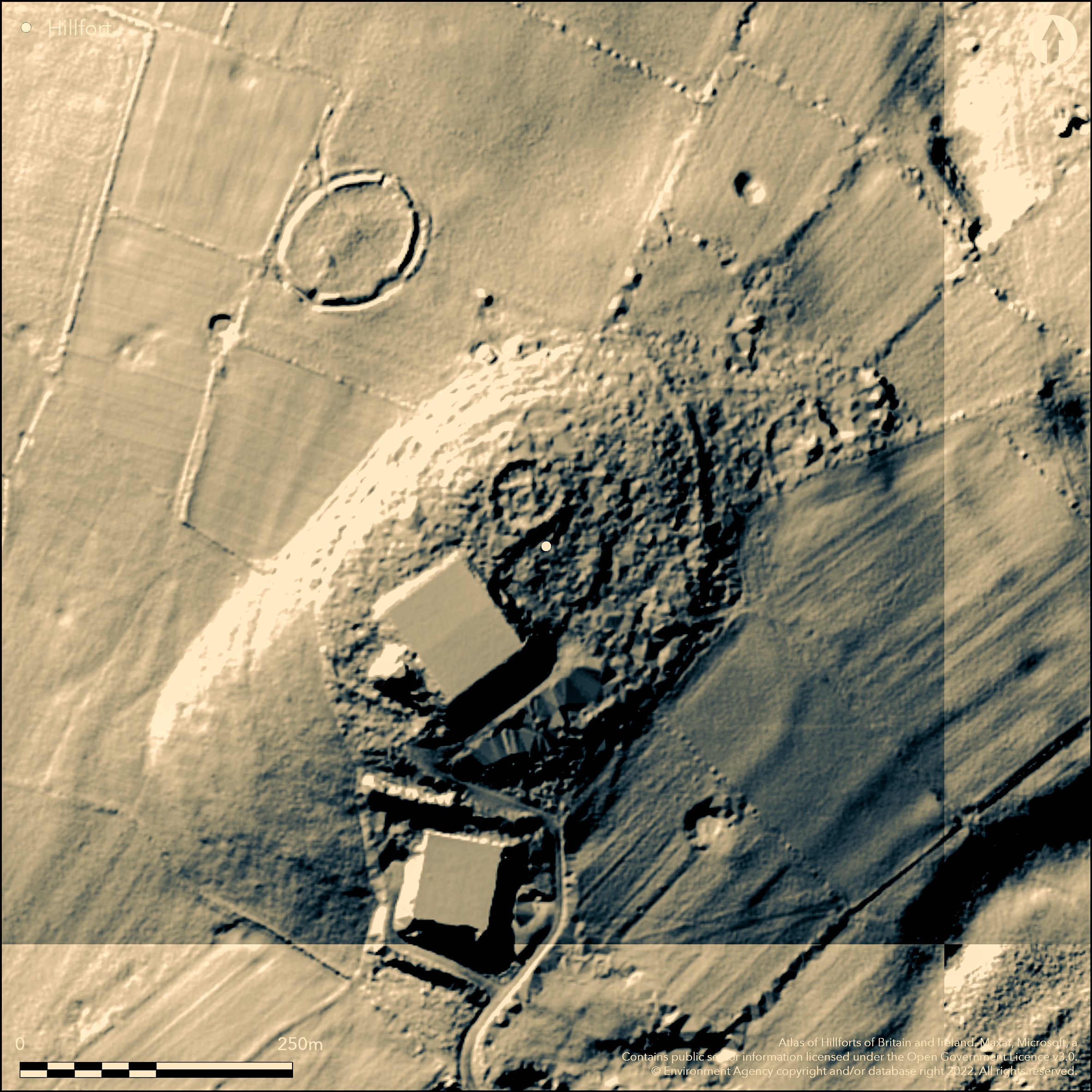
LiDAR 1m DTM Hillshade
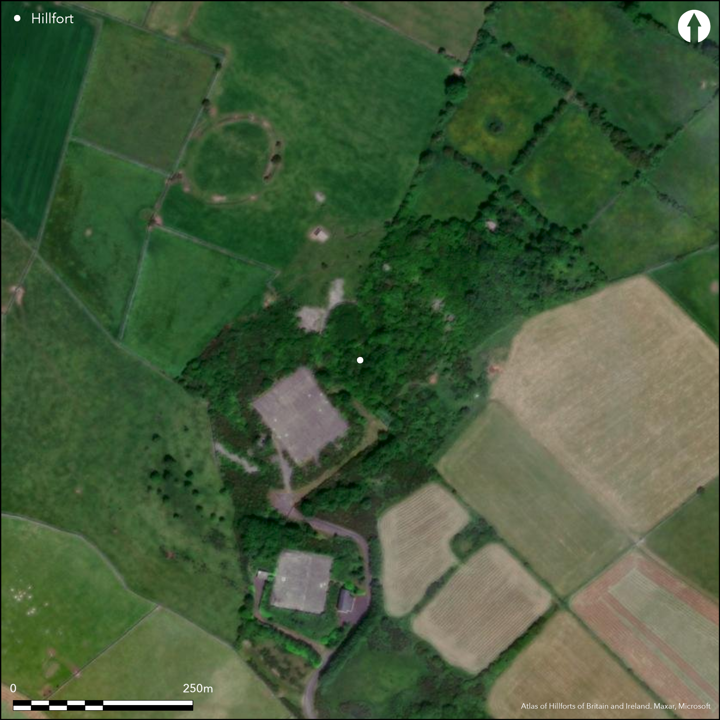
Satellite Imagery
LiDAR 1m DTM Hillshade
Satellite Imagery
Scroll left/right to view further images.
HER: Archaeological Survey of Ireland SMR Database GA043-033006 (None)
NMR: GA 043 (None)
SM: None
NGR: None
X: 537801 Y: 748825 (IRENET95)
Oval fort of approximately 4.8ha enclosed area positioned surrounding the summit and S slopes of Knockacarrigeen Hill, overlooking low-lying terrain to the N, E and S. Univallate for its entire circuit with no recorded entrance features. Cairn and Early Medieval ringfort located at N of interior. Excavation has revealed an elongated stone enclosure within the interior, dated to the Neolithic/Early Bronze Age (Carey 2002). Ramparts survive as a rubble stone bank and is extant for much of its circuit. Heavy gorse and scrub growth within interior. Water reservoir built within interior. Excavations by Carey (2002) in 1994. No radiocarbon dates relating to the construction of the hillfort. Dates obtained from a small stone-built enclosure inside the hillfort (2121_1913 to 2173_1828 BC and 2600_2484 to 2860_2460 BC) indicate that the hilltop was occupied during the Neolithic and/or Early Bronze Age.
Citizen Science: ✗
Reliability of Data: Confirmed
Reliability of Interpretation: Confirmed
X: -994882 Y: 7073362 (EPSG: 3857)
Longitude: -8.93717698769886 Latitude: 53.485766373816695 (EPSG:4326)
Country: Republic of Ireland; None
Current County or Unitary Authority: Galway
Historic County: Galway
Current Parish/Community/Council/Townland: Knockacarrigeen
Excavations by Carey (2002) prior to development of interior.
| Extant | ✓ |
| Cropmark | ✗ |
| Likely Destroyed | ✗ |
Heavy overgrowth particularly in the S of the hillfort.
| Woodland | ✗ |
| Commercial Forestry Plantation | ✗ |
| Parkland | ✗ |
| Pasture (Grazing) | ✗ |
| Arable | ✗ |
| Scrub/Bracken | ✓ |
| Bare Outcrop | ✗ |
| Heather/Moorland | ✗ |
| Heath | ✗ |
| Built-up | ✗ |
| Coastal Grassland | ✗ |
| Other | ✗ |
Univallate hillslope fort surrounding the summit and S slopes of Knockacarrigeen Hill. Positioned in low-lying terrain, the hillfort has excellent view in all directions and particularily to the N, E and S. Knockma Hill overlooks the hilltop 1.5km to the W.
| Contour Fort | ✗ |
| Partial Contour Fort | ✓ |
| Promontory Fort | ✗ |
| Hillslope Fort | ✗ |
| Level Terrain Fort | ✗ |
| Marsh Fort | ✗ |
| Multiple Enclosure Fort | ✗ |
| Hilltop | ✓ |
| Coastal Promontory | ✗ |
| Inland Promontory | ✗ |
| Valley Bottom | ✗ |
| Knoll/Hillock/Outcrop | ✗ |
| Ridge | ✗ |
| Cliff/Plateau-edge/Scarp | ✗ |
| Hillslope | ✗ |
| Lowland | ✗ |
| Spur | ✗ |
Dominant Topographic Feature: Knockacarrigeen Hill.
| North | ✗ |
| Northeast | ✗ |
| East | ✗ |
| Southeast | ✗ |
| South | ✓ |
| Southwest | ✗ |
| West | ✗ |
| Northwest | ✗ |
| Level | ✗ |
Altitude: 101.0m
At the center of the hillfort, the four townlans of Knockacarrigeen, Carrowntemple, Pollaturk and Cartron meet.
Boundary Type: Parish/Townland
Dates obtained from a small stone-built enclosure inside the hillfort (2121_1913 to 2173_1828 BC and 2600_2484 to 2860_2460 BC) indicate that the hilltop was occupied during the Neolithic and/or Early Bronze Age. There were no dates obtained from the excavated hillfort bank or associated old ground surface (Carey 2002). Therefore, the construction and occupation of the hillfort could date to any period after the Early Bronze Age.
Reliability: C - Low
| Pre 1200BC | ✓ |
| 1200BC - 800BC | ✗ |
| 800BC - 400BC | ✗ |
| 400BC - AD50 | ✗ |
| AD50 - AD400 | ✗ |
| AD400 - AD 800 | ✗ |
| Post AD800 | ✗ |
| Unknown | ✓ |
| Pre Hillfort: | None |
| Post Hillfort: | Early Medieval ringforts located within and abutting the hillfort. |
| C14: | None |
First discovered by aerial reconnaissance by the Galway Archaeological Survey in 1987, Monument survey by Byrne and Gosling in 1988. Excavation by Carey (2002) in 1994 prior to development.
| Other (1987): | First discovered by aerial reconnaissance by the Galway Archaeological Survey. |
| 1st Identified Written Reference (1988): | Byrne and Gosling |
| Excavation (1994): | Carey (2002) |
Interior cut by a number of modern field boundaries. A cairn and Early Medieval ringfort are located in the N of the interior. Excavation revealed an elongated enclosure approximately 15m by 7.5m, dated to the Neolithic/Early Bronze Age.
None
| None | ✓ |
| Spring | ✗ |
| Stream | ✗ |
| Pool | ✗ |
| Flush | ✗ |
| Well | ✗ |
| Other | ✗ |
None
| No Known Features | ✗ |
| Round Stone Structures | ✗ |
| Rectangular Stone Structures | ✓ |
| Curvilinear Platforms | ✗ |
| Other Roundhouse Evidence | ✗ |
| Pits | ✗ |
| Quarry Hollows | ✗ |
| Other | ✗ |
Elongated enclosure dated to the Neolithic/Early Bronze Age.
| No Known Excavation | ✗ |
| Pits | ✗ |
| Postholes | ✗ |
| Roundhouses | ✗ |
| Rectangular Structures | ✗ |
| Roads/Tracks | ✗ |
| Quarry Hollows | ✗ |
| Other | ✓ |
| Nothing Found | ✗ |
None
| No Known Geophysics | ✓ |
| Pits | ✗ |
| Roundhouses | ✗ |
| Rectangular Structures | ✗ |
| Roads/Tracks | ✗ |
| Quarry Hollows | ✗ |
| Other | ✗ |
| Nothing Found | ✗ |
No artifacts recovered from excavations (Carey 2002, 68). A small number of animal bones were recovered (Carey 2002, 70).
| No Known Finds | ✗ |
| Pottery | ✗ |
| Metal | ✗ |
| Metalworking | ✗ |
| Human Bones | ✗ |
| Animal Bones | ✓ |
| Lithics | ✗ |
| Environmental | ✗ |
| Other | ✗ |
NO APPARENT FEATURES
| APs Not Checked | ✗ |
| None | ✓ |
| Roundhouses | ✗ |
| Rectangular Structures | ✗ |
| Pits | ✗ |
| Postholes | ✗ |
| Roads/Tracks | ✗ |
| Other | ✗ |
No obvious entrance features recorded (Carey 2002, 55).
| 0: | None |
| 2: | None |
Guard Chambers: ✗
Chevaux de Frise: ✗
Univallate hillfort comprising a collapsed drystone wall between 6 _ 7m in width. Best preserved at the S and W where it reached a maximum height of 1m. The enclosing element runs underneath a modern field wall at N and NE.
| Area 1: | 4.61ha. |
| Total: | 4.61ha. |
Total Footprint Area: 4.85ha.
None
| ✗ | None |
| ✓ | None |
| NE Quadrant: | 1 |
| SE Quadrant: | 1 |
| SW Quadrant: | 1 |
| NW Quadrant: | 1 |
| Total: | 1 |
| Partial Univallate | ✗ |
| Univallate | ✓ |
| Partial Bivallate | ✗ |
| Bivallate | ✗ |
| Partial Multivallate | ✗ |
| Multivallate | ✗ |
| Unknown | ✗ |
| Partial Univallate | ✗ |
| Univallate | ✗ |
| Partial Bivallate | ✗ |
| Bivallate | ✗ |
| Partial Multivallate | ✗ |
| Multivallate | ✗ |
None
| None | ✗ |
| Earthen Bank | ✗ |
| Stone Wall | ✗ |
| Rubble | ✓ |
| Wall-walk | ✗ |
| Evidence of Timber | ✗ |
| Vitrification | ✗ |
| Other Burning | ✗ |
| Palisade | ✗ |
| Counter Scarp Bank | ✗ |
| Berm | ✗ |
| Unfinished | ✗ |
| Other | ✗ |
Unfaced rubble stone bank.
| None | ✗ |
| Earthen Bank | ✗ |
| Stone Wall | ✗ |
| Murus Duplex | ✗ |
| Timber-framed | ✗ |
| Timber-laced | ✗ |
| Vitrification | ✗ |
| Other Burning | ✗ |
| Palisade | ✗ |
| Counter Scarp Bank | ✗ |
| Berm | ✗ |
| Unfinished | ✗ |
| No Known Excavation | ✗ |
| Other | ✓ |
| ✗ | None |
| ✗ | No evidence for a ditch feature. |
Number of Ditches: 0
| ✗ | None. |
Byrne, C. and Gosling, P. 1988. A hilltop enclosure on Knockacarrigeen, near Knockmaa, Co. Galway. Journal of the Galway Archaeological and Historical Society, Vol. 41, 138-141.
Carey, A. 2002. Excavations at Knockacarrigeen Hill, Tuam Co. Galway. Journal of the Galway Archaeological and Historical Society, 55-71
Atlas of Hillforts:
Wikidata:
This work is licensed under CC BY-SA 4.0

 and should be cited as:
Lock, Gary and Ralston, Ian. 2024. Atlas of Hillforts of Britain and Ireland. Available at: https://hillforts.arch.ox.ac.uk
Document Version 1.1