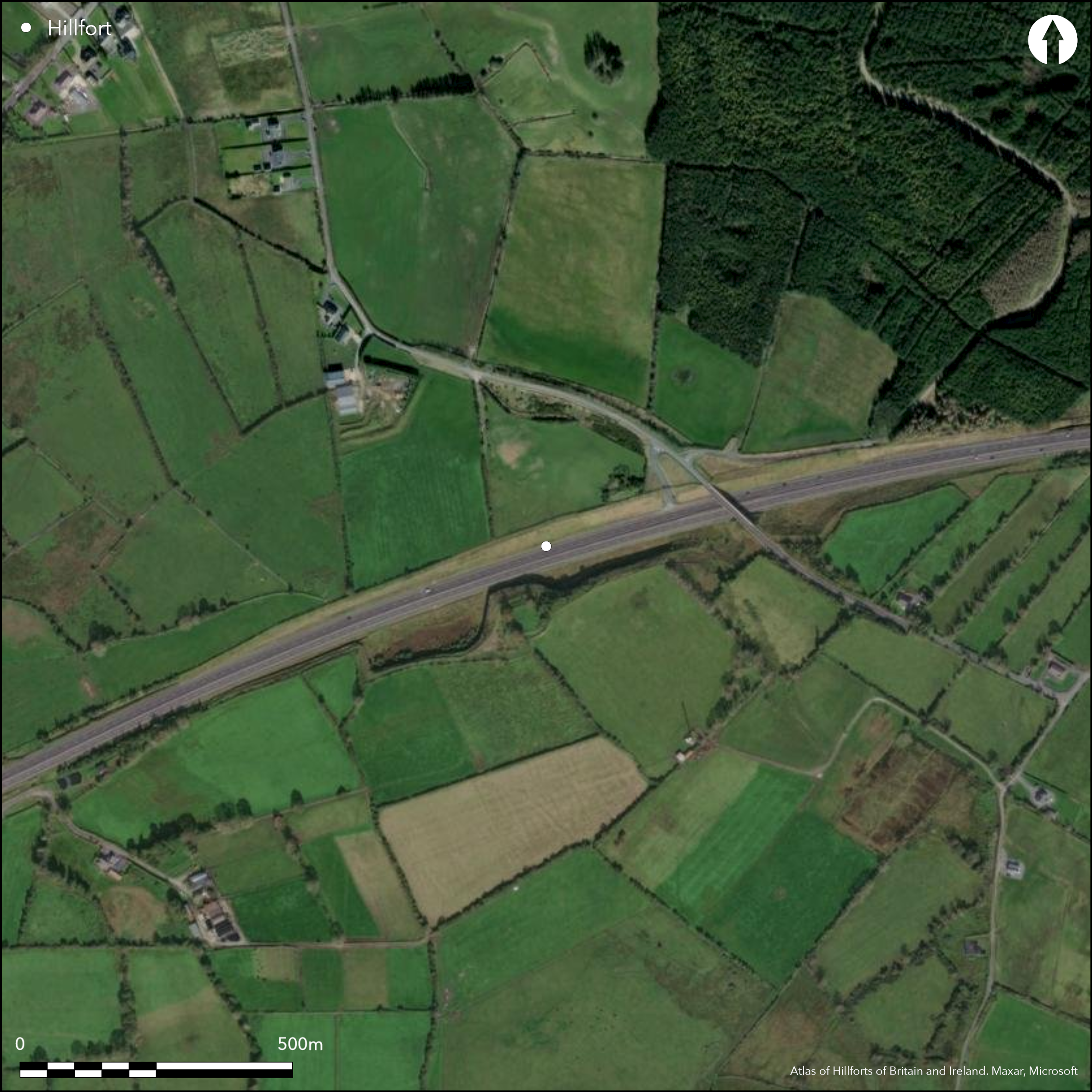
Satellite Imagery
Satellite Imagery
HER: Archaeological Survey of Ireland SMR Database GA086-211 (None)
NMR: GA 086 (None)
SM: None
NGR: None
X: 565965 Y: 725900 (IRENET95)
The multiple enclosure of Rahally hillfort, Co. Galway, was discovered in 2004 _ 5 while archaeological evaluation was being undertaken in advance of the N6 Galway to East Ballinasloe PPP scheme (Mullins 2008). This revealed a large trivallate hillfort with widely spaced enclosing elements, situated on the NW summit of a low glacial ridge. The road cut through the centre of the hillfort, necessitating excavation of over 50% of its interior and approximately 30% of the entire monument. Despite the large area excavated, there was a distinct lack of artifacts or features associated with the construction and occupation of the hillfort. There was a notable arrangement of parallel entrances running E _ W through all three enclosures. The site was later re-occupied in the Early Medieval period when a number of ringforts were built within and abutting the enclosing elements of the hillfort. Galway to Ballinasloe road runs through centre of monument, the remainder is under pasture. Excavated by Mullins in 2005. Late Bronze Age radiocarbon dates and pottery.
Citizen Science: ✗
Reliability of Data: Confirmed
Reliability of Interpretation: Confirmed
X: -947371 Y: 7035392 (EPSG: 3857)
Longitude: -8.510375409992838 Latitude: 53.28232469095757 (EPSG:4326)
Country: Republic of Ireland; None
Current County or Unitary Authority: Galway
Historic County: Galway
Current Parish/Community/Council/Townland: Rahally
Discovered in 2004 _ 5 while archaeological testing was being undertaken in advance of the N6 Galway to East Ballinasloe PPP scheme (Mullins 2008).
| Extant | ✗ |
| Cropmark | ✗ |
| Likely Destroyed | ✓ |
None
| Woodland | ✗ |
| Commercial Forestry Plantation | ✗ |
| Parkland | ✗ |
| Pasture (Grazing) | ✓ |
| Arable | ✗ |
| Scrub/Bracken | ✗ |
| Bare Outcrop | ✗ |
| Heather/Moorland | ✗ |
| Heath | ✗ |
| Built-up | ✗ |
| Coastal Grassland | ✗ |
| Other | ✗ |
Multiple enclosure positioned on domed NW summit of a SW-NW running ridge, overlooking a number of small river tributaries to the W. Panoramic views from the summit. Enclosing elements are widely spaced and do not follow contours of the hill.
| Contour Fort | ✗ |
| Partial Contour Fort | ✗ |
| Promontory Fort | ✗ |
| Hillslope Fort | ✗ |
| Level Terrain Fort | ✗ |
| Marsh Fort | ✗ |
| Multiple Enclosure Fort | ✓ |
| Hilltop | ✓ |
| Coastal Promontory | ✗ |
| Inland Promontory | ✗ |
| Valley Bottom | ✗ |
| Knoll/Hillock/Outcrop | ✗ |
| Ridge | ✓ |
| Cliff/Plateau-edge/Scarp | ✗ |
| Hillslope | ✗ |
| Lowland | ✗ |
| Spur | ✗ |
Dominant Topographic Feature: SW-NW running ridge.
| North | ✗ |
| Northeast | ✗ |
| East | ✗ |
| Southeast | ✗ |
| South | ✗ |
| Southwest | ✗ |
| West | ✗ |
| Northwest | ✗ |
| Level | ✓ |
Altitude: 104.0m
W section of the outer enclosing elements form the boundary between Rahally and Cloonyconaun and Cross townlands.
Boundary Type: Parish/Townland
Sherds of Late Bronze Age coarse ware pottery and a damaged polished stone axe were recovered from the inner ditch. A radiocarbon date of 994_827 BC was retrieved from charcoal found at the base of the ditch fill. A charcoal sample from the basal layer of the middle ditch returned a date of 790_520 BC. A charcoal sample from the base of the outer ditch returned a date of 1090_900 BC (Mullins 2008, 26).
Reliability: A - High
| Pre 1200BC | ✗ |
| 1200BC - 800BC | ✓ |
| 800BC - 400BC | ✗ |
| 400BC - AD50 | ✗ |
| AD50 - AD400 | ✗ |
| AD400 - AD 800 | ✗ |
| Post AD800 | ✗ |
| Unknown | ✗ |
| Pre Hillfort: | None |
| Post Hillfort: | None |
| Artefactual: | None |
| C14: | None |
First identification and excavations by Mullins (2008) in 2005.
| Excavation (2005): | Mullins |
Approximately 50% of the interior and 30% of the entire monument was excavated. There was a notable lack of finds and contexts associated with the hillfort (Mullins 2008). A Neolithic polished stone axe and a La Tene iron artifact of unknown function were recovered from the interior.
None
| None | ✓ |
| Spring | ✗ |
| Stream | ✗ |
| Pool | ✗ |
| Flush | ✗ |
| Well | ✗ |
| Other | ✗ |
None
| No Known Features | ✓ |
| Round Stone Structures | ✗ |
| Rectangular Stone Structures | ✗ |
| Curvilinear Platforms | ✗ |
| Other Roundhouse Evidence | ✗ |
| Pits | ✗ |
| Quarry Hollows | ✗ |
| Other | ✗ |
A Neolithic polished stone axe and a possible Iron Age a La Tene artifact were recovered from the interior. No artifacts were recovered that might be contemporary with the hillfort.
| No Known Excavation | ✗ |
| Pits | ✗ |
| Postholes | ✗ |
| Roundhouses | ✗ |
| Rectangular Structures | ✗ |
| Roads/Tracks | ✗ |
| Quarry Hollows | ✗ |
| Other | ✓ |
| Nothing Found | ✗ |
None
| No Known Geophysics | ✓ |
| Pits | ✗ |
| Roundhouses | ✗ |
| Rectangular Structures | ✗ |
| Roads/Tracks | ✗ |
| Quarry Hollows | ✗ |
| Other | ✗ |
| Nothing Found | ✗ |
Polished stone axe, La Tene iron artifact, bone needle, whetstone, coarse wear pottery, canine and deer remains.
| No Known Finds | ✗ |
| Pottery | ✗ |
| Metal | ✓ |
| Metalworking | ✗ |
| Human Bones | ✗ |
| Animal Bones | ✗ |
| Lithics | ✓ |
| Environmental | ✗ |
| Other | ✗ |
NO APPARENT FEATURES
| APs Not Checked | ✗ |
| None | ✓ |
| Roundhouses | ✗ |
| Rectangular Structures | ✗ |
| Pits | ✗ |
| Postholes | ✗ |
| Roads/Tracks | ✗ |
| Other | ✗ |
A number of entrances were excavated in all three enclosing elements. There was a notable arrangement of parallel entrances running E _ W through all three enclosures. These comprise simple breaks in the enclosing elements. A larger 30m break occurs in the inner enclosure. Here, the hillfort builders integrated a naturally wet/marshy area (Mullins 2008, 26). The area was covered in colluvial deposits, confirming this was a marshy area for a prolonged period. Deposited in this area was a La T_ne copper alloy artifact of unknown function (Mullins 2008, 26).
| 3: | None |
| 2: | None |
Guard Chambers: ✗
Chevaux de Frise: ✗
| 1. Simple Gap (East): | Simple break in inner enclosing elements. |
| 1. Simple Gap (East): | Simple break in middle enclosing elements. |
| 1. Simple Gap (East): | Simple break in outer enclosing elements. |
| 2. Simple Gap (West): | Simple break in inner enclosing elements. |
| 2. Simple Gap (West): | Simple break in middle enclosing elements. |
| 2. Simple Gap (West): | Simple break in outer enclosing elements. |
| 3. Simple Gap (North): | Large 30m break in inner enclosing elements. |
Upon excavation, the ditches of the hillfort were revealed to be U shaped, up to 4m wide and 1.5m deep, with the outer and inner elements being more substantial than the middle (Mullins 2008, 26). All three ditches of the hillfort were re-cut, most likely in the Late Bronze Age, intimating that maintenance of the hillfort was undertaken at some stage shortly after it was constructed. The outer enclosing element of the hillfort comprises a ditch-bank-ditch arrangement. Evidence for an intervening bank was identified on the W section of the hillfort (Mullins 2008, 26). No artifactual or radiocarbon evidence is available to suggest a construction date for this bank. Ditch in-fill layers suggest the presence of a bank accompanying both the middle and inner ditches (Mullins 2008, 26). Sherds of Late Bronze Age coarse-ware pottery and a damaged polished stone axe were recovered from the inner ditch, while a damaged bone needle and whetstone were found in the outer ditch (Mullins 2008, 26). Interestingly, animal bone was also recovered from the ditch fills, most notably dog bone and a complete deer skeleton (Mullins 2008). A charcoal sample from the basal layer of the three hillfort ditches returned dates of 994 _ 827 Cal. BC. (inner), 790 _ 520 Cal. BC (middle) and 1090 _ 900 Cal. BC (outer), securely dating the monument to the Late Bronze Age (Mullins 2008, 26). Although the radiocarbon dates suggest that the middle enclosure may post-date the other enclosing elements, pottery sherds typologically dated to the Late Bronze Age were recovered from all three ditches, suggesting that the construction and use of these enclosing elements was contemporary.
| Area 1: | 1.66ha. |
| Area 2: | 5.19ha. |
| Area 3: | 13.75ha. |
| Total: | 13.75ha. |
Total Footprint Area: 14.24ha.
None
| ✗ | None |
| ✓ | None |
| NE Quadrant: | 3 |
| SE Quadrant: | 3 |
| SW Quadrant: | 3 |
| NW Quadrant: | 3 |
| Total: | 3 |
| Partial Univallate | ✗ |
| Univallate | ✗ |
| Partial Bivallate | ✗ |
| Bivallate | ✗ |
| Partial Multivallate | ✗ |
| Multivallate | ✓ |
| Unknown | ✗ |
| Partial Univallate | ✗ |
| Univallate | ✓ |
| Partial Bivallate | ✗ |
| Bivallate | ✗ |
| Partial Multivallate | ✗ |
| Multivallate | ✗ |
None
| None | ✓ |
| Earthen Bank | ✗ |
| Stone Wall | ✗ |
| Rubble | ✗ |
| Wall-walk | ✗ |
| Evidence of Timber | ✗ |
| Vitrification | ✗ |
| Other Burning | ✗ |
| Palisade | ✗ |
| Counter Scarp Bank | ✗ |
| Berm | ✗ |
| Unfinished | ✗ |
| Other | ✗ |
None
| None | ✗ |
| Earthen Bank | ✓ |
| Stone Wall | ✗ |
| Murus Duplex | ✗ |
| Timber-framed | ✗ |
| Timber-laced | ✗ |
| Vitrification | ✗ |
| Other Burning | ✗ |
| Palisade | ✗ |
| Counter Scarp Bank | ✗ |
| Berm | ✗ |
| Unfinished | ✗ |
| No Known Excavation | ✗ |
| Other | ✗ |
| ✗ | None |
| ✓ | None |
Number of Ditches: 3
| ✗ | None. |
Mullins, G. 2008. Three thousand years of human activity at Rahally, Co. Galway. In O'Sullivan, J. and Stanley, M. Roads, Rediscovery and Research: Proceedings of a Public Seminar on Archaeological Discoveries on National Road Schemes, August 2007. National Roads Authority, Dublin. 25-35.
Atlas of Hillforts:
Wikidata:
This work is licensed under CC BY-SA 4.0

 and should be cited as:
Lock, Gary and Ralston, Ian. 2024. Atlas of Hillforts of Britain and Ireland. Available at: https://hillforts.arch.ox.ac.uk
Document Version 1.1