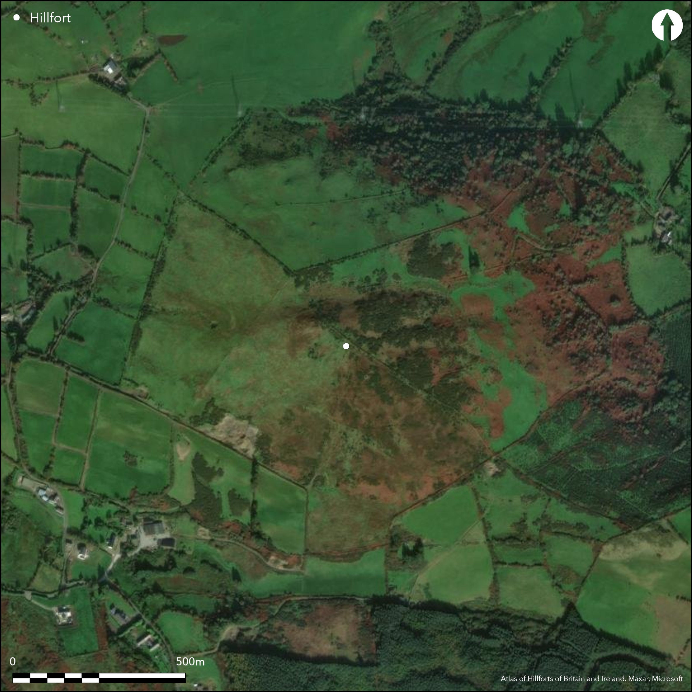
Satellite Imagery
Satellite Imagery
HER: Archaeological Survey of Ireland SMR Database CL044-085 (None)
NMR: CL 044 (None)
SM: None
NGR: None
X: 560391 Y: 671278 (IRENET95)
Multivallate hillfort positioned overlooking a deep, curving river valley forming a pass through the Slieve Bearnagh Mountains. The site has a total footprint of approximately 6.8ha. Bivallate for the entire circuit with widely spaced enclosing elements. No obvious entrance features recorded. Possible cairn identified by Condit (1995, 37) just off summit of interior. No other evidence for internal features on the surface. Ramparts survive well throughout but are covered in a layer of blanket bog. Earliest identification by Condit (1995) during investigation of aerial photographs for the North Munster Project. GPS and geophysical survey by Hogan (2004). Excavation by O'Brien in 2012. These excavations produced Late Bronze Age dates, indicating the hillfort was constructed during this period.
Citizen Science: ✗
Reliability of Data: Confirmed
Reliability of Interpretation: Confirmed
X: -955928 Y: 6944442 (EPSG: 3857)
Longitude: -8.587248638921727 Latitude: 52.791054232068625 (EPSG:4326)
Country: Republic of Ireland; None
Current County or Unitary Authority: Clare
Historic County: Clare
Current Parish/Community/Council/Townland: Foymoyle Beg
None
| Extant | ✓ |
| Cropmark | ✗ |
| Likely Destroyed | ✗ |
None
| Woodland | ✗ |
| Commercial Forestry Plantation | ✗ |
| Parkland | ✗ |
| Pasture (Grazing) | ✗ |
| Arable | ✗ |
| Scrub/Bracken | ✓ |
| Bare Outcrop | ✗ |
| Heather/Moorland | ✓ |
| Heath | ✗ |
| Built-up | ✗ |
| Coastal Grassland | ✗ |
| Other | ✗ |
Large Multiple enclosure surrounding the domed summit of hilltop. Positioned in commanding location at edge of upland terrain, overlooking the Broadford River and Glenomra River and an important mountain pass running E-W through the Slieve Bernagh Mountains.
| Contour Fort | ✓ |
| Partial Contour Fort | ✗ |
| Promontory Fort | ✗ |
| Hillslope Fort | ✗ |
| Level Terrain Fort | ✗ |
| Marsh Fort | ✗ |
| Multiple Enclosure Fort | ✓ |
| Hilltop | ✓ |
| Coastal Promontory | ✗ |
| Inland Promontory | ✗ |
| Valley Bottom | ✗ |
| Knoll/Hillock/Outcrop | ✗ |
| Ridge | ✗ |
| Cliff/Plateau-edge/Scarp | ✗ |
| Hillslope | ✗ |
| Lowland | ✗ |
| Spur | ✗ |
Dominant Topographic Feature: Hilltop at edge of upland terrain.
| North | ✗ |
| Northeast | ✗ |
| East | ✗ |
| Southeast | ✗ |
| South | ✗ |
| Southwest | ✗ |
| West | ✗ |
| Northwest | ✗ |
| Level | ✓ |
Altitude: 242.0m
The hillfort is bisected by the boundary separating Formoyle Beg and Cloonyconry More.
Boundary Type: Parish/Townland
Five Late Bronze Age dates from palisade and ditch contexts, dating the construction and initial occupation of the hillfort (O'Brien 2012).
Reliability: A - High
| Pre 1200BC | ✗ |
| 1200BC - 800BC | ✓ |
| 800BC - 400BC | ✗ |
| 400BC - AD50 | ✗ |
| AD50 - AD400 | ✗ |
| AD400 - AD 800 | ✗ |
| Post AD800 | ✗ |
| Unknown | ✗ |
| Pre Hillfort: | None |
| Post Hillfort: | None |
| C14: | O'Brien (in prep.) |
Earliest identification by Condit (1995) during investigation of aerial photographs for the North Munster Project. GPS and geophysical survey by Hogan (2004). Excavation by O'Brien in 2012.
| 1st Identified Written Reference (1995): | Condit |
| Other (1998): | Visited by Hillfort Study Group |
| Geophysical Survey (2004): | Hogan |
| Earthwork Survey (2004): | Hogan |
| Geophysical Survey (2012): | O'Brien |
Condit (1995, 37) suggests there is a small cairn positied just off the summit of the interior, however, this is not recorded.
None
| None | ✓ |
| Spring | ✗ |
| Stream | ✗ |
| Pool | ✗ |
| Flush | ✗ |
| Well | ✗ |
| Other | ✗ |
Possible small cairn
| No Known Features | ✗ |
| Round Stone Structures | ✗ |
| Rectangular Stone Structures | ✗ |
| Curvilinear Platforms | ✗ |
| Other Roundhouse Evidence | ✗ |
| Pits | ✗ |
| Quarry Hollows | ✗ |
| Other | ✓ |
None
| No Known Excavation | ✓ |
| Pits | ✗ |
| Postholes | ✗ |
| Roundhouses | ✗ |
| Rectangular Structures | ✗ |
| Roads/Tracks | ✗ |
| Quarry Hollows | ✗ |
| Other | ✗ |
| Nothing Found | ✗ |
No evidence for any internal features in geophysics, although, the survey was limited to a number of small sections over the enclosing elements.
| No Known Geophysics | ✗ |
| Pits | ✗ |
| Roundhouses | ✗ |
| Rectangular Structures | ✗ |
| Roads/Tracks | ✗ |
| Quarry Hollows | ✗ |
| Other | ✓ |
| Nothing Found | ✗ |
None
| No Known Finds | ✓ |
| Pottery | ✗ |
| Metal | ✗ |
| Metalworking | ✗ |
| Human Bones | ✗ |
| Animal Bones | ✗ |
| Lithics | ✗ |
| Environmental | ✗ |
| Other | ✗ |
NO APPARENT FEATURES
| APs Not Checked | ✗ |
| None | ✓ |
| Roundhouses | ✗ |
| Rectangular Structures | ✗ |
| Pits | ✗ |
| Postholes | ✗ |
| Roads/Tracks | ✗ |
| Other | ✗ |
No obvious entrance features recorded.
| 0: | None |
| 2: | None |
Guard Chambers: ✗
Chevaux de Frise: ✗
Bivallate hillfort with widely spaced enclosing elements separated by 50 - 80m. The inner enclosure surrounded an area 2.57ha in size and upon excavation, comprised a low rise inner bank of earth and a shallow outer ditch. A small timber palisade is positioned at the crest of the bank. This enclosure follows a natural terrace which exaggerates the size of the bank and ditch, making it look significantly bigger from the exterior. Similarly, the outer enclosure, which surrounds an area of 6.45ha, takes advantage of another natural terrace for the majority of its length. On top and at the outer edge of this bank, a dense series of post-holes were revealed through excavation. While this may be a result of different phasing and replacement of timber posts over time, it is interesting that this is not a feature of the inner enclosure and several of the post-holes were angled outwards. The inner and outer enclosing elements have a uniform construction, each consisting of an internal bank 6-7m wide and an external bank 2.5m wide.
| Area 1: | 2.57ha. |
| Area 2: | 6.45ha. |
| Total: | 6.45ha. |
Total Footprint Area: 6.79ha.
None
| ✗ | None |
| ✓ | None |
| NE Quadrant: | 2 |
| SE Quadrant: | 2 |
| SW Quadrant: | 2 |
| NW Quadrant: | 2 |
| Total: | 2 |
| Partial Univallate | ✗ |
| Univallate | ✗ |
| Partial Bivallate | ✗ |
| Bivallate | ✓ |
| Partial Multivallate | ✗ |
| Multivallate | ✗ |
| Unknown | ✗ |
| Partial Univallate | ✗ |
| Univallate | ✓ |
| Partial Bivallate | ✗ |
| Bivallate | ✗ |
| Partial Multivallate | ✗ |
| Multivallate | ✗ |
None
| None | ✗ |
| Earthen Bank | ✓ |
| Stone Wall | ✗ |
| Rubble | ✗ |
| Wall-walk | ✗ |
| Evidence of Timber | ✗ |
| Vitrification | ✗ |
| Other Burning | ✗ |
| Palisade | ✗ |
| Counter Scarp Bank | ✗ |
| Berm | ✗ |
| Unfinished | ✗ |
| Other | ✗ |
External ditch
| None | ✗ |
| Earthen Bank | ✓ |
| Stone Wall | ✗ |
| Murus Duplex | ✗ |
| Timber-framed | ✗ |
| Timber-laced | ✗ |
| Vitrification | ✗ |
| Other Burning | ✗ |
| Palisade | ✓ |
| Counter Scarp Bank | ✓ |
| Berm | ✗ |
| Unfinished | ✗ |
| No Known Excavation | ✗ |
| Other | ✓ |
| ✗ | None |
| ✓ | The internal and external ramparts both had shallow external ditches. |
Number of Ditches: 2
| ✗ | None. |
Condit, T. 1995. Hillfort discoveries near Killaloe, Co. Clare. Archaeology Ireland 9 (1), 34-37.
Hogan, N.2004. Unpublished geophysical and GPS survey report: Formoyle Beg, Co. Clare. NUIG, Dept of Archaeology.
O'Brien, W. 2012. Unpublished excavation report: Formoyle Beg, Co. Clare. University College Cork, Dept of Archaeology.
Atlas of Hillforts:
Wikidata:
This work is licensed under CC BY-SA 4.0

 and should be cited as:
Lock, Gary and Ralston, Ian. 2024. Atlas of Hillforts of Britain and Ireland. Available at: https://hillforts.arch.ox.ac.uk
Document Version 1.1