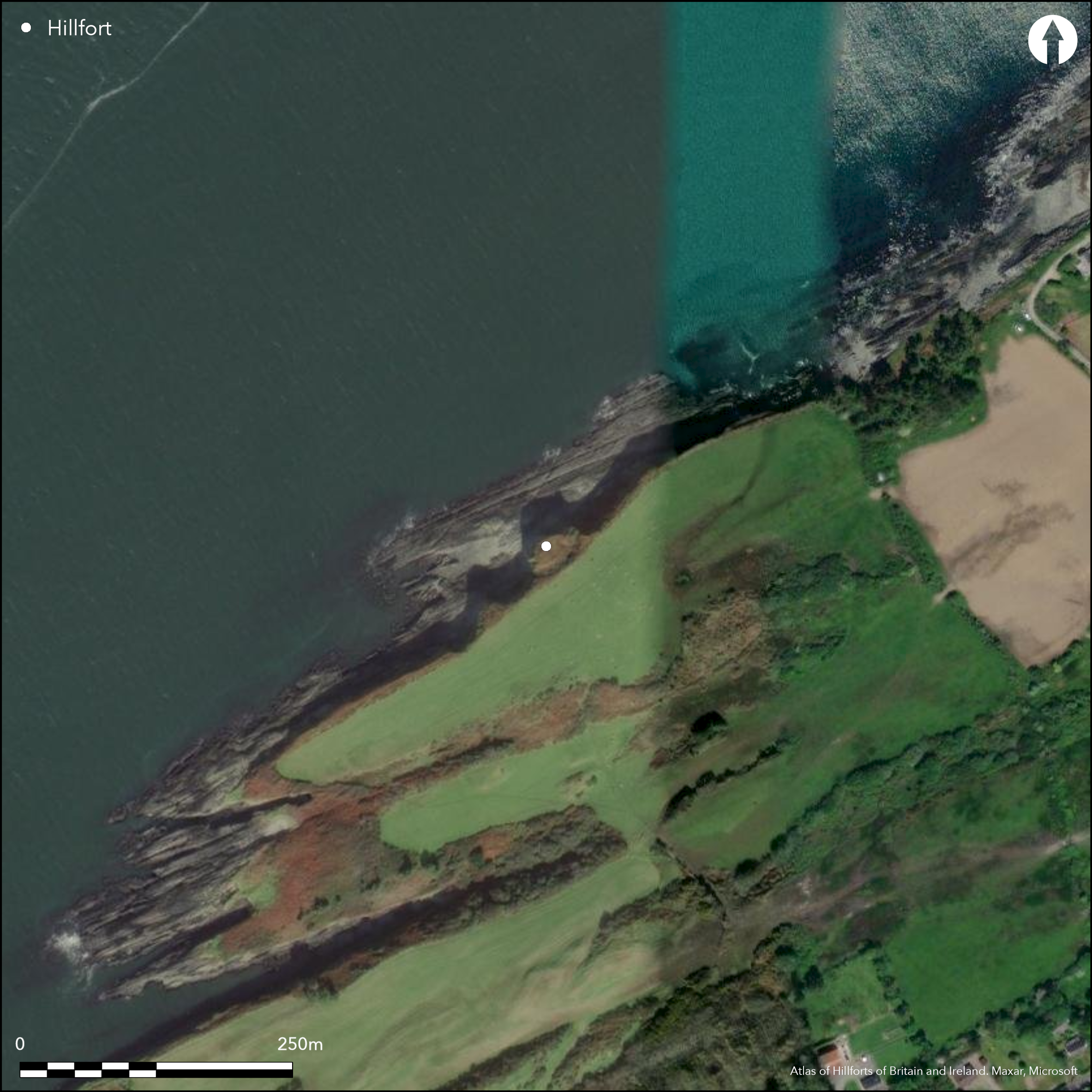
Satellite Imagery
Satellite Imagery
HER: Archaeological Survey of Ireland SMR Database CO130-024001 (None)
NMR: CO 130 (None)
SM: None
NGR: None
X: 490522 Y: 539582 (IRENET95)
This coastal promontory is situated c. 5km SW of Durrus town on the W coast of Co. Cork. It can be described as a small oval area (23.6m NE-SW; 13m SE-NW) barely projecting N into Dunmanus Bay at an altitude of 8m OD. The promontory is depicted on the first edition OS six-inch map (1842) as a circular enclosure. It has an overall site footprint of 0.08ha. Westropp notes that the fort 'once defended a longer headland, a deep bank of drift on low rocks and 24 feet high, that has since crumbled away since 1840, when the maps show it projecting nearly its own depth beyond the present edge' (1915, 283). The neck is defended by an earthen bank, 5.2m in height and an external ditch with a depth of 2.65m. Westropp (1915, 283) noted a dry stone revetment to bank which is no longer visible. The bank and ditch are crossed by a causeway c. 2m wide which leads into the interior of the site to the S. The internal area is now reduced in size to less than half that area recorded on the first edition OS map and much of it is now overgrown with scrub. Westropp (1915, 284) noted a collapsed souterrain (CO130-024002-) 'close to the dangerous edge'.
Citizen Science: ✗
Reliability of Data: Confirmed
Reliability of Interpretation: Confirmed
X: -1066474 Y: 6727780 (EPSG: 3857)
Longitude: -9.58029663538885 Latitude: 51.598097514822534 (EPSG:4326)
Country: Republic of Ireland
Current County or Unitary Authority: Cork
Historic County: Cork
Current Parish/Community/Council/Townland: Dunbeacon
Westropp noted that the fort 'once defended a longer headland, a deep bank of drift on low rocks and 24 feet high, that has since crumbled away since 1840, when the maps show it projecting nearly its own depth beyond the present edge' (1915, 283). Much of the defences on the SE survived intact. The N face of the promontory is nearly perpendicular and presents itself as an unprotected front exposed to the sea.
| Extant | ✓ |
| Cropmark | ✗ |
| Likely Destroyed | ✗ |
The site is heavily overgrown with scrub and bracken
| Woodland | ✗ |
| Commercial Forestry Plantation | ✗ |
| Parkland | ✗ |
| Pasture (Grazing) | ✗ |
| Arable | ✗ |
| Scrub/Bracken | ✓ |
| Bare Outcrop | ✗ |
| Heather/Moorland | ✗ |
| Heath | ✗ |
| Built-up | ✗ |
| Coastal Grassland | ✗ |
| Other | ✗ |
The fort can be described as a small oval area defended by an earthen bank and an external ditch projecting N into Dunmanus Bay. It is situated at an altitude of 8m OD with views of the the Sheep's Head peninsula to the N.
| Contour Fort | ✗ |
| Partial Contour Fort | ✗ |
| Promontory Fort | ✓ |
| Hillslope Fort | ✗ |
| Level Terrain Fort | ✗ |
| Marsh Fort | ✗ |
| Multiple Enclosure Fort | ✗ |
| Hilltop | ✗ |
| Coastal Promontory | ✓ |
| Inland Promontory | ✗ |
| Valley Bottom | ✗ |
| Knoll/Hillock/Outcrop | ✗ |
| Ridge | ✗ |
| Cliff/Plateau-edge/Scarp | ✗ |
| Hillslope | ✗ |
| Lowland | ✗ |
| Spur | ✗ |
Dominant Topographic Feature: None
| North | ✓ |
| Northeast | ✗ |
| East | ✗ |
| Southeast | ✗ |
| South | ✗ |
| Southwest | ✗ |
| West | ✗ |
| Northwest | ✗ |
| Level | ✗ |
Altitude: 8.0m
N/A
Reliability: D - None
| Pre 1200BC | ✗ |
| 1200BC - 800BC | ✗ |
| 800BC - 400BC | ✗ |
| 400BC - AD50 | ✗ |
| AD50 - AD400 | ✗ |
| AD400 - AD 800 | ✗ |
| Post AD800 | ✗ |
| Unknown | ✓ |
| Pre Hillfort: | None |
| Post Hillfort: | None |
Depicted on first edition OS-map as circular, hachured area. Surveyed by Westropp who noted small headland defended by a curving earthen bank with a dry-stone revetment and external ditch. He also observed an external path that led to a spring/well and rocks below the promontory (1915, 283). Subsequent visitation by the Cork Archaeological Survey in 1985 who noted that the stone-facing of the bank was no longer visible.
| 1st Identified Map Depiction (1842): | First edition 6-inch map |
| 1st Identified Written Reference (1915): | Westropp |
| Earthwork Survey (1985): | Cork Archaeological Survey |
There were no recorded internal structures within the interior of the site, however, Westropp notes a possible collapsed souterrain 'close to the dangerous edge' (1915, 284).
While there is no evident water source inside the enclosure, Westropp notes an 'old, narrow path scaling the very steep slope up to the north end of the fosse where it 'touches a little spring'. He suggested that this was the 'water-path of the fort-dwellers and a means of securing shellfish and fish' (1915, 1283).
| None | ✓ |
| Spring | ✗ |
| Stream | ✗ |
| Pool | ✗ |
| Flush | ✗ |
| Well | ✗ |
| Other | ✗ |
Possible collapsed soutterain
| No Known Features | ✗ |
| Round Stone Structures | ✗ |
| Rectangular Stone Structures | ✗ |
| Curvilinear Platforms | ✗ |
| Other Roundhouse Evidence | ✗ |
| Pits | ✗ |
| Quarry Hollows | ✗ |
| Other | ✓ |
None
| No Known Excavation | ✓ |
| Pits | ✗ |
| Postholes | ✗ |
| Roundhouses | ✗ |
| Rectangular Structures | ✗ |
| Roads/Tracks | ✗ |
| Quarry Hollows | ✗ |
| Other | ✗ |
| Nothing Found | ✗ |
None
| No Known Geophysics | ✓ |
| Pits | ✗ |
| Roundhouses | ✗ |
| Rectangular Structures | ✗ |
| Roads/Tracks | ✗ |
| Quarry Hollows | ✗ |
| Other | ✗ |
| Nothing Found | ✗ |
None
| No Known Finds | ✓ |
| Pottery | ✗ |
| Metal | ✗ |
| Metalworking | ✗ |
| Human Bones | ✗ |
| Animal Bones | ✗ |
| Lithics | ✗ |
| Environmental | ✗ |
| Other | ✗ |
NO APPARENT FEATURES
| APs Not Checked | ✗ |
| None | ✓ |
| Roundhouses | ✗ |
| Rectangular Structures | ✗ |
| Pits | ✗ |
| Postholes | ✗ |
| Roads/Tracks | ✗ |
| Other | ✗ |
Single break in the bank on the S side with a rough casueway across the fosse. This break measured 2m in width. This is possible an original entrance to the site, however without excavation, this cannot be confirmed.
| 1: | None |
| 2: | None |
Guard Chambers: ✗
Chevaux de Frise: ✗
| 1. Simple Gap (South): | Single break in the bank on the S side with a rough casueway across the ditch. This break measured 2m in width. |
The neck is defended by an earthen bank, 5.2m in height and an external ditch with a depth of 2.65m. Westropp (1915, 283) noted a dry stone revetment to the bank which is no longer visible. Bank and ditch crossed by causeway (Wth 2m) to S.
| Area 1: | 0.04ha. |
| Total: | 0.04ha. |
Total Footprint Area: 0.08ha.
None
| ✗ | None |
| ✗ | None |
| NE Quadrant: | 1 |
| SE Quadrant: | 1 |
| SW Quadrant: | None |
| NW Quadrant: | None |
| Total: | 1 |
| Partial Univallate | ✓ |
| Univallate | ✗ |
| Partial Bivallate | ✗ |
| Bivallate | ✗ |
| Partial Multivallate | ✗ |
| Multivallate | ✗ |
| Unknown | ✗ |
| Partial Univallate | ✗ |
| Univallate | ✗ |
| Partial Bivallate | ✗ |
| Bivallate | ✗ |
| Partial Multivallate | ✗ |
| Multivallate | ✗ |
Westropp noted dry-stone revetment to the bank and a possible 'cap-wall'. He observed that only the 'ledge and a few blocks remain of the stone-work' (1915, 284). The defences are much overgrown
| None | ✗ |
| Earthen Bank | ✓ |
| Stone Wall | ✓ |
| Rubble | ✗ |
| Wall-walk | ✗ |
| Evidence of Timber | ✗ |
| Vitrification | ✗ |
| Other Burning | ✗ |
| Palisade | ✗ |
| Counter Scarp Bank | ✗ |
| Berm | ✗ |
| Unfinished | ✗ |
| Other | ✗ |
None
| None | ✗ |
| Earthen Bank | ✗ |
| Stone Wall | ✗ |
| Murus Duplex | ✗ |
| Timber-framed | ✗ |
| Timber-laced | ✗ |
| Vitrification | ✗ |
| Other Burning | ✗ |
| Palisade | ✗ |
| Counter Scarp Bank | ✗ |
| Berm | ✗ |
| Unfinished | ✗ |
| No Known Excavation | ✓ |
| Other | ✗ |
| ✗ | None |
| ✓ | Single curving ditch on E side running in a N-S direction. Recorded depth of 2.65m. Rough causeway crosses the fosse to the S. |
Number of Ditches: 1
| ✗ | None |
Power, D., Byrne, E., Egan, U., Lane, S., and Sleeman, M. 1992. Archaeological Inventory of County Cork Volume 1: West Cork, 126-130. The stationary Office, Dublin.
Westropp, T.J. 1915. Fortified headlands and castles in western County Cork. Proceedings of the Royal Irish Academy 32C, 249-86.
Atlas of Hillforts:
Wikidata:
This work is licensed under CC BY-SA 4.0

 and should be cited as:
Lock, Gary and Ralston, Ian. 2024. Atlas of Hillforts of Britain and Ireland. Available at: https://hillforts.arch.ox.ac.uk
Document Version 1.1