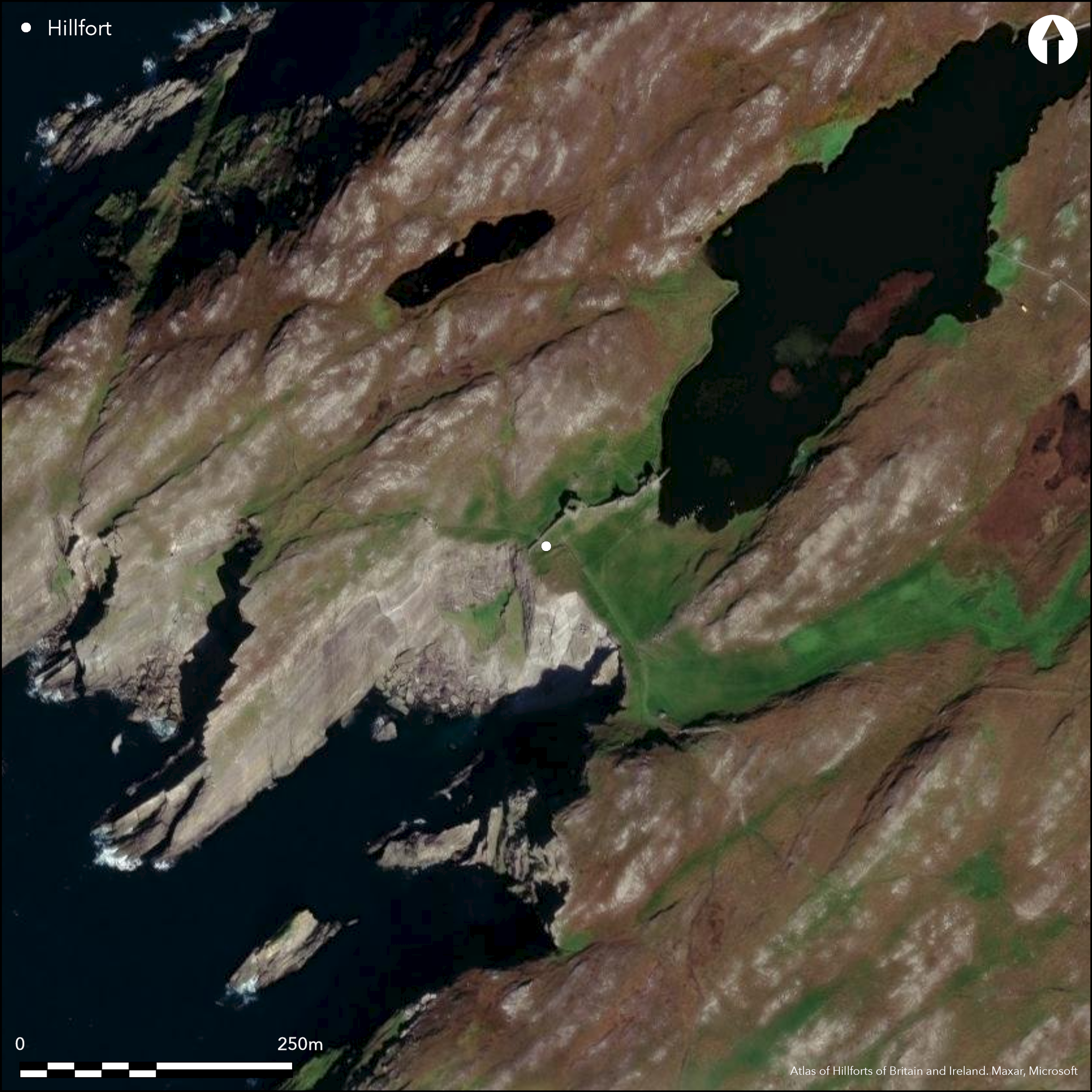
Satellite Imagery
Satellite Imagery
HER: Archaeological Survey of Ireland SMR Database CO146-001001 (None)
NMR: CO 146 (None)
SM: None
NGR: None
X: 472919 Y: 527124 (IRENET95)
The site is located at the westernmost point of Mizen peninsula, Co. Cork, on S side of the 'Three Castles Head' and 'Dun Lough'. The site occupies a remote and somewhat inaccessible nook among low hills to the N of the Ivagha peninsula, on a steep cliff face at an altitude of 62m OD. Traces of earlier earthworks run in front of, and on roughly the same line as, the curtain wall of Late Medieval defences (CO146-001002). These run for 25m from cliff to SW at Coosnaronety Cove, possibly representing the NW flank of an enclosure backing onto the cliff-edge above the cove. A wide ditch (Wth 8m; D 1.6m) runs 2.5m in front of the curtain wall, outside of which is bank (H 1.2m) with an external ditch (Wth 4m; D 0.6m). The traceable defences end on line with a modern wire fence. Running at oblique angle, outside external ditch is a low bank with a single gap defined by flanking stone slabs. Westropp (1915, 274) regarded this as remains of earliest defences on promontory, however, the Cork Archaeological survey suggest that this is likely to be a later field fence (Power et al. 1992).
Citizen Science: ✗
Reliability of Data: Confirmed
Reliability of Interpretation: Confirmed
X: -1094245 Y: 6707084 (EPSG: 3857)
Longitude: -9.829766906965746 Latitude: 51.48246664114075 (EPSG:4326)
Country: Republic of Ireland
Current County or Unitary Authority: Cork
Historic County: Cork
Current Parish/Community/Council/Townland: Dunlough
Only remnants of the early defences remain as much of the area was re-modelled during the Later medieval period when a castle, curtain wall and other structures and landscape features were built in the area.
| Extant | ✗ |
| Cropmark | ✗ |
| Likely Destroyed | ✓ |
None
| Woodland | ✗ |
| Commercial Forestry Plantation | ✗ |
| Parkland | ✗ |
| Pasture (Grazing) | ✗ |
| Arable | ✓ |
| Scrub/Bracken | ✗ |
| Bare Outcrop | ✗ |
| Heather/Moorland | ✗ |
| Heath | ✗ |
| Built-up | ✗ |
| Coastal Grassland | ✗ |
| Other | ✗ |
The site occupies a remote and somewhat inaccessible nook among low hills to the N of the Ivagha peninsula. It is located at the westernmost point of Mizen peninsula, on S side of the Three Castles Head and Dun Lough at an altitude of 62m OD. There are extensive views of the great rock islands of Caher, Illaunacaheragh and Illaunbirrane. Only traces of the fort survive today in front of, and on same line as, the curtain wall of Late Medieval defences (CO146-001002-). These run for 25m from cliff to S at Coosnaronety Cove.
| Contour Fort | ✗ |
| Partial Contour Fort | ✗ |
| Promontory Fort | ✓ |
| Hillslope Fort | ✗ |
| Level Terrain Fort | ✗ |
| Marsh Fort | ✗ |
| Multiple Enclosure Fort | ✗ |
| Hilltop | ✗ |
| Coastal Promontory | ✓ |
| Inland Promontory | ✗ |
| Valley Bottom | ✗ |
| Knoll/Hillock/Outcrop | ✗ |
| Ridge | ✗ |
| Cliff/Plateau-edge/Scarp | ✗ |
| Hillslope | ✗ |
| Lowland | ✗ |
| Spur | ✗ |
Dominant Topographic Feature: The site is overlooked by a series of hills to the N
| North | ✗ |
| Northeast | ✗ |
| East | ✗ |
| Southeast | ✗ |
| South | ✓ |
| Southwest | ✗ |
| West | ✗ |
| Northwest | ✗ |
| Level | ✗ |
Altitude: 62.0m
N/A
There is no dating available for the site
Reliability: D - None
| Pre 1200BC | ✗ |
| 1200BC - 800BC | ✗ |
| 800BC - 400BC | ✗ |
| 400BC - AD50 | ✗ |
| AD50 - AD400 | ✗ |
| AD400 - AD 800 | ✗ |
| Post AD800 | ✗ |
| Unknown | ✓ |
| Pre Hillfort: | None |
| Post Hillfort: | Aerial photos show a number of earthworks that may relate to Later Medieval castle and defences |
The promontory is not depicted on any of the OS 6-inch maps. Noted by Dr Fogerty as a 'fort as small as Cooshaneimme or the spur fort near Ballyvoony, in Co. Waterford, and, like them, illustrates "the fear that accompanied the early shore-dwellers" and led them to fortify even so sorry a refuge as these ledges afforded' (1901, 224).
| 1st Identified Written Reference (1901): | Dr. Fogerty |
| Earthwork Survey (1915): | Thomas Westropp |
| Earthwork Survey (1985): | Cork Archaeological Survey |
The interior of this site is not clearly defined as only the partial remains of some earthworks remain. There are no recorded structures at the site associated with the early fort.
Dun Lough lies 100m north
| None | ✗ |
| Spring | ✗ |
| Stream | ✗ |
| Pool | ✗ |
| Flush | ✗ |
| Well | ✗ |
| Other | ✓ |
None
| No Known Features | ✓ |
| Round Stone Structures | ✗ |
| Rectangular Stone Structures | ✗ |
| Curvilinear Platforms | ✗ |
| Other Roundhouse Evidence | ✗ |
| Pits | ✗ |
| Quarry Hollows | ✗ |
| Other | ✗ |
None
| No Known Excavation | ✓ |
| Pits | ✗ |
| Postholes | ✗ |
| Roundhouses | ✗ |
| Rectangular Structures | ✗ |
| Roads/Tracks | ✗ |
| Quarry Hollows | ✗ |
| Other | ✗ |
| Nothing Found | ✗ |
None
| No Known Geophysics | ✓ |
| Pits | ✗ |
| Roundhouses | ✗ |
| Rectangular Structures | ✗ |
| Roads/Tracks | ✗ |
| Quarry Hollows | ✗ |
| Other | ✗ |
| Nothing Found | ✗ |
None
| No Known Finds | ✓ |
| Pottery | ✗ |
| Metal | ✗ |
| Metalworking | ✗ |
| Human Bones | ✗ |
| Animal Bones | ✗ |
| Lithics | ✗ |
| Environmental | ✗ |
| Other | ✗ |
NO APPARENT FEATURES
| APs Not Checked | ✗ |
| None | ✓ |
| Roundhouses | ✗ |
| Rectangular Structures | ✗ |
| Pits | ✗ |
| Postholes | ✗ |
| Roads/Tracks | ✗ |
| Other | ✗ |
Running at oblique angle, outside external fosse is a low bank with a single gap defined by flanking stone slabs; Westropp (1915, 274) regarded this as remains of earliest defences on promontory, however, the Cork Archaeological survey suggest that this is likely to be a later field fence
| 1: | None |
| 2: | None |
Guard Chambers: ✗
Chevaux de Frise: ✗
Traces of earlier defences run in front of, and on same line as, the curtain wall of Late Medieval defences (CO146-001002-). These run for 25m from cliff to S at Coosnaronety Cove. Wide ditch (Wth 8m; D 1.6m) runs 2.5m in front of curtain wall; outside is bank (H 1.2m) with external ditch (Wth 4m; D 0.6m). Traceable defences end on line of modern wire fence
| Area 1: | Noneha. |
| Total: | Noneha. |
Total Footprint Area: Noneha.
None
| ✗ | As only traces of the defences are visible, it is impossible to determine original enclosed area or even whole site footprint. If the arrangement of tower between the cliffs and the SW end of the small lough to the NE, and associated bawn at the NE end of the lough, was repeated by the earlier defences, it would have formed an enclosure of some 200ha on the headland |
| ✗ | Plan and configuration of the defences is too uncertain to be entered below |
| NE Quadrant: | 0 |
| SE Quadrant: | 0 |
| SW Quadrant: | 0 |
| NW Quadrant: | 0 |
| Total: | 0 |
| Partial Univallate | ✗ |
| Univallate | ✗ |
| Partial Bivallate | ✗ |
| Bivallate | ✗ |
| Partial Multivallate | ✗ |
| Multivallate | ✗ |
| Unknown | ✓ |
| Partial Univallate | ✗ |
| Univallate | ✗ |
| Partial Bivallate | ✗ |
| Bivallate | ✗ |
| Partial Multivallate | ✗ |
| Multivallate | ✗ |
None
| None | ✗ |
| Earthen Bank | ✓ |
| Stone Wall | ✗ |
| Rubble | ✗ |
| Wall-walk | ✗ |
| Evidence of Timber | ✗ |
| Vitrification | ✗ |
| Other Burning | ✗ |
| Palisade | ✗ |
| Counter Scarp Bank | ✗ |
| Berm | ✗ |
| Unfinished | ✗ |
| Other | ✗ |
None
| None | ✗ |
| Earthen Bank | ✗ |
| Stone Wall | ✗ |
| Murus Duplex | ✗ |
| Timber-framed | ✗ |
| Timber-laced | ✗ |
| Vitrification | ✗ |
| Other Burning | ✗ |
| Palisade | ✗ |
| Counter Scarp Bank | ✗ |
| Berm | ✗ |
| Unfinished | ✗ |
| No Known Excavation | ✓ |
| Other | ✗ |
| ✗ | None |
| ✗ | Wide ditch (Wth 8m; D 1.6m) runs 2.5m in front of medieval curtain wall; outside is bank (H 1.2m) with external ditch (Wth 4m; D 0.6m) |
Number of Ditches: 2
| ✗ | None |
Power, D., Byrne, E., Egan, U., Lane, S., and Sleeman, M. 1992. Archaeological Inventory of County Cork Volume 1: West Cork, 126-130. The stationary Office, Dublin.
Westropp, T.J. 1915. Fortified headlands and castles in western County Cork. Proceedings of the Royal Irish Academy 32C, 249-86.
Atlas of Hillforts:
Wikidata:
This work is licensed under CC BY-SA 4.0

 and should be cited as:
Lock, Gary and Ralston, Ian. 2024. Atlas of Hillforts of Britain and Ireland. Available at: https://hillforts.arch.ox.ac.uk
Document Version 1.1