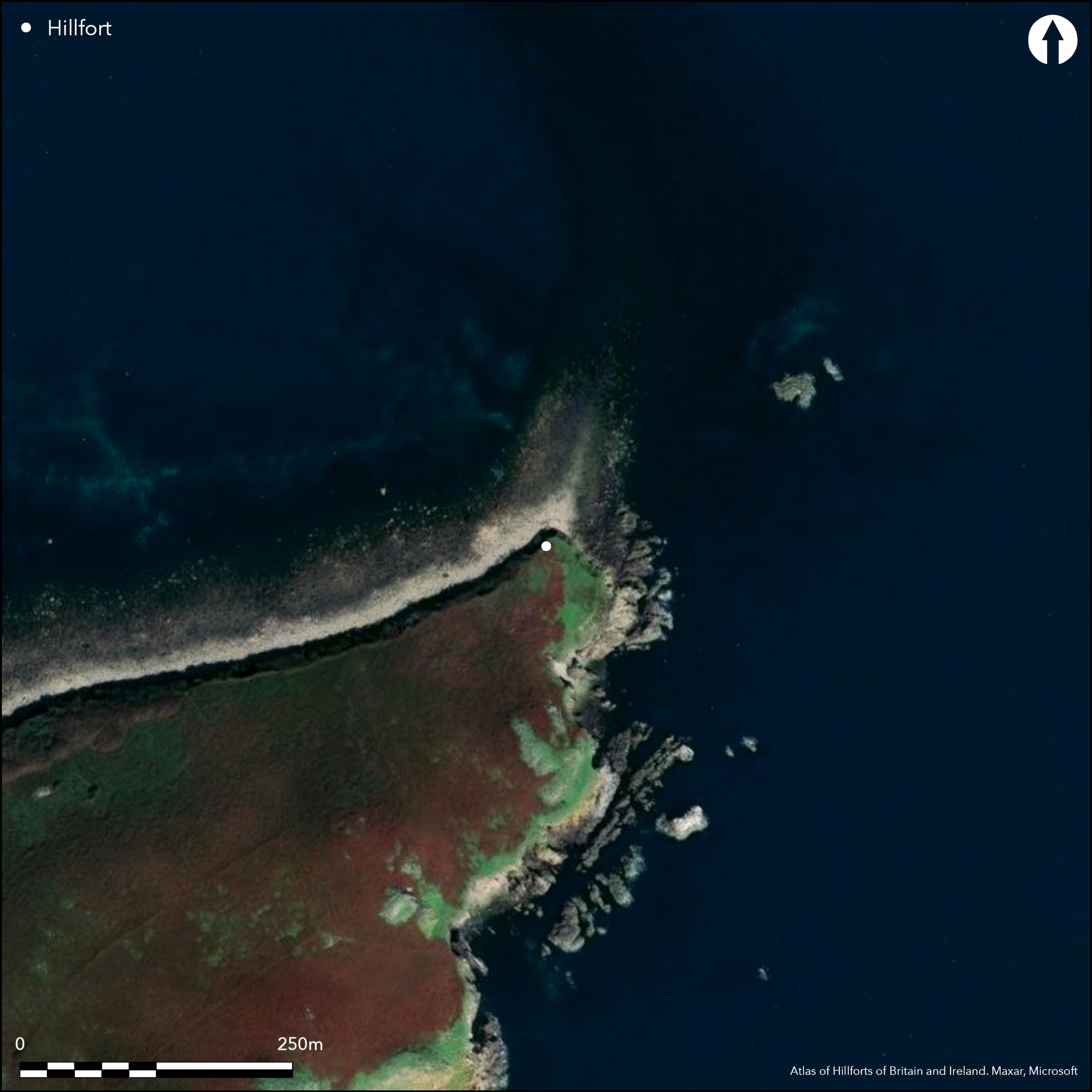
Satellite Imagery
Satellite Imagery
HER: Archaeological Survey of Ireland SMR Database WX051-002001 (None)
NMR: WX 051 (None)
SM: None
NGR: None
X: 695570 Y: 597629 (IRENET95)
This possible coastal promontory fort is located at the NE point of the Great Saltee Island off the S coast of Co. Wexford. It lies on a low-lying, level (2m OD), grass and fern-covered field and is not marked on any edition of the OS six-inch maps. It is defended to the S by a curved earthen bank 4m in width and 1.5m high that runs for 26m across the headland and is accompanied by an external ditch (Wth of top c. 4m; max. ext. D 0.4m); the latter is exposed in the clay cliff sections (H c. 3m) which define the margins of the promontory. There is a possible entrance (Wth c. 4.4m) at the SE end of the arc. The interior elsewhere is heavily reduced bt erosion and now no more than 11.8m in length N-S, but part of the foundation course of a circular hut site (int. dims 7.9m E-W; 4.8m plus N-S) can be seen. It has been suggested that this may be part of a later ringfort (Moore 1996,26) .
Citizen Science: ✗
Reliability of Data: Confirmed
Reliability of Interpretation: Confirmed
X: -735192 Y: 6822264 (EPSG: 3857)
Longitude: -6.604343982001256 Latitude: 52.122270648056585 (EPSG:4326)
Country: Republic of Ireland
Current County or Unitary Authority: Wexford (Saltee Island Great)
Historic County: Wexford
Current Parish/Community/Council/Townland: Saltee Island Great
None
| Extant | ✓ |
| Cropmark | ✗ |
| Likely Destroyed | ✗ |
None
| Woodland | ✗ |
| Commercial Forestry Plantation | ✗ |
| Parkland | ✗ |
| Pasture (Grazing) | ✓ |
| Arable | ✗ |
| Scrub/Bracken | ✗ |
| Bare Outcrop | ✗ |
| Heather/Moorland | ✗ |
| Heath | ✗ |
| Built-up | ✗ |
| Coastal Grassland | ✗ |
| Other | ✗ |
This possible coastal promontory fort is located at the NE point of the Great Saltee Island, on a low-lying, level (2m OD), grass and fern-covered field. The island lies off the S coast of Co. Wexford. Defended to the S by a curving bank and external ditch.
| Contour Fort | ✗ |
| Partial Contour Fort | ✗ |
| Promontory Fort | ✓ |
| Hillslope Fort | ✗ |
| Level Terrain Fort | ✗ |
| Marsh Fort | ✗ |
| Multiple Enclosure Fort | ✗ |
| Hilltop | ✗ |
| Coastal Promontory | ✓ |
| Inland Promontory | ✗ |
| Valley Bottom | ✗ |
| Knoll/Hillock/Outcrop | ✗ |
| Ridge | ✗ |
| Cliff/Plateau-edge/Scarp | ✗ |
| Hillslope | ✗ |
| Lowland | ✗ |
| Spur | ✗ |
Dominant Topographic Feature: N-facing promontory
| North | ✗ |
| Northeast | ✗ |
| East | ✗ |
| Southeast | ✗ |
| South | ✗ |
| Southwest | ✗ |
| West | ✗ |
| Northwest | ✗ |
| Level | ✓ |
Altitude: 2.0m
N/A
There is no dating available for the site.
Reliability: D - None
| Pre 1200BC | ✗ |
| 1200BC - 800BC | ✗ |
| 800BC - 400BC | ✗ |
| 400BC - AD50 | ✗ |
| AD50 - AD400 | ✗ |
| AD400 - AD 800 | ✗ |
| Post AD800 | ✗ |
| Unknown | ✓ |
| Pre Hillfort: | None |
| Post Hillfort: | None |
The site is not marked on any edition of the OS six-inch maps. site was visited and surveyed for the compilation of the Wexford Archaeological Inventory (Moore 1996)
| 1st Identified Written Reference (1989): | Moore |
Part of the foundation course of a circular hut site (int. dims 7.9m E-W; 4.8m plus N-S) is within, but most of the perimeter SW-N-SE is missing. It is suggested that this may have been part of a later ringfort, however this cannot be confirmed.
None
| None | ✓ |
| Spring | ✗ |
| Stream | ✗ |
| Pool | ✗ |
| Flush | ✗ |
| Well | ✗ |
| Other | ✗ |
None
| No Known Features | ✗ |
| Round Stone Structures | ✓ |
| Rectangular Stone Structures | ✗ |
| Curvilinear Platforms | ✗ |
| Other Roundhouse Evidence | ✗ |
| Pits | ✗ |
| Quarry Hollows | ✗ |
| Other | ✗ |
None
| No Known Excavation | ✓ |
| Pits | ✗ |
| Postholes | ✗ |
| Roundhouses | ✗ |
| Rectangular Structures | ✗ |
| Roads/Tracks | ✗ |
| Quarry Hollows | ✗ |
| Other | ✗ |
| Nothing Found | ✗ |
None
| No Known Geophysics | ✓ |
| Pits | ✗ |
| Roundhouses | ✗ |
| Rectangular Structures | ✗ |
| Roads/Tracks | ✗ |
| Quarry Hollows | ✗ |
| Other | ✗ |
| Nothing Found | ✗ |
None
| No Known Finds | ✓ |
| Pottery | ✗ |
| Metal | ✗ |
| Metalworking | ✗ |
| Human Bones | ✗ |
| Animal Bones | ✗ |
| Lithics | ✗ |
| Environmental | ✗ |
| Other | ✗ |
NO APPARENT FEATURES
| APs Not Checked | ✓ |
| None | ✗ |
| Roundhouses | ✗ |
| Rectangular Structures | ✗ |
| Pits | ✗ |
| Postholes | ✗ |
| Roads/Tracks | ✗ |
| Other | ✗ |
There is a possible entrance (Wth c. 4.4m) at the SE end of the curving defences.It cannot be confirmed whether this is an original entrance to the site.
| 1: | None |
| 2: | None |
Guard Chambers: ✗
Chevaux de Frise: ✗
Defended to the S by a curving bank (Wth 4m; int. H 1m; ext. H 0.5-1.4m) that runs for 26m with an external ditch (Wth of top c. 4m; max. ext. D 0.4m).
| Area 1: | 0.04ha. |
| Total: | 0.04ha. |
Total Footprint Area: 0.06ha.
None
| ✗ | None |
| ✗ | None |
| NE Quadrant: | 0 |
| SE Quadrant: | 1 |
| SW Quadrant: | 1 |
| NW Quadrant: | 0 |
| Total: | 1 |
| Partial Univallate | ✓ |
| Univallate | ✗ |
| Partial Bivallate | ✗ |
| Bivallate | ✗ |
| Partial Multivallate | ✗ |
| Multivallate | ✗ |
| Unknown | ✗ |
| Partial Univallate | ✗ |
| Univallate | ✗ |
| Partial Bivallate | ✗ |
| Bivallate | ✗ |
| Partial Multivallate | ✗ |
| Multivallate | ✗ |
None
| None | ✗ |
| Earthen Bank | ✓ |
| Stone Wall | ✗ |
| Rubble | ✗ |
| Wall-walk | ✗ |
| Evidence of Timber | ✗ |
| Vitrification | ✗ |
| Other Burning | ✗ |
| Palisade | ✗ |
| Counter Scarp Bank | ✗ |
| Berm | ✗ |
| Unfinished | ✗ |
| Other | ✗ |
None
| None | ✗ |
| Earthen Bank | ✗ |
| Stone Wall | ✗ |
| Murus Duplex | ✗ |
| Timber-framed | ✗ |
| Timber-laced | ✗ |
| Vitrification | ✗ |
| Other Burning | ✗ |
| Palisade | ✗ |
| Counter Scarp Bank | ✗ |
| Berm | ✗ |
| Unfinished | ✗ |
| No Known Excavation | ✓ |
| Other | ✗ |
| ✗ | None |
| ✓ | External ditch runs for 26m cutting off the headland to the SW. |
Number of Ditches: 1
| ✗ | None |
Moore, M. 1996. Archaeological inventory of County Wexford, 26. The stationary Office, Dublin.
Atlas of Hillforts:
Wikidata:
This work is licensed under CC BY-SA 4.0

 and should be cited as:
Lock, Gary and Ralston, Ian. 2024. Atlas of Hillforts of Britain and Ireland. Available at: https://hillforts.arch.ox.ac.uk
Document Version 1.1