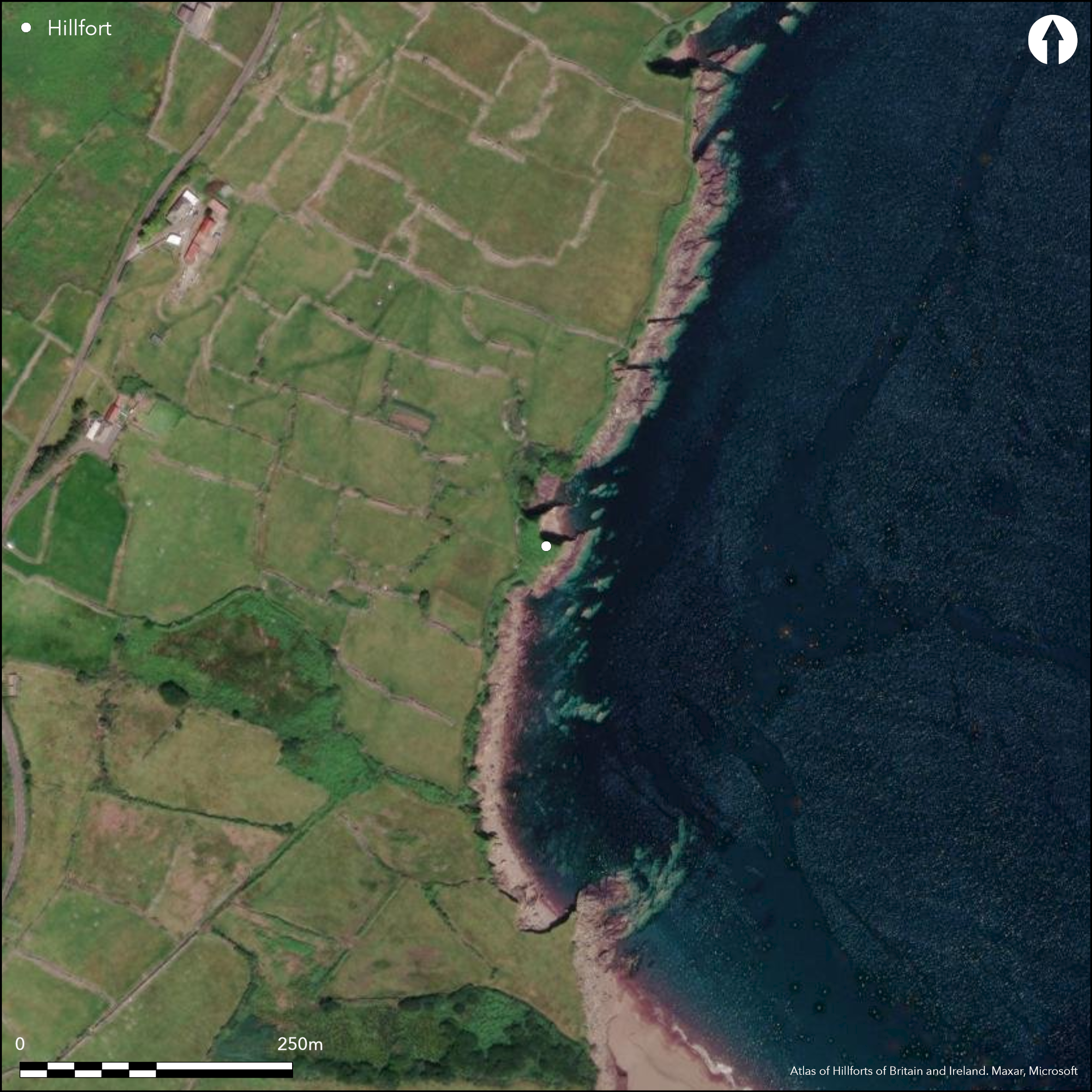
Satellite Imagery
Satellite Imagery
HER: Archaeological Survey of Ireland SMR Database KE026-004 (None)
NMR: KE 026 (None)
SM: None
NGR: None
X: 452640 Y: 616457 (IRENET95)
This coastal promontory, known locally as 'An Cathairin', is located near Brandon Point on the W side of Brandon Bay, c. 10km NW of Stradbally, Co. Kerry. The headland projects into Brandon Bay to the NW at an altitude of 12m OD and is enclosed on the landward side by a thick stone wall. The site is not depicted on any edition of the OS six-inch maps. The interior of the site is level and measures a maximum of 18.8m E-W by 23.5m N-S and is bounded to N and SE by sheer cliffs. The wall rises up to 1.95m above the external ground level which is considerably higher than the level of the interior of the fort. Within the interior, it varies from 1.1m to 4.15m high, but the inner face is not well preserved and is in a poor state of repair. The wall varies in thickness from 2.2 to 4.37m (Cuppage 1986, 96; O'Sullivan and Sheehan 1996, 96). At the N end of the wall, its profile displays traces of two terraces, 1m and 0.7m wide respectively, and the wall is 2.2m wide at the top. A single course of stone walling extends 5m along the edge of the promontory from the S end of the wall. There is no recorded entrance through the defences. The interior was formerly cultivated (OS Namebook; Cloghane 1, 46) but is now under a dense covering of ferns. No internal features are recorded.
Citizen Science: ✗
Reliability of Data: Confirmed
Reliability of Interpretation: Confirmed
X: -1130970 Y: 6850915 (EPSG: 3857)
Longitude: -10.159679632385973 Latitude: 52.28001773083634 (EPSG:4326)
Country: Republic of Ireland
Current County or Unitary Authority: Kerry
Historic County: Kerry
Current Parish/Community/Council/Townland: Murirrigane
None
| Extant | ✓ |
| Cropmark | ✗ |
| Likely Destroyed | ✗ |
None
| Woodland | ✗ |
| Commercial Forestry Plantation | ✗ |
| Parkland | ✗ |
| Pasture (Grazing) | ✗ |
| Arable | ✗ |
| Scrub/Bracken | ✓ |
| Bare Outcrop | ✗ |
| Heather/Moorland | ✗ |
| Heath | ✗ |
| Built-up | ✗ |
| Coastal Grassland | ✗ |
| Other | ✗ |
The coastal promontory projects into Brandon Bay to the NW and is defended on the landward side by a thick stone wall. The interior of the fort is at an altitude of 12m OD and measures a maximum of 18.8m E-W and 23.5m N-S and is bounded to N and SE by sheer cliffs
| Contour Fort | ✗ |
| Partial Contour Fort | ✗ |
| Promontory Fort | ✓ |
| Hillslope Fort | ✗ |
| Level Terrain Fort | ✗ |
| Marsh Fort | ✗ |
| Multiple Enclosure Fort | ✗ |
| Hilltop | ✗ |
| Coastal Promontory | ✓ |
| Inland Promontory | ✗ |
| Valley Bottom | ✗ |
| Knoll/Hillock/Outcrop | ✗ |
| Ridge | ✗ |
| Cliff/Plateau-edge/Scarp | ✗ |
| Hillslope | ✗ |
| Lowland | ✗ |
| Spur | ✗ |
Dominant Topographic Feature: NE-facing promontory
| North | ✗ |
| Northeast | ✗ |
| East | ✓ |
| Southeast | ✗ |
| South | ✗ |
| Southwest | ✗ |
| West | ✗ |
| Northwest | ✗ |
| Level | ✗ |
Altitude: 12.0m
N/A
There is no dating available for the site
Reliability: D - None
| Pre 1200BC | ✗ |
| 1200BC - 800BC | ✗ |
| 800BC - 400BC | ✗ |
| 400BC - AD50 | ✗ |
| AD50 - AD400 | ✗ |
| AD400 - AD 800 | ✗ |
| Post AD800 | ✗ |
| Unknown | ✓ |
| Pre Hillfort: | None |
| Post Hillfort: | The interior of the fort has been cultivated |
The site is not depicted on any edition of the OS six-inch maps. Recorded by the Dingle Archaeological Survey in the 1980s.
| Earthwork Survey (1986): | Cuppage |
| Other (1995): | Redmond |
There are no recorded internal features
None
| None | ✓ |
| Spring | ✗ |
| Stream | ✗ |
| Pool | ✗ |
| Flush | ✗ |
| Well | ✗ |
| Other | ✗ |
None
| No Known Features | ✓ |
| Round Stone Structures | ✗ |
| Rectangular Stone Structures | ✗ |
| Curvilinear Platforms | ✗ |
| Other Roundhouse Evidence | ✗ |
| Pits | ✗ |
| Quarry Hollows | ✗ |
| Other | ✗ |
None
| No Known Excavation | ✓ |
| Pits | ✗ |
| Postholes | ✗ |
| Roundhouses | ✗ |
| Rectangular Structures | ✗ |
| Roads/Tracks | ✗ |
| Quarry Hollows | ✗ |
| Other | ✗ |
| Nothing Found | ✗ |
None
| No Known Geophysics | ✓ |
| Pits | ✗ |
| Roundhouses | ✗ |
| Rectangular Structures | ✗ |
| Roads/Tracks | ✗ |
| Quarry Hollows | ✗ |
| Other | ✗ |
| Nothing Found | ✗ |
None
| No Known Finds | ✓ |
| Pottery | ✗ |
| Metal | ✗ |
| Metalworking | ✗ |
| Human Bones | ✗ |
| Animal Bones | ✗ |
| Lithics | ✗ |
| Environmental | ✗ |
| Other | ✗ |
NO APPARENT FEATURES
| APs Not Checked | ✗ |
| None | ✓ |
| Roundhouses | ✗ |
| Rectangular Structures | ✗ |
| Pits | ✗ |
| Postholes | ✗ |
| Roads/Tracks | ✗ |
| Other | ✗ |
There is no recorded entrance through the defences
| 0: | None |
| 2: | None |
Guard Chambers: ✗
Chevaux de Frise: ✗
Defended on the landward side by a thick stone wall. The wall rises up to 1.95m above the external ground level which is considerably higher than the level of the interior of the fort. Within the interior it varies from 1.1m to 4.15m high but the inner face is not well preserved and is in a poor state of repair. Nevertheless, the wall varies in thickness from 2.2 to 4.37m, and at the N end of the wall, the interior face is terraced. Two such terraces survive, 1m and 0.7m wide with the wall 2.2m wide at the top. A single course of stone walling extends 5m along the edge of the promontory from the S end of the wall.
| Area 1: | 0.05ha. |
| Total: | 0.05ha. |
Total Footprint Area: 0.07ha.
None
| ✗ | None |
| ✗ | None |
| NE Quadrant: | 0 |
| SE Quadrant: | 0 |
| SW Quadrant: | 1 |
| NW Quadrant: | 1 |
| Total: | 1 |
| Partial Univallate | ✓ |
| Univallate | ✗ |
| Partial Bivallate | ✗ |
| Bivallate | ✗ |
| Partial Multivallate | ✗ |
| Multivallate | ✗ |
| Unknown | ✗ |
| Partial Univallate | ✗ |
| Univallate | ✗ |
| Partial Bivallate | ✗ |
| Bivallate | ✗ |
| Partial Multivallate | ✗ |
| Multivallate | ✗ |
Stone wall with external facing. Internally, the wall is terraced in places, particularly at the N end, though whether these are the remains of wall walks or some other structural device is unclear.
| None | ✗ |
| Earthen Bank | ✗ |
| Stone Wall | ✓ |
| Rubble | ✗ |
| Wall-walk | ✓ |
| Evidence of Timber | ✗ |
| Vitrification | ✗ |
| Other Burning | ✗ |
| Palisade | ✗ |
| Counter Scarp Bank | ✗ |
| Berm | ✗ |
| Unfinished | ✗ |
| Other | ✗ |
None
| None | ✗ |
| Earthen Bank | ✗ |
| Stone Wall | ✗ |
| Murus Duplex | ✗ |
| Timber-framed | ✗ |
| Timber-laced | ✗ |
| Vitrification | ✗ |
| Other Burning | ✗ |
| Palisade | ✗ |
| Counter Scarp Bank | ✗ |
| Berm | ✗ |
| Unfinished | ✗ |
| No Known Excavation | ✓ |
| Other | ✗ |
| ✗ | None |
| ✗ | None |
Number of Ditches: 0
| ✗ | None |
Cuppage, J. et al. 1986. Archaeological Survey of the Dingle Peninsula. Ballyferriter
O'Sullivan, A and Sheehan, J. 1996. Iveragh Peninsula: An Archaeological Survey of South Kerry. Cork University Press. Cork
Redmond, M. 1995. A survey of the promontory forts of the Kerry peninsulas. Journal of the Kerry Archaeological and Historical Society 28, 5-63.
Atlas of Hillforts:
Wikidata:
This work is licensed under CC BY-SA 4.0

 and should be cited as:
Lock, Gary and Ralston, Ian. 2024. Atlas of Hillforts of Britain and Ireland. Available at: https://hillforts.arch.ox.ac.uk
Document Version 1.1