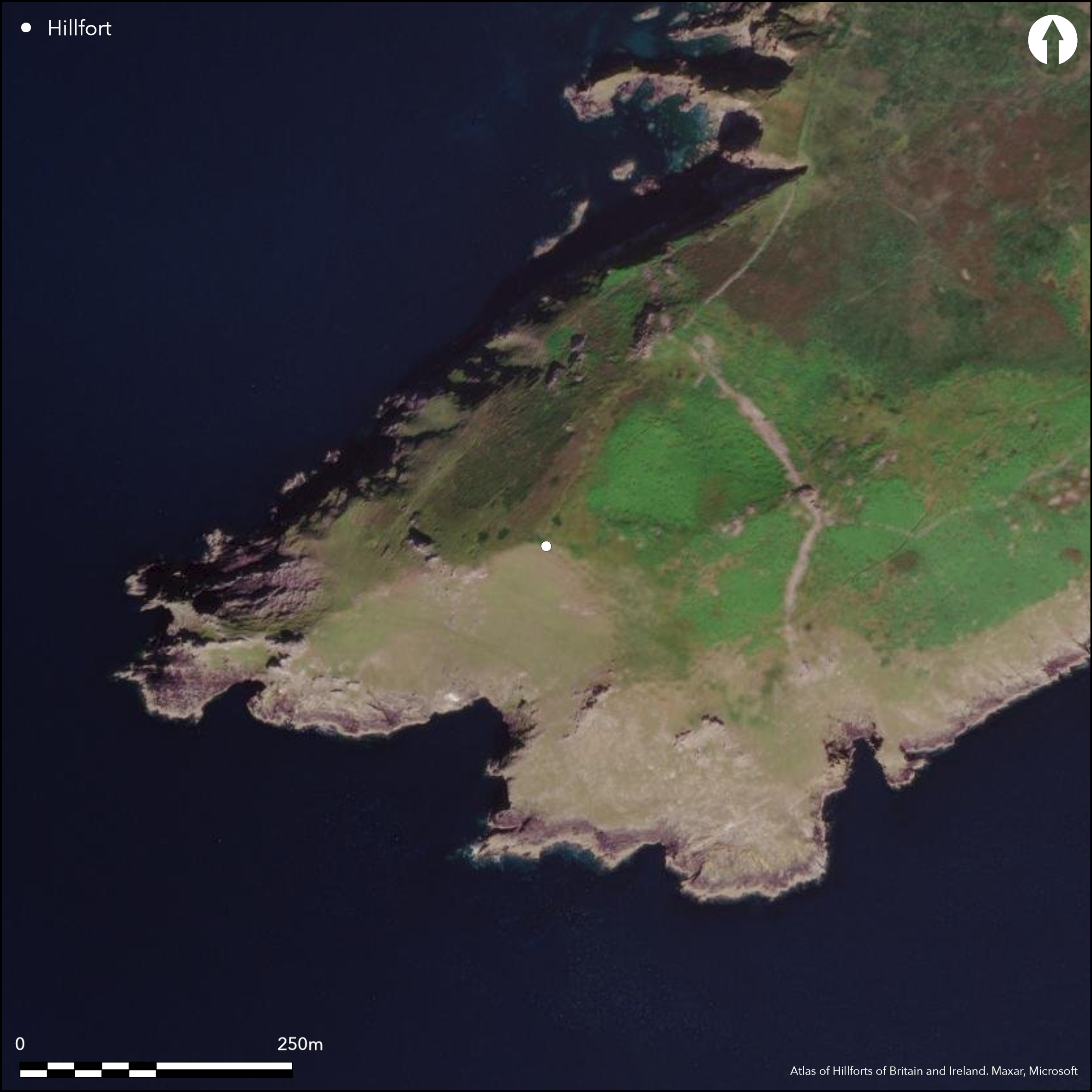
Satellite Imagery
Satellite Imagery
HER: Archaeological Survey of Ireland SMR Database KE053-085001 (None)
NMR: KE 053 (None)
SM: None
NGR: None
X: 449565 Y: 597552 (IRENET95)
This coastal promontory, known as 'Bulls Head', is located c. 7km SE of Dingle town Co. Kerry, projecting SW into Dingle Bay at an altitude of 87m OD. A distinctive landmass that rises steeply to a rocky ridge extending NE-SW along its spine. It is marked by several rocky outcrops, three of which are incorporated into the defences. The defences, first described by Tim Creedon in 1978 (Redmond 1995, 22), occur about 100m E of the highest point, overlooking the landward approach to the site. They consist of three dry-stone walls that run for a distance of c. 200m continuing downhill to the cliff edge, isolating an area measuring 350m by 320m. The walls are separated by level spaces or slight ditches that step gradually downhill to the exterior. These defences are greatly confused by recent interference and collapse. The inner wall has also been used to create sheep shelters along the inner and outer faces to the N. At the NW end, the outermost line of defence is an earthen bank which may correspond with the third wall elsewhere. The outermost wall is 2 courses high and 1m and 4.3m wide, while the middle one, 1.3m away, is two courses high (0.8m) and 1.55m wide. The third wall is 3-4 courses high (1.15m) and 2.9m wide (Cuppage 1986, 90; Redmond 1995, 22). Three entrances are recorded along the line of defences. The two examples to the N are now blocked but are interpreted as original features due to the presence of facing forming the sides (O'Sullivan and Sheehan 1996, 92). The third entrance to the S does not break through the inner wall, therefore, it is unclear whether this is an original feature; its causeway crosses the outer lines but extends only as far as the level berm which separates these from the inner wall in this area. Within the interior of the promontory, extending W from the walls along the spine of the promontory are 14-15 hut sites. These are sub-rectangular, oval and circular, while some are conjoined composed of dry-stone walling or stony banks. They vary in internal diameter from 2m to 6m. In addition, an additional 75 depressions of hollows occur along the sloping flanks of the promontory above the sea; these consist of depressions cut into the slope no more than 0.7m deep and c. 1 to 5m in diameter. Two appear to have entrance gaps and enclosing banks. These may have been additional hut-sites but their presence at the edges of the cliff or at the tops of slopes above cliffs render them enigmatic and their function remains unclear.
Citizen Science: ✗
Reliability of Data: Confirmed
Reliability of Interpretation: Confirmed
X: -1135049 Y: 6819927 (EPSG: 3857)
Longitude: -10.196321658601997 Latitude: 52.10937963116302 (EPSG:4326)
Country: Republic of Ireland
Current County or Unitary Authority: Kerry
Historic County: Kerry
Current Parish/Community/Council/Townland: Doonties Commons
None
| Extant | ✓ |
| Cropmark | ✗ |
| Likely Destroyed | ✗ |
None
| Woodland | ✗ |
| Commercial Forestry Plantation | ✗ |
| Parkland | ✗ |
| Pasture (Grazing) | ✗ |
| Arable | ✗ |
| Scrub/Bracken | ✓ |
| Bare Outcrop | ✗ |
| Heather/Moorland | ✓ |
| Heath | ✗ |
| Built-up | ✗ |
| Coastal Grassland | ✗ |
| Other | ✗ |
This coastal promontory projects SW into Dingle Bay at an approximate altitude of 87m OD. A distinctive landmass that rises steeply to a rocky ridge extending NE-SW along the axis of the headland and attaining a maximum height of 376 feet. It is marked by several rocky outcrops, three of which are incorporated into the defences.
| Contour Fort | ✗ |
| Partial Contour Fort | ✗ |
| Promontory Fort | ✓ |
| Hillslope Fort | ✗ |
| Level Terrain Fort | ✗ |
| Marsh Fort | ✗ |
| Multiple Enclosure Fort | ✗ |
| Hilltop | ✗ |
| Coastal Promontory | ✓ |
| Inland Promontory | ✗ |
| Valley Bottom | ✗ |
| Knoll/Hillock/Outcrop | ✗ |
| Ridge | ✗ |
| Cliff/Plateau-edge/Scarp | ✗ |
| Hillslope | ✗ |
| Lowland | ✗ |
| Spur | ✗ |
Dominant Topographic Feature: The site is overlooked to the NE
| North | ✗ |
| Northeast | ✗ |
| East | ✗ |
| Southeast | ✗ |
| South | ✗ |
| Southwest | ✓ |
| West | ✗ |
| Northwest | ✗ |
| Level | ✗ |
Altitude: 115.0m
N/A
There is no dating available for the site
Reliability: D - None
| Pre 1200BC | ✗ |
| 1200BC - 800BC | ✗ |
| 800BC - 400BC | ✗ |
| 400BC - AD50 | ✗ |
| AD50 - AD400 | ✗ |
| AD400 - AD 800 | ✗ |
| Post AD800 | ✗ |
| Unknown | ✓ |
| Pre Hillfort: | None |
| Post Hillfort: | Some of the stone wall shave been robbed out to create sheep-shelters in later periods. |
The site is not depicted on any edition of the OS six-inch maps, however some of the sheepfolds are marked on the second edition six-inch and twenty-five-inch map. Sir Thomas Newenham Deane mentioned a 'massive wall' across Bulls Head in 1893 (Dean 1893, 102) however it seems that the site was not described until 1978 by Tim Creedon (unpublished letter in SMR file; Redmond 1995, 22). Later surveyed by the Dingle Survey in the 1980s (Cuppage 1986).
| 1st Identified Written Reference (1893): | Newenham Deane |
| Other (1978): | Creedon |
| Earthwork Survey (1986): | Dingle Survey (Cuppage) |
14-15 hut sites within the interior of the promontory extending W from the walls and on the summit of the hilltop. These are sub-rectangular, oval and circular, while some are conjoined composed of dry-stone walling or stony banks. They vary in internal diameter from 2m to 6m. An additional 75 depressions are cut into the flanks of the promontory above the sea. These consist of depressions cut into the slope no more than 0.7m deep and c. 1 to 5m in diameter
None
| None | ✓ |
| Spring | ✗ |
| Stream | ✗ |
| Pool | ✗ |
| Flush | ✗ |
| Well | ✗ |
| Other | ✗ |
None
| No Known Features | ✗ |
| Round Stone Structures | ✓ |
| Rectangular Stone Structures | ✓ |
| Curvilinear Platforms | ✓ |
| Other Roundhouse Evidence | ✓ |
| Pits | ✗ |
| Quarry Hollows | ✗ |
| Other | ✗ |
None
| No Known Excavation | ✓ |
| Pits | ✗ |
| Postholes | ✗ |
| Roundhouses | ✗ |
| Rectangular Structures | ✗ |
| Roads/Tracks | ✗ |
| Quarry Hollows | ✗ |
| Other | ✗ |
| Nothing Found | ✗ |
None
| No Known Geophysics | ✓ |
| Pits | ✗ |
| Roundhouses | ✗ |
| Rectangular Structures | ✗ |
| Roads/Tracks | ✗ |
| Quarry Hollows | ✗ |
| Other | ✗ |
| Nothing Found | ✗ |
None
| No Known Finds | ✓ |
| Pottery | ✗ |
| Metal | ✗ |
| Metalworking | ✗ |
| Human Bones | ✗ |
| Animal Bones | ✗ |
| Lithics | ✗ |
| Environmental | ✗ |
| Other | ✗ |
None
| APs Not Checked | ✗ |
| None | ✗ |
| Roundhouses | ✓ |
| Rectangular Structures | ✗ |
| Pits | ✗ |
| Postholes | ✗ |
| Roads/Tracks | ✗ |
| Other | ✗ |
Three entrances are recorded along the line of defences. The two examples to the N are now blocked but are interpreted as original features (O'Sullivan and Sheehan 1996, 92). The third entrance to the S does not break through the inner wall, therefore, it is unclear whether this is an original feature.
| 3: | None |
| 2: | None |
Guard Chambers: ✗
Chevaux de Frise: ✗
| 1. Simple Gap (North east): | Possible original entrance now blocked piercing all defensive elements. Facing noted on each side. |
| 2. Simple Gap (North east): | Possible original entrance now blocked piercing all defensive elements. Facing noted on each side |
The defences occur about 100m E of the highest point, overlooking the landward approach to the site. They consist of three dry-stone walls that run for a distance of c. 200m and continue downhill to the cliff edge. At the NW end, the outermost line of defence is an earthen bank which may correspond with the third wall. The outermost wall is 2 courses high at 1m and 4.3m wide, while the middle one, 1.3m away, is two courses high (0.8m) and 1.55m wide. The third wall is 3-4 courses high (1.15m) and 2.9m wide (Cuppage 1986, 90; Redmond 1995, 22). Three entrances are recorded along the line of defences.
| Area 1: | 1.9ha. |
| Total: | 1.9ha. |
Total Footprint Area: 2.35ha.
None
| ✗ | None |
| ✗ | None |
| NE Quadrant: | 3 |
| SE Quadrant: | 0 |
| SW Quadrant: | 0 |
| NW Quadrant: | 0 |
| Total: | 3 |
| Partial Univallate | ✗ |
| Univallate | ✗ |
| Partial Bivallate | ✗ |
| Bivallate | ✗ |
| Partial Multivallate | ✓ |
| Multivallate | ✗ |
| Unknown | ✗ |
| Partial Univallate | ✗ |
| Univallate | ✗ |
| Partial Bivallate | ✗ |
| Bivallate | ✗ |
| Partial Multivallate | ✗ |
| Multivallate | ✗ |
None
| None | ✗ |
| Earthen Bank | ✓ |
| Stone Wall | ✓ |
| Rubble | ✗ |
| Wall-walk | ✗ |
| Evidence of Timber | ✗ |
| Vitrification | ✗ |
| Other Burning | ✗ |
| Palisade | ✗ |
| Counter Scarp Bank | ✗ |
| Berm | ✗ |
| Unfinished | ✗ |
| Other | ✗ |
None
| None | ✗ |
| Earthen Bank | ✗ |
| Stone Wall | ✗ |
| Murus Duplex | ✗ |
| Timber-framed | ✗ |
| Timber-laced | ✗ |
| Vitrification | ✗ |
| Other Burning | ✗ |
| Palisade | ✗ |
| Counter Scarp Bank | ✗ |
| Berm | ✗ |
| Unfinished | ✗ |
| No Known Excavation | ✓ |
| Other | ✗ |
| ✗ | None |
| ✗ | None |
Number of Ditches: 0
| ✗ | None |
Cuppage, J. et al. 1986. Archaeological Survey of the Dingle Peninsula. Ballyferriter
Dean, T.N. 1893. A report on ancient monuments in Co. Kerry. Proceedings of the Royal Irish Academy 19, 100-107.
O'Sullivan, A and Sheehan, J. 1996. Iveragh Peninsula: An Archaeological Survey of South Kerry. Cork University Press. Cork
Redmond, M. 1995. A survey of the promontory forts of the Kerry peninsulas. Journal of the Kerry Archaeological and Historical Society 28, 5-63
Atlas of Hillforts:
Wikidata:
This work is licensed under CC BY-SA 4.0

 and should be cited as:
Lock, Gary and Ralston, Ian. 2024. Atlas of Hillforts of Britain and Ireland. Available at: https://hillforts.arch.ox.ac.uk
Document Version 1.1