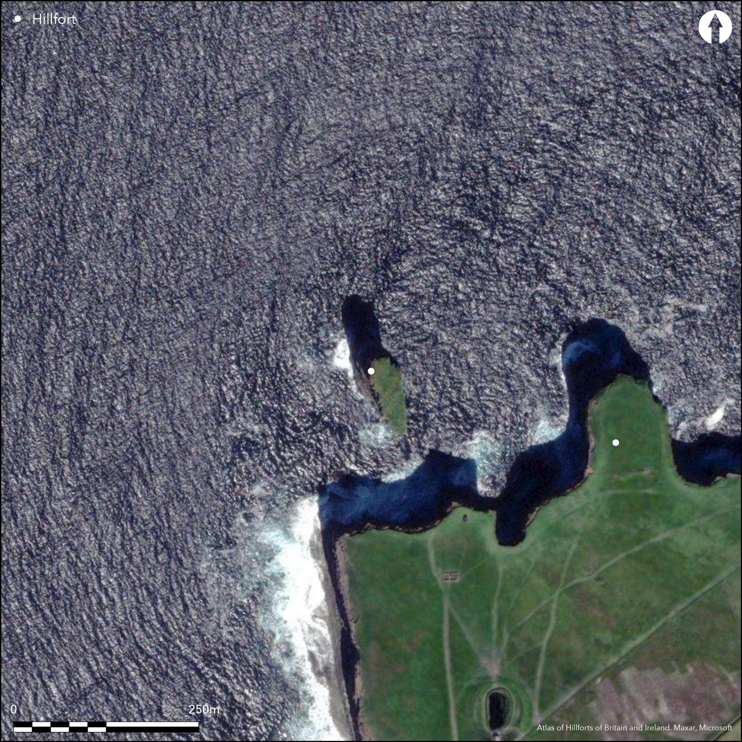
Satellite Imagery
Satellite Imagery
HER: Archaeological Survey of Ireland SMR Database MA007-001001 (None)
NMR: MA 007 (None)
SM: None
NGR: None
X: 512297 Y: 842963 (IRENET95)
This sea stack rise up to $%m OD out of the sea off 'Downpatrick Head', c. 5.5km N of Ballycastle village on the coast of Co. Mayo. The top of the stack is c. 0.1ha in extent and lies c. 80m from the nearest part of the headland on the S. The Annals of the Four Masters records 'the cutting of the rock of Duross promontory, in Tirawley, by the sea in 1393, and O' Donovan's translation records the sea stack as 'Dun Deodruisce, a remarkable loft rock, off Downpatrick Head. On this rock stood an ancient fortress, which has not been explored' (1856, 480). Recorded on the first edition OS six-inch map as 'Doonbristy' (1839), according to Westropp it was known locally as 'Dun Geodruisge', from a giant, Geodruisge, Deodruisge, or Johdhrick, of whom variant legends are told' (1912, 106). Westropp, 'examining its summit with a strong glass' observed a low wall of flat stones running E and W across the platform. Among it was a stone slab standing upright behind it among heaps of stones 'bossed and partly hid by luxuriant sea pink' (1912, 105). MacParlan (1802) noted 'the ruins of some buildings on the detached rock', while O'Conor (1838) observed the same along with a stone wall with a possible doorway or gateway. Otway (1841) noted similar buildings and a doorway of dressed stone forming the jams of an entrance. None of these features were visible to Westropp in the early part of the twentieth century.
Citizen Science: ✗
Reliability of Data: Confirmed
Reliability of Interpretation: Confirmed
X: -1040651 Y: 7232491 (EPSG: 3857)
Longitude: -9.348326357623643 Latitude: 54.32783821408617 (EPSG:4326)
Country: Republic of Ireland
Current County or Unitary Authority: Mayo
Historic County: Mayo
Current Parish/Community/Council/Townland: Knockaun
None
| Extant | ✓ |
| Cropmark | ✗ |
| Likely Destroyed | ✗ |
Sea stack
| Woodland | ✗ |
| Commercial Forestry Plantation | ✗ |
| Parkland | ✗ |
| Pasture (Grazing) | ✗ |
| Arable | ✗ |
| Scrub/Bracken | ✗ |
| Bare Outcrop | ✗ |
| Heather/Moorland | ✗ |
| Heath | ✗ |
| Built-up | ✗ |
| Coastal Grassland | ✓ |
| Other | ✗ |
A sea stack situated off 'Downpatrick Head' c. 5.5km N of Ballycastle village on the coast of Co. Mayo. Towering to an altitude of 45m OD, the top is c. 0.1ha and it lies c. 80m off the nearest part of the headland. Westropp, 'examining its summit with a strong glass', observed a low wall of flat stones running E and W across the top
| Contour Fort | ✗ |
| Partial Contour Fort | ✗ |
| Promontory Fort | ✓ |
| Hillslope Fort | ✗ |
| Level Terrain Fort | ✗ |
| Marsh Fort | ✗ |
| Multiple Enclosure Fort | ✗ |
| Hilltop | ✗ |
| Coastal Promontory | ✓ |
| Inland Promontory | ✗ |
| Valley Bottom | ✗ |
| Knoll/Hillock/Outcrop | ✗ |
| Ridge | ✗ |
| Cliff/Plateau-edge/Scarp | ✗ |
| Hillslope | ✗ |
| Lowland | ✗ |
| Spur | ✗ |
Dominant Topographic Feature: None
| North | ✗ |
| Northeast | ✗ |
| East | ✗ |
| Southeast | ✗ |
| South | ✗ |
| Southwest | ✗ |
| West | ✗ |
| Northwest | ✗ |
| Level | ✓ |
Altitude: 45.0m
N/A
There is no dating available for the site
Reliability: D - None
| Pre 1200BC | ✗ |
| 1200BC - 800BC | ✗ |
| 800BC - 400BC | ✗ |
| 400BC - AD50 | ✗ |
| AD50 - AD400 | ✗ |
| AD400 - AD 800 | ✗ |
| Post AD800 | ✗ |
| Unknown | ✓ |
| Pre Hillfort: | None |
| Post Hillfort: | None |
The Annals of the Four Masters records 'the cutting of the rock of Duross promontory, in Tirawley, by the sea in 1393 (Westropp 1912, 105). Recorded on the first edition OS six-inch map as 'Doonbristy' (1839), according to Westropp it was known locally as 'Dun Geodruisge', from a giant, Geodruisge, Deodruisge, or Johdhrick, of whom variant legends are told' (1912, 106). O' Donovan's translation of the Annals of the Four Masters records the sea stack as 'Dun Deodruisce, a remarkable loft rock, off Downpatrick Head. On this rock stood an ancient fortress, which has not been explored' (1856, 480). Site has been described by several writers. Dr James MacParlan in 1802, and by the Rev. Caesar Otway in 1841; also in an unpublished letter of T. O'Conor, annotated by Dr John O' Donovan in 1838.
| 1st Identified Written Reference (1393): | O'Donnovan 1856 |
| Other (1802): | MacParlan |
| 1st Identified Map Depiction (1838): | OS six-inch mapping |
| Other (1838): | T. O'Conor |
| Other (1841): | Caesar Otway |
| Earthwork Survey (1912): | Thomas Westropp |
MacParlan (1802) noted 'the ruins of some buildings on the detached rock' while O'Conor (1838) observed the same along with a stone wall with a possible doorway or gateway. Otway (1841) noted a similar buildings and a doorway of dressed stone forming the jams of an entrance. None of these features were noted by Westropp in the early part of the twentieth century.
None
| None | ✓ |
| Spring | ✗ |
| Stream | ✗ |
| Pool | ✗ |
| Flush | ✗ |
| Well | ✗ |
| Other | ✗ |
Possible stone structures however due to innaccessibility, this cannot be confirmed.
| No Known Features | ✗ |
| Round Stone Structures | ✗ |
| Rectangular Stone Structures | ✓ |
| Curvilinear Platforms | ✗ |
| Other Roundhouse Evidence | ✗ |
| Pits | ✗ |
| Quarry Hollows | ✗ |
| Other | ✗ |
None
| No Known Excavation | ✓ |
| Pits | ✗ |
| Postholes | ✗ |
| Roundhouses | ✗ |
| Rectangular Structures | ✗ |
| Roads/Tracks | ✗ |
| Quarry Hollows | ✗ |
| Other | ✗ |
| Nothing Found | ✗ |
None
| No Known Geophysics | ✓ |
| Pits | ✗ |
| Roundhouses | ✗ |
| Rectangular Structures | ✗ |
| Roads/Tracks | ✗ |
| Quarry Hollows | ✗ |
| Other | ✗ |
| Nothing Found | ✗ |
None
| No Known Finds | ✓ |
| Pottery | ✗ |
| Metal | ✗ |
| Metalworking | ✗ |
| Human Bones | ✗ |
| Animal Bones | ✗ |
| Lithics | ✗ |
| Environmental | ✗ |
| Other | ✗ |
NO APPARENT FEATURES
| APs Not Checked | ✓ |
| None | ✗ |
| Roundhouses | ✗ |
| Rectangular Structures | ✗ |
| Pits | ✗ |
| Postholes | ✗ |
| Roads/Tracks | ✗ |
| Other | ✗ |
The landmass is cut off from Downpatrick Head. It is unknown when it was last connected to the mainland.
| 0: | None |
| 2: | None |
Guard Chambers: ✗
Chevaux de Frise: ✗
Westropp, 'examining its summit with a strong glass' observed a low wall of flat stones running in an E/W direction across the platform. Among it was a stone slab standing upright behind it among heaps of stones 'bossed and partly hid by luxuriant sea pink' (1912, 105).
| Area 1: | 0.1ha. |
| Total: | 0.1ha. |
Total Footprint Area: 0.1ha.
None
| ✗ | None |
| ✗ | None |
| NE Quadrant: | 0 |
| SE Quadrant: | 1 |
| SW Quadrant: | 0 |
| NW Quadrant: | 0 |
| Total: | 1 |
| Partial Univallate | ✓ |
| Univallate | ✗ |
| Partial Bivallate | ✗ |
| Bivallate | ✗ |
| Partial Multivallate | ✗ |
| Multivallate | ✗ |
| Unknown | ✗ |
| Partial Univallate | ✗ |
| Univallate | ✗ |
| Partial Bivallate | ✗ |
| Bivallate | ✗ |
| Partial Multivallate | ✗ |
| Multivallate | ✗ |
None
| None | ✗ |
| Earthen Bank | ✗ |
| Stone Wall | ✓ |
| Rubble | ✗ |
| Wall-walk | ✗ |
| Evidence of Timber | ✗ |
| Vitrification | ✗ |
| Other Burning | ✗ |
| Palisade | ✗ |
| Counter Scarp Bank | ✗ |
| Berm | ✗ |
| Unfinished | ✗ |
| Other | ✗ |
None
| None | ✗ |
| Earthen Bank | ✗ |
| Stone Wall | ✗ |
| Murus Duplex | ✗ |
| Timber-framed | ✗ |
| Timber-laced | ✗ |
| Vitrification | ✗ |
| Other Burning | ✗ |
| Palisade | ✗ |
| Counter Scarp Bank | ✗ |
| Berm | ✗ |
| Unfinished | ✗ |
| No Known Excavation | ✓ |
| Other | ✗ |
| ✗ | None |
| ✗ | None |
Number of Ditches: 0
| ✗ | None |
Westropp, T.J. 1912. The promontory forts and early remains of the coasts of County Mayo. Part 1- The north coast (Tirawley and Erris). The Journal of the Royal Society of Antiquaries of Ireland 42, 59-139.
O'Donovan, J. 1856. Annals of the Kingdom of Ireland by the Four Masters Volume 1 (1856). Hodges and Smith and Co. Dublin.
Otway, C. 1841. Sketches in Erris and Tirawley. Dublin
Atlas of Hillforts:
Wikidata:
This work is licensed under CC BY-SA 4.0

 and should be cited as:
Lock, Gary and Ralston, Ian. 2024. Atlas of Hillforts of Britain and Ireland. Available at: https://hillforts.arch.ox.ac.uk
Document Version 1.1