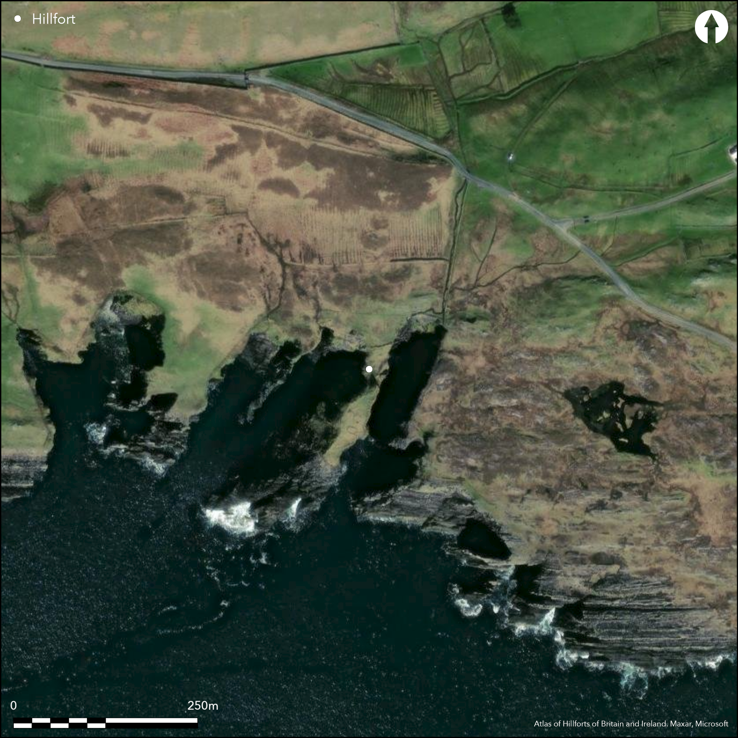
Satellite Imagery
Satellite Imagery
HER: Archaeological Survey of Ireland SMR Database MA084-005001 (None)
NMR: MA 084 (None)
SM: None
NGR: None
X: 466896 Y: 784335 (IRENET95)
Located on the S end of Clare Island off the W coast of Co. Mayo, this coastal promontory is marked as 'Doon' on the first edition OS six-inch map (1839). Projecting SW from the Island at Ooghaniska Cove, it is long and narrow, some 150m in length overall and rising to seaward on the SW. The grassy slope dipping into the low neck, which lies about 3m below the level of the old fields to the N, is c. 8.2m wide and, is traversed by two shallow ditches with rock outcrop between them. The outer ditch runs ENE and WSW and is 2.7m wide by 0.9m deep. The inner lies E and W c. 10m to seaward and is 2.7m wide by 0.9m deep. A wall 'rarely over 3 feet high and 6 feet thick' seems to have extended along the NW margin of the promontory above a path created by scarping the slope. Ranging from 1.2m to 2.7m thick, Westropp describes this wall with a 'bastion' at the entrance at the head of the path. The raised area enclosed measures about 60m long by up to 21m wide and contains two hut-sites. The northern has rounded corners and measures 6.4m N-S by 5.4m E-W, with earth and stone walls 1.2m thick. The second lies 4.5m to the S and has an irregular plan, measuring 6m N/S by 9m E/W; it has rounded corners with walls 1.2m thick. To the S the ground has been formed into three shallow terraces 0.6m high and 3.6m wide.
Citizen Science: ✗
Reliability of Data: Confirmed
Reliability of Interpretation: Confirmed
X: -1115442 Y: 7130774 (EPSG: 3857)
Longitude: -10.020186418849494 Latitude: 53.79153286191672 (EPSG:4326)
Country: Republic of Ireland
Current County or Unitary Authority: Mayo (Clare Island)
Historic County: Mayo
Current Parish/Community/Council/Townland: Strake
None
| Extant | ✓ |
| Cropmark | ✗ |
| Likely Destroyed | ✗ |
None
| Woodland | ✗ |
| Commercial Forestry Plantation | ✗ |
| Parkland | ✗ |
| Pasture (Grazing) | ✓ |
| Arable | ✗ |
| Scrub/Bracken | ✗ |
| Bare Outcrop | ✗ |
| Heather/Moorland | ✓ |
| Heath | ✗ |
| Built-up | ✗ |
| Coastal Grassland | ✗ |
| Other | ✗ |
Projecting SW from the Island at Ooghaniska Cove, this is a long narrow promontory 150m in length rising to seaward on the SW. Scarping along the NW face has created a terrace carrying a path. The raised seaward end measures 60m long and 21m wide. The low grassy dip at the neck is c. 3m below the old fields to the N and has a sloped approach c. 8.2m wide, fenced by two shallow ditches. A 'bastion' described by Westropp was fenced by a wall 1.2m thick adjoined by a similar wall 2.7m thick at the head of the path where the entrance was located.
| Contour Fort | ✗ |
| Partial Contour Fort | ✗ |
| Promontory Fort | ✓ |
| Hillslope Fort | ✗ |
| Level Terrain Fort | ✗ |
| Marsh Fort | ✗ |
| Multiple Enclosure Fort | ✗ |
| Hilltop | ✗ |
| Coastal Promontory | ✓ |
| Inland Promontory | ✗ |
| Valley Bottom | ✗ |
| Knoll/Hillock/Outcrop | ✗ |
| Ridge | ✗ |
| Cliff/Plateau-edge/Scarp | ✗ |
| Hillslope | ✗ |
| Lowland | ✗ |
| Spur | ✗ |
Dominant Topographic Feature: None
| North | ✗ |
| Northeast | ✗ |
| East | ✗ |
| Southeast | ✗ |
| South | ✗ |
| Southwest | ✓ |
| West | ✗ |
| Northwest | ✗ |
| Level | ✗ |
Altitude: 15.0m
N/A
There is no dating available for the site
Reliability: D - None
| Pre 1200BC | ✗ |
| 1200BC - 800BC | ✗ |
| 800BC - 400BC | ✗ |
| 400BC - AD50 | ✗ |
| AD50 - AD400 | ✗ |
| AD400 - AD 800 | ✗ |
| Post AD800 | ✗ |
| Unknown | ✓ |
| Pre Hillfort: | None |
| Post Hillfort: | Possible evidence of later medieval fortification |
Marked as 'Doon' on the first edition OS six-inch maps (1839). First visited and surveyed by Thomas Westropp in 1914
| 1st Identified Map Depiction (1839): | OS six-inch mapping |
| Earthwork Survey (1914): | Thomas Westropp |
A hut-site with rounded corners abuts the inner wall and measures 6.4m N/S by 5.4m E/W with walls 1.2m thick composed of earth and stone. A second lies 4.5m to the S with an irregular plan measuring 6m N/S by 9m E/W; it has rounded corners with walls 1.2m thick.
None
| None | ✓ |
| Spring | ✗ |
| Stream | ✗ |
| Pool | ✗ |
| Flush | ✗ |
| Well | ✗ |
| Other | ✗ |
None
| No Known Features | ✗ |
| Round Stone Structures | ✗ |
| Rectangular Stone Structures | ✓ |
| Curvilinear Platforms | ✗ |
| Other Roundhouse Evidence | ✗ |
| Pits | ✗ |
| Quarry Hollows | ✗ |
| Other | ✗ |
None
| No Known Excavation | ✓ |
| Pits | ✗ |
| Postholes | ✗ |
| Roundhouses | ✗ |
| Rectangular Structures | ✗ |
| Roads/Tracks | ✗ |
| Quarry Hollows | ✗ |
| Other | ✗ |
| Nothing Found | ✗ |
None
| No Known Geophysics | ✓ |
| Pits | ✗ |
| Roundhouses | ✗ |
| Rectangular Structures | ✗ |
| Roads/Tracks | ✗ |
| Quarry Hollows | ✗ |
| Other | ✗ |
| Nothing Found | ✗ |
None
| No Known Finds | ✓ |
| Pottery | ✗ |
| Metal | ✗ |
| Metalworking | ✗ |
| Human Bones | ✗ |
| Animal Bones | ✗ |
| Lithics | ✗ |
| Environmental | ✗ |
| Other | ✗ |
NO APPARENT FEATURES
| APs Not Checked | ✓ |
| None | ✗ |
| Roundhouses | ✗ |
| Rectangular Structures | ✗ |
| Pits | ✗ |
| Postholes | ✗ |
| Roads/Tracks | ✗ |
| Other | ✗ |
A 'bastion' described by Westropp was fenced by a wall 1.2m thick adjoined by a similar wall 2.7m thick at the head of the path where the entrance was located. Its precise position is not recorded, but the path was apparently on the NW flank.
| 0: | None |
| 2: | None |
Guard Chambers: ✗
Chevaux de Frise: ✗
| 1. Simple Gap (North east): | None |
The grassy slope dipping into the low neck about 3m below the level of the old fields to the N c. 8.2m wide, is traversed by two shallow ditches with rock outcrop between them. The outer ditch runs ENE and WSW and is 2.7m wide by 0.9m deep. The inner lies E and W c. 10m to seaward and is 2.7m wide by 0.9m deep. A wall 'rarely over 3 feet high and 6 feet thick' seems to have extended along the NW margin of the promontory above a path created by scarping the slope. Ranging from 1.2m to 2.7m thick, Westropp describes this wall with a 'bastion' at the entrance at the head of the path.
| Area 1: | 0.09ha. |
| Total: | 0.09ha. |
Total Footprint Area: 0.15ha.
None
| ✗ | None |
| ✗ | None |
| NE Quadrant: | 2 |
| SE Quadrant: | 0 |
| SW Quadrant: | 0 |
| NW Quadrant: | 0 |
| Total: | 2 |
| Partial Univallate | ✗ |
| Univallate | ✗ |
| Partial Bivallate | ✓ |
| Bivallate | ✗ |
| Partial Multivallate | ✗ |
| Multivallate | ✗ |
| Unknown | ✗ |
| Partial Univallate | ✗ |
| Univallate | ✗ |
| Partial Bivallate | ✗ |
| Bivallate | ✗ |
| Partial Multivallate | ✗ |
| Multivallate | ✗ |
None
| None | ✗ |
| Earthen Bank | ✗ |
| Stone Wall | ✓ |
| Rubble | ✗ |
| Wall-walk | ✗ |
| Evidence of Timber | ✗ |
| Vitrification | ✗ |
| Other Burning | ✗ |
| Palisade | ✗ |
| Counter Scarp Bank | ✗ |
| Berm | ✗ |
| Unfinished | ✗ |
| Other | ✗ |
None
| None | ✗ |
| Earthen Bank | ✗ |
| Stone Wall | ✗ |
| Murus Duplex | ✗ |
| Timber-framed | ✗ |
| Timber-laced | ✗ |
| Vitrification | ✗ |
| Other Burning | ✗ |
| Palisade | ✗ |
| Counter Scarp Bank | ✗ |
| Berm | ✗ |
| Unfinished | ✗ |
| No Known Excavation | ✓ |
| Other | ✗ |
| ✗ | None |
| ✓ | None |
Number of Ditches: 2
| ✗ | None |
Westropp, T.J. 1914. The promontory forts and early remains of islands of Connacht. The Journal of the Royal Society of Antiquaries of Ireland 44, 297-337
Atlas of Hillforts:
Wikidata:
This work is licensed under CC BY-SA 4.0

 and should be cited as:
Lock, Gary and Ralston, Ian. 2024. Atlas of Hillforts of Britain and Ireland. Available at: https://hillforts.arch.ox.ac.uk
Document Version 1.1