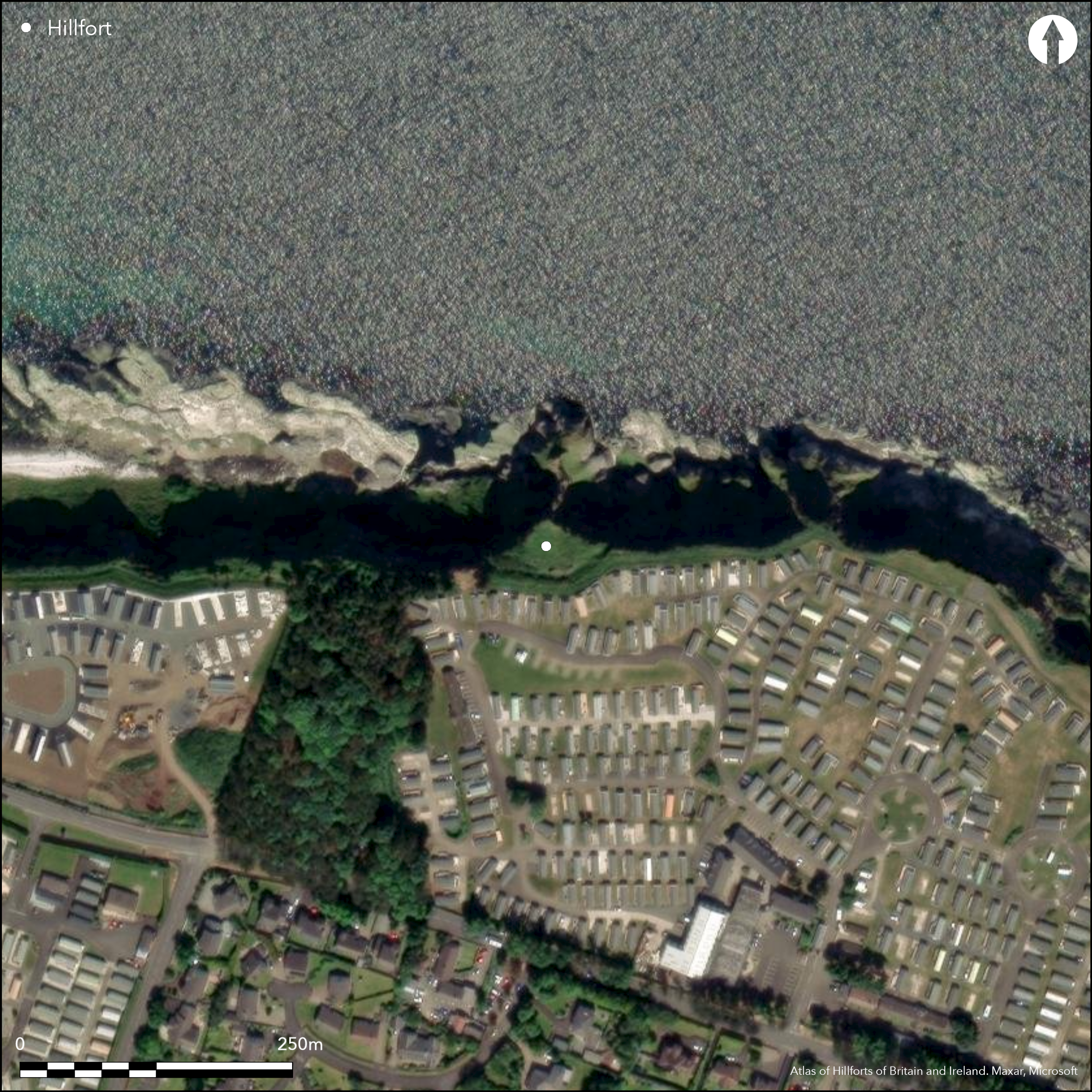
Satellite Imagery
Satellite Imagery
HER: Northern Ireland Sites and Monuments Record ANT004:001 (None)
NMR: ANT 004 (None)
SM: ANT 4:1
NGR: None
X: 711307 Y: 941881 (IRENET95)
This coastal promontory, depicted on the first edition (1839) OS six-inch map as 'Duineny', is situated at 'Castle Point' on top of a projecting cliff at Ballycastle, Co. Antrim. It is bounded to the E by cliffs culminating in the promontory of Fair Head, some 200m high, and to the W by a headland of basalt some 60m high. The River Margy flows into the bay at its W end. It has superb views all round. The visible remains comprise an almost level triangular area 30m N-S by 45m wide and falls away down the cliff everywhere except the SE, where the neck is enclosed by a rock-cut ditch and there are elements of a masonry castle with a wall and gatehouse built in basalt bonded with coarse mortar. According to McNeill (2004), the remains of at least two structures survive in the interior and there are probable traces of others. Excavation of the site in 2004 revealed a more complex history. A trench was excavated across the expected line of any bank or wall along the inner side of the ditch (McNeill 2004, 173). This revealed a pile of large stones up to half-a-metre across lying on a truncated soil. Along the top of this material was a poorly defined shallow scoop filled with dark brown earth. Over the stones to the N lay a deposit of brown earth 0.2m thick. At the S end of the trench between the stones and the lip of the ditch was a narrow berm on which was found a dump of pink clay. McNeill observes that in section, the stones and other associated material have every appearance of being the remains of a truncated bank, lying within the line of the ditch (2004, 173). Two sherds of prehistoric pottery were recovered from the pile of stones in Trench 2. This possible inner bank material was also found in Trench 1 along with the remnant of a turf pile against it. The excavated ditch was some 6m deep and flat bottomed and contained much dumped medieval refuse. McNeill however notes that the flat bottom and near vertical lower sides looked as though they had been made as a result of quarrying the basalt for stone, presumably for the medieval gate structure (2004, 182). Higher in the ditch the sides were less vertical and McNeill suggests that this sloping upper section may be the remains of an earlier ditch, later deepened, and this may relate to the remains of the truncated bank and inner turf pile. This early phase may have been a late prehistoric or protohistoric promontory fort reoccupied as a base for a small detachment of troops in the late sixteenth century (ibid). Shortly after 1600, Sir Randall MacDonnell built the castle here to serve as the administrative centre for one of his baronies. This was built with a castle-like front, with ditch and gate.
Citizen Science: ✗
Reliability of Data: Unconfirmed
Reliability of Interpretation: Unconfirmed
X: -695863 Y: 7403040 (EPSG: 3857)
Longitude: -6.251045533367155 Latitude: 55.211591074988156 (EPSG:4326)
Country: Northern Ireland
Current County or Unitary Authority: Antrim
Historic County: Antrim
Current Parish/Community/Council/Townland: Townparks (Ballycastle)
None
| Extant | ✓ |
| Cropmark | ✗ |
| Likely Destroyed | ✗ |
None
| Woodland | ✗ |
| Commercial Forestry Plantation | ✗ |
| Parkland | ✗ |
| Pasture (Grazing) | ✗ |
| Arable | ✗ |
| Scrub/Bracken | ✗ |
| Bare Outcrop | ✗ |
| Heather/Moorland | ✗ |
| Heath | ✗ |
| Built-up | ✗ |
| Coastal Grassland | ✓ |
| Other | ✗ |
This possible coastal promontory fort is situated on top of a projecting cliff at Ballycastle Co. Antrim. It is bounded to the E by cliffs culminating in the promontory of Fair Head, some 200m high, and to the W by a headland of basalt overlying chalk some 60m high. It is enclosed by a rock-cut ditch to the S.
| Contour Fort | ✗ |
| Partial Contour Fort | ✗ |
| Promontory Fort | ✓ |
| Hillslope Fort | ✗ |
| Level Terrain Fort | ✗ |
| Marsh Fort | ✗ |
| Multiple Enclosure Fort | ✗ |
| Hilltop | ✗ |
| Coastal Promontory | ✓ |
| Inland Promontory | ✗ |
| Valley Bottom | ✗ |
| Knoll/Hillock/Outcrop | ✗ |
| Ridge | ✗ |
| Cliff/Plateau-edge/Scarp | ✗ |
| Hillslope | ✗ |
| Lowland | ✗ |
| Spur | ✗ |
Dominant Topographic Feature: N-facing promontory
| North | ✗ |
| Northeast | ✗ |
| East | ✗ |
| Southeast | ✗ |
| South | ✗ |
| Southwest | ✗ |
| West | ✗ |
| Northwest | ✗ |
| Level | ✓ |
Altitude: 34.0m
N/A
Two sherds of prehistoric pottery were recovered from a possible earlier inner bank during excavation of a late medieval fortified headland (McNeill 2004).
Reliability: D - None
| Pre 1200BC | ✗ |
| 1200BC - 800BC | ✗ |
| 800BC - 400BC | ✗ |
| 400BC - AD50 | ✗ |
| AD50 - AD400 | ✗ |
| AD400 - AD 800 | ✗ |
| Post AD800 | ✗ |
| Unknown | ✓ |
| Pre Hillfort: | None |
| Post Hillfort: | Late Medieval castle and gate-house |
| Artefactual: | None |
The site is depicted as a hachured promontory on the first edition OS six-inch map (1839). Castle remains noted by Fagan in the parish memoirs (1831) and later by McNeill (1983). Surveyed by the Archaeological Survey of Northern Ireland in 1994. Medieval defences and interior structures excavated by McNeill in 2004 who also observed evidence of earlier prehistoric phase on the promontory.
| 1st Identified Written Reference (1831): | Fagan (Parish Memoirs) |
| 1st Identified Map Depiction (1839): | OS six-inch mapping |
| Other (1983): | T.E McNeill |
| Excavation (2004): | T.E McNeill |
The castle on the site consists of an almost level triangular area 30m N-S by 45m wide within which at least two rectangular buildings are visible.
None
| None | ✓ |
| Spring | ✗ |
| Stream | ✗ |
| Pool | ✗ |
| Flush | ✗ |
| Well | ✗ |
| Other | ✗ |
Castle
| No Known Features | ✗ |
| Round Stone Structures | ✗ |
| Rectangular Stone Structures | ✓ |
| Curvilinear Platforms | ✗ |
| Other Roundhouse Evidence | ✗ |
| Pits | ✗ |
| Quarry Hollows | ✗ |
| Other | ✗ |
None
| No Known Excavation | ✓ |
| Pits | ✗ |
| Postholes | ✗ |
| Roundhouses | ✗ |
| Rectangular Structures | ✗ |
| Roads/Tracks | ✗ |
| Quarry Hollows | ✗ |
| Other | ✗ |
| Nothing Found | ✗ |
None
| No Known Geophysics | ✓ |
| Pits | ✗ |
| Roundhouses | ✗ |
| Rectangular Structures | ✗ |
| Roads/Tracks | ✗ |
| Quarry Hollows | ✗ |
| Other | ✗ |
| Nothing Found | ✗ |
Prehistoric pottery
| No Known Finds | ✗ |
| Pottery | ✓ |
| Metal | ✗ |
| Metalworking | ✗ |
| Human Bones | ✗ |
| Animal Bones | ✗ |
| Lithics | ✗ |
| Environmental | ✗ |
| Other | ✗ |
NO APPARENT FEATURES
| APs Not Checked | ✓ |
| None | ✗ |
| Roundhouses | ✗ |
| Rectangular Structures | ✗ |
| Pits | ✗ |
| Postholes | ✗ |
| Roads/Tracks | ✗ |
| Other | ✗ |
The site is accessed through a late medieval stone gated structure. There is no indicateion of an earlier entrance in this position
| 1: | None |
| 2: | None |
Guard Chambers: ✗
Chevaux de Frise: ✗
The promontory is defended by a curving rock-cut ditch to the S. Excavation across this feature revealed the remains of a possible truncated stone and earthen bank c. 1.5m wide and 0.5m high. The remains of a turf pile were also revealed lying against this wall. At the S end of the trench between the stones and the lip of the ditch was a narrow berm on which was found a dump of pink clay. McNeill observes that in section, these features have every appearance of being the remains of a truncated bank, lying within the line of the ditch (2004, 173). Two sherds of prehistoric pottery were recovered. The excavated ditch was some 6m deep and flat bottomed and contained much dumped medieval refuse. McNeill however notes that the flat bottom and near vertical lower sides looked as though they had been made as a result later re-cutting as a quarry. Higher in the ditch the sides were less vertical with McNeill observing that this may be the remains of an earlier ditch, later deepened. This earlier ditch may relate to the remains of the truncated bank.
| Area 1: | 0.1ha. |
| Total: | 0.1ha. |
Total Footprint Area: 0.17ha.
None
| ✗ | None |
| ✗ | None |
| NE Quadrant: | 0 |
| SE Quadrant: | 1 |
| SW Quadrant: | 0 |
| NW Quadrant: | 0 |
| Total: | 1 |
| Partial Univallate | ✓ |
| Univallate | ✗ |
| Partial Bivallate | ✗ |
| Bivallate | ✗ |
| Partial Multivallate | ✗ |
| Multivallate | ✗ |
| Unknown | ✗ |
| Partial Univallate | ✗ |
| Univallate | ✗ |
| Partial Bivallate | ✗ |
| Bivallate | ✗ |
| Partial Multivallate | ✗ |
| Multivallate | ✗ |
None
| None | ✓ |
| Earthen Bank | ✗ |
| Stone Wall | ✗ |
| Rubble | ✗ |
| Wall-walk | ✗ |
| Evidence of Timber | ✗ |
| Vitrification | ✗ |
| Other Burning | ✗ |
| Palisade | ✗ |
| Counter Scarp Bank | ✗ |
| Berm | ✗ |
| Unfinished | ✗ |
| Other | ✗ |
Remains of truncated stone and earth bank revealed within the ditch.
| None | ✗ |
| Earthen Bank | ✓ |
| Stone Wall | ✓ |
| Murus Duplex | ✗ |
| Timber-framed | ✗ |
| Timber-laced | ✗ |
| Vitrification | ✗ |
| Other Burning | ✗ |
| Palisade | ✗ |
| Counter Scarp Bank | ✗ |
| Berm | ✓ |
| Unfinished | ✗ |
| No Known Excavation | ✗ |
| Other | ✓ |
| ✗ | None |
| ✓ | Possible prehistoric rock-cut ditch later rec-cut during the medieval period. |
Number of Ditches: 1
| ✗ | None |
www.ni-environment.co.uk
OS memoirs of Ramoan Fagan 1838, Box 15, 5, 2, 65-67
Proudfoot V.B and Wilson, B.C.S 1961. Further excavations at Larrybane Promontory Fort, Co. Antrim. Ulster Journal of Archaeology 24-25, 91-115.
McNeill, T.E. 1983. The stone castles of northern County Antrim. Ulster Journal of Archaeology 46, 101-28.
McNeill, T.E. 2004. Excavations at Dunineny Castle, Co. Antrim. Medieval Archaeology 48, 167-200.
Atlas of Hillforts:
Wikidata:
This work is licensed under CC BY-SA 4.0

 and should be cited as:
Lock, Gary and Ralston, Ian. 2024. Atlas of Hillforts of Britain and Ireland. Available at: https://hillforts.arch.ox.ac.uk
Document Version 1.1