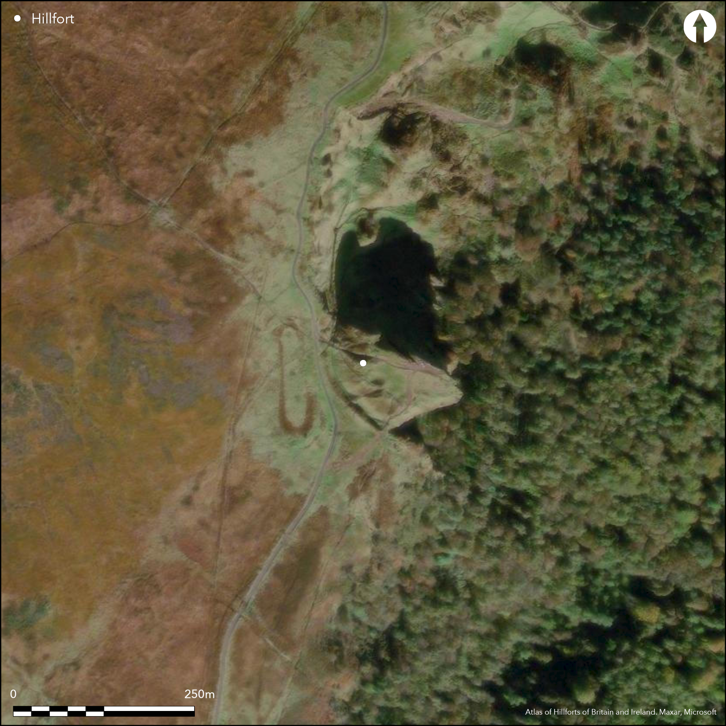
Satellite Imagery
Satellite Imagery
HER: Northern Ireland Sites and Monuments Record ANT056:018 (None)
NMR: ANT 056 (None)
SM: ANT056:018
NGR: J3250079600
X: 732423 Y: 879595 (IRENET95)
Triangular shaped inland promontory fort overlooking the city of Belfast to the east and SE. There are excellent views in all directions except the NW, where the summit of Cave Hill obstructs visibility. The site comprises an earthen bank, ditch and counter-scarp bank at the NW. This cuts off a natural promontory from the remainder of Cave Hill. The defences on the east and south consist of natural steep slopes. The southern part of the enclosing elements are heavily eroded by natural slippage. The banks survive best immediately to the N of this erosion, where they measures 7.7m wide and up to 1m high. In this area the ditch measures 2.8m wide and 2.1m below the level of the outer bank, which measures 7.7m wide and 0.6m high. There is an apparent entrance at the northern end of the enclosing elements. This comprises a simple causewayed break measuring 6.1m wide. There are no obvious features visible on the surface of the interior. The site is covered in light heather and gorse. Although there have been no archaeological investigations at McArt's Fort, another earthwork approximately 400m to the N has been partially investigated. Metal detecting discovered a Late Bronze Age gold dress fastener there; subsequent excavation revealed Early medieval pottery, and a possible Neolithic sherd of pottery, as well as an Early Medieval radiocarbon date. However, it is important to stress that this earthwork, other than by its proximity may not be associated with McArt's Fort.
Citizen Science: ✗
Reliability of Data: Confirmed
Reliability of Interpretation: Confirmed
X: -662145 Y: 7293682 (EPSG: 3857)
Longitude: -5.948149796423683 Latitude: 54.647137741038584 (EPSG:4326)
Country: Northern Ireland
Current County or Unitary Authority: Antrim
Historic County: Antrim
Current Parish/Community/Council/Townland: Ballyaghagan
The site is partially extant. The enclosing elements at the SW-W are heavily eroded.
| Extant | ✓ |
| Cropmark | ✗ |
| Likely Destroyed | ✗ |
The site is covered in light scrub and heather.
| Woodland | ✗ |
| Commercial Forestry Plantation | ✗ |
| Parkland | ✗ |
| Pasture (Grazing) | ✗ |
| Arable | ✗ |
| Scrub/Bracken | ✓ |
| Bare Outcrop | ✗ |
| Heather/Moorland | ✓ |
| Heath | ✗ |
| Built-up | ✗ |
| Coastal Grassland | ✗ |
| Other | ✗ |
Triangular shaped inland promontory fort positioned on the southeastern edge of Cave Hill, a prominent topographical landmark that overlooks Belfast City and harbor.
| Contour Fort | ✗ |
| Partial Contour Fort | ✗ |
| Promontory Fort | ✓ |
| Hillslope Fort | ✗ |
| Level Terrain Fort | ✗ |
| Marsh Fort | ✗ |
| Multiple Enclosure Fort | ✗ |
| Hilltop | ✗ |
| Coastal Promontory | ✗ |
| Inland Promontory | ✓ |
| Valley Bottom | ✗ |
| Knoll/Hillock/Outcrop | ✗ |
| Ridge | ✗ |
| Cliff/Plateau-edge/Scarp | ✗ |
| Hillslope | ✗ |
| Lowland | ✗ |
| Spur | ✗ |
Dominant Topographic Feature: The site is positioned on the southeastern edge of Cave Hill, a prominent topographical landmark that overlooks Belfast City and harbor.
| North | ✓ |
| Northeast | ✓ |
| East | ✓ |
| Southeast | ✓ |
| South | ✓ |
| Southwest | ✓ |
| West | ✓ |
| Northwest | ✗ |
| Level | ✗ |
Altitude: 322.0m
N/A
There are no internal features that might suggest a date for the monument. Approximately 400m to the NW, a Late Bronze Age gold dress fastener was recovered by metal detecting in a recently discovered earthwork, confirming activity on the hilltop in that period. Excavation's carried out there by McSparron recovered Early medieval pottery, as well as a single sherd of possible Neolithic pottery. Radiocarbon determinations from an earlier excavation by Warner (1994) returned an Early Medieval date. However, it is important to note that no excavations or dating information has been retrieved from McArt's Fort itself.
Reliability: D - None
| Pre 1200BC | ✗ |
| 1200BC - 800BC | ✗ |
| 800BC - 400BC | ✗ |
| 400BC - AD50 | ✗ |
| AD50 - AD400 | ✗ |
| AD400 - AD 800 | ✗ |
| Post AD800 | ✗ |
| Unknown | ✓ |
| Pre Hillfort: | None |
| Post Hillfort: | None |
There have been no archaeological investigations of this site. 400m to the N of McArt's Fort, another earthwork was discovered, in which a Late Bronze Age gold dress fastener was discovered. Excavation's carried out there by McSparron recovered Early medieval pottery, as well as a single sherd of possible Neolithic pottery. Radiocarbon determinations from an earlier excavation on the earthwork by Warner (1994) returned an Early Medieval date.
No obvious features on the surface.
None
| None | ✓ |
| Spring | ✗ |
| Stream | ✗ |
| Pool | ✗ |
| Flush | ✗ |
| Well | ✗ |
| Other | ✗ |
None
| No Known Features | ✓ |
| Round Stone Structures | ✗ |
| Rectangular Stone Structures | ✗ |
| Curvilinear Platforms | ✗ |
| Other Roundhouse Evidence | ✗ |
| Pits | ✗ |
| Quarry Hollows | ✗ |
| Other | ✗ |
None
| No Known Excavation | ✓ |
| Pits | ✗ |
| Postholes | ✗ |
| Roundhouses | ✗ |
| Rectangular Structures | ✗ |
| Roads/Tracks | ✗ |
| Quarry Hollows | ✗ |
| Other | ✗ |
| Nothing Found | ✗ |
None
| No Known Geophysics | ✓ |
| Pits | ✗ |
| Roundhouses | ✗ |
| Rectangular Structures | ✗ |
| Roads/Tracks | ✗ |
| Quarry Hollows | ✗ |
| Other | ✗ |
| Nothing Found | ✗ |
None
| No Known Finds | ✓ |
| Pottery | ✗ |
| Metal | ✗ |
| Metalworking | ✗ |
| Human Bones | ✗ |
| Animal Bones | ✗ |
| Lithics | ✗ |
| Environmental | ✗ |
| Other | ✗ |
NO APPARENT FEATURES
| APs Not Checked | ✗ |
| None | ✓ |
| Roundhouses | ✗ |
| Rectangular Structures | ✗ |
| Pits | ✗ |
| Postholes | ✗ |
| Roads/Tracks | ✗ |
| Other | ✗ |
Causeway across the ditch at NW measures 6.1m wide.
| 1: | None |
| 2: | None |
Guard Chambers: ✗
Chevaux de Frise: ✗
| 1. Simple Gap (North west): | Causeway across the ditch at NW measures 6.1m wide. |
An earthen bank, ditch and counter-scarp bank at the NW divide this section of the hilltop from the remainder of Cave Hill. At the south and east, the steep natural slopes probably augmented the defences. The enclosing elements are heavily eroded at the SW-W. At the south, the bank measures 7.7m wide and up to 1m high. In this area the ditch measures 2.8m wide and 2.1m below the level of the outer bank, which measures 7.7m wide and 0.6m high.
| Area 1: | 0.24ha. |
| Total: | 0.24ha. |
Total Footprint Area: 0.5ha.
None
| ✗ | None |
| ✗ | None |
| NE Quadrant: | 0 |
| SE Quadrant: | 0 |
| SW Quadrant: | 1 |
| NW Quadrant: | 1 |
| Total: | 1 |
| Partial Univallate | ✓ |
| Univallate | ✗ |
| Partial Bivallate | ✗ |
| Bivallate | ✗ |
| Partial Multivallate | ✗ |
| Multivallate | ✗ |
| Unknown | ✗ |
| Partial Univallate | ✗ |
| Univallate | ✗ |
| Partial Bivallate | ✗ |
| Bivallate | ✗ |
| Partial Multivallate | ✗ |
| Multivallate | ✗ |
None
| None | ✗ |
| Earthen Bank | ✓ |
| Stone Wall | ✗ |
| Rubble | ✗ |
| Wall-walk | ✗ |
| Evidence of Timber | ✗ |
| Vitrification | ✗ |
| Other Burning | ✗ |
| Palisade | ✗ |
| Counter Scarp Bank | ✓ |
| Berm | ✗ |
| Unfinished | ✗ |
| Other | ✗ |
None
| None | ✗ |
| Earthen Bank | ✗ |
| Stone Wall | ✗ |
| Murus Duplex | ✗ |
| Timber-framed | ✗ |
| Timber-laced | ✗ |
| Vitrification | ✗ |
| Other Burning | ✗ |
| Palisade | ✗ |
| Counter Scarp Bank | ✗ |
| Berm | ✗ |
| Unfinished | ✗ |
| No Known Excavation | ✓ |
| Other | ✗ |
| ✗ | No obvious evidence for gang working. |
| ✓ | An external ditch measures 2.8m wide and 2.1m below the level of the external counter-scarp bank. |
Number of Ditches: 1
| ✗ | None. |
McSparron, C. 2011. Excavations at Ballyaghagan, Antrim. https://www.excavations.ie/report/2011/Antrim/0022113/
Warner, R. 1994 A summary report on the gold object from Ballyaghagan, Cavehill. Unpublished report lodged with the NIEA.
Atlas of Hillforts:
Wikidata:
This work is licensed under CC BY-SA 4.0

 and should be cited as:
Lock, Gary and Ralston, Ian. 2024. Atlas of Hillforts of Britain and Ireland. Available at: https://hillforts.arch.ox.ac.uk
Document Version 1.1