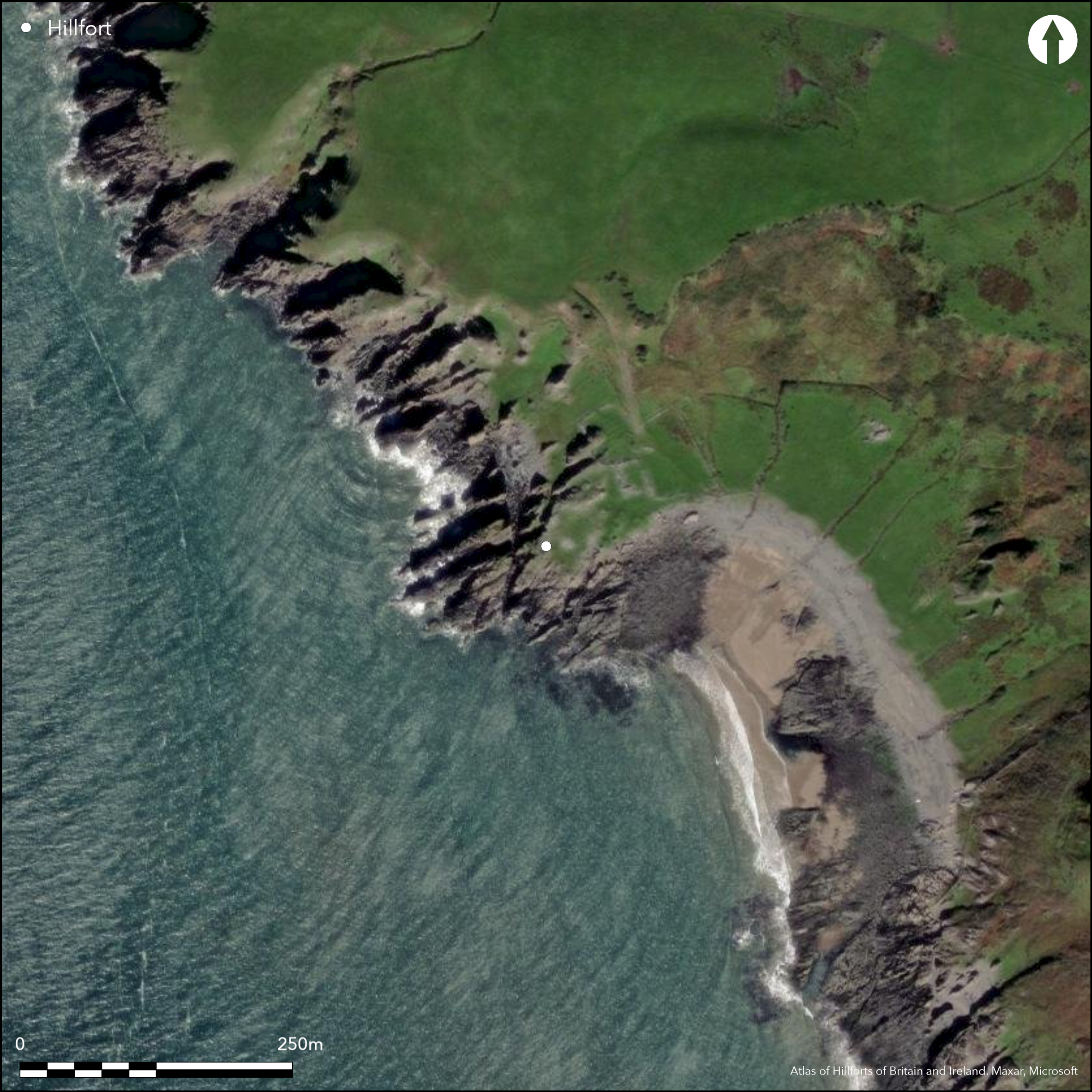
Satellite Imagery
Satellite Imagery
HER: Dumfries & Galloway MDG557 (None)
NMR: NW 96 SE 2 (60389)
SM: 1982
NGR: NW 9639 6157
X: 196390 Y: 561570 (OSGB36)
This fort occupies a rocky promontory that projects SW into the sea from the foot of the coastal escarpment on the NW side of Salt Pans Bay. The defences comprise two walls, both of which have been heavily robbed, the inner enclosing an area measuring at least 30m from NE to SW by 22.9m transversely, and the outer providing additional protection across the landward approach from the N and E. On the SSW the course of the inner wall cannot be distinguished in the rubble strewn across the interior, but elsewhere it varies in thickness from 1.9m on the SW to 2.7m on the SE and at least 3m on the N. Numerous outer facing-stones are visible along the NW side, and a few can also be seen on the NE; on the NNW the face is composed of large blocks up to 1.1m long and 0.5m high and stands up to 0.8m high in two courses. Little of the inner face is visible, but in 1984 it was observed at one point on the SW 0.8m high. Both walls exploit the natural rock outcrops to advantage, the inner extending along an outcrop on the NE that stands about 2m above the rest of the interior; likewise on the N a scatter of debris from the outer wall can be seen on the crest of an outcrop up to 4m high. At the E end of this outcrop the outer wall turns abruptly down the slope, increasing in thickness to 3m adjacent to a probable entrance, which is marked by a shallow hollow 3.5m wide. The original configuration of these two walls is uncertain and, while the outer may have sprung from the inner, the remains are too heavily disturbed to detect the relationship between them. One of the buildings of an adjacent post-medieval farmstead overlies the outer wall on the E.
Citizen Science: ✗
Reliability of Data: Confirmed
Reliability of Interpretation: Confirmed
X: -576379 Y: 7343886 (EPSG: 3857)
Longitude: -5.177698847638151 Latitude: 54.90725057676901 (EPSG:4326)
Country: Scotland
Current County or Unitary Authority: Dumfries & Galloway
Historic County: Wigtownshire
Current Parish/Community/Council/Townland: Leswalt
None
| Extant | ✓ |
| Cropmark | ✗ |
| Likely Destroyed | ✗ |
None
| Woodland | ✗ |
| Commercial Forestry Plantation | ✗ |
| Parkland | ✗ |
| Pasture (Grazing) | ✓ |
| Arable | ✗ |
| Scrub/Bracken | ✗ |
| Bare Outcrop | ✗ |
| Heather/Moorland | ✗ |
| Heath | ✗ |
| Built-up | ✗ |
| Coastal Grassland | ✓ |
| Other | ✗ |
None
| Contour Fort | ✗ |
| Partial Contour Fort | ✗ |
| Promontory Fort | ✓ |
| Hillslope Fort | ✗ |
| Level Terrain Fort | ✗ |
| Marsh Fort | ✗ |
| Multiple Enclosure Fort | ✗ |
| Hilltop | ✗ |
| Coastal Promontory | ✓ |
| Inland Promontory | ✗ |
| Valley Bottom | ✗ |
| Knoll/Hillock/Outcrop | ✗ |
| Ridge | ✗ |
| Cliff/Plateau-edge/Scarp | ✗ |
| Hillslope | ✗ |
| Lowland | ✗ |
| Spur | ✗ |
Dominant Topographic Feature: None
| North | ✗ |
| Northeast | ✗ |
| East | ✗ |
| Southeast | ✗ |
| South | ✗ |
| Southwest | ✗ |
| West | ✗ |
| Northwest | ✗ |
| Level | ✓ |
Altitude: 7.0m
N/A
In the absence of excavation, there are neither stratified artefacts nor radiocarbon dates to provide a chronology for the defences.
Reliability: D - None
| Pre 1200BC | ✗ |
| 1200BC - 800BC | ✗ |
| 800BC - 400BC | ✗ |
| 400BC - AD50 | ✗ |
| AD50 - AD400 | ✗ |
| AD400 - AD 800 | ✗ |
| Post AD800 | ✗ |
| Unknown | ✓ |
| Pre Hillfort: | None |
| Post Hillfort: | One building of the adjacent post-medieval farmstead overlies the outer wall on the E. |
First mapped by the OS 1n 1848, the fort was described by RCAHMS in 1911. It was surveyed by the OS at 1:2500 in 1968, and revisited by RCAHMS in 1984. It was Scheduled in 1993.
| 1st Identified Map Depiction (1848): | Annotated Fort on the 1st edition OS 6-inch map (Wigtownshire 1849, sheet 15) |
| Other (1911): | Description (RCAHMS 1912, 71, No.180) |
| Other (1968): | Surveyed at 1:2500 by the OS |
| Other (1984): | RCAHMS Description |
| Other (1993): | Scheduled |
Featureless
None
| None | ✓ |
| Spring | ✗ |
| Stream | ✗ |
| Pool | ✗ |
| Flush | ✗ |
| Well | ✗ |
| Other | ✗ |
None
| No Known Features | ✓ |
| Round Stone Structures | ✗ |
| Rectangular Stone Structures | ✗ |
| Curvilinear Platforms | ✗ |
| Other Roundhouse Evidence | ✗ |
| Pits | ✗ |
| Quarry Hollows | ✗ |
| Other | ✗ |
None
| No Known Excavation | ✓ |
| Pits | ✗ |
| Postholes | ✗ |
| Roundhouses | ✗ |
| Rectangular Structures | ✗ |
| Roads/Tracks | ✗ |
| Quarry Hollows | ✗ |
| Other | ✗ |
| Nothing Found | ✗ |
None
| No Known Geophysics | ✓ |
| Pits | ✗ |
| Roundhouses | ✗ |
| Rectangular Structures | ✗ |
| Roads/Tracks | ✗ |
| Quarry Hollows | ✗ |
| Other | ✗ |
| Nothing Found | ✗ |
None
| No Known Finds | ✓ |
| Pottery | ✗ |
| Metal | ✗ |
| Metalworking | ✗ |
| Human Bones | ✗ |
| Animal Bones | ✗ |
| Lithics | ✗ |
| Environmental | ✗ |
| Other | ✗ |
None
| APs Not Checked | ✗ |
| None | ✓ |
| Roundhouses | ✗ |
| Rectangular Structures | ✗ |
| Pits | ✗ |
| Postholes | ✗ |
| Roads/Tracks | ✗ |
| Other | ✗ |
See main summary
| 1: | Only visible in the outer wall |
| 2: | None |
Guard Chambers: ✗
Chevaux de Frise: ✗
| 1. Simple Gap (East): | None |
Up to two walls, the inner possibly a complete circuit, but the outer only covering the landward approaches.
| Area 1: | 0.07ha. |
| Total: | 0.07ha. |
Total Footprint Area: 0.22ha.
None
| ✗ | The two walls are not concentric and the outer may have formed a free standing promontory fort. |
| ✗ | The line of the inner wall is lost in the spread of rubble on the SW, but may well have formed a complete inner circuit. |
| NE Quadrant: | 2 |
| SE Quadrant: | 2 |
| SW Quadrant: | 1 |
| NW Quadrant: | 1 |
| Total: | 2 |
| Partial Univallate | ✓ |
| Univallate | ✗ |
| Partial Bivallate | ✓ |
| Bivallate | ✗ |
| Partial Multivallate | ✗ |
| Multivallate | ✗ |
| Unknown | ✗ |
| Partial Univallate | ✗ |
| Univallate | ✗ |
| Partial Bivallate | ✗ |
| Bivallate | ✗ |
| Partial Multivallate | ✗ |
| Multivallate | ✗ |
None
| None | ✗ |
| Earthen Bank | ✗ |
| Stone Wall | ✓ |
| Rubble | ✗ |
| Wall-walk | ✗ |
| Evidence of Timber | ✗ |
| Vitrification | ✗ |
| Other Burning | ✗ |
| Palisade | ✗ |
| Counter Scarp Bank | ✗ |
| Berm | ✗ |
| Unfinished | ✗ |
| Other | ✗ |
None
| None | ✗ |
| Earthen Bank | ✗ |
| Stone Wall | ✗ |
| Murus Duplex | ✗ |
| Timber-framed | ✗ |
| Timber-laced | ✗ |
| Vitrification | ✗ |
| Other Burning | ✗ |
| Palisade | ✗ |
| Counter Scarp Bank | ✗ |
| Berm | ✗ |
| Unfinished | ✗ |
| No Known Excavation | ✓ |
| Other | ✗ |
| ✗ | None |
| ✗ | None |
Number of Ditches: None
| ✗ | None |
RCAHMS (1912) The Royal Commission on the Ancient and Historical Monuments and Constructions of Scotland. Fourth report and inventory of monuments and constructions in Galloway, 1, county of Wigtown, Edinburgh. (p 71, No.180)
Atlas of Hillforts:
Wikidata:
This work is licensed under CC BY-SA 4.0

 and should be cited as:
Lock, Gary and Ralston, Ian. 2024. Atlas of Hillforts of Britain and Ireland. Available at: https://hillforts.arch.ox.ac.uk
Document Version 1.1