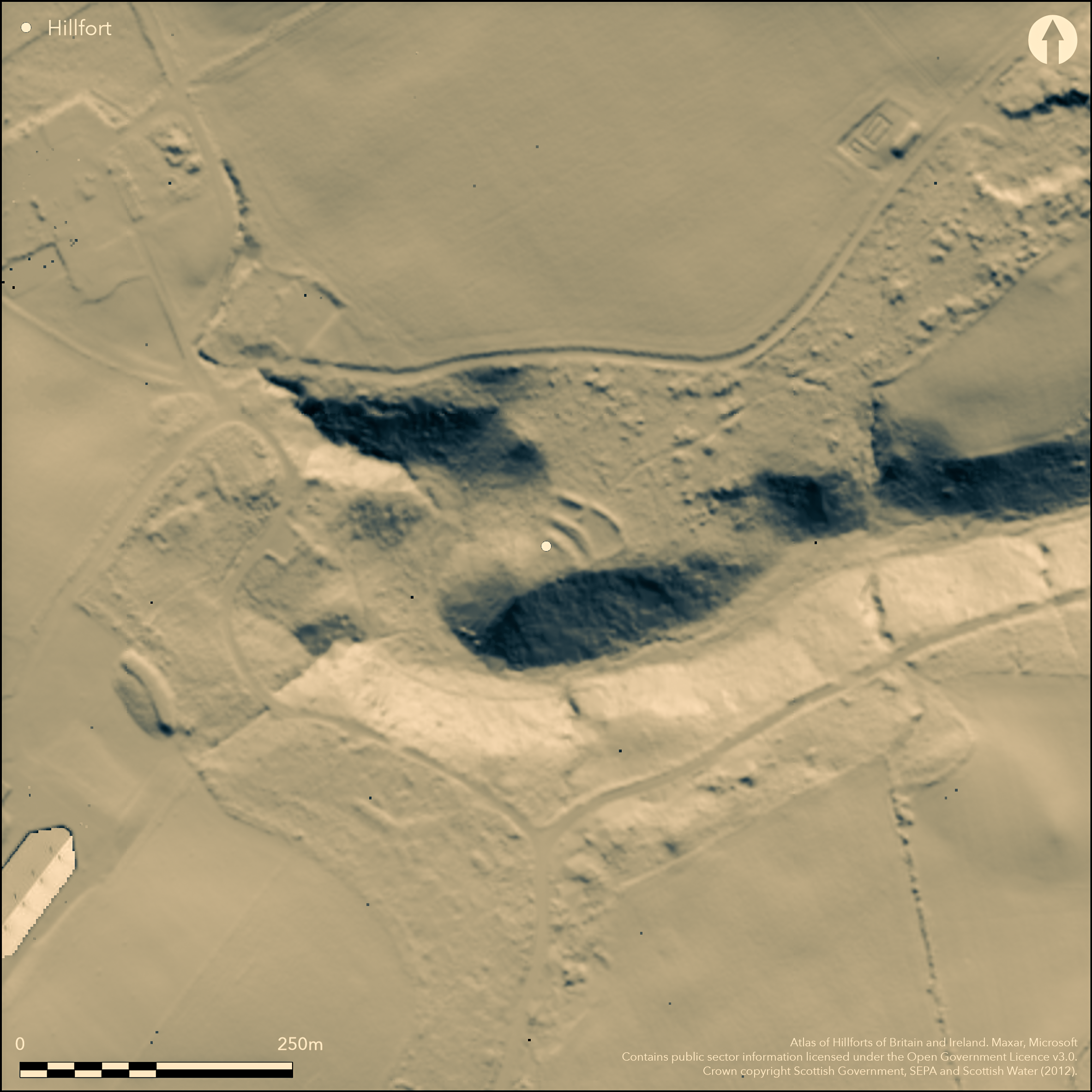
LiDAR 1m DTM Hillshade
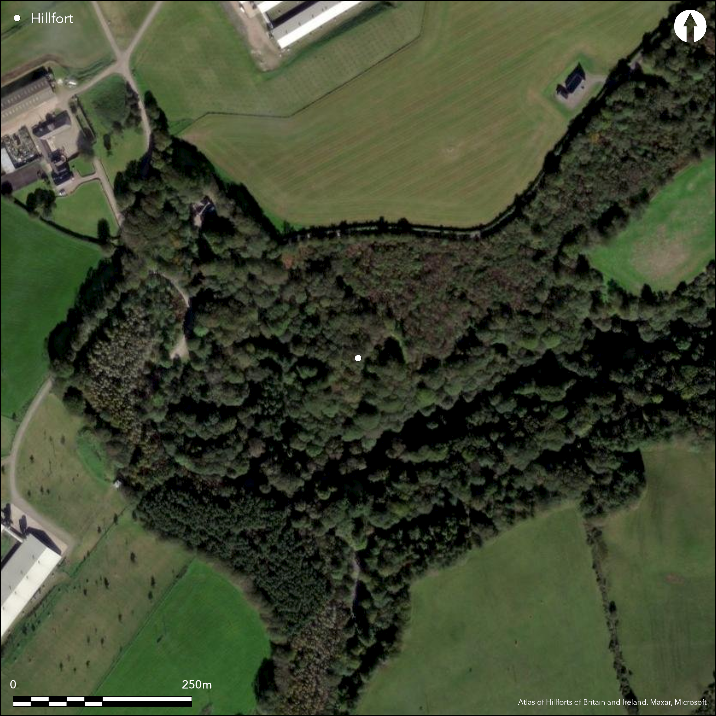
Satellite Imagery
LiDAR 1m DTM Hillshade
Satellite Imagery
Scroll left/right to view further images.
HER: Dumfries & Galloway MDG1004 (None)
NMR: NX 06 SW 3 (60845)
SM: 1983
NGR: NX 0078 6352
X: 200780 Y: 563520 (OSGB36)
This fort, which is overlain by a later enclosure, occupies a steep-sided promontory on the N side of Aldouran Glen, at this point a deeply-cut minor valley some 30m deep. The defences of the fort comprise up to three earthen ramparts with intervening ditches, which cut off a triangular area measuring 27m from NE to SW by a maximum of 23m transversely (0.03ha). The innermost rampart measures up to 5.4m in thickness by 0.8m in height and is flanked externally by a ditch 5.5m in breadth by 0.7m in depth. Outside this ditch there is the appearance of another rampart set beyond a berm from 1m to 3m wide, but this is almost certainly a later bank extending along the inner lip of a broad flat-bottomed outer ditch from 8.3m to 15.5m across. The bank turns outwards along the sides of the promontory to unite with a bank overlying the outermost rampart, thus exploiting the ditch to form an enclosure measuring some 42m in length. The outermost rampart forms a counterscarp on the outer lip of the outer ditch and is up to 4.7m thick by 1m high. The position of the original entrance is uncertain, and though there seems to be a gap between the terminals of the ramparts and the NW side of the promontory, traces of the inner ditch can be seen extending across it.
Citizen Science: ✗
Reliability of Data: Confirmed
Reliability of Interpretation: Confirmed
X: -568919 Y: 7347618 (EPSG: 3857)
Longitude: -5.110682031024668 Latitude: 54.92651848193349 (EPSG:4326)
Country: Scotland
Current County or Unitary Authority: Dumfries & Galloway
Historic County: Wigtownshire
Current Parish/Community/Council/Townland: Leswalt
Deciduous woodland thinned and the site largely cleared by 2013, although in places the ground is hidden by piles of decaying branches.
| Extant | ✓ |
| Cropmark | ✗ |
| Likely Destroyed | ✗ |
None
| Woodland | ✓ |
| Commercial Forestry Plantation | ✗ |
| Parkland | ✗ |
| Pasture (Grazing) | ✗ |
| Arable | ✗ |
| Scrub/Bracken | ✓ |
| Bare Outcrop | ✗ |
| Heather/Moorland | ✗ |
| Heath | ✗ |
| Built-up | ✗ |
| Coastal Grassland | ✗ |
| Other | ✗ |
None
| Contour Fort | ✗ |
| Partial Contour Fort | ✗ |
| Promontory Fort | ✓ |
| Hillslope Fort | ✗ |
| Level Terrain Fort | ✗ |
| Marsh Fort | ✗ |
| Multiple Enclosure Fort | ✗ |
| Hilltop | ✗ |
| Coastal Promontory | ✗ |
| Inland Promontory | ✓ |
| Valley Bottom | ✗ |
| Knoll/Hillock/Outcrop | ✗ |
| Ridge | ✗ |
| Cliff/Plateau-edge/Scarp | ✗ |
| Hillslope | ✗ |
| Lowland | ✗ |
| Spur | ✗ |
Dominant Topographic Feature: None
| North | ✗ |
| Northeast | ✗ |
| East | ✗ |
| Southeast | ✗ |
| South | ✗ |
| Southwest | ✗ |
| West | ✗ |
| Northwest | ✗ |
| Level | ✓ |
Altitude: 80.0m
N/A
The character of the broad outer ditch possibly indicates these earthworks are the remains of a castle. In the absence of excavation, there are neither stratified artefacts nor radiocarbon dates to provide a chronology for the defences.
Reliability: D - None
| Pre 1200BC | ✗ |
| 1200BC - 800BC | ✗ |
| 800BC - 400BC | ✗ |
| 400BC - AD50 | ✗ |
| AD50 - AD400 | ✗ |
| AD400 - AD 800 | ✗ |
| Post AD800 | ✗ |
| Unknown | ✓ |
| Pre Hillfort: | None |
| Post Hillfort: | Overlying enclosure |
First noted by OS surveyors in 1847, a more detailed depiction was drawn up at 1:2500 in 1892/3, and it was described in the County Inventory for Wigtownshire (RCAHMS 1912, 69-70, No. 175). It was Scheduled in 1938. Subsequent visits were carried out by RCAHMS in 1953 and 1984, and by the OS in 1968. Most recently, following the felling of dense tree cover, John Pickin of Leswalt has drawn up a compass survey.
| 1st Identified Map Depiction (1847): | Annotated Fort on the 1st edition OS 6-inch map (Wigtownshire 1849, sheet 9) |
| Earthwork Survey (1893): | OS 25-inch (Wigtownshire 1894, sheet 11.9) |
| Earthwork Survey (1911): | and description (RCAHMS 1912, 69-70, No. 175) |
| Other (1938): | Scheduled |
| Other (1953): | Description during RCAHMS Survey of Marginal Lands |
| Other (1968): | Resurveyed at 1:2500 by the OS |
| Other (1984): | Description by RCAHMS |
| Earthwork Survey (2013): | Compass survey by J Pickin |
| Other (2014): | Visit by the Hillfort Study Group |
Featureless
None
| None | ✓ |
| Spring | ✗ |
| Stream | ✗ |
| Pool | ✗ |
| Flush | ✗ |
| Well | ✗ |
| Other | ✗ |
None
| No Known Features | ✓ |
| Round Stone Structures | ✗ |
| Rectangular Stone Structures | ✗ |
| Curvilinear Platforms | ✗ |
| Other Roundhouse Evidence | ✗ |
| Pits | ✗ |
| Quarry Hollows | ✗ |
| Other | ✗ |
None
| No Known Excavation | ✓ |
| Pits | ✗ |
| Postholes | ✗ |
| Roundhouses | ✗ |
| Rectangular Structures | ✗ |
| Roads/Tracks | ✗ |
| Quarry Hollows | ✗ |
| Other | ✗ |
| Nothing Found | ✗ |
None
| No Known Geophysics | ✓ |
| Pits | ✗ |
| Roundhouses | ✗ |
| Rectangular Structures | ✗ |
| Roads/Tracks | ✗ |
| Quarry Hollows | ✗ |
| Other | ✗ |
| Nothing Found | ✗ |
None
| No Known Finds | ✓ |
| Pottery | ✗ |
| Metal | ✗ |
| Metalworking | ✗ |
| Human Bones | ✗ |
| Animal Bones | ✗ |
| Lithics | ✗ |
| Environmental | ✗ |
| Other | ✗ |
Obscured by trees
| APs Not Checked | ✗ |
| None | ✓ |
| Roundhouses | ✗ |
| Rectangular Structures | ✗ |
| Pits | ✗ |
| Postholes | ✗ |
| Roads/Tracks | ✗ |
| Other | ✗ |
See main summary
| 1: | On the NW margin of the promontory |
| 2: | None known |
Guard Chambers: ✗
Chevaux de Frise: ✗
Up to three earthen ramparts separated by two ditches
| Area 1: | 0.03ha. |
| Total: | 0.03ha. |
Total Footprint Area: 0.12ha.
None
| ✓ | None |
| ✗ | None |
| NE Quadrant: | 3 |
| SE Quadrant: | 0 |
| SW Quadrant: | 0 |
| NW Quadrant: | 0 |
| Total: | 3 |
| Partial Univallate | ✗ |
| Univallate | ✗ |
| Partial Bivallate | ✗ |
| Bivallate | ✗ |
| Partial Multivallate | ✓ |
| Multivallate | ✗ |
| Unknown | ✗ |
| Partial Univallate | ✓ |
| Univallate | ✗ |
| Partial Bivallate | ✗ |
| Bivallate | ✗ |
| Partial Multivallate | ✗ |
| Multivallate | ✗ |
None
| None | ✗ |
| Earthen Bank | ✓ |
| Stone Wall | ✗ |
| Rubble | ✗ |
| Wall-walk | ✗ |
| Evidence of Timber | ✗ |
| Vitrification | ✗ |
| Other Burning | ✗ |
| Palisade | ✗ |
| Counter Scarp Bank | ✗ |
| Berm | ✗ |
| Unfinished | ✗ |
| Other | ✗ |
None
| None | ✗ |
| Earthen Bank | ✗ |
| Stone Wall | ✗ |
| Murus Duplex | ✗ |
| Timber-framed | ✗ |
| Timber-laced | ✗ |
| Vitrification | ✗ |
| Other Burning | ✗ |
| Palisade | ✗ |
| Counter Scarp Bank | ✗ |
| Berm | ✗ |
| Unfinished | ✗ |
| No Known Excavation | ✓ |
| Other | ✗ |
| ✗ | None |
| ✓ | The broad flat-bottomed outer ditch is an unusual feature. |
Number of Ditches: 2
| ✗ | None |
No related records
Atlas of Hillforts:
Wikidata:
This work is licensed under CC BY-SA 4.0

 and should be cited as:
Lock, Gary and Ralston, Ian. 2024. Atlas of Hillforts of Britain and Ireland. Available at: https://hillforts.arch.ox.ac.uk
Document Version 1.1