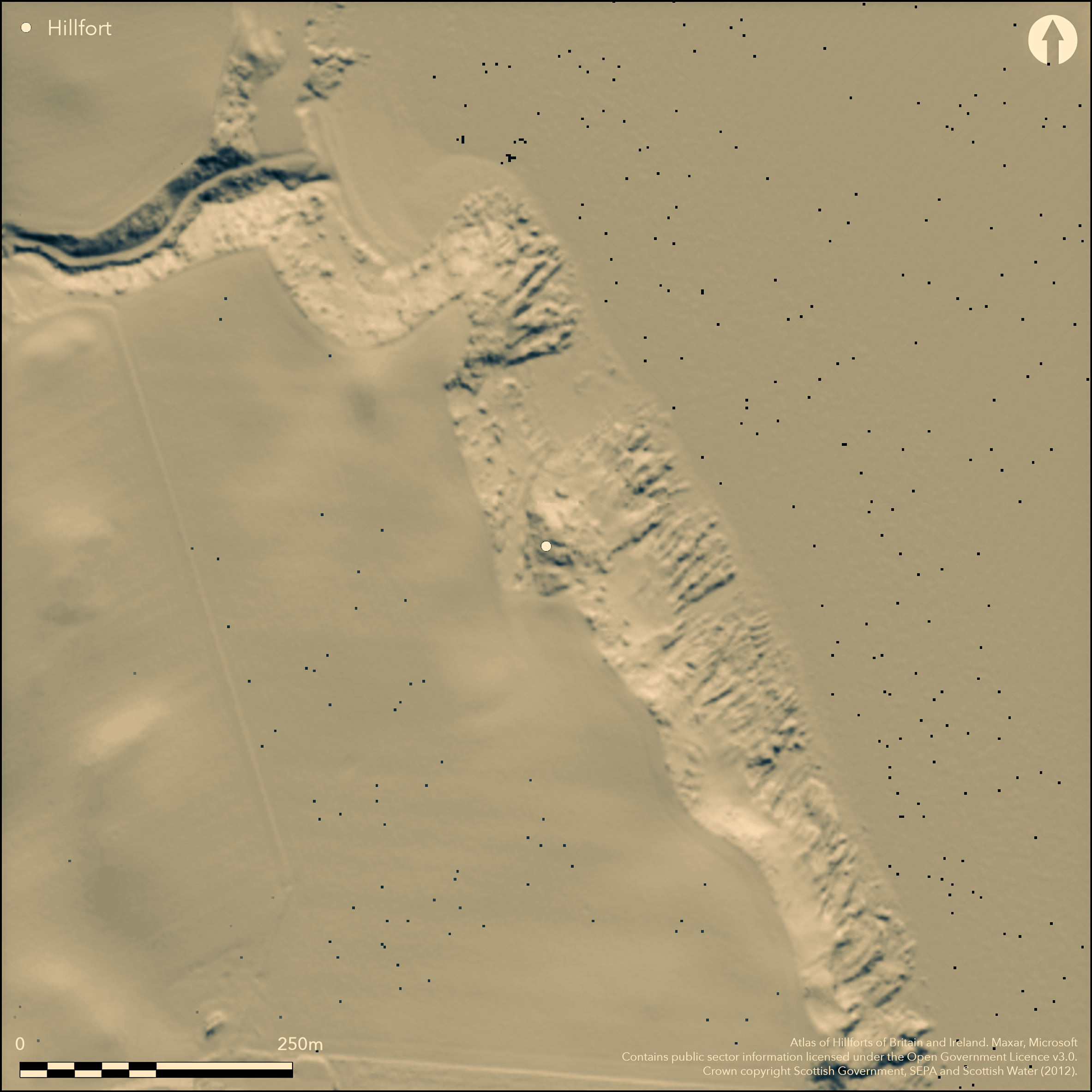
LiDAR 1m DTM Hillshade
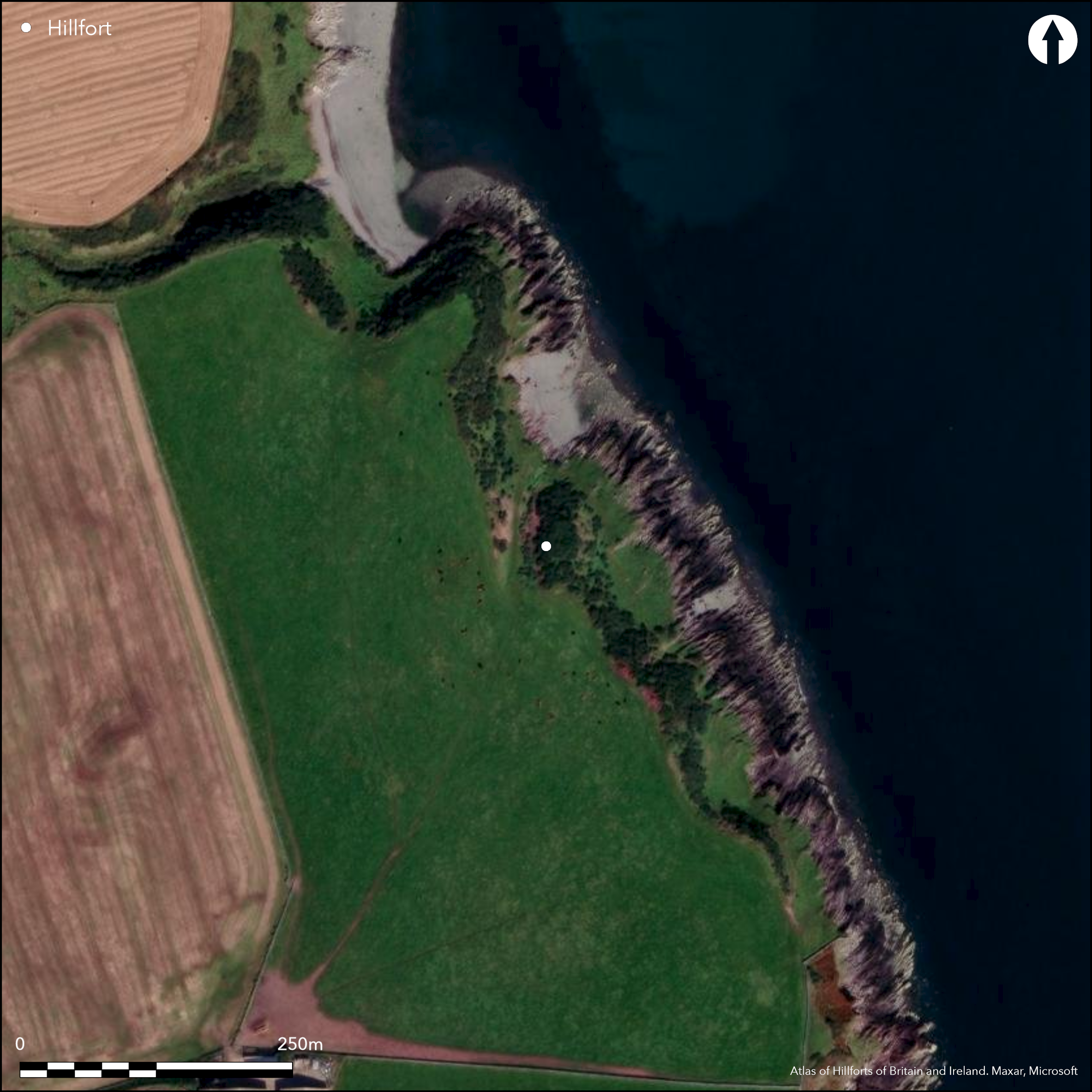
Satellite Imagery
LiDAR 1m DTM Hillshade
Satellite Imagery
Scroll left/right to view further images.
HER: Dumfries & Galloway MDG1170 (None)
NMR: NX 13 SW 8 (61096)
SM: 4759
NGR: NX 1417 3229
X: 214170 Y: 532290 (OSGB36)
This small promontory work is situated on the coastal escarpment and on the S comprises a thick rampart with at least two external ditches, which cut off a wedge-shaped area measuring no more than 12.3m in length from N to S by 10.3m transversely (0.01ha). The inner of the ramparts, which measures up to 4.8m in thickness by 1.1m in height, turns back along the sides of the promontory and four probable outer facing-stones have been noted on the W, but there is no evidence that it completely enclosed the interior. The first of the external ditches, which lies immediately outside the rampart, measures 7m in breadth by 1.2m in depth, while the second, some 6.5m beyond it, is about 7m broad by 0.5m deep and has a counterscarp bank up to 4.8m thick by 0.4m high. There is no visible evidence of a rampart between the two ditches, nor of an additional outer ditch noted at the edge of the field in 1886 (Trotter and Maxwell 1886), traces of which Alexander Curle observed in 1911 (RCAHMS 1912, 53, No. 140), though even then obscured by the dense gorse thickets that continue to clothe the site. The position of the entrance is uncertain but may have been on the E margin of the promontory.
Citizen Science: ✗
Reliability of Data: Confirmed
Reliability of Interpretation: Confirmed
X: -543461 Y: 7294500 (EPSG: 3857)
Longitude: -4.881996356857544 Latitude: 54.65138811797576 (EPSG:4326)
Country: Scotland
Current County or Unitary Authority: Dumfries & Galloway
Historic County: Wigtownshire
Current Parish/Community/Council/Townland: Kirkmaiden
None
| Extant | ✓ |
| Cropmark | ✗ |
| Likely Destroyed | ✗ |
None
| Woodland | ✗ |
| Commercial Forestry Plantation | ✗ |
| Parkland | ✗ |
| Pasture (Grazing) | ✗ |
| Arable | ✗ |
| Scrub/Bracken | ✓ |
| Bare Outcrop | ✗ |
| Heather/Moorland | ✗ |
| Heath | ✗ |
| Built-up | ✗ |
| Coastal Grassland | ✓ |
| Other | ✗ |
None
| Contour Fort | ✗ |
| Partial Contour Fort | ✗ |
| Promontory Fort | ✓ |
| Hillslope Fort | ✗ |
| Level Terrain Fort | ✗ |
| Marsh Fort | ✗ |
| Multiple Enclosure Fort | ✗ |
| Hilltop | ✗ |
| Coastal Promontory | ✓ |
| Inland Promontory | ✗ |
| Valley Bottom | ✗ |
| Knoll/Hillock/Outcrop | ✗ |
| Ridge | ✗ |
| Cliff/Plateau-edge/Scarp | ✗ |
| Hillslope | ✗ |
| Lowland | ✗ |
| Spur | ✗ |
Dominant Topographic Feature: None
| North | ✗ |
| Northeast | ✗ |
| East | ✗ |
| Southeast | ✗ |
| South | ✗ |
| Southwest | ✗ |
| West | ✗ |
| Northwest | ✗ |
| Level | ✓ |
Altitude: 20.0m
N/A
In the absence of excavation, there are neither stratified artefacts nor radiocarbon dates to provide a chronology for the defences.
Reliability: D - None
| Pre 1200BC | ✗ |
| 1200BC - 800BC | ✗ |
| 800BC - 400BC | ✗ |
| 400BC - AD50 | ✗ |
| AD50 - AD400 | ✗ |
| AD400 - AD 800 | ✗ |
| Post AD800 | ✗ |
| Unknown | ✓ |
| Pre Hillfort: | None |
| Post Hillfort: | None |
First noted about 1885 (Wilson 1885, 53; Trotter and Maxwell 1886, 77), there is an anonymous undated sketch plan in The Society of Antiquaries collection held in the RCAHMS archive (DC59005). In 1893 it was depicted by the OS at 1:2500 (Wigtownshire 1895, sheet 37.7), and in 1911 described for the County Inventory of Wigtownshire (RCAHMS 1912, 53, No. 140). It was visited subsequently by RCAHMS in 1953 and 1984, and by the OS in 1972. It was Scheduled in 1990.
| 1st Identified Written Reference (1885): | First noted about 1885 (Wilson 1885, 53; Trotter and Maxwell 1886, 77) |
| 1st Identified Map Depiction (1893): | OS 25_inch map (Wigtownshire 1895, sheet 37.7) |
| Other (1911): | Description (RCAHMS 1912, 53, No. 140) |
| Other (1953): | Description during RCAHMS Survey of Marginal Lands |
| Other (1972): | Revised at 1:2500 by the OS |
| Other (1984): | Description by RCAHMS |
| Other (1990): | Scheduled |
| Other (1990): | Scheduled |
| Earthwork Survey (None): | Sketch plan 1": 20" (RCAHMS SAS455; DC59005) |
Featureless
None
| None | ✓ |
| Spring | ✗ |
| Stream | ✗ |
| Pool | ✗ |
| Flush | ✗ |
| Well | ✗ |
| Other | ✗ |
None
| No Known Features | ✓ |
| Round Stone Structures | ✗ |
| Rectangular Stone Structures | ✗ |
| Curvilinear Platforms | ✗ |
| Other Roundhouse Evidence | ✗ |
| Pits | ✗ |
| Quarry Hollows | ✗ |
| Other | ✗ |
None
| No Known Excavation | ✓ |
| Pits | ✗ |
| Postholes | ✗ |
| Roundhouses | ✗ |
| Rectangular Structures | ✗ |
| Roads/Tracks | ✗ |
| Quarry Hollows | ✗ |
| Other | ✗ |
| Nothing Found | ✗ |
None
| No Known Geophysics | ✓ |
| Pits | ✗ |
| Roundhouses | ✗ |
| Rectangular Structures | ✗ |
| Roads/Tracks | ✗ |
| Quarry Hollows | ✗ |
| Other | ✗ |
| Nothing Found | ✗ |
None
| No Known Finds | ✓ |
| Pottery | ✗ |
| Metal | ✗ |
| Metalworking | ✗ |
| Human Bones | ✗ |
| Animal Bones | ✗ |
| Lithics | ✗ |
| Environmental | ✗ |
| Other | ✗ |
None
| APs Not Checked | ✗ |
| None | ✓ |
| Roundhouses | ✗ |
| Rectangular Structures | ✗ |
| Pits | ✗ |
| Postholes | ✗ |
| Roads/Tracks | ✗ |
| Other | ✗ |
See main summary
| 0: | None |
| 2: | Position not clear but may have been at the E end of the rampart. |
Guard Chambers: ✗
Chevaux de Frise: ✗
Thick rampart with at least two external ditches cutting off a promontory.
| Area 1: | 0.01ha. |
| Total: | 0.01ha. |
Total Footprint Area: 0.04ha.
None
| ✗ | None |
| ✗ | None |
| NE Quadrant: | 0 |
| SE Quadrant: | 0 |
| SW Quadrant: | 2 |
| NW Quadrant: | 0 |
| Total: | 2 |
| Partial Univallate | ✗ |
| Univallate | ✗ |
| Partial Bivallate | ✓ |
| Bivallate | ✗ |
| Partial Multivallate | ✗ |
| Multivallate | ✗ |
| Unknown | ✗ |
| Partial Univallate | ✗ |
| Univallate | ✗ |
| Partial Bivallate | ✗ |
| Bivallate | ✗ |
| Partial Multivallate | ✗ |
| Multivallate | ✗ |
None
| None | ✗ |
| Earthen Bank | ✓ |
| Stone Wall | ✗ |
| Rubble | ✗ |
| Wall-walk | ✗ |
| Evidence of Timber | ✗ |
| Vitrification | ✗ |
| Other Burning | ✗ |
| Palisade | ✗ |
| Counter Scarp Bank | ✗ |
| Berm | ✗ |
| Unfinished | ✗ |
| Other | ✗ |
None
| None | ✗ |
| Earthen Bank | ✗ |
| Stone Wall | ✗ |
| Murus Duplex | ✗ |
| Timber-framed | ✗ |
| Timber-laced | ✗ |
| Vitrification | ✗ |
| Other Burning | ✗ |
| Palisade | ✗ |
| Counter Scarp Bank | ✗ |
| Berm | ✗ |
| Unfinished | ✗ |
| No Known Excavation | ✓ |
| Other | ✗ |
| ✗ | None |
| ✓ | None |
Number of Ditches: 2
| ✗ | None |
RCAHMS (1912) The Royal Commission on the Ancient and Historical Monuments and Constructions of Scotland. Fourth report and inventory of monuments and constructions in Galloway, 1, county of Wigtown, Edinburgh
Trotter, R, and Maxwell, H E (1886) 'Notice of the excavation of St Medan's cave and chapel, Kirkmaiden, Wigtownshire', Proc Soc Antiq Scot 20, 76-90.
Wilson, G (1885) 'Description of ancient forts, etc., in Wigtownshire'. Archaeol Hist Collect Ayrshire Galloway 5 (1885), 62-73
Atlas of Hillforts:
Wikidata:
This work is licensed under CC BY-SA 4.0

 and should be cited as:
Lock, Gary and Ralston, Ian. 2024. Atlas of Hillforts of Britain and Ireland. Available at: https://hillforts.arch.ox.ac.uk
Document Version 1.1