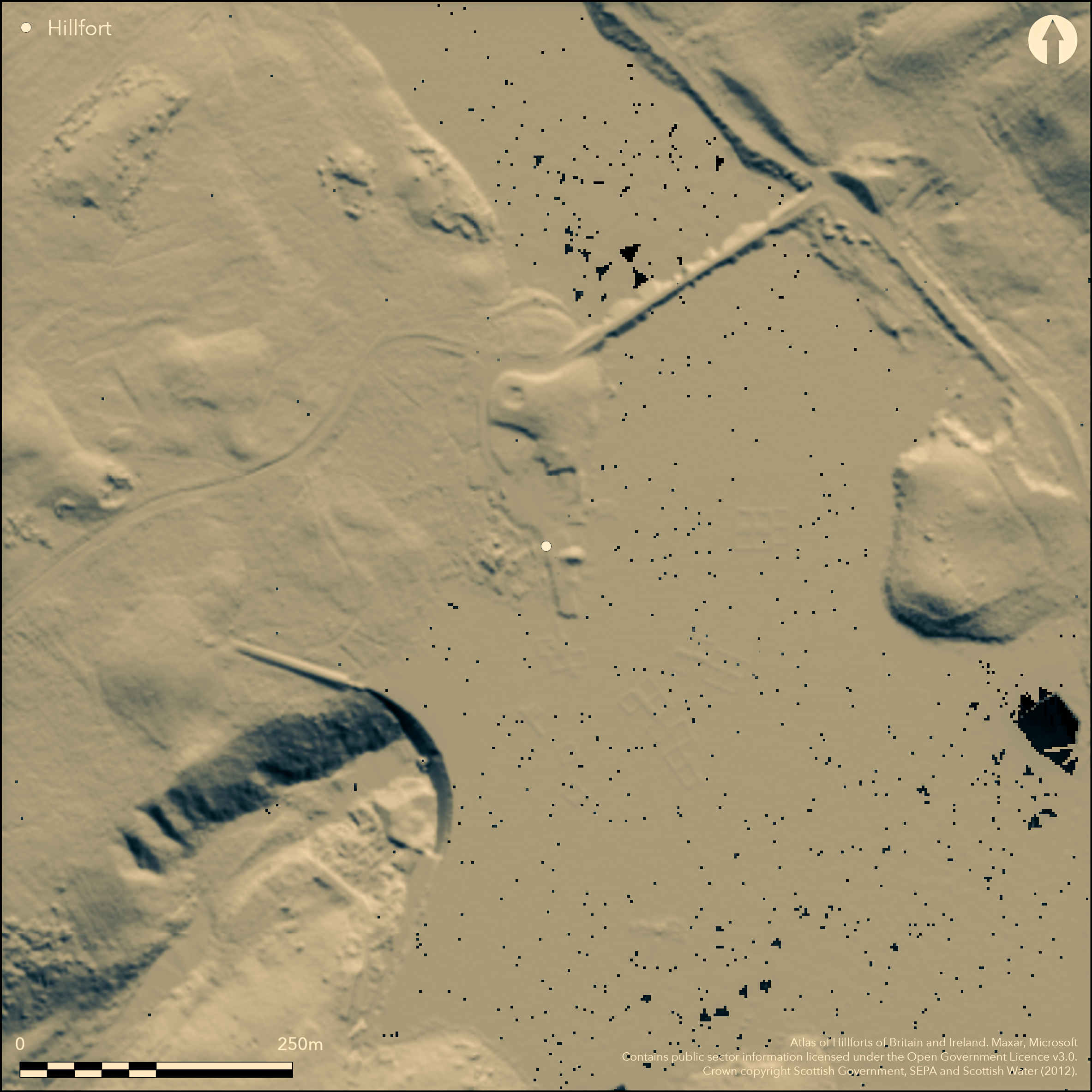
LiDAR 1m DTM Hillshade
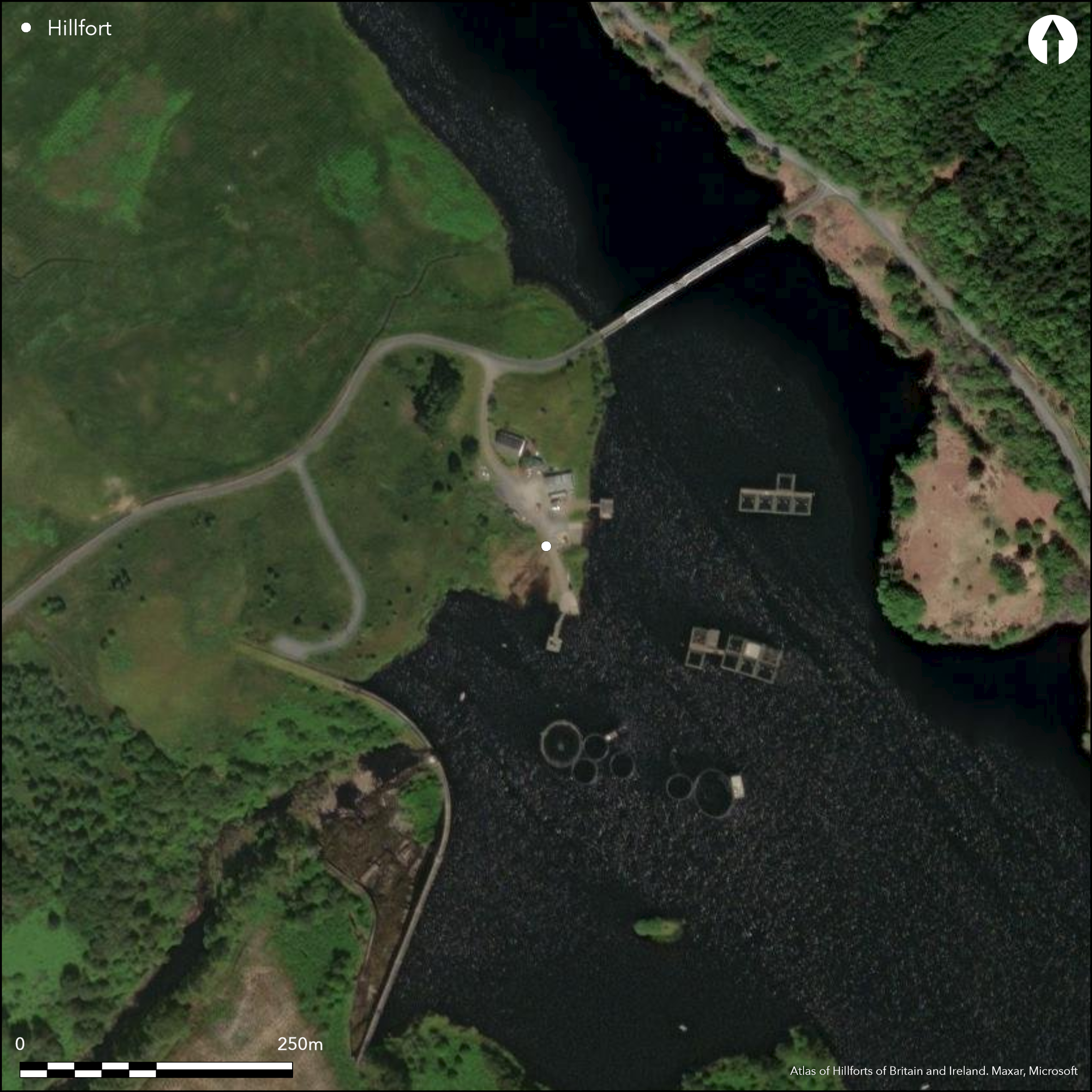
Satellite Imagery
LiDAR 1m DTM Hillshade
Satellite Imagery
Scroll left/right to view further images.
HER: Dumfries & Galloway MDG3969 (None)
NMR: NX 69 SW 8 (64379)
SM: None
NGR: NX 6064 9072
X: 260640 Y: 590720 (OSGB36)
In 1978 only a fragment of the defences of this promontory work was still visible at the edge of the Kendoon Reservoir, comprising some 50m of the NW side. When first noted and sketch-planned by Frederick Coles, it was relatively undisturbed, comprising three ramparts with external ditches, which formed an angular belt some 24m deep blocking access to the promontory from the N. Bounded elsewhere by a steep drop down to the Water of Deugh, the interior measured about 54m from NW to SE by 45m transversely (0.24ha). Coles suggested that there was an entrance on the NE, denoted by a vagueness in the depiction on his plan but contradicted by the way he carries the outermost rampart across the gap; RCAHMS also follow this line, though the site had evidently suffered considerably more damage by this time, and this feature was unrecognisable by the time of Gordon Childe's excavations in 1935. Childe dug at least five trenches, mainly concentrating on the defences, but also attempting to identify structures in the interior. Unfortunately he does not provide an overall plan to support his confusing account. Nevertheless, the innermost rampart, which where best preserved stood to a height of 2m above the adjacent ditch, was shown to have measured up to 2.4m in thickness and its faces still stood 0.9m in height. He seems to have struggled to identify the cuts of the ditches between any of the ramparts, though one of the outer ditches measured 1.8m in breadth by 0.6m in depth. In one section he found that the middle rampart was retained by a kerb of stones set on edge in the subsoil, a curious description, but one perhaps indicating the packing of timbers in a foundation trench. He failed to identify any traces of structures within the interior, but seems to have encountered a hearth in the hollow between two of the ramparts.
Citizen Science: ✗
Reliability of Data: Confirmed
Reliability of Interpretation: Confirmed
X: -466505 Y: 7399039 (EPSG: 3857)
Longitude: -4.190688410229302 Latitude: 55.191078495961996 (EPSG:4326)
Country: Scotland
Current County or Unitary Authority: Dumfries & Galloway
Historic County: Kirkcudbrightshire
Current Parish/Community/Council/Townland: Carsphairn
Flooded
| Extant | ✓ |
| Cropmark | ✗ |
| Likely Destroyed | ✓ |
Submerged
| Woodland | ✗ |
| Commercial Forestry Plantation | ✗ |
| Parkland | ✗ |
| Pasture (Grazing) | ✓ |
| Arable | ✗ |
| Scrub/Bracken | ✗ |
| Bare Outcrop | ✗ |
| Heather/Moorland | ✗ |
| Heath | ✗ |
| Built-up | ✗ |
| Coastal Grassland | ✗ |
| Other | ✗ |
None
| Contour Fort | ✗ |
| Partial Contour Fort | ✗ |
| Promontory Fort | ✓ |
| Hillslope Fort | ✗ |
| Level Terrain Fort | ✗ |
| Marsh Fort | ✗ |
| Multiple Enclosure Fort | ✗ |
| Hilltop | ✗ |
| Coastal Promontory | ✗ |
| Inland Promontory | ✓ |
| Valley Bottom | ✗ |
| Knoll/Hillock/Outcrop | ✗ |
| Ridge | ✗ |
| Cliff/Plateau-edge/Scarp | ✗ |
| Hillslope | ✗ |
| Lowland | ✗ |
| Spur | ✗ |
Dominant Topographic Feature: None
| North | ✗ |
| Northeast | ✗ |
| East | ✗ |
| Southeast | ✗ |
| South | ✗ |
| Southwest | ✗ |
| West | ✗ |
| Northwest | ✗ |
| Level | ✓ |
Altitude: 150.0m
N/A
There are neither stratified artefacts nor radiocarbon dates to provide a chronology for the defences.
Reliability: D - None
| Pre 1200BC | ✗ |
| 1200BC - 800BC | ✗ |
| 800BC - 400BC | ✗ |
| 400BC - AD50 | ✗ |
| AD50 - AD400 | ✗ |
| AD400 - AD 800 | ✗ |
| Post AD800 | ✗ |
| Unknown | ✓ |
| Pre Hillfort: | None |
| Post Hillfort: | None |
Crudely shown in 1849-50 on the 1st edition OS 6-inch map (Kirkcudbrightshire 1853, sheet 9) and annotated Roman Camp (Supposed), this promontory work was sketch-planned by Frederick Coles about 1891 (Coles 1892, 66-8, fig 71) and surveyed by the OS in greater detail for the 25-inch map in 1894 (Kirkcudbrightshire 1895, sheet 13.1). It was visited by RCAHMS in 1911 for the County Inventory of the Stewartry (RCAHMS 1914, 62-3, no.87), by which time the earthworks had already been mutilated by the erection of a plantation enclosure and the creation of a footpath, both of which are shown by the OS in 1894 but not mentioned by Coles. In 1935, prior to the submergence of part of the defences and most of the interior by the construction of the Kendoon Reservoir, Gordon Childe excavated a number of trenches across the defences and in the interior (Childe 1936, 341-7). It was revisited by RCAHMS in 1951, and by the OS in 1978.
| 1st Identified Map Depiction (1850): | Annotated Roman Camp in Roman type on the 1st edition OS 6-inch map (Kirkcudbrightshire 1853, sheet 9) |
| Earthwork Survey (1891): | Sketch-plan and description (Coles 1892, 66-8, fig 71) |
| Other (1894): | Annotated Earthworks on the 25-inch map (Kirkcudbrightshire 1895, sheet 13.1) |
| Other (1911): | Description (RCAHMS 1914, 62-3, no.87) |
| Excavation (1935): | Childe 1936, 341-7 |
| Other (1951): | Description during RCAHMS Survey of Marginal Lands |
| Other (1978): | Surveyed at 1:10.000 by the OS |
| Other (1994): | De-Scheduled (date of Scheduling not recorded in Pastmap) |
Featureless
None
| None | ✓ |
| Spring | ✗ |
| Stream | ✗ |
| Pool | ✗ |
| Flush | ✗ |
| Well | ✗ |
| Other | ✗ |
None
| No Known Features | ✓ |
| Round Stone Structures | ✗ |
| Rectangular Stone Structures | ✗ |
| Curvilinear Platforms | ✗ |
| Other Roundhouse Evidence | ✗ |
| Pits | ✗ |
| Quarry Hollows | ✗ |
| Other | ✗ |
Hearth discovered between the ramparts
| No Known Excavation | ✗ |
| Pits | ✗ |
| Postholes | ✗ |
| Roundhouses | ✗ |
| Rectangular Structures | ✗ |
| Roads/Tracks | ✗ |
| Quarry Hollows | ✗ |
| Other | ✓ |
| Nothing Found | ✗ |
None
| No Known Geophysics | ✓ |
| Pits | ✗ |
| Roundhouses | ✗ |
| Rectangular Structures | ✗ |
| Roads/Tracks | ✗ |
| Quarry Hollows | ✗ |
| Other | ✗ |
| Nothing Found | ✗ |
Minor scraps of burnt bone and flint
| No Known Finds | ✗ |
| Pottery | ✗ |
| Metal | ✗ |
| Metalworking | ✗ |
| Human Bones | ✗ |
| Animal Bones | ✓ |
| Lithics | ✓ |
| Environmental | ✗ |
| Other | ✗ |
None
| APs Not Checked | ✗ |
| None | ✓ |
| Roundhouses | ✗ |
| Rectangular Structures | ✗ |
| Pits | ✗ |
| Postholes | ✗ |
| Roads/Tracks | ✗ |
| Other | ✗ |
See main summary
| 0: | None |
| 2: | Coles thought there was possibly an entrance on the NE, partly shown by sleight of hand on his plan, which also has the outer rampart carrying across its line. |
Guard Chambers: ✗
Chevaux de Frise: ✗
Three ramparts with external ditches cutting off the northern approaches
| Area 1: | 0.2ha. |
| Total: | 0.2ha. |
Total Footprint Area: Noneha.
None
| ✗ | None |
| ✗ | None |
| NE Quadrant: | 3 |
| SE Quadrant: | 0 |
| SW Quadrant: | 0 |
| NW Quadrant: | 3 |
| Total: | 3 |
| Partial Univallate | ✗ |
| Univallate | ✗ |
| Partial Bivallate | ✗ |
| Bivallate | ✗ |
| Partial Multivallate | ✓ |
| Multivallate | ✗ |
| Unknown | ✗ |
| Partial Univallate | ✗ |
| Univallate | ✗ |
| Partial Bivallate | ✗ |
| Bivallate | ✗ |
| Partial Multivallate | ✗ |
| Multivallate | ✗ |
None
| None | ✗ |
| Earthen Bank | ✓ |
| Stone Wall | ✗ |
| Rubble | ✗ |
| Wall-walk | ✗ |
| Evidence of Timber | ✗ |
| Vitrification | ✗ |
| Other Burning | ✗ |
| Palisade | ✗ |
| Counter Scarp Bank | ✗ |
| Berm | ✗ |
| Unfinished | ✗ |
| Other | ✗ |
Stones set on edge in the subsoil may indicate a palisade trench.
| None | ✗ |
| Earthen Bank | ✓ |
| Stone Wall | ✓ |
| Murus Duplex | ✗ |
| Timber-framed | ✗ |
| Timber-laced | ✗ |
| Vitrification | ✗ |
| Other Burning | ✗ |
| Palisade | ✓ |
| Counter Scarp Bank | ✗ |
| Berm | ✗ |
| Unfinished | ✗ |
| No Known Excavation | ✗ |
| Other | ✗ |
| ✗ | None |
| ✓ | None |
Number of Ditches: 3
| ✗ | None |
Childe, V G (1936b) '(1) Carminnow Fort; (2) Supplementary excavations at the vitrified fort of Finavon, Angus; and (3) some Bronze Age vessels from Angus', Proc Soc Antiq Scot 70, Page(s): 341-56
Coles, F R 1892 'The Motes, Forts, and Doons of the Stewartry of Kirkcudbrightshire. (Part II)' Proc Soc Antiq Scot 26, 117-70
RCAHMS (1914) The Royal Commission on the Ancient and Historical Monuments and Constructions of Scotland. Fifth report and inventory of monuments and constructions in Galloway, II, county of the Stewartry of Kirkcudbright, Edinburgh
Atlas of Hillforts:
Wikidata:
This work is licensed under CC BY-SA 4.0

 and should be cited as:
Lock, Gary and Ralston, Ian. 2024. Atlas of Hillforts of Britain and Ireland. Available at: https://hillforts.arch.ox.ac.uk
Document Version 1.1