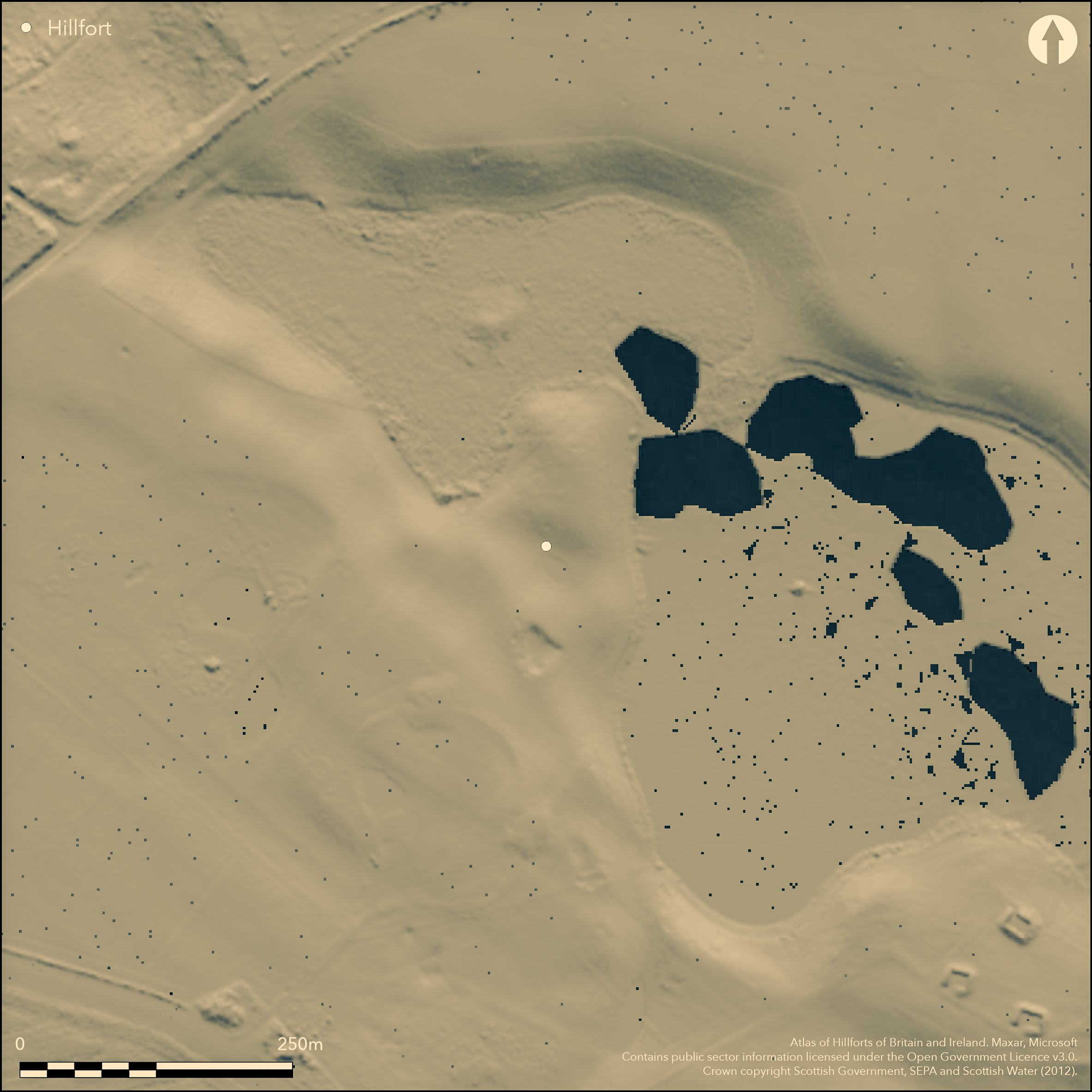
LiDAR 1m DTM Hillshade
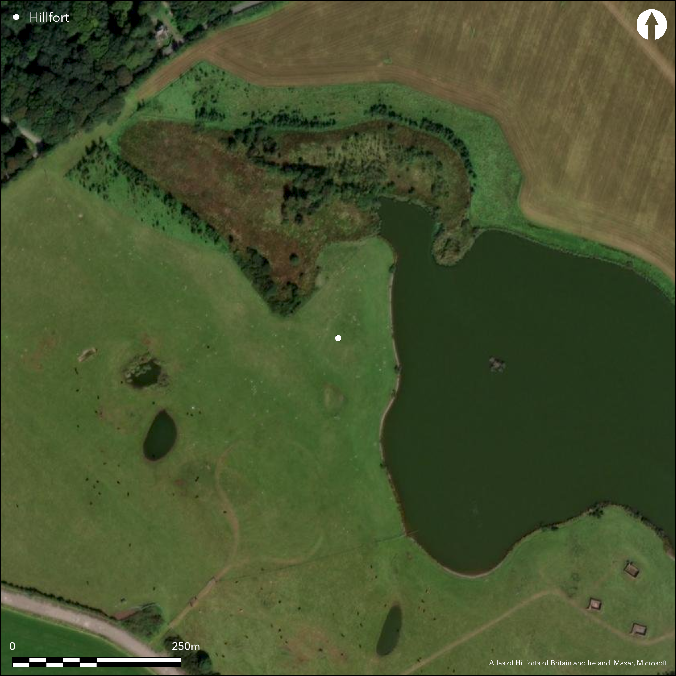
Satellite Imagery
LiDAR 1m DTM Hillshade
Satellite Imagery
Scroll left/right to view further images.
HER: Dumfries & Galloway MDG1752 (None)
NMR: NX 16 SW 18 (61697)
SM: 7500
NGR: NX 1193 6050
X: 211930 Y: 560500 (OSGB36)
Nothing is visible of this fort, which was first discovered by aerial photography in 1978. It occupies a promontory on the western shore of Cults Loch, where a raised tongue of ground is sandwiched between between the open water of the loch on the E and a bog on the W. The N end of the promontory forms a low hillock and is separated from the gently rising ground to the S and SW by a deep natural hollow cutting transversely across its axis. Whereas the cropmarks revealed two ditches on the rising ground to the S, apparently enclosing an overall area of almost 1ha with an entrance on the SW, excavation and geophysical survey located three more ditches in the natural hollow, forming a belt of defences up to 60m deep. These cut off about 0.4ha, though there is also evidence that in its earliest phase a much smaller area of perhaps only 0.23ha was enclosed, its perimeter formed by digging into the flanks of the hillock to create a steep scarp about 1m in height in front of a continuous rampart with a stone face and a timber revetment to the rear; a single date of 1410-1210 BC from the foundation trench for the timberwork is considerably earlier than any from the rest of the defences and may be from residual material (Cavers et al in prep). The ditches of the main defences would have formed substantial barriers, the innermost measuring 5m in breadth by 3.2m in depth. The main area of excavation lay immediately within the entrance through this ditch on the SW, and while the position of the accompanying rampart could not be determined, to the rear there was a complex of five palisade trenches, representing entrances in at least three phases. The precise sequence of their construction, and indeed of the cutting of the ditches and the overall configuration of the defences in separate phases, cannot be demonstrated, and the five radiocarbon dates from various contexts indicate only that the bulk of the activity probably lay after the mid 1st millennium BC.
Citizen Science: ✗
Reliability of Data: Confirmed
Reliability of Interpretation: Confirmed
X: -549357 Y: 7343207 (EPSG: 3857)
Longitude: -4.934955320808865 Latitude: 54.90374092818356 (EPSG:4326)
Country: Scotland
Current County or Unitary Authority: Dumfries & Galloway
Historic County: Wigtownshire
Current Parish/Community/Council/Townland: Inch
None
| Extant | ✗ |
| Cropmark | ✓ |
| Likely Destroyed | ✗ |
None
| Woodland | ✗ |
| Commercial Forestry Plantation | ✗ |
| Parkland | ✗ |
| Pasture (Grazing) | ✓ |
| Arable | ✓ |
| Scrub/Bracken | ✗ |
| Bare Outcrop | ✗ |
| Heather/Moorland | ✗ |
| Heath | ✗ |
| Built-up | ✗ |
| Coastal Grassland | ✗ |
| Other | ✗ |
None
| Contour Fort | ✗ |
| Partial Contour Fort | ✗ |
| Promontory Fort | ✓ |
| Hillslope Fort | ✗ |
| Level Terrain Fort | ✗ |
| Marsh Fort | ✗ |
| Multiple Enclosure Fort | ✗ |
| Hilltop | ✗ |
| Coastal Promontory | ✗ |
| Inland Promontory | ✓ |
| Valley Bottom | ✗ |
| Knoll/Hillock/Outcrop | ✗ |
| Ridge | ✗ |
| Cliff/Plateau-edge/Scarp | ✗ |
| Hillslope | ✗ |
| Lowland | ✗ |
| Spur | ✗ |
Dominant Topographic Feature: None
| North | ✗ |
| Northeast | ✗ |
| East | ✗ |
| Southeast | ✗ |
| South | ✗ |
| Southwest | ✗ |
| West | ✗ |
| Northwest | ✗ |
| Level | ✓ |
Altitude: 20.0m
N/A
Radiocarbon chronology based on about eight radiocarbon dates, to which Bayesian statistics have been applied in the preparation of the final report (Cavers et al in prep). Horn (Forthcoming) provisionally suggests start: 615-540 cal. BC (95% probability), end: 395-250 cal. BC (95% probability)
Reliability: A - High
| Pre 1200BC | ✗ |
| 1200BC - 800BC | ✗ |
| 800BC - 400BC | ✓ |
| 400BC - AD50 | ✓ |
| AD50 - AD400 | ✗ |
| AD400 - AD 800 | ✗ |
| Post AD800 | ✗ |
| Unknown | ✗ |
| Pre Hillfort: | None |
| Post Hillfort: | None |
| C14: | None |
First discovered in 1978 by the RCAHMS Aerial Survey Programme, the fort has been re-photographed in 1984 and 1992. Excavations and geophysical survey were carried out in 2009 and 2010 by AOC Archaeology as part of a wider project centred on Cults Loch.
| Other (1978): | Discovered by the RCAHMS Aerial Survey Programme |
| Other (1998): | Scheduled |
| Excavation (2009): | Evaluation by AOC Archaeology (Cavers and Crone 2009) |
| Geophysical Survey (2009): | Tessa Poller on behalf of AOC Archaeology |
| Excavation (2010): | By AOC Archaeology (Cavers 2010) |
No coherent structures
None
| None | ✓ |
| Spring | ✗ |
| Stream | ✗ |
| Pool | ✗ |
| Flush | ✗ |
| Well | ✗ |
| Other | ✗ |
None
| No Known Features | ✓ |
| Round Stone Structures | ✗ |
| Rectangular Stone Structures | ✗ |
| Curvilinear Platforms | ✗ |
| Other Roundhouse Evidence | ✗ |
| Pits | ✗ |
| Quarry Hollows | ✗ |
| Other | ✗ |
None
| No Known Excavation | ✗ |
| Pits | ✓ |
| Postholes | ✓ |
| Roundhouses | ✗ |
| Rectangular Structures | ✗ |
| Roads/Tracks | ✗ |
| Quarry Hollows | ✗ |
| Other | ✗ |
| Nothing Found | ✗ |
None
| No Known Geophysics | ✗ |
| Pits | ✓ |
| Roundhouses | ✗ |
| Rectangular Structures | ✗ |
| Roads/Tracks | ✗ |
| Quarry Hollows | ✗ |
| Other | ✗ |
| Nothing Found | ✗ |
None
| No Known Finds | ✓ |
| Pottery | ✗ |
| Metal | ✗ |
| Metalworking | ✗ |
| Human Bones | ✗ |
| Animal Bones | ✗ |
| Lithics | ✗ |
| Environmental | ✗ |
| Other | ✗ |
None
| APs Not Checked | ✗ |
| None | ✗ |
| Roundhouses | ✗ |
| Rectangular Structures | ✗ |
| Pits | ✓ |
| Postholes | ✗ |
| Roads/Tracks | ✗ |
| Other | ✗ |
See main summary
| 1: | Ploughed flat |
| 2: | The simple gaps in the ditches belie a multiperiod complex of entrances in separate phases at this one spot. |
Guard Chambers: ✗
Chevaux de Frise: ✗
| 1. Simple Gap (South west): | None |
At least five ditches, presumably accompanied by earthen ramparts, and also several lines of palisading
| Area 1: | 0.4ha. |
| Total: | 0.4ha. |
Total Footprint Area: 1.0ha.
None
| ✗ | None |
| ✗ | None |
| NE Quadrant: | 0 |
| SE Quadrant: | 0 |
| SW Quadrant: | 5 |
| NW Quadrant: | 0 |
| Total: | 5 |
| Partial Univallate | ✗ |
| Univallate | ✗ |
| Partial Bivallate | ✗ |
| Bivallate | ✗ |
| Partial Multivallate | ✓ |
| Multivallate | ✗ |
| Unknown | ✗ |
| Partial Univallate | ✗ |
| Univallate | ✗ |
| Partial Bivallate | ✗ |
| Bivallate | ✗ |
| Partial Multivallate | ✗ |
| Multivallate | ✗ |
No trace of presumed standing ramparts discovered, unless they are represented by some of the foundation trenches for timberwork.
| None | ✓ |
| Earthen Bank | ✗ |
| Stone Wall | ✗ |
| Rubble | ✗ |
| Wall-walk | ✗ |
| Evidence of Timber | ✗ |
| Vitrification | ✗ |
| Other Burning | ✗ |
| Palisade | ✗ |
| Counter Scarp Bank | ✗ |
| Berm | ✗ |
| Unfinished | ✗ |
| Other | ✗ |
Ditches
| None | ✓ |
| Earthen Bank | ✗ |
| Stone Wall | ✗ |
| Murus Duplex | ✗ |
| Timber-framed | ✗ |
| Timber-laced | ✗ |
| Vitrification | ✗ |
| Other Burning | ✗ |
| Palisade | ✓ |
| Counter Scarp Bank | ✗ |
| Berm | ✗ |
| Unfinished | ✗ |
| No Known Excavation | ✗ |
| Other | ✓ |
| ✗ | None |
| ✓ | None |
Number of Ditches: 5
| ✗ | None |
Cavers and Crone, G and A (2009) 'Cults Landscape Project - Cults Loch, Castle Kennedy, Dumfries and Galloway (Inch parish), excavation', Disc Exc Scot, New Ser 10 (2009), 56
Cavers, G (2010) 'Cults Loch fort, Dumfries and Galloway (Inch parish), excavation', Disc Exc Scot, New Ser 11 (2010), 53
Horn, J. Forthcoming. The dating of hillforts in Britain and Ireland. Unpublished PhD thesis, University of Edinburgh.
Atlas of Hillforts:
Wikidata:
This work is licensed under CC BY-SA 4.0

 and should be cited as:
Lock, Gary and Ralston, Ian. 2024. Atlas of Hillforts of Britain and Ireland. Available at: https://hillforts.arch.ox.ac.uk
Document Version 1.1