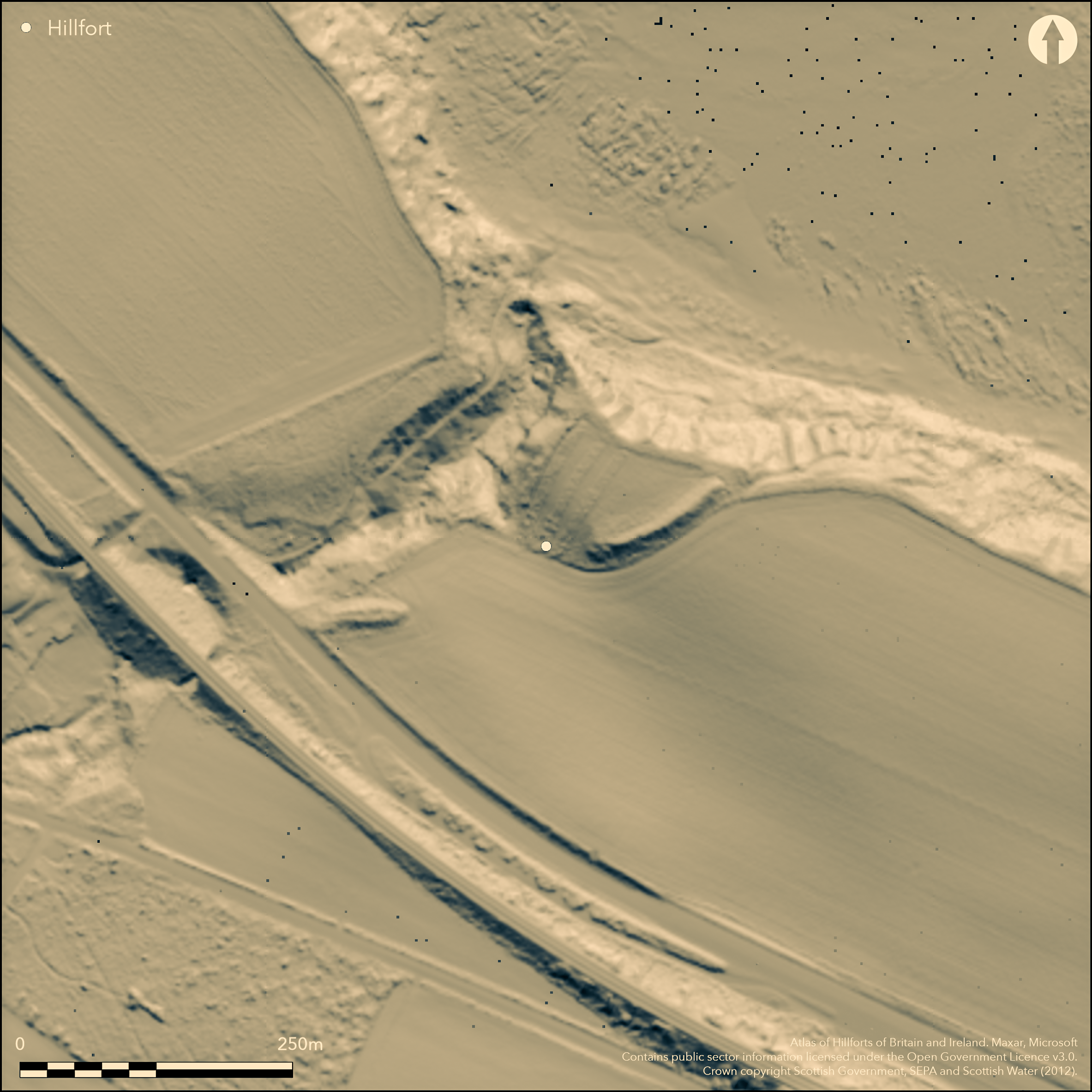
LiDAR 1m DTM Hillshade
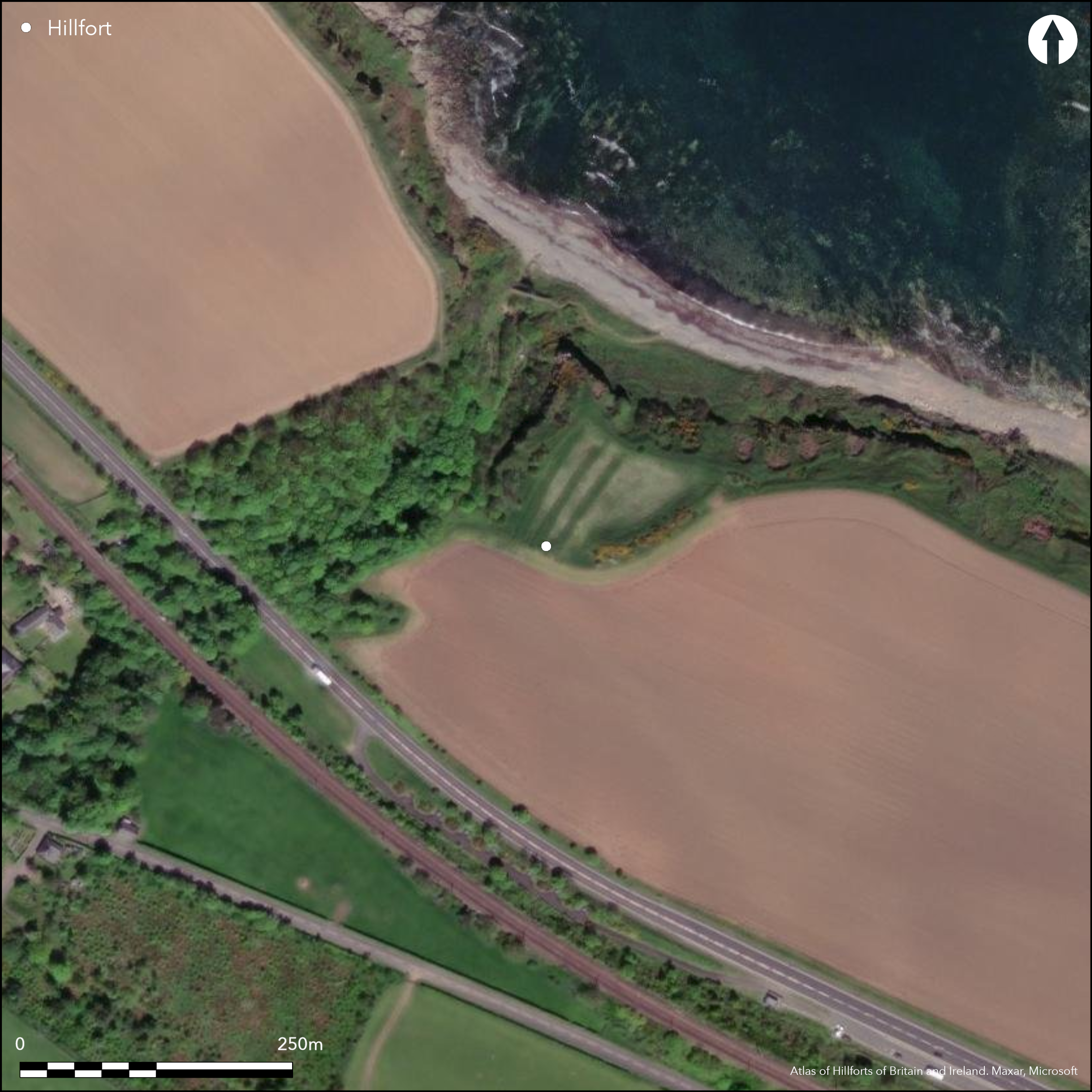
Satellite Imagery
LiDAR 1m DTM Hillshade
Satellite Imagery
Scroll left/right to view further images.
HER: East Lothian Council MEL1819 (None)
NMR: NT 77 SE 3 (58870)
SM: None
NGR: NT 7660 7262
X: 376600 Y: 672620 (OSGB36)
This fort exploits the steep-sided promontory forming the E side of the mouth of the deeply incised gully where the Bilsdean Burn cuts through the coastal escarpment. Triangular on plan, the cliif-top is cut off by a massive earthen rampart up to 10m in thickness by 3.5m in height, enclosing an area measuring 70m from ESE to WNW by about 50m transversely (0.37ha). In addition to the broad gap in the southern arc, on the NE the rampart terminates short of the cliff-edge, but in both sectors it is depicted as a continuous arc on the 1st edition OS 6-inch map (Haddingtonshire 1854, sheet 12). The map also shows a concentric hedge-line some 10m outside it, almost certainly indicating the position of an external ditch. By 1893, the perimeter had been reduced to its present state, but the first 25-inch depiction (Haddingtonshire 1894, sheet 13.5) shows a separate short length of rampart extending into the field on the E of the gully a further 70m to the SW; the purpose and extent of this equally massive bank are uncertain, but in 1913 it led RCAHMS investigators into believing that it and the main rampart had formed a continuous barrier to cut off an area of 0.6ha; all later investigators have adopted this view (Hogg 1945; OS 1:2500 revision 1966). While the map evidence indicates that this is not the case, this second rampart lies so far out from the inner perimeter that it is quite likely to represent a separate line of defence of a much bigger enclosure of at least 0.6ha in extent. In 1853 the OS surveyors noted that cists had been discovered here some years before (Name Book, Haddingtonshire) No.16, pp 21, 63), while in 1913 RCAHMS noted that 'stone foundations had been ploughed up within the interior (RCAHMS 1924, 79, no.126); a fragment of Roman glass has also been discovered in the interior (Hogg 1945).
Citizen Science: ✗
Reliability of Data: Confirmed
Reliability of Interpretation: Confirmed
X: -264521 Y: 7547691 (EPSG: 3857)
Longitude: -2.3762358084374444 Latitude: 55.94608973879151 (EPSG:4326)
Country: Scotland
Current County or Unitary Authority: East Lothian
Historic County: East Lothian
Current Parish/Community/Council/Townland: Oldhamstocks
None
| Extant | ✓ |
| Cropmark | ✗ |
| Likely Destroyed | ✗ |
None
| Woodland | ✗ |
| Commercial Forestry Plantation | ✗ |
| Parkland | ✗ |
| Pasture (Grazing) | ✗ |
| Arable | ✓ |
| Scrub/Bracken | ✗ |
| Bare Outcrop | ✗ |
| Heather/Moorland | ✗ |
| Heath | ✗ |
| Built-up | ✗ |
| Coastal Grassland | ✗ |
| Other | ✗ |
None
| Contour Fort | ✗ |
| Partial Contour Fort | ✗ |
| Promontory Fort | ✓ |
| Hillslope Fort | ✗ |
| Level Terrain Fort | ✗ |
| Marsh Fort | ✗ |
| Multiple Enclosure Fort | ✗ |
| Hilltop | ✗ |
| Coastal Promontory | ✓ |
| Inland Promontory | ✗ |
| Valley Bottom | ✗ |
| Knoll/Hillock/Outcrop | ✗ |
| Ridge | ✗ |
| Cliff/Plateau-edge/Scarp | ✗ |
| Hillslope | ✗ |
| Lowland | ✗ |
| Spur | ✗ |
Dominant Topographic Feature: None
| North | ✗ |
| Northeast | ✗ |
| East | ✗ |
| Southeast | ✗ |
| South | ✗ |
| Southwest | ✗ |
| West | ✗ |
| Northwest | ✗ |
| Level | ✓ |
Altitude: 30.0m
N/A
Single fragment of colourless Roman glass (rim).
Reliability: C - Low
| Pre 1200BC | ✗ |
| 1200BC - 800BC | ✗ |
| 800BC - 400BC | ✗ |
| 400BC - AD50 | ✗ |
| AD50 - AD400 | ✓ |
| AD400 - AD 800 | ✗ |
| Post AD800 | ✗ |
| Unknown | ✓ |
| Pre Hillfort: | None |
| Post Hillfort: | Context of Roman glass unknown. Cists |
| Artefactual: | Stray find |
Depicted on Roy's map 1747-55, it also appears in more detail on the 1st edition of the OS 6-inch map (Haddingtonshire 1854, sheet 12) and the 25-inch map (Haddingtonshire 1894, sheet 13.5), which chart the partial demolition of the main rampart. Visited in 1913 by J G Callander for RCAHMS, a description appears in the County Inventory for East Lothian (RCAHMS 1924, 79, no.126). The OS revised the 1:2500 depiction in 1966.
| 1st Identified Map Depiction (1755): | Roy Lowlands 1747-1755 |
| Other (1853): | Named in Gothic type on theOS 6-inch map (Haddingtonshire 1854, sheet 12) |
| Other (1893): | OS 25-inch map (Haddingtonshire 1894, sheet 13.5) |
| Other (1913): | Description (RCAHMS 1924, 79, no.126) |
| Other (1966): | Revised at 1:2500 by the OS |
Foundations of stone structures said to have been ploughed up.
None
| None | ✓ |
| Spring | ✗ |
| Stream | ✗ |
| Pool | ✗ |
| Flush | ✗ |
| Well | ✗ |
| Other | ✗ |
None
| No Known Features | ✓ |
| Round Stone Structures | ✗ |
| Rectangular Stone Structures | ✗ |
| Curvilinear Platforms | ✗ |
| Other Roundhouse Evidence | ✗ |
| Pits | ✗ |
| Quarry Hollows | ✗ |
| Other | ✗ |
None
| No Known Excavation | ✓ |
| Pits | ✗ |
| Postholes | ✗ |
| Roundhouses | ✗ |
| Rectangular Structures | ✗ |
| Roads/Tracks | ✗ |
| Quarry Hollows | ✗ |
| Other | ✗ |
| Nothing Found | ✗ |
None
| No Known Geophysics | ✓ |
| Pits | ✗ |
| Roundhouses | ✗ |
| Rectangular Structures | ✗ |
| Roads/Tracks | ✗ |
| Quarry Hollows | ✗ |
| Other | ✗ |
| Nothing Found | ✗ |
Glass rim (Roman)
| No Known Finds | ✗ |
| Pottery | ✗ |
| Metal | ✗ |
| Metalworking | ✗ |
| Human Bones | ✗ |
| Animal Bones | ✗ |
| Lithics | ✗ |
| Environmental | ✗ |
| Other | ✓ |
NO APPARENT FEATURES
| APs Not Checked | ✗ |
| None | ✓ |
| Roundhouses | ✗ |
| Rectangular Structures | ✗ |
| Pits | ✗ |
| Postholes | ✗ |
| Roads/Tracks | ✗ |
| Other | ✗ |
See main summary
| 2: | All breaks seem to be modern |
| 2: | None |
Guard Chambers: ✗
Chevaux de Frise: ✗
Single rampart cutting off coastal promontory, but with a fragment of another rampart suggesting a bigger enclosure of at least 0.6ha.
| Area 1: | 0.4ha. |
| Total: | 0.4ha. |
Total Footprint Area: 1.2ha.
None
| ✗ | None |
| ✗ | None |
| NE Quadrant: | 0 |
| SE Quadrant: | 1 |
| SW Quadrant: | 0 |
| NW Quadrant: | 0 |
| Total: | 1 |
| Partial Univallate | ✓ |
| Univallate | ✗ |
| Partial Bivallate | ✗ |
| Bivallate | ✗ |
| Partial Multivallate | ✗ |
| Multivallate | ✗ |
| Unknown | ✗ |
| Partial Univallate | ✗ |
| Univallate | ✗ |
| Partial Bivallate | ✗ |
| Bivallate | ✗ |
| Partial Multivallate | ✗ |
| Multivallate | ✗ |
In 1945 Hogg noted a 'dilapidated drystone wall' in the top of the rampart, which he suggested was an original feature, but it is not mentioned by any other investigator
| None | ✗ |
| Earthen Bank | ✓ |
| Stone Wall | ✗ |
| Rubble | ✗ |
| Wall-walk | ✗ |
| Evidence of Timber | ✗ |
| Vitrification | ✗ |
| Other Burning | ✗ |
| Palisade | ✗ |
| Counter Scarp Bank | ✗ |
| Berm | ✗ |
| Unfinished | ✗ |
| Other | ✗ |
None
| None | ✗ |
| Earthen Bank | ✗ |
| Stone Wall | ✗ |
| Murus Duplex | ✗ |
| Timber-framed | ✗ |
| Timber-laced | ✗ |
| Vitrification | ✗ |
| Other Burning | ✗ |
| Palisade | ✗ |
| Counter Scarp Bank | ✗ |
| Berm | ✗ |
| Unfinished | ✗ |
| No Known Excavation | ✓ |
| Other | ✗ |
| ✗ | None |
| ✓ | Nothing visible, but almost certainly present |
Number of Ditches: 1
| ✗ | None |
Hogg, A H A (1956) 'Roman fragments from Castle Dykes near Cockburnspath and from St Abb's Head', Proc Soc Antiq Scot 79, 172-3.
Name Book, Ordnance Survey Object Name Books (6 inch and 1/2500 scale); available https://www.scotlandsplaces.gov.uk/; Haddingtonshire No.16
RCAHMS (1924) The Royal Commission on the Ancient and Historical Monuments and Constructions of Scotland. Eighth report with inventory of monuments and constructions in the county of East Lothian, Edinburgh
Robertson, A S (1970) 'Roman finds from non-Roman sites in Scotland', Britannia 1.
Atlas of Hillforts:
Wikidata:
This work is licensed under CC BY-SA 4.0

 and should be cited as:
Lock, Gary and Ralston, Ian. 2024. Atlas of Hillforts of Britain and Ireland. Available at: https://hillforts.arch.ox.ac.uk
Document Version 1.1