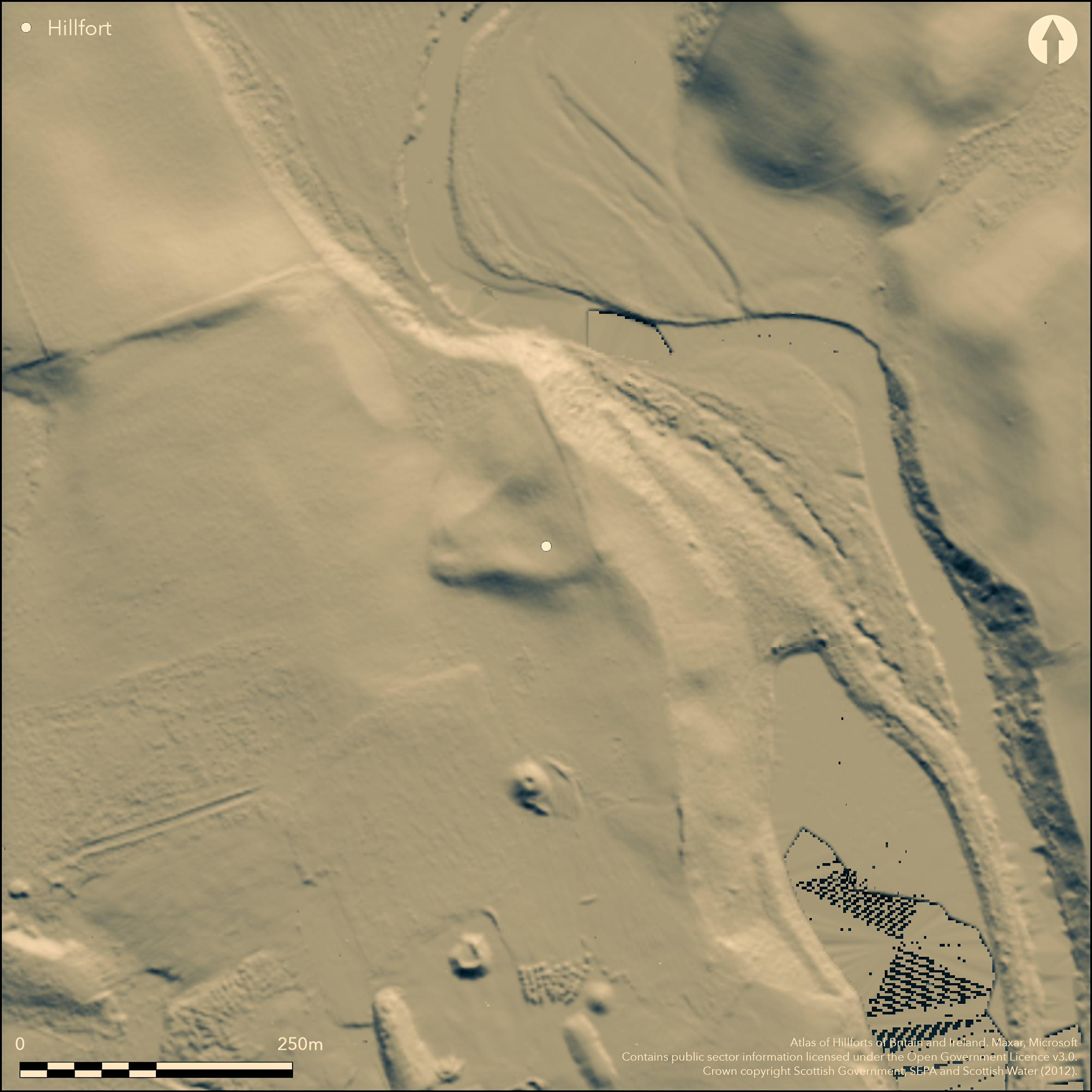
LiDAR 1m DTM Hillshade
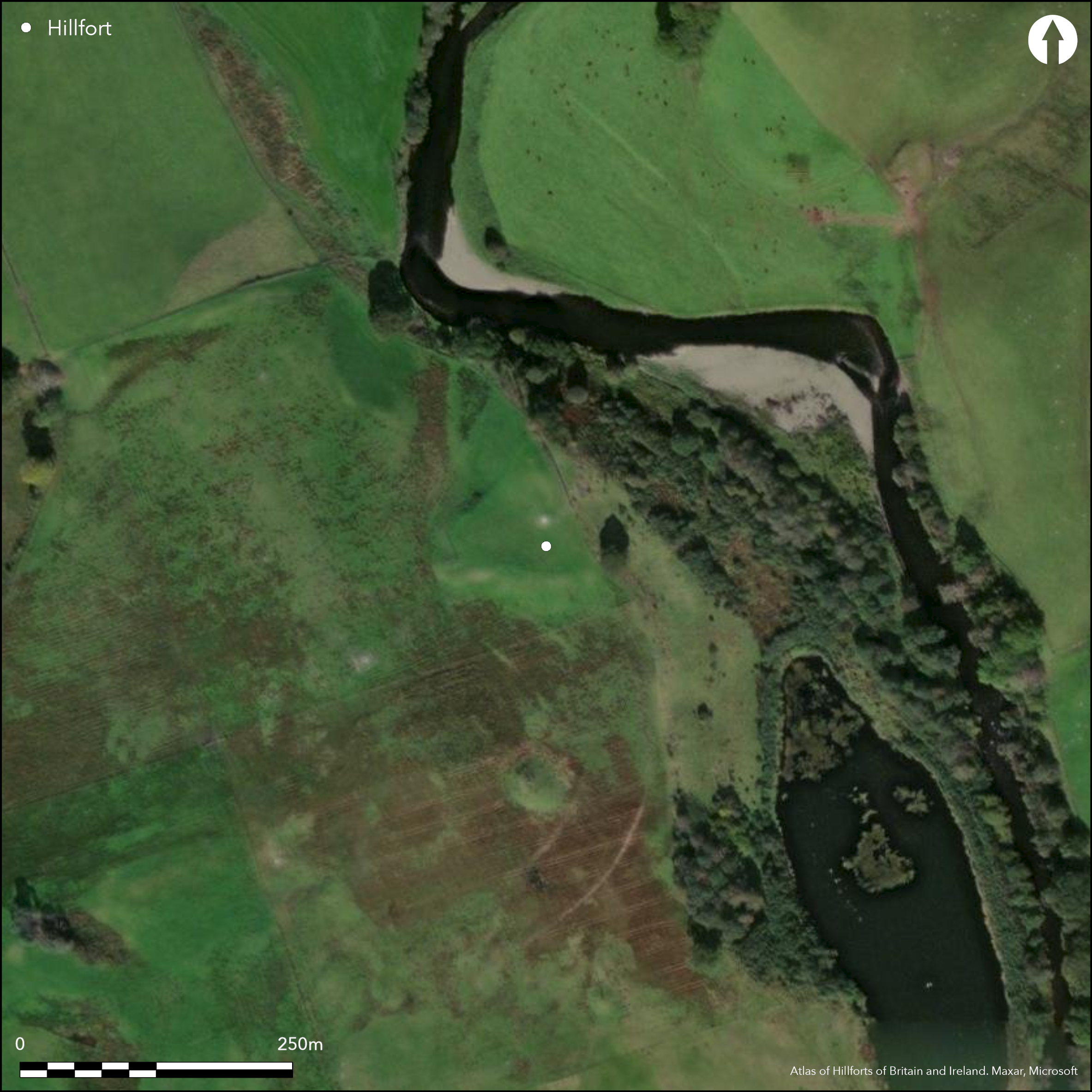
Satellite Imagery
LiDAR 1m DTM Hillshade
Satellite Imagery
Scroll left/right to view further images.
HER: Dumfries & Galloway MDG7268 (None)
NMR: NY 19 NW 23 (66913)
SM: None
NGR: NY 1040 9894
X: 310402 Y: 598941 (OSGB36)
Aerial photography revealed the site of this fort cutting off a promontory of the gravel terrace on the W bank of the River Annan opposite Catherine's Hill (Atlas No. 0947). The defences, which comprise two ditches cut off the level approach along the terrace from the S, have been largely ploughed down, though the stubs of the ditches can be seen on the lip of the escarpment forming the E margin of the promontory. The wedge-shaped interior, which measures about 80m from N to S by a maximum of 45m transvesely to the rear of the defences, is featureless, and the position of the entrance is unknown. In the course of an evaluation by Rathmell Archaeology in 2003 in advance of a proposal for gravel extraction, five trenches were excavated across the defences. These revealed that the inner ditch, which enhances a natural depression, ranges from 4m to 6m in breadth by at least 1.5m in depth. The outer is not strictly concentric, diverging from 5m apart on the E margin of the promontory to some 14m on the W, and is about 2m in breadth by 1m in depth; its absence from one of the trenches on the WSW may indicate the presence of an entrance causeway, though there is no corresponding break in the inner ditch at this point. No certain evidence of any upcast ramparts was located In the interior, but about 10m within the line of the inner ditch, at least three lines of palisade trench were located, evidently representing more than one phase of construction. The interior was otherwise largely devoid of cut features, and those few that were uncovered contained no prehistoric artefacts (Matthews and Rees 2003; Rathmell Archaeology 2003).
Citizen Science: ✗
Reliability of Data: Confirmed
Reliability of Interpretation: Confirmed
X: -379816 Y: 7415708 (EPSG: 3857)
Longitude: -3.411948525755823 Latitude: 55.276463367762595 (EPSG:4326)
Country: Scotland
Current County or Unitary Authority: Dumfries & Galloway
Historic County: Dumfriesshire
Current Parish/Community/Council/Townland: Kirkpatrick-Juxta
None
| Extant | ✗ |
| Cropmark | ✓ |
| Likely Destroyed | ✗ |
None
| Woodland | ✗ |
| Commercial Forestry Plantation | ✗ |
| Parkland | ✗ |
| Pasture (Grazing) | ✗ |
| Arable | ✓ |
| Scrub/Bracken | ✗ |
| Bare Outcrop | ✗ |
| Heather/Moorland | ✗ |
| Heath | ✗ |
| Built-up | ✗ |
| Coastal Grassland | ✗ |
| Other | ✗ |
None
| Contour Fort | ✗ |
| Partial Contour Fort | ✗ |
| Promontory Fort | ✓ |
| Hillslope Fort | ✗ |
| Level Terrain Fort | ✗ |
| Marsh Fort | ✗ |
| Multiple Enclosure Fort | ✗ |
| Hilltop | ✗ |
| Coastal Promontory | ✗ |
| Inland Promontory | ✓ |
| Valley Bottom | ✗ |
| Knoll/Hillock/Outcrop | ✗ |
| Ridge | ✗ |
| Cliff/Plateau-edge/Scarp | ✗ |
| Hillslope | ✗ |
| Lowland | ✗ |
| Spur | ✗ |
Dominant Topographic Feature: None
| North | ✗ |
| Northeast | ✗ |
| East | ✗ |
| Southeast | ✗ |
| South | ✗ |
| Southwest | ✗ |
| West | ✗ |
| Northwest | ✗ |
| Level | ✓ |
Altitude: 90.0m
N/A
No dating evidence was recovered by the excavations
Reliability: D - None
| Pre 1200BC | ✗ |
| 1200BC - 800BC | ✗ |
| 800BC - 400BC | ✗ |
| 400BC - AD50 | ✗ |
| AD50 - AD400 | ✗ |
| AD400 - AD 800 | ✗ |
| Post AD800 | ✗ |
| Unknown | ✓ |
| Pre Hillfort: | None |
| Post Hillfort: | Ploughed down |
First identified in 1975 by aerial survey of John Dewar, it was re-photographed by the RCAHMS Aerial Survey Programme in 1992. In 2003 an evaluation of the defences and the interior was carried out as part of a planning proposal for sand and gravel quarrying (Matthews and Rees 2003; Rathmell Archaeology 2003).
| Other (1975): | Discovery: John Dewar (Photographs in RCAHMS) |
| Excavation (2003): | Evaluation (Matthews and Rees 2003; Rathmell Archaeology 2003) |
Featureless
None
| None | ✓ |
| Spring | ✗ |
| Stream | ✗ |
| Pool | ✗ |
| Flush | ✗ |
| Well | ✗ |
| Other | ✗ |
None
| No Known Features | ✓ |
| Round Stone Structures | ✗ |
| Rectangular Stone Structures | ✗ |
| Curvilinear Platforms | ✗ |
| Other Roundhouse Evidence | ✗ |
| Pits | ✗ |
| Quarry Hollows | ✗ |
| Other | ✗ |
Little found in evaluation
| No Known Excavation | ✗ |
| Pits | ✗ |
| Postholes | ✗ |
| Roundhouses | ✗ |
| Rectangular Structures | ✗ |
| Roads/Tracks | ✗ |
| Quarry Hollows | ✗ |
| Other | ✓ |
| Nothing Found | ✗ |
None
| No Known Geophysics | ✓ |
| Pits | ✗ |
| Roundhouses | ✗ |
| Rectangular Structures | ✗ |
| Roads/Tracks | ✗ |
| Quarry Hollows | ✗ |
| Other | ✗ |
| Nothing Found | ✗ |
None
| No Known Finds | ✓ |
| Pottery | ✗ |
| Metal | ✗ |
| Metalworking | ✗ |
| Human Bones | ✗ |
| Animal Bones | ✗ |
| Lithics | ✗ |
| Environmental | ✗ |
| Other | ✗ |
NO APPARENT FEATURES
| APs Not Checked | ✗ |
| None | ✓ |
| Roundhouses | ✗ |
| Rectangular Structures | ✗ |
| Pits | ✗ |
| Postholes | ✗ |
| Roads/Tracks | ✗ |
| Other | ✗ |
None known
| 0: | Ploughed flat |
| 2: | None recorded |
Guard Chambers: ✗
Chevaux de Frise: ✗
Two ditches, presumably accompanied by upcast ramparts, cutting off a promontory
| Area 1: | 0.2ha. |
| Total: | 0.2ha. |
Total Footprint Area: 0.38ha.
None
| ✗ | None |
| ✗ | None |
| NE Quadrant: | 0 |
| SE Quadrant: | 2 |
| SW Quadrant: | 0 |
| NW Quadrant: | 0 |
| Total: | 2 |
| Partial Univallate | ✗ |
| Univallate | ✗ |
| Partial Bivallate | ✓ |
| Bivallate | ✗ |
| Partial Multivallate | ✗ |
| Multivallate | ✗ |
| Unknown | ✗ |
| Partial Univallate | ✗ |
| Univallate | ✗ |
| Partial Bivallate | ✗ |
| Bivallate | ✗ |
| Partial Multivallate | ✗ |
| Multivallate | ✗ |
Stub of the ramparts survive on the scarp edge on the E
| None | ✗ |
| Earthen Bank | ✓ |
| Stone Wall | ✗ |
| Rubble | ✗ |
| Wall-walk | ✗ |
| Evidence of Timber | ✗ |
| Vitrification | ✗ |
| Other Burning | ✗ |
| Palisade | ✗ |
| Counter Scarp Bank | ✗ |
| Berm | ✗ |
| Unfinished | ✗ |
| Other | ✗ |
Two ditches
| None | ✓ |
| Earthen Bank | ✗ |
| Stone Wall | ✗ |
| Murus Duplex | ✗ |
| Timber-framed | ✗ |
| Timber-laced | ✗ |
| Vitrification | ✗ |
| Other Burning | ✗ |
| Palisade | ✓ |
| Counter Scarp Bank | ✗ |
| Berm | ✗ |
| Unfinished | ✗ |
| No Known Excavation | ✗ |
| Other | ✓ |
| ✗ | None |
| ✓ | None |
Number of Ditches: 2
| ✗ | None |
Matthews, A, & Rees, T (2003) 'Nether Murthat, Beattock (Kirkpatrick-Juxta parish), Evaluation'. Disc Exc Scot 4 (2003), 49
Rathmell Archaeology (2003) Nether Murthat, Beattock: Archaeological Evaluation; Data Straucture Report 27th November 2003.
Atlas of Hillforts:
Wikidata:
This work is licensed under CC BY-SA 4.0

 and should be cited as:
Lock, Gary and Ralston, Ian. 2024. Atlas of Hillforts of Britain and Ireland. Available at: https://hillforts.arch.ox.ac.uk
Document Version 1.1