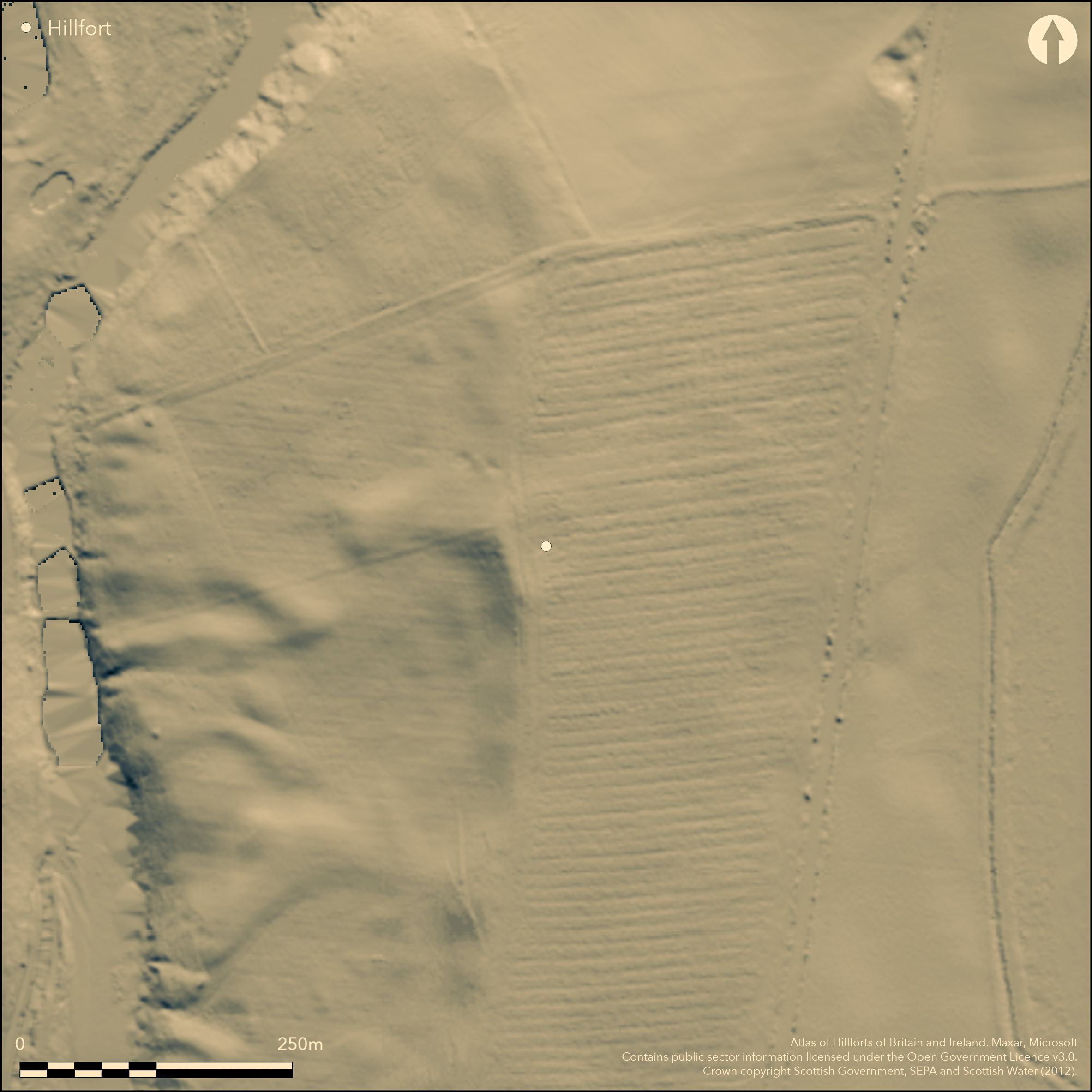
LiDAR 1m DTM Hillshade
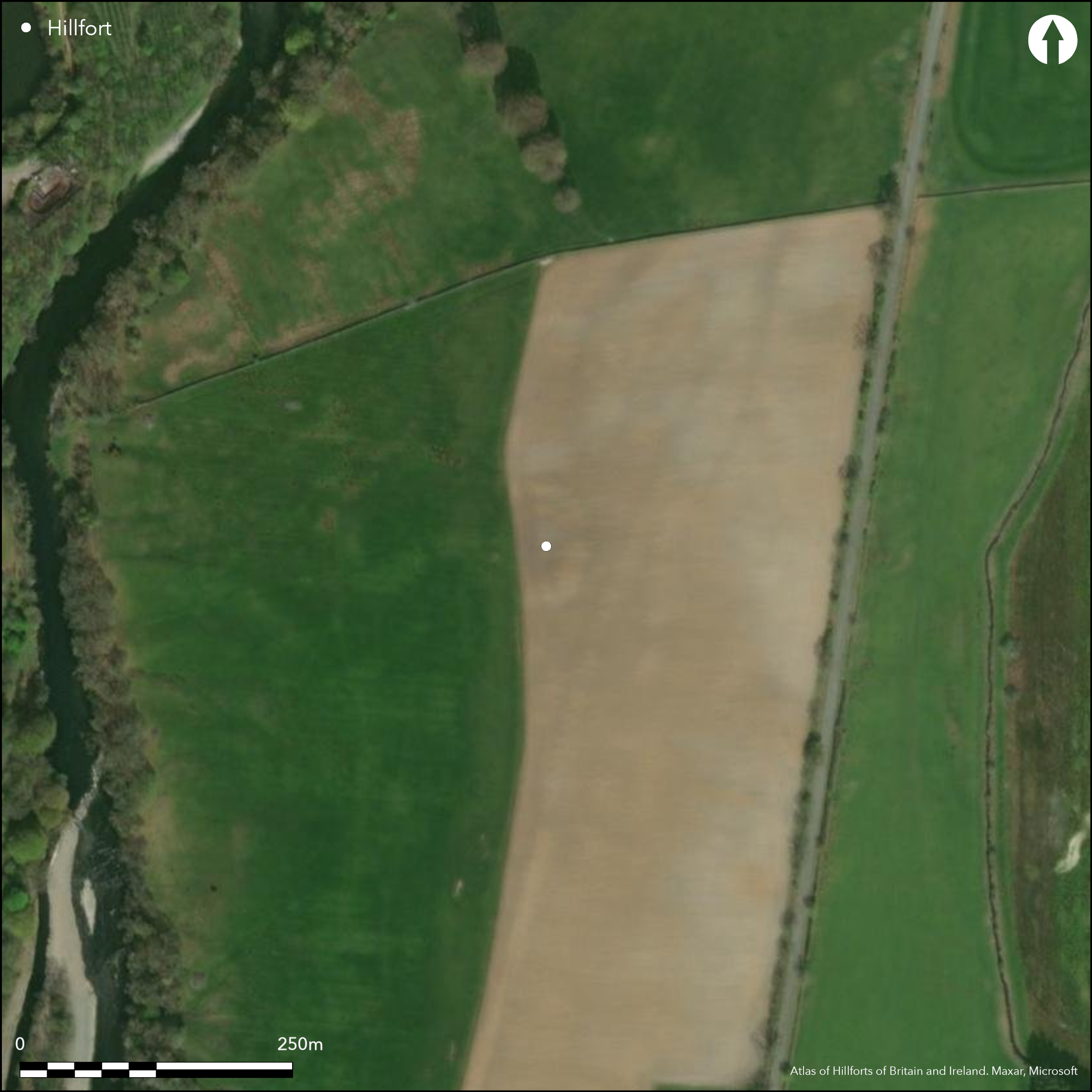
Satellite Imagery
LiDAR 1m DTM Hillshade
Satellite Imagery
Scroll left/right to view further images.
HER: Dumfries & Galloway MDG7335 (None)
NMR: NY 19 SW 3 (66967)
SM: 12665
NGR: NY 1075 9242
X: 310750 Y: 592429 (OSGB36)
This fort, which is overlain by a small rectilinear settlement, is situated on the crest of a long ridge known as Dinwoodie Hill. The top of the ridge is relatively level, but the ground falls away steeply along its W flank, which has been exploited to enhance the defensive qualities on this side. All that can be seen on the ground is the ploughed down bank of the rectilinear settlement, which measures internally about 32m from N to S by 24m transversely and has an entrance on the E. The fort into which it has been inserted is oval on plan and measures about 65m from N to S by 50m transversely within a ditch up to 4m in breadth, though a section excavated on the S by J K St Joseph revealed that it was relatively shallow at this point and no more than 3m in breadth (St Joseph 1952, 101-3). What was left of the rampart was little more than a mound of sand, but allowing for a thickness of up to 5m, the interior would have been in the order of 0.2ha and the entrance was on the E. Cropmarks, however, reveal that this inner defence is also the focus of a much larger enclosure, which again exploits the escarpment on the W flank of the ridge, its perimeter turning as if to extend along its edge on both the N and the S. Though displaying a marked angle on the SE, it is roughly oval on plan and measures about 200m from N to S by a maximum of 75m transversely (1.36ha) within a ditch between 2m and 3m in breadth. There is at least one entrance immediately N of the angle on the SE, but the line of the ditch is only intermittently visible on the aerial photographs, and there may be other causeways elsewhere. The only features visible within its interior are further lengths of ditch at either end, where they also turn onto the edge of the escarpment, but they are not concentric and nor can they be shown to form parts of a single enclosure.
Citizen Science: ✗
Reliability of Data: Confirmed
Reliability of Interpretation: Confirmed
X: -378977 Y: 7404296 (EPSG: 3857)
Longitude: -3.4044081597874047 Latitude: 55.21802753222068 (EPSG:4326)
Country: Scotland
Current County or Unitary Authority: Dumfries & Galloway
Historic County: Dumfriesshire
Current Parish/Community/Council/Townland: Applegarth
None
| Extant | ✓ |
| Cropmark | ✓ |
| Likely Destroyed | ✗ |
None
| Woodland | ✗ |
| Commercial Forestry Plantation | ✗ |
| Parkland | ✗ |
| Pasture (Grazing) | ✓ |
| Arable | ✓ |
| Scrub/Bracken | ✗ |
| Bare Outcrop | ✗ |
| Heather/Moorland | ✗ |
| Heath | ✗ |
| Built-up | ✗ |
| Coastal Grassland | ✗ |
| Other | ✗ |
None
| Contour Fort | ✓ |
| Partial Contour Fort | ✗ |
| Promontory Fort | ✗ |
| Hillslope Fort | ✗ |
| Level Terrain Fort | ✗ |
| Marsh Fort | ✗ |
| Multiple Enclosure Fort | ✓ |
| Hilltop | ✗ |
| Coastal Promontory | ✗ |
| Inland Promontory | ✗ |
| Valley Bottom | ✗ |
| Knoll/Hillock/Outcrop | ✗ |
| Ridge | ✓ |
| Cliff/Plateau-edge/Scarp | ✗ |
| Hillslope | ✗ |
| Lowland | ✗ |
| Spur | ✗ |
Dominant Topographic Feature: None
| North | ✗ |
| Northeast | ✗ |
| East | ✗ |
| Southeast | ✗ |
| South | ✗ |
| Southwest | ✗ |
| West | ✗ |
| Northwest | ✗ |
| Level | ✓ |
Altitude: 105.0m
N/A
There are neither stratified artefacts nor radiocarbon dates to provide a chronology for the defences.
Reliability: D - None
| Pre 1200BC | ✗ |
| 1200BC - 800BC | ✗ |
| 800BC - 400BC | ✗ |
| 400BC - AD50 | ✗ |
| AD50 - AD400 | ✗ |
| AD400 - AD 800 | ✗ |
| Post AD800 | ✗ |
| Unknown | ✓ |
| Pre Hillfort: | None |
| Post Hillfort: | Overlain by a rectilinear settlement enclosure |
First depicted on Roy's Map as a rectangular enclosure (Roy 1747-55), it is shown oval on the 1st edition OS 25-inch map (Dumfriesshire 1861, sheet 33.8). David Christison failed to visit it in 1890 (Christison 1891, 246), but it was subsequently described by Alexander Curle in 1912 (RCAHMS 1920, 6, no.19), though the ditch had apparently been ploughed out and he found it difficult to grasp that he was observing the remains of two enclosures, and thus described the ground between the interior of the rectilinear enclosure and the outline of the oval enclosure as the remains of a massive rampart. Subsequent work at the site in the 1940s and 50s was driven by the search for Roman installations in Annandale, which, building on Roy's depiction, led J K St Joseph to dig a trench across the perimeter (St Joseph 1952, 101-3) and RCAHMS to plan the small rectilinear enclosure in the interior in 1955 (RCAHMS DFD 3/2 and DP160651). The OS re-surveyed at 1:2500 in 1972 and drew attention to the much large enclosure revealed by CUCAP aerial photographs. CUCAP has photographed the hill on at least four occasions, and the RCAHMS Aerial Survey Programme on another three. RCAHMS revisited in 1991 and the site was Scheduled in 2010.
| 1st Identified Map Depiction (1755): | William Roy (1747-55) |
| Other (1857): | Annotated Fort on the 1st edition OS 25-inch map (Dumfriesshire 1861, sheet 33.8) |
| Other (1890): | Listed by David Christison (1891, 246) |
| Other (1912): | Description (RCAHMS 1920, 6, no.19) |
| Excavation (1952): | Trial trench by J K St Joseph (1952, 101-3) |
| Earthwork Survey (1955): | Plan and description during RCAHMS Survey of Marginal Lands of the inner enclosure (RCAHMS DFD 3/2 and DP160651) |
| Other (1972): | Resurveyed at 1:2500 by the OS |
| Other (2010): | Scheduled |
Featureless apart from the settlement enclosure
None
| None | ✓ |
| Spring | ✗ |
| Stream | ✗ |
| Pool | ✗ |
| Flush | ✗ |
| Well | ✗ |
| Other | ✗ |
None
| No Known Features | ✓ |
| Round Stone Structures | ✗ |
| Rectangular Stone Structures | ✗ |
| Curvilinear Platforms | ✗ |
| Other Roundhouse Evidence | ✗ |
| Pits | ✗ |
| Quarry Hollows | ✗ |
| Other | ✗ |
None
| No Known Excavation | ✓ |
| Pits | ✗ |
| Postholes | ✗ |
| Roundhouses | ✗ |
| Rectangular Structures | ✗ |
| Roads/Tracks | ✗ |
| Quarry Hollows | ✗ |
| Other | ✗ |
| Nothing Found | ✗ |
None
| No Known Geophysics | ✓ |
| Pits | ✗ |
| Roundhouses | ✗ |
| Rectangular Structures | ✗ |
| Roads/Tracks | ✗ |
| Quarry Hollows | ✗ |
| Other | ✗ |
| Nothing Found | ✗ |
None
| No Known Finds | ✓ |
| Pottery | ✗ |
| Metal | ✗ |
| Metalworking | ✗ |
| Human Bones | ✗ |
| Animal Bones | ✗ |
| Lithics | ✗ |
| Environmental | ✗ |
| Other | ✗ |
NO APPARENT FEATURES
| APs Not Checked | ✗ |
| None | ✓ |
| Roundhouses | ✗ |
| Rectangular Structures | ✗ |
| Pits | ✗ |
| Postholes | ✗ |
| Roads/Tracks | ✗ |
| Other | ✗ |
See main summary
| 1: | Apart from the overlying settlement enclsure, the defences are ploughed flat |
| 2: | None |
Guard Chambers: ✗
Chevaux de Frise: ✗
| 1. Simple Gap (East): | None |
single rampart and ditch, but possibly a much larger outer enclosure
| Area 1: | 0.2ha. |
| Area 2: | 1.36ha. |
| Total: | 1.36ha. |
Total Footprint Area: Noneha.
None
| ✗ | None |
| ✓ | Excludes the outer enclosure |
| NE Quadrant: | 1 |
| SE Quadrant: | 1 |
| SW Quadrant: | 1 |
| NW Quadrant: | 1 |
| Total: | 1 |
| Partial Univallate | ✗ |
| Univallate | ✓ |
| Partial Bivallate | ✗ |
| Bivallate | ✗ |
| Partial Multivallate | ✗ |
| Multivallate | ✗ |
| Unknown | ✗ |
| Partial Univallate | ✗ |
| Univallate | ✓ |
| Partial Bivallate | ✗ |
| Bivallate | ✗ |
| Partial Multivallate | ✗ |
| Multivallate | ✗ |
None
| None | ✓ |
| Earthen Bank | ✗ |
| Stone Wall | ✗ |
| Rubble | ✗ |
| Wall-walk | ✗ |
| Evidence of Timber | ✗ |
| Vitrification | ✗ |
| Other Burning | ✗ |
| Palisade | ✗ |
| Counter Scarp Bank | ✗ |
| Berm | ✗ |
| Unfinished | ✗ |
| Other | ✗ |
Ditch
| None | ✗ |
| Earthen Bank | ✓ |
| Stone Wall | ✗ |
| Murus Duplex | ✗ |
| Timber-framed | ✗ |
| Timber-laced | ✗ |
| Vitrification | ✗ |
| Other Burning | ✗ |
| Palisade | ✗ |
| Counter Scarp Bank | ✗ |
| Berm | ✗ |
| Unfinished | ✗ |
| No Known Excavation | ✗ |
| Other | ✓ |
| ✗ | None |
| ✓ | None |
Number of Ditches: 1
| ✓ | The large enclosure of 1.36ha around the fort is either a freestanding enclosure or the remains of an annexe. |
Christison, D (1891) 'A general view of the forts, camps, and motes of Dumfriesshire, with a detailed description of those in Upper Annandale, and an introduction to the study of Scottish motes', Proc Soc Antiq Scot 25 (1890-91), 198-256
RCAHMS (1920) The Royal Commission on the Ancient and Historical Monuments of Scotland. Seventh Report with Inventory of Monuments and Constructions in the County of Dumfries. HMSO: Edinburgh
St Joseph, J K (1952) 'Forts. From the Esk to Dalmakethar', in Miller, S N 1952 The Roman occupation of south-western Scotland. Maclehose: Glasgow
Atlas of Hillforts:
Wikidata:
This work is licensed under CC BY-SA 4.0

 and should be cited as:
Lock, Gary and Ralston, Ian. 2024. Atlas of Hillforts of Britain and Ireland. Available at: https://hillforts.arch.ox.ac.uk
Document Version 1.1