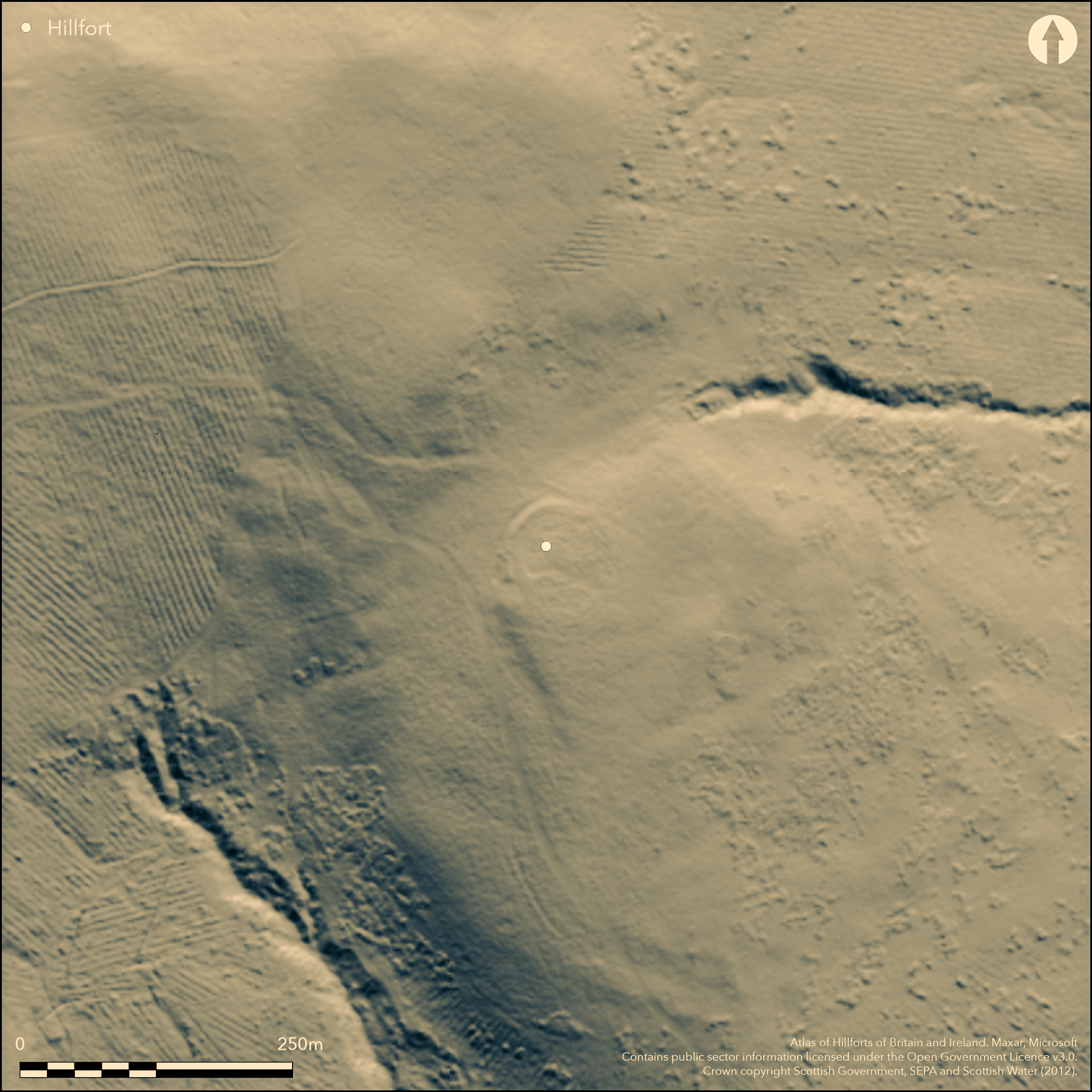
LiDAR 1m DTM Hillshade
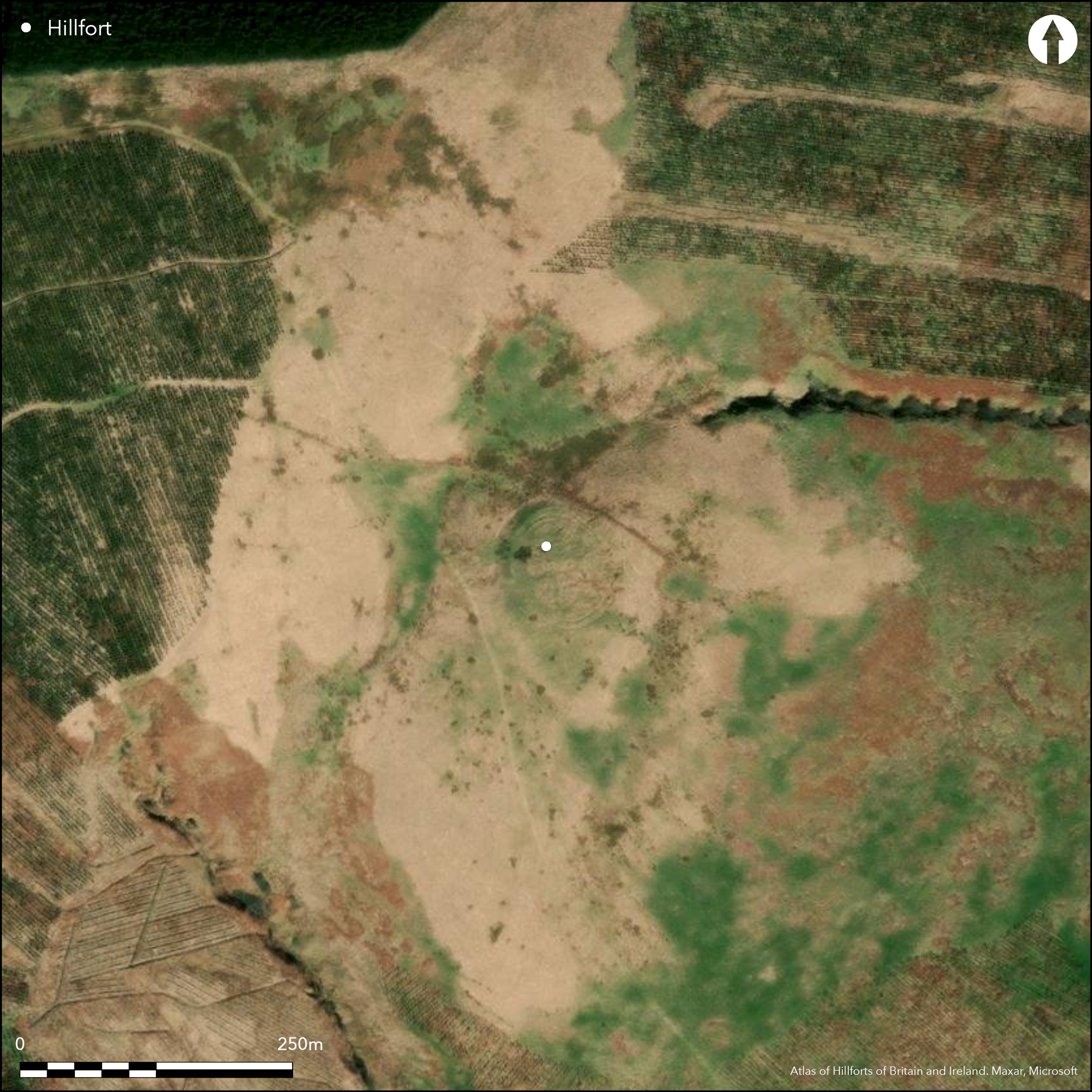
Satellite Imagery
LiDAR 1m DTM Hillshade
Satellite Imagery
Scroll left/right to view further images.
HER: Dumfries & Galloway MDG8014 (None)
NMR: NY 38 SW 13 (67716)
SM: 4518
NGR: NY 3086 8418
X: 330860 Y: 584180 (OSGB36)
A complex palisaded enclosure displaying evidence of up to six phases of construction is situated on the summit of Gibb's Hill, a spur of Rashy Knowes from which it is separated on the NW by a shallow saddle. Several of these perimeters are relatively slight stockades, comprising no more than a single line of palisading, but three can be picked out from the palimpsest of intercutting palisade trenches and timber round-houses that evidently represent more substantial enclosures with some intent to provide a measure of defence. The earliest of these was a sub-oval enclosure of some 0.25ha, measuring about 60m from N to S by 53m transversely within for most of its circuit by a single palisade trench, but which has been reinforced in the NW sector facing onto the saddle by a low rampart with an external ditch; while the rampart is little more than 0.5m in height internally, externally it forms a more formidable barrier dropping up to 2m into the bottom of the shallow ditch. There was probably an entrance on the WSW, adjacent to the well-formed terminal of the rampart, and there may have been a second on the ESE, which was the position of the entrance in the subsequent phases, two of which were provided with pairs of concentric palisade trenches forming enclosures on slightly different axes. The earlier of these is an enclosure of 0.18ha, measuring 57m from NW to SE by 42m transversely within trenches between 1.5m and 3m apart, while the later is of 0.12ha and measures 45m from NNW to SSE by 31m transversely within close-set trenches about 2m apart. The entrances of both are on the same ESE axis, with a worn hollow running up between the hairpin terminals into the interior. The better preserved of the round houses, which have floors levelled into the slope and traces of a ring-grooves and external banks, are probably the latest and are set in a contiguous row on the W, but there are fragments of grooves and shallow ring-ditches throughout the rest of the interior, and there are also three in the saddle on the W, one of which appears to cut through the counterscarp of the ditch accompanying the rampart.
Citizen Science: ✗
Reliability of Data: Confirmed
Reliability of Interpretation: Confirmed
X: -343573 Y: 7390476 (EPSG: 3857)
Longitude: -3.0863649191320093 Latitude: 55.14714334997284 (EPSG:4326)
Country: Scotland
Current County or Unitary Authority: Dumfries & Galloway
Historic County: Dumfriesshire
Current Parish/Community/Council/Townland: Langholm
None
| Extant | ✓ |
| Cropmark | ✗ |
| Likely Destroyed | ✗ |
None
| Woodland | ✗ |
| Commercial Forestry Plantation | ✗ |
| Parkland | ✗ |
| Pasture (Grazing) | ✓ |
| Arable | ✗ |
| Scrub/Bracken | ✗ |
| Bare Outcrop | ✗ |
| Heather/Moorland | ✓ |
| Heath | ✗ |
| Built-up | ✗ |
| Coastal Grassland | ✗ |
| Other | ✗ |
None
| Contour Fort | ✓ |
| Partial Contour Fort | ✗ |
| Promontory Fort | ✗ |
| Hillslope Fort | ✗ |
| Level Terrain Fort | ✗ |
| Marsh Fort | ✗ |
| Multiple Enclosure Fort | ✗ |
| Hilltop | ✓ |
| Coastal Promontory | ✗ |
| Inland Promontory | ✗ |
| Valley Bottom | ✗ |
| Knoll/Hillock/Outcrop | ✗ |
| Ridge | ✗ |
| Cliff/Plateau-edge/Scarp | ✗ |
| Hillslope | ✗ |
| Lowland | ✗ |
| Spur | ✗ |
Dominant Topographic Feature: None
| North | ✗ |
| Northeast | ✗ |
| East | ✗ |
| Southeast | ✗ |
| South | ✗ |
| Southwest | ✗ |
| West | ✗ |
| Northwest | ✗ |
| Level | ✓ |
Altitude: 290.0m
N/A
In the absence of excavation, there are neither stratified artefacts nor radiocarbon dates to provide a chronology for the defences.
Reliability: D - None
| Pre 1200BC | ✗ |
| 1200BC - 800BC | ✗ |
| 800BC - 400BC | ✗ |
| 400BC - AD50 | ✗ |
| AD50 - AD400 | ✗ |
| AD400 - AD 800 | ✗ |
| Post AD800 | ✗ |
| Unknown | ✓ |
| Pre Hillfort: | Some of the timber round-houses may predate the defensive phases |
| Post Hillfort: | Long sequence of enclosures and round-houses |
First discovered during RCAHMS fieldwork in 1981, a detailed lan was drawn up in 1993 (RCAHMS 1997, 122-5, figs 116-18). It has also been photographed by the RCAHMS Aerial Survey Programme on three occasions, in 1986, 1991 and 1995. It was Scheduled 1988.
| Earthwork Survey (1981): | Discovery, sketch-plan and description by RCAHMS |
| Other (1988): | Scheduled |
| Earthwork Survey (1993): | Plan and description (RCAHMS 1997, 122-5, figs 116-18; RCAHMS DC32349 & SC1346164; DC 32202 & SC382002) |
Multiple fragments of timber round-houses
None
| None | ✓ |
| Spring | ✗ |
| Stream | ✗ |
| Pool | ✗ |
| Flush | ✗ |
| Well | ✗ |
| Other | ✗ |
Ring-grooves. Ring-ditch houses
| No Known Features | ✗ |
| Round Stone Structures | ✗ |
| Rectangular Stone Structures | ✗ |
| Curvilinear Platforms | ✓ |
| Other Roundhouse Evidence | ✓ |
| Pits | ✗ |
| Quarry Hollows | ✗ |
| Other | ✗ |
None
| No Known Excavation | ✓ |
| Pits | ✗ |
| Postholes | ✗ |
| Roundhouses | ✗ |
| Rectangular Structures | ✗ |
| Roads/Tracks | ✗ |
| Quarry Hollows | ✗ |
| Other | ✗ |
| Nothing Found | ✗ |
None
| No Known Geophysics | ✓ |
| Pits | ✗ |
| Roundhouses | ✗ |
| Rectangular Structures | ✗ |
| Roads/Tracks | ✗ |
| Quarry Hollows | ✗ |
| Other | ✗ |
| Nothing Found | ✗ |
None
| No Known Finds | ✓ |
| Pottery | ✗ |
| Metal | ✗ |
| Metalworking | ✗ |
| Human Bones | ✗ |
| Animal Bones | ✗ |
| Lithics | ✗ |
| Environmental | ✗ |
| Other | ✗ |
None
| APs Not Checked | ✗ |
| None | ✗ |
| Roundhouses | ✓ |
| Rectangular Structures | ✗ |
| Pits | ✗ |
| Postholes | ✗ |
| Roads/Tracks | ✗ |
| Other | ✗ |
See main summary
| 2: | None |
| 2: | None |
Guard Chambers: ✗
Chevaux de Frise: ✗
| 1. Oblique (East): | Probably staggered palisade terminals in the 1st phase to create an oblique approach exposing the left side |
| 2. Simple Gap (West): | None |
Palisade trenches with a rampart and ditch in one quadrant
| Area 1: | 0.25ha. |
| Total: | 0.25ha. |
Total Footprint Area: 0.32ha.
None
| ✓ | Palisade trenches intersect |
| ✓ | Earliest phase only and mainly represented by a palisade trench |
| NE Quadrant: | 1 |
| SE Quadrant: | 1 |
| SW Quadrant: | 1 |
| NW Quadrant: | 1 |
| Total: | 1 |
| Partial Univallate | ✗ |
| Univallate | ✓ |
| Partial Bivallate | ✗ |
| Bivallate | ✗ |
| Partial Multivallate | ✗ |
| Multivallate | ✗ |
| Unknown | ✗ |
| Partial Univallate | ✗ |
| Univallate | ✗ |
| Partial Bivallate | ✗ |
| Bivallate | ✗ |
| Partial Multivallate | ✗ |
| Multivallate | ✗ |
None
| None | ✗ |
| Earthen Bank | ✓ |
| Stone Wall | ✗ |
| Rubble | ✗ |
| Wall-walk | ✗ |
| Evidence of Timber | ✗ |
| Vitrification | ✗ |
| Other Burning | ✗ |
| Palisade | ✓ |
| Counter Scarp Bank | ✗ |
| Berm | ✗ |
| Unfinished | ✗ |
| Other | ✗ |
None
| None | ✗ |
| Earthen Bank | ✗ |
| Stone Wall | ✗ |
| Murus Duplex | ✗ |
| Timber-framed | ✗ |
| Timber-laced | ✗ |
| Vitrification | ✗ |
| Other Burning | ✗ |
| Palisade | ✗ |
| Counter Scarp Bank | ✗ |
| Berm | ✗ |
| Unfinished | ✗ |
| No Known Excavation | ✓ |
| Other | ✗ |
| ✗ | None |
| ✓ | in one quadrant |
Number of Ditches: 1
| ✗ | None |
RCAHMS (1997) Eastern Dumfriesshire: an archaeological landscape. HMSO: Edinburgh
Atlas of Hillforts:
Wikidata:
This work is licensed under CC BY-SA 4.0

 and should be cited as:
Lock, Gary and Ralston, Ian. 2024. Atlas of Hillforts of Britain and Ireland. Available at: https://hillforts.arch.ox.ac.uk
Document Version 1.1