Satellite Imagery
Satellite Imagery
HER: The West of Scotland Archaeology Service 5335 (None)
NMR: NS 17 SE 4 (40757)
SM: None
NGR: NS 1220 7023
X: 212200 Y: 670230 (OSGB36)
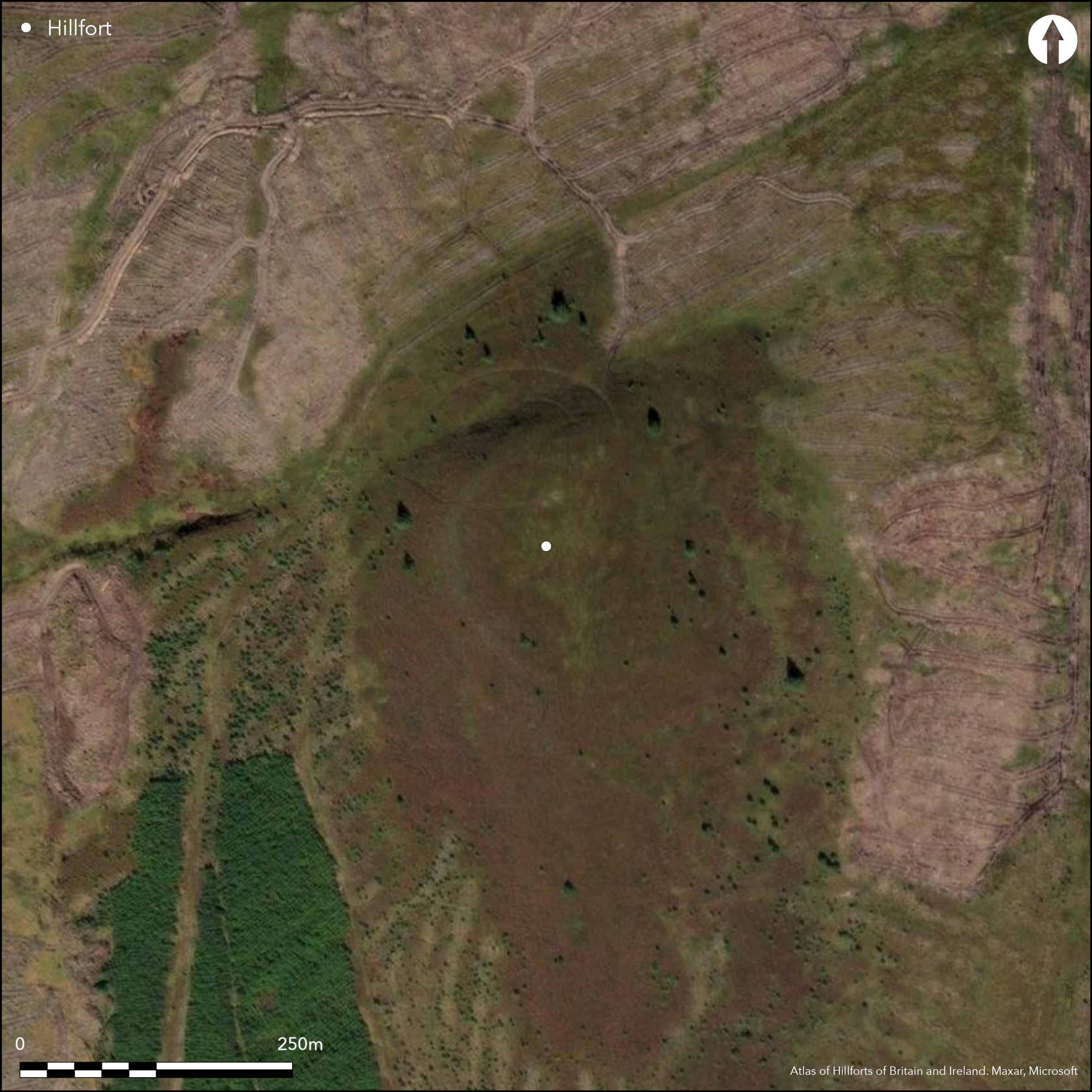
Marked on an estate plan of 1819 as 'Old Camp' (Name Book, Argyll, No.4, p 93 ), this attribution was carried onto the 1st edition OS 25-inch map (Argyll and Bute 1869, sheet 194.8), by which time the whole area had been planted with coniferous woodland. Subsequent OS and RCAHMS investigators, however, have not located any evidence of a fortification on this prominent and commanding hilltop, omitting it from more recent maps and the RCAHMS County Inventory for Argyll. Nevertheless, Several local archaeological groups have also visited the site and describe traces of a stony bank spread some 2.8m in thickness and enclosing an oval area on the summit measuring 103m from NW to SE by 70m transversely (0.55ha) (Rennie 1995); in addition, several lines of stones have been observed in the deep heather (Dorren, Garner and Henry 2001), but a visit in the spring of 2015 by S Halliday could find no convincing evidence of a fortification occupying the summit of this hill, which forms a spectacular vantage point at the bottom of the Cowal peninsular overlooking the inner end of the Firth of Clyde.
Citizen Science: ✗
Reliability of Data: Irreconciled issues
Reliability of Interpretation: Irreconciled issues
X: -557107 Y: 7536256 (EPSG: 3857)
Longitude: -5.004579143598315 Latitude: 55.88852628675153 (EPSG:4326)
Country: Scotland
Current County or Unitary Authority: Argyll & Bute
Historic County: Argyll
Current Parish/Community/Council/Townland: Dunoon And Kilmun
Status uncertain
| Extant | ✗ |
| Cropmark | ✗ |
| Likely Destroyed | ✓ |
Been under woodland
| Woodland | ✗ |
| Commercial Forestry Plantation | ✗ |
| Parkland | ✗ |
| Pasture (Grazing) | ✗ |
| Arable | ✗ |
| Scrub/Bracken | ✗ |
| Bare Outcrop | ✗ |
| Heather/Moorland | ✓ |
| Heath | ✗ |
| Built-up | ✗ |
| Coastal Grassland | ✗ |
| Other | ✗ |
None
| Contour Fort | ✓ |
| Partial Contour Fort | ✗ |
| Promontory Fort | ✗ |
| Hillslope Fort | ✗ |
| Level Terrain Fort | ✗ |
| Marsh Fort | ✗ |
| Multiple Enclosure Fort | ✗ |
| Hilltop | ✓ |
| Coastal Promontory | ✗ |
| Inland Promontory | ✗ |
| Valley Bottom | ✗ |
| Knoll/Hillock/Outcrop | ✗ |
| Ridge | ✗ |
| Cliff/Plateau-edge/Scarp | ✗ |
| Hillslope | ✗ |
| Lowland | ✗ |
| Spur | ✗ |
Dominant Topographic Feature: None
| North | ✗ |
| Northeast | ✗ |
| East | ✗ |
| Southeast | ✗ |
| South | ✗ |
| Southwest | ✗ |
| West | ✗ |
| Northwest | ✗ |
| Level | ✓ |
Altitude: 340.0m
N/A
Requires excavation to demonstrate whether this hilltop has ever been enclosed
Reliability: D - None
| Pre 1200BC | ✗ |
| 1200BC - 800BC | ✗ |
| 800BC - 400BC | ✗ |
| 400BC - AD50 | ✗ |
| AD50 - AD400 | ✗ |
| AD400 - AD 800 | ✗ |
| Post AD800 | ✗ |
| Unknown | ✓ |
| Pre Hillfort: | None |
| Post Hillfort: | None |
First annotated on an estate plan of 1819 (Name Book, Argyll, No.4, p 93), it was subsequently annotated on the 1st edition OS 25-inch map (Argyll and Bute 1869, sheet 194.8). The OS visited in 1973, and RCAHMS in the 1980s. Local groups visited in 1994 (Rennie 1995) and 2001 (Dorren, Garner and Henry 2001)
| 1st Identified Map Depiction (1819): | Appears on an estate plan (Name Book, Argyll, No.4, p 93) |
| Other (1865): | Annotated Fort on the 1st edition OS 25-inch map (Argyll and Bute 1869, sheet 194.8) |
| Other (1973): | Visited by the OS |
| Other (1994): | Description (Rennie 1995) |
| Other (2015): | Visited by S Halliday |
Featureless
None
| None | ✓ |
| Spring | ✗ |
| Stream | ✗ |
| Pool | ✗ |
| Flush | ✗ |
| Well | ✗ |
| Other | ✗ |
None
| No Known Features | ✓ |
| Round Stone Structures | ✗ |
| Rectangular Stone Structures | ✗ |
| Curvilinear Platforms | ✗ |
| Other Roundhouse Evidence | ✗ |
| Pits | ✗ |
| Quarry Hollows | ✗ |
| Other | ✗ |
None
| No Known Excavation | ✓ |
| Pits | ✗ |
| Postholes | ✗ |
| Roundhouses | ✗ |
| Rectangular Structures | ✗ |
| Roads/Tracks | ✗ |
| Quarry Hollows | ✗ |
| Other | ✗ |
| Nothing Found | ✗ |
None
| No Known Geophysics | ✓ |
| Pits | ✗ |
| Roundhouses | ✗ |
| Rectangular Structures | ✗ |
| Roads/Tracks | ✗ |
| Quarry Hollows | ✗ |
| Other | ✗ |
| Nothing Found | ✗ |
None
| No Known Finds | ✓ |
| Pottery | ✗ |
| Metal | ✗ |
| Metalworking | ✗ |
| Human Bones | ✗ |
| Animal Bones | ✗ |
| Lithics | ✗ |
| Environmental | ✗ |
| Other | ✗ |
NO APPARENT FEATURES
| APs Not Checked | ✗ |
| None | ✓ |
| Roundhouses | ✗ |
| Rectangular Structures | ✗ |
| Pits | ✗ |
| Postholes | ✗ |
| Roads/Tracks | ✗ |
| Other | ✗ |
See main summary
| 0: | None |
| 2: | Nil |
Guard Chambers: ✗
Chevaux de Frise: ✗
Nil
| Area 1: | Noneha. |
| Total: | Noneha. |
Total Footprint Area: Noneha.
None
| ✗ | None |
| ✗ | Uncertain attribution |
| NE Quadrant: | 0 |
| SE Quadrant: | 0 |
| SW Quadrant: | 0 |
| NW Quadrant: | 0 |
| Total: | 0 |
| Partial Univallate | ✗ |
| Univallate | ✗ |
| Partial Bivallate | ✗ |
| Bivallate | ✗ |
| Partial Multivallate | ✗ |
| Multivallate | ✗ |
| Unknown | ✓ |
| Partial Univallate | ✗ |
| Univallate | ✗ |
| Partial Bivallate | ✗ |
| Bivallate | ✗ |
| Partial Multivallate | ✗ |
| Multivallate | ✗ |
Rubble claimed
| None | ✓ |
| Earthen Bank | ✗ |
| Stone Wall | ✗ |
| Rubble | ✗ |
| Wall-walk | ✗ |
| Evidence of Timber | ✗ |
| Vitrification | ✗ |
| Other Burning | ✗ |
| Palisade | ✗ |
| Counter Scarp Bank | ✗ |
| Berm | ✗ |
| Unfinished | ✗ |
| Other | ✗ |
None
| None | ✗ |
| Earthen Bank | ✗ |
| Stone Wall | ✗ |
| Murus Duplex | ✗ |
| Timber-framed | ✗ |
| Timber-laced | ✗ |
| Vitrification | ✗ |
| Other Burning | ✗ |
| Palisade | ✗ |
| Counter Scarp Bank | ✗ |
| Berm | ✗ |
| Unfinished | ✗ |
| No Known Excavation | ✓ |
| Other | ✗ |
| ✗ | None |
| ✗ | None |
Number of Ditches: None
| ✗ | None |
Dorren, Garner and Henry, D, A and N (2001) 'Buachaillean, Argyll and Bute (Dunoon and Kilmun parish), ?hillfort', Disc Exc Scot 2 (2001), 18-19 Fig. 7
Name Book, Ordnance Survey Object Name Books (6 inch and 1/2500 scale); available https://www.scotlandsplaces.gov.uk/
Paterson, M (1970) Cowal before history, (p 20)
Rennie, E B (1995) 'Buchailean Hill (Dunoon & Kilmun parish', Disc Exc Scot 1995, 61
Atlas of Hillforts:
Wikidata:
This work is licensed under CC BY-SA 4.0

 and should be cited as:
Lock, Gary and Ralston, Ian. 2024. Atlas of Hillforts of Britain and Ireland. Available at: https://hillforts.arch.ox.ac.uk
Document Version 1.1