Satellite Imagery
Satellite Imagery
HER: The West of Scotland Archaeology Service 5510 (None)
NMR: NS 21 NE 3 (40933)
SM: 5594
NGR: NS 2849 1870
X: 228493 Y: 618709 (OSGB36)
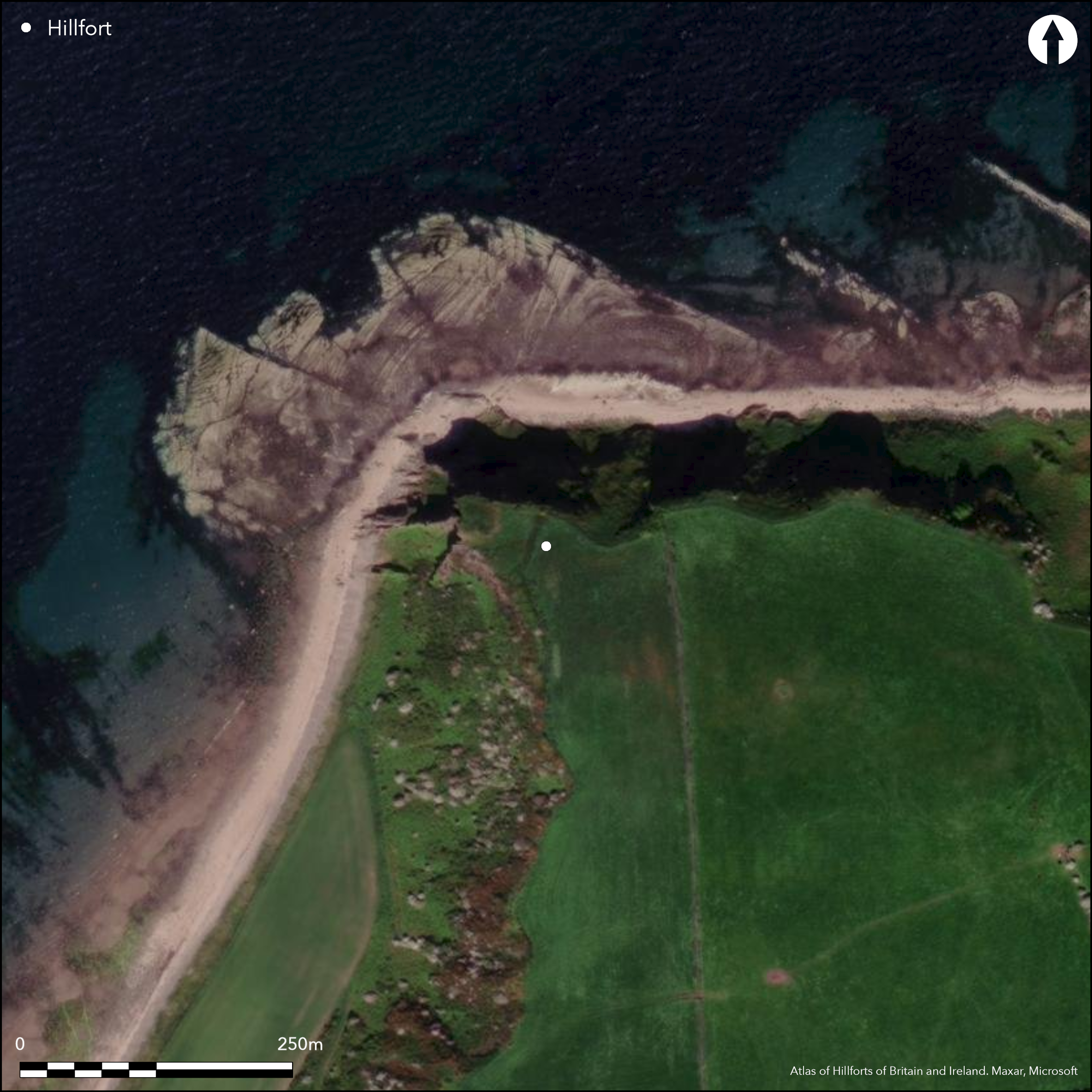
Cropmarks reveal that the promontory that forms the dramatic NW buttress of the headland known as the Heads of Ayr is cut off from the SE by two ditches set about 20m apart. The inner is about 3m broad, and the outer 4m, but it is uncertain whether they relate to a single scheme of defence. While the inner cuts off a wedge-shaped area measuring about 60m from NW to SE by a maximum of 55m transversely, about 0.18ha), the outer takes in a much bigger area of about 0.38ha. There is no clear evidence for the position of the entrance in the cropmarks. The interior is divided into two parts by a natural gully some 18m broad and 3m deep, and while the tip of the promontory to the NW is rocky and uneven, all the ground to the SE is cultivated. John Smith mistook the natural gully for a defensive earthwork (Smith 1895, 175-6), but his collection donated in 1931 to the National Museum of Antiquities of Scotland includes a small sherd of pottery from the Heads of Ayr.
Citizen Science: ✓
Reliability of Data: Confirmed
Reliability of Interpretation: Confirmed
X: -524561 Y: 7446202 (EPSG: 3857)
Longitude: -4.712207903233569 Latitude: 55.43219519195061 (EPSG:4326)
Country: Scotland
Current County or Unitary Authority: South Ayrshire
Historic County: Ayrshire
Current Parish/Community/Council/Townland: Maybole
None
| Extant | ✗ |
| Cropmark | ✓ |
| Likely Destroyed | ✗ |
None
| Woodland | ✗ |
| Commercial Forestry Plantation | ✗ |
| Parkland | ✗ |
| Pasture (Grazing) | ✓ |
| Arable | ✓ |
| Scrub/Bracken | ✗ |
| Bare Outcrop | ✗ |
| Heather/Moorland | ✗ |
| Heath | ✗ |
| Built-up | ✗ |
| Coastal Grassland | ✗ |
| Other | ✗ |
None
| Contour Fort | ✗ |
| Partial Contour Fort | ✗ |
| Promontory Fort | ✓ |
| Hillslope Fort | ✗ |
| Level Terrain Fort | ✗ |
| Marsh Fort | ✗ |
| Multiple Enclosure Fort | ✗ |
| Hilltop | ✗ |
| Coastal Promontory | ✓ |
| Inland Promontory | ✗ |
| Valley Bottom | ✗ |
| Knoll/Hillock/Outcrop | ✗ |
| Ridge | ✗ |
| Cliff/Plateau-edge/Scarp | ✗ |
| Hillslope | ✗ |
| Lowland | ✗ |
| Spur | ✗ |
Dominant Topographic Feature: None
| North | ✗ |
| Northeast | ✗ |
| East | ✗ |
| Southeast | ✗ |
| South | ✗ |
| Southwest | ✗ |
| West | ✗ |
| Northwest | ✗ |
| Level | ✓ |
Altitude: 60.0m
N/A
In the absence of excavation, there are neither stratified artefacts nor radiocarbon dates to provide a chronology for the defences.
Reliability: D - None
| Pre 1200BC | ✗ |
| 1200BC - 800BC | ✗ |
| 800BC - 400BC | ✗ |
| 400BC - AD50 | ✗ |
| AD50 - AD400 | ✗ |
| AD400 - AD 800 | ✗ |
| Post AD800 | ✗ |
| Unknown | ✓ |
| Pre Hillfort: | None |
| Post Hillfort: | Ploughed flat |
Identified by John Smith in the mistaken belief that the natural gully that isolates the tip of the headland was a ditch (Smith 1895, 175-6), it was dismissed by RCAHMS in 1954, and by the OS in 1955 and 1967. The ditches of the fort were first recorded by aerial photography carried out by W S Hanson, and it was revisited by RCAHMS in 1985. It was Scheduled in 1993.
| 1st Identified Written Reference (1895): | Description (Smith 1895, 175-6) |
| Other (1954): | Description and dismissal during RCAHMS Survey of Marginal Lands |
| Other (1955): | Visited by the OS and dismissed |
| Other (1967): | Visited by the OS and dismissed |
| Other (1983): | Discovered by W H Hanson (copies of photographs in RCAHMS) |
| Other (1985): | Description by RCAHMS |
| Other (1993): | Scheduled |
Featureless
None
| None | ✓ |
| Spring | ✗ |
| Stream | ✗ |
| Pool | ✗ |
| Flush | ✗ |
| Well | ✗ |
| Other | ✗ |
None
| No Known Features | ✓ |
| Round Stone Structures | ✗ |
| Rectangular Stone Structures | ✗ |
| Curvilinear Platforms | ✗ |
| Other Roundhouse Evidence | ✗ |
| Pits | ✗ |
| Quarry Hollows | ✗ |
| Other | ✗ |
None
| No Known Excavation | ✓ |
| Pits | ✗ |
| Postholes | ✗ |
| Roundhouses | ✗ |
| Rectangular Structures | ✗ |
| Roads/Tracks | ✗ |
| Quarry Hollows | ✗ |
| Other | ✗ |
| Nothing Found | ✗ |
None
| No Known Geophysics | ✓ |
| Pits | ✗ |
| Roundhouses | ✗ |
| Rectangular Structures | ✗ |
| Roads/Tracks | ✗ |
| Quarry Hollows | ✗ |
| Other | ✗ |
| Nothing Found | ✗ |
None
| No Known Finds | ✓ |
| Pottery | ✗ |
| Metal | ✗ |
| Metalworking | ✗ |
| Human Bones | ✗ |
| Animal Bones | ✗ |
| Lithics | ✗ |
| Environmental | ✗ |
| Other | ✗ |
NO APPARENT FEATURES
| APs Not Checked | ✓ |
| None | ✗ |
| Roundhouses | ✗ |
| Rectangular Structures | ✗ |
| Pits | ✗ |
| Postholes | ✗ |
| Roads/Tracks | ✗ |
| Other | ✗ |
None known
| 0: | Ploughed flat |
| 2: | None recorded |
Guard Chambers: ✗
Chevaux de Frise: ✗
Two ditches, presumably with upcast banks, cutting off the promontory from the SE
| Area 1: | 0.18ha. |
| Total: | 0.18ha. |
Total Footprint Area: 0.38ha.
None
| ✗ | None |
| ✗ | None |
| NE Quadrant: | 0 |
| SE Quadrant: | 2 |
| SW Quadrant: | 0 |
| NW Quadrant: | 0 |
| Total: | 2 |
| Partial Univallate | ✗ |
| Univallate | ✗ |
| Partial Bivallate | ✓ |
| Bivallate | ✗ |
| Partial Multivallate | ✗ |
| Multivallate | ✗ |
| Unknown | ✗ |
| Partial Univallate | ✗ |
| Univallate | ✗ |
| Partial Bivallate | ✗ |
| Bivallate | ✗ |
| Partial Multivallate | ✗ |
| Multivallate | ✗ |
None
| None | ✓ |
| Earthen Bank | ✗ |
| Stone Wall | ✗ |
| Rubble | ✗ |
| Wall-walk | ✗ |
| Evidence of Timber | ✗ |
| Vitrification | ✗ |
| Other Burning | ✗ |
| Palisade | ✗ |
| Counter Scarp Bank | ✗ |
| Berm | ✗ |
| Unfinished | ✗ |
| Other | ✗ |
None
| None | ✗ |
| Earthen Bank | ✗ |
| Stone Wall | ✗ |
| Murus Duplex | ✗ |
| Timber-framed | ✗ |
| Timber-laced | ✗ |
| Vitrification | ✗ |
| Other Burning | ✗ |
| Palisade | ✗ |
| Counter Scarp Bank | ✗ |
| Berm | ✗ |
| Unfinished | ✗ |
| No Known Excavation | ✓ |
| Other | ✗ |
| ✗ | None |
| ✓ | None |
Number of Ditches: 2
| ✗ | None |
Smith, J (1895) Prehistoric man in Ayrshire. London
Atlas of Hillforts:
Wikidata:
This work is licensed under CC BY-SA 4.0

 and should be cited as:
Lock, Gary and Ralston, Ian. 2024. Atlas of Hillforts of Britain and Ireland. Available at: https://hillforts.arch.ox.ac.uk
Document Version 1.1