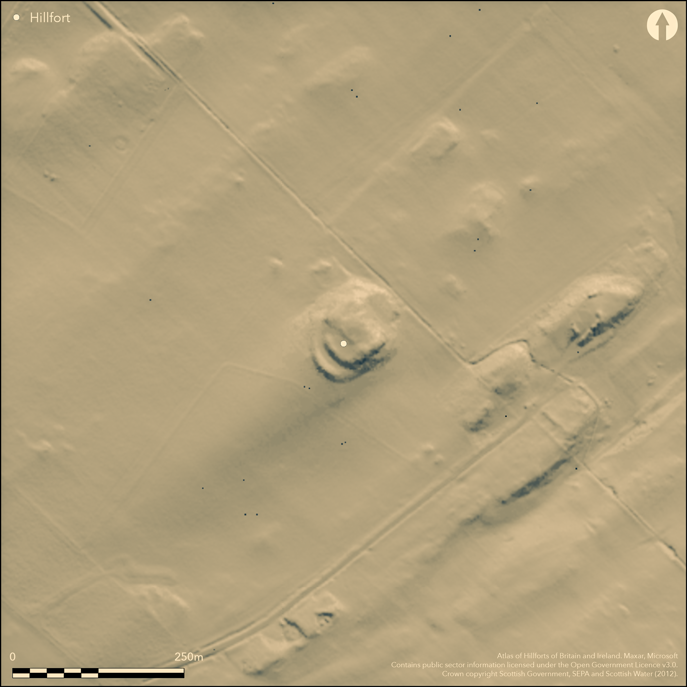
LiDAR 1m DTM Hillshade
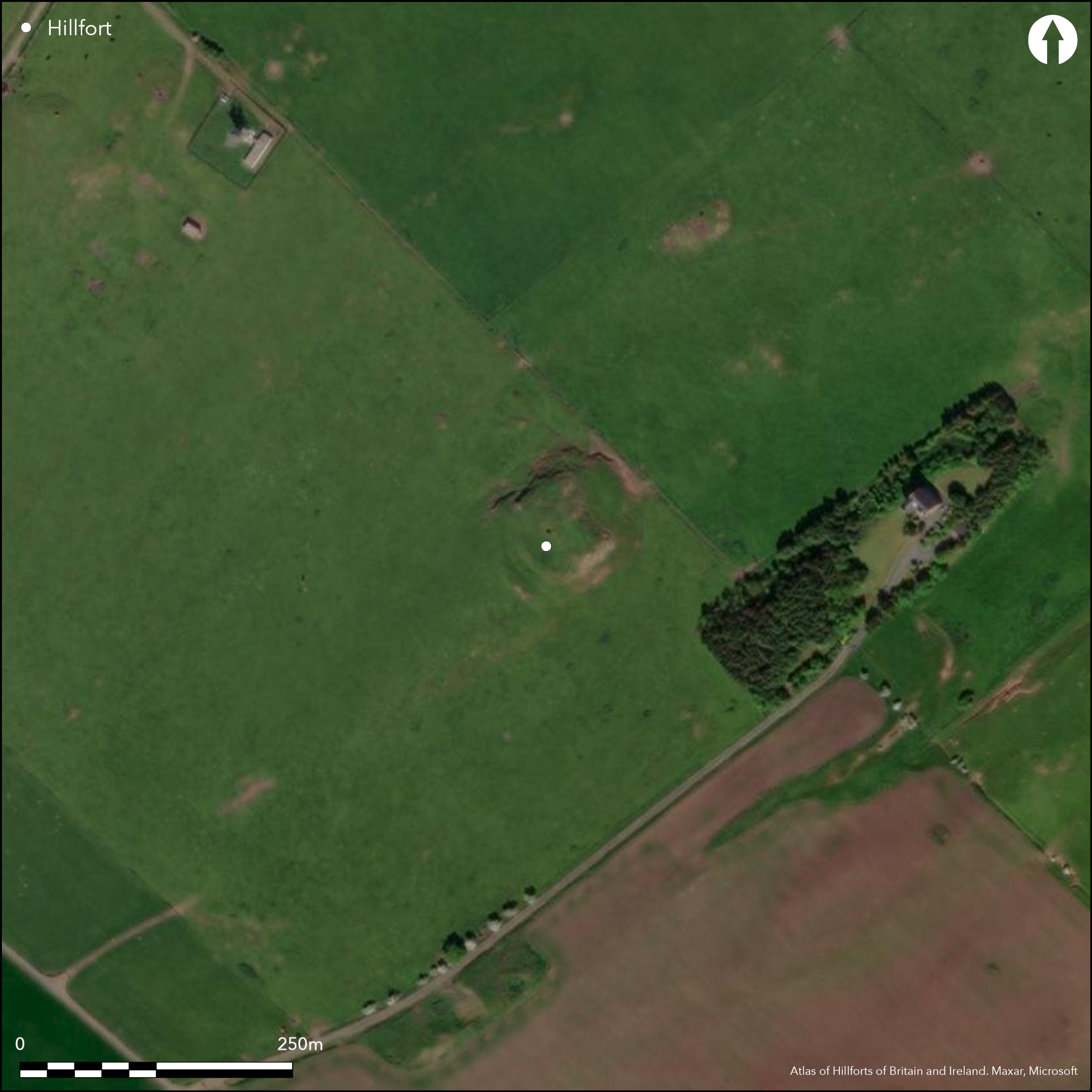
Satellite Imagery
LiDAR 1m DTM Hillshade
Satellite Imagery
Scroll left/right to view further images.
HER: The West of Scotland Archaeology Service 5513 (None)
NMR: NS 21 NE 6 (40936)
SM: 4602
NGR: NS 2700 1635
X: 227000 Y: 616350 (OSGB36)
This small fortification is situated on a rocky hillock 160m W of Dunduff Castle. The defences comprise twin ramparts and a medial ditch, but these are only visible on the SW flank of the hillock and as a result of quarrying at the NE end it is not known whether they once formed a complete circuit. Nevertheless, the inner and outer ramparts on the SW measure up to 4.7m and 7.9m in thickness respectively by 1m and 1.3m in height, and the ditch is 9.2m in breadth by 0.9m in depth. A gap between the defences and the scarp forming the NW flank of the knoll probably marks the entrance. The interior presently measures 43m from NW to SE by 28m transversely but at least 10m of the summit area has probably been removed from this latter dimension by the quarry, giving an original internal area of about 0.1ha.
Citizen Science: ✓
Reliability of Data: Confirmed
Reliability of Interpretation: Confirmed
X: -527021 Y: 7441946 (EPSG: 3857)
Longitude: -4.734310544760809 Latitude: 55.41049703691414 (EPSG:4326)
Country: Scotland
Current County or Unitary Authority: South Ayrshire
Historic County: Ayrshire
Current Parish/Community/Council/Townland: Maybole
None
| Extant | ✓ |
| Cropmark | ✗ |
| Likely Destroyed | ✗ |
None
| Woodland | ✗ |
| Commercial Forestry Plantation | ✗ |
| Parkland | ✗ |
| Pasture (Grazing) | ✓ |
| Arable | ✗ |
| Scrub/Bracken | ✗ |
| Bare Outcrop | ✗ |
| Heather/Moorland | ✗ |
| Heath | ✗ |
| Built-up | ✗ |
| Coastal Grassland | ✗ |
| Other | ✗ |
None
| Contour Fort | ✓ |
| Partial Contour Fort | ✗ |
| Promontory Fort | ✗ |
| Hillslope Fort | ✗ |
| Level Terrain Fort | ✗ |
| Marsh Fort | ✗ |
| Multiple Enclosure Fort | ✗ |
| Hilltop | ✗ |
| Coastal Promontory | ✗ |
| Inland Promontory | ✗ |
| Valley Bottom | ✗ |
| Knoll/Hillock/Outcrop | ✓ |
| Ridge | ✗ |
| Cliff/Plateau-edge/Scarp | ✗ |
| Hillslope | ✗ |
| Lowland | ✗ |
| Spur | ✗ |
Dominant Topographic Feature: None
| North | ✗ |
| Northeast | ✗ |
| East | ✗ |
| Southeast | ✗ |
| South | ✗ |
| Southwest | ✗ |
| West | ✗ |
| Northwest | ✗ |
| Level | ✓ |
Altitude: 135.0m
N/A
In the absence of excavation, there are neither stratified artefacts nor radiocarbon dates to provide a chronology for the defences.
Reliability: D - None
| Pre 1200BC | ✗ |
| 1200BC - 800BC | ✗ |
| 800BC - 400BC | ✗ |
| 400BC - AD50 | ✗ |
| AD50 - AD400 | ✗ |
| AD400 - AD 800 | ✗ |
| Post AD800 | ✗ |
| Unknown | ✓ |
| Pre Hillfort: | None |
| Post Hillfort: | Quarried and probably ploughed internally |
First noted in 1837 (NSA 5, Ayrshire, 365), curiously it does not appear on either the 1st or 2nd editions of the OS 25-inch map, other than as a small patch of rough ground (Ayrshire 1859, sheet 38.7; 1896, sheet 38.7). It was sketch-planned and by John Smith in the early 1890s, possibly before it was quarried as his paced measurements of the interior are 52 by 37 respectively (Smith 1895, 176-7, fig 253). It was visited by RCAHMS in 1942 as part of the wartime Emergency Surveys and planned during the Survey of Marginal Lands in 1955. The OS first surveyed visited it in 1955, surveying it at 1:2500 in 1967, and revising the depiction in 1977. RCAHMS revisited in 1985. It was Scheduled 1989. in the early 1970s the earthwork may have been visited by Eric Talbot, who suggested that it might be a medieval ringwork, probably on account of its proximity to the castellated late 16th- or early 17th-century mansion nearby (Talbot 1975, 56).
| 1st Identified Written Reference (1837): | Noted (NSA 5, Ayrshire, 365) |
| Earthwork Survey (1895): | Sketch-plan and description (Smith 1895, 176-7, fig 253) |
| Other (1942): | Description by Angus Graham and Gordon Childe during RCAHMS wartime Emergency Surveys |
| Earthwork Survey (1955): | RCAHMS AYD 11/1-2, DP147608 & DP147613 |
| Other (1955): | Surveyed at 1:2500 by the OS |
| Other (1967): | Surveyed at 1:2500 by the OS |
| Other (1977): | Revised at 1:2500 by the OS |
| Other (1985): | Description by RCAHMS |
| Other (1989): | Scheduled |
Featureless
None
| None | ✓ |
| Spring | ✗ |
| Stream | ✗ |
| Pool | ✗ |
| Flush | ✗ |
| Well | ✗ |
| Other | ✗ |
None
| No Known Features | ✓ |
| Round Stone Structures | ✗ |
| Rectangular Stone Structures | ✗ |
| Curvilinear Platforms | ✗ |
| Other Roundhouse Evidence | ✗ |
| Pits | ✗ |
| Quarry Hollows | ✗ |
| Other | ✗ |
None
| No Known Excavation | ✓ |
| Pits | ✗ |
| Postholes | ✗ |
| Roundhouses | ✗ |
| Rectangular Structures | ✗ |
| Roads/Tracks | ✗ |
| Quarry Hollows | ✗ |
| Other | ✗ |
| Nothing Found | ✗ |
None
| No Known Geophysics | ✓ |
| Pits | ✗ |
| Roundhouses | ✗ |
| Rectangular Structures | ✗ |
| Roads/Tracks | ✗ |
| Quarry Hollows | ✗ |
| Other | ✗ |
| Nothing Found | ✗ |
None
| No Known Finds | ✓ |
| Pottery | ✗ |
| Metal | ✗ |
| Metalworking | ✗ |
| Human Bones | ✗ |
| Animal Bones | ✗ |
| Lithics | ✗ |
| Environmental | ✗ |
| Other | ✗ |
NO APPARENT FEATURES
| APs Not Checked | ✗ |
| None | ✓ |
| Roundhouses | ✗ |
| Rectangular Structures | ✗ |
| Pits | ✗ |
| Postholes | ✗ |
| Roads/Tracks | ✗ |
| Other | ✗ |
See main summary
| 1: | Extensively quarried in some sectors |
| 2: | None |
Guard Chambers: ✗
Chevaux de Frise: ✗
| 1. Simple Gap (West): | None |
Twin ramparts and ditches surviving on one side
| Area 1: | 0.1ha. |
| Total: | 0.1ha. |
Total Footprint Area: Noneha.
None
| ✗ | None |
| ✗ | None |
| NE Quadrant: | 0 |
| SE Quadrant: | 0 |
| SW Quadrant: | 2 |
| NW Quadrant: | 1 |
| Total: | 2 |
| Partial Univallate | ✓ |
| Univallate | ✗ |
| Partial Bivallate | ✓ |
| Bivallate | ✗ |
| Partial Multivallate | ✗ |
| Multivallate | ✗ |
| Unknown | ✗ |
| Partial Univallate | ✗ |
| Univallate | ✗ |
| Partial Bivallate | ✗ |
| Bivallate | ✗ |
| Partial Multivallate | ✗ |
| Multivallate | ✗ |
None
| None | ✗ |
| Earthen Bank | ✓ |
| Stone Wall | ✗ |
| Rubble | ✗ |
| Wall-walk | ✗ |
| Evidence of Timber | ✗ |
| Vitrification | ✗ |
| Other Burning | ✗ |
| Palisade | ✗ |
| Counter Scarp Bank | ✗ |
| Berm | ✗ |
| Unfinished | ✗ |
| Other | ✗ |
None
| None | ✗ |
| Earthen Bank | ✗ |
| Stone Wall | ✗ |
| Murus Duplex | ✗ |
| Timber-framed | ✗ |
| Timber-laced | ✗ |
| Vitrification | ✗ |
| Other Burning | ✗ |
| Palisade | ✗ |
| Counter Scarp Bank | ✗ |
| Berm | ✗ |
| Unfinished | ✗ |
| No Known Excavation | ✓ |
| Other | ✗ |
| ✗ | None |
| ✓ | None |
Number of Ditches: 1
| ✗ | None |
NSA (1834-1845) The new statistical account of Scotland by the ministers of the respective parishes under the superintendence of a committee of the society for the benefit of the sons and daughters of the clergy, 15v Edinburgh
Smith, J (1895) Prehistoric man in Ayrshire. London
Talbot, E (1975) 'Early Scottish castles of earth and timber - recent field-work and excavation'. Scot Archaeol Forum 6 (1975),
Atlas of Hillforts:
Wikidata:
This work is licensed under CC BY-SA 4.0

 and should be cited as:
Lock, Gary and Ralston, Ian. 2024. Atlas of Hillforts of Britain and Ireland. Available at: https://hillforts.arch.ox.ac.uk
Document Version 1.1