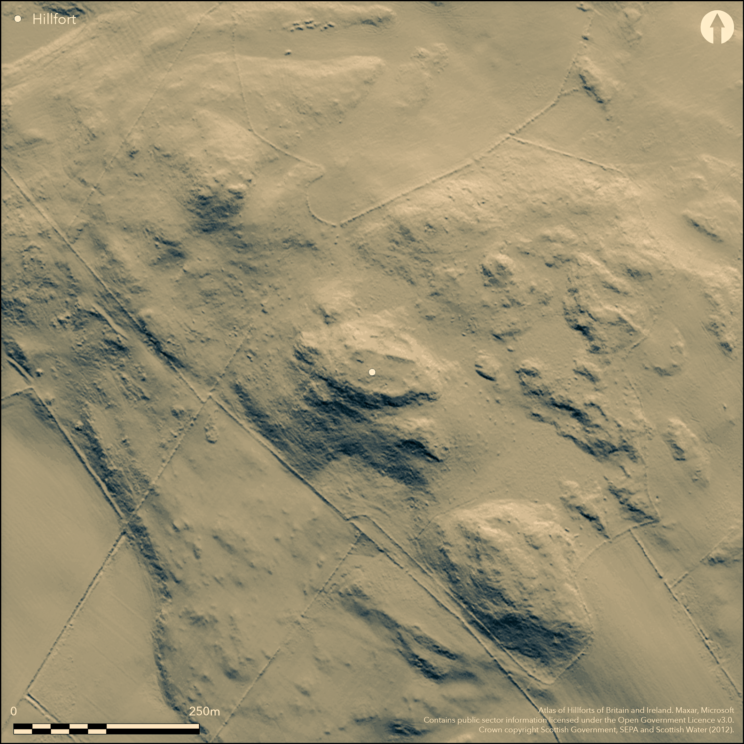
LiDAR 1m DTM Hillshade
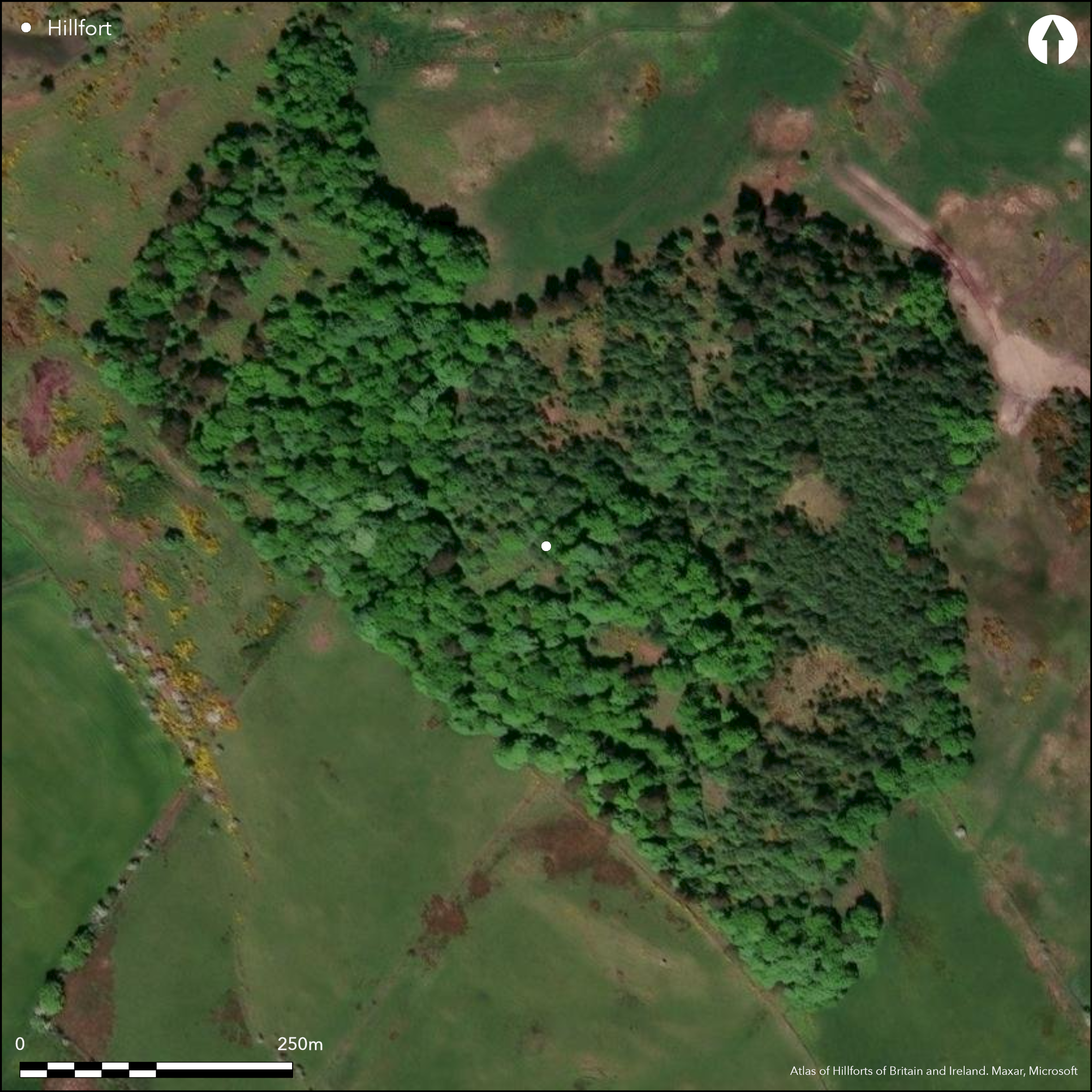
Satellite Imagery
LiDAR 1m DTM Hillshade
Satellite Imagery
Scroll left/right to view further images.
HER: Inverclyde Council (No accessible HER) 1C/026 (None)
NMR: NS 37 SW 8 (42453)
SM: 4379
NGR: NS 3443 7185
X: 234430 Y: 671850 (OSGB36)
This fort occupies one of several hillocks in Craigmarloch Wood, with steep rocky slopes protecting its western flank and shallow gullies isolating it on the NNE and SSW. Subrectangular on plan, the interior measures about 49m from ESE to WNW by 26m transversely (0.11ha) within a wall reduced to a mound of rubble 3.5m in thickness by 1m in height. Extensive vitrifaction can be seen to either side of a narrow entrance on the WNW, and a broader gap on the ESE may indicate the position of a second, though this may equally be a more recent break. On the NNW side of the fort there is also what appears to be an annexe. This is shown on a plan drawn up by RCAHMS in 1954 as a D-shaped enclosure dropping down the slope to the N and measuring about 40m from ESE to WNW along the chord formed by the fort wall by 18m transversely within a wall reduced to a mound of rubble some 2m in thickness, but a later rendering of the remains by Helen Nisbet, prepared in the course of her excavations 1963-5, shows it pursuing a different line on the NW, swinging round the WNW end of the fort, with a clear implication that it forms the plinth she observed beneath the wall of the fort on the S (Nisbet 1996, 44, fig 2). If this is indeed the case, it represents the remains of an earlier enclosure of some 0.25ha, with an entrance on the NE. Another length of wall on the S side of the shallow gully flanking the southern side of the hillock is not so easily explicable as the line of an earlier perimeter and may indicate the presence of an annexe, albeit that the greater part of its interior lies on the boggy floor of the gully. The excavations concentrated on the WNW end of the fort, revealing that the fort wall, which measured about 3m in thickness over its faces, was a complex structure, with an inner kerbed core and possible evidence of both upright and longitudinal timberwork, as well as the casts of transverse beams in the vitrified masses to either side of the entrance; the entrance itself was 1.8m wide, but the facing of its sides included lumps of vitrifaction and it appears to have been reconstructed after the destruction of the timber-laced wall on a narrower design. In the third season twin palisade trenches were uncovered outside the entrance, adding a further dimension to what is evidently a complex history of occupation and construction. The palisades were thought to have been burnt and replaced on at least one occasion and are probably associated with occupation deposits predating the fort which produced a rich assemblage of coarse pottery, five fragments of iron, fragments of crucible, a mould for a decorative boss, fragments of shale bracelets and working debris, a tanged flint arrowhead and a disc of barytes.
Citizen Science: ✓
Reliability of Data: Confirmed
Reliability of Interpretation: Confirmed
X: -517698 Y: 7540763 (EPSG: 3857)
Longitude: -4.650558279694177 Latitude: 55.91122327197716 (EPSG:4326)
Country: Scotland
Current County or Unitary Authority: Inverclyde
Historic County: Renfrewshire
Current Parish/Community/Council/Townland: Kilmacolm
None
| Extant | ✓ |
| Cropmark | ✗ |
| Likely Destroyed | ✗ |
None
| Woodland | ✓ |
| Commercial Forestry Plantation | ✗ |
| Parkland | ✗ |
| Pasture (Grazing) | ✗ |
| Arable | ✗ |
| Scrub/Bracken | ✓ |
| Bare Outcrop | ✗ |
| Heather/Moorland | ✗ |
| Heath | ✗ |
| Built-up | ✗ |
| Coastal Grassland | ✗ |
| Other | ✗ |
None
| Contour Fort | ✓ |
| Partial Contour Fort | ✗ |
| Promontory Fort | ✗ |
| Hillslope Fort | ✗ |
| Level Terrain Fort | ✗ |
| Marsh Fort | ✗ |
| Multiple Enclosure Fort | ✗ |
| Hilltop | ✓ |
| Coastal Promontory | ✗ |
| Inland Promontory | ✗ |
| Valley Bottom | ✗ |
| Knoll/Hillock/Outcrop | ✗ |
| Ridge | ✗ |
| Cliff/Plateau-edge/Scarp | ✗ |
| Hillslope | ✗ |
| Lowland | ✗ |
| Spur | ✗ |
Dominant Topographic Feature: None
| North | ✗ |
| Northeast | ✗ |
| East | ✗ |
| Southeast | ✗ |
| South | ✗ |
| Southwest | ✗ |
| West | ✗ |
| Northwest | ✗ |
| Level | ✓ |
Altitude: 155.0m
N/A
Two old radiocarbon dates (MacKie 1969, 17-19)
Reliability: C - Low
| Pre 1200BC | ✗ |
| 1200BC - 800BC | ✗ |
| 800BC - 400BC | ✓ |
| 400BC - AD50 | ✓ |
| AD50 - AD400 | ✓ |
| AD400 - AD 800 | ✗ |
| Post AD800 | ✗ |
| Unknown | ✗ |
| Pre Hillfort: | None |
| Post Hillfort: | None |
Lying in woodland since about 1830, this fort was first noted by and sketch-planned in 1918 by J B Collins, but apparently forgotten to be rediscovered in 1953 by Mrs A Halifax-Crawford and Frank Newall (Nisbet 1996, 43). It was subsequently visited and planned in 1954 by RCAHMS for the Survey of Marginal Lands, and excavated 1963-5 by Helen Nisbet (Nisbet 1963; 1964; 1965; 1966; 1996), being one of the first forts in Scotland to be radiocarbon dated (Mackie 1969, 17-19). It was Scheduled in 1986.
| Earthwork Survey (1918): | Sketch-plan by H B Collins (RCAHMS REN 28/1 & E52650 & SC923367) |
| Earthwork Survey (1954): | Plan and description during RCAHMS Survey of Marginal Lands (RCAHMS DC31568 & DP149901; DC31569 & DP149900; DP148823 & REN 28/4) |
| Excavation (1963): | Nisbet 1963; 1996 |
| Excavation (1964): | Nisbet 1964; 1996 |
| Other (1964): | Surveyed at 1:2500 by the OS |
| Excavation (1965): | Nisbet 1965: 1996 |
| Other (1983): | Visit by the Hill-Fort Study Group |
Featureless
None
| None | ✓ |
| Spring | ✗ |
| Stream | ✗ |
| Pool | ✗ |
| Flush | ✗ |
| Well | ✗ |
| Other | ✗ |
None
| No Known Features | ✓ |
| Round Stone Structures | ✗ |
| Rectangular Stone Structures | ✗ |
| Curvilinear Platforms | ✗ |
| Other Roundhouse Evidence | ✗ |
| Pits | ✗ |
| Quarry Hollows | ✗ |
| Other | ✗ |
Occupation debris thought to be associated with an earlier palisade and sealed under cobbling.
| No Known Excavation | ✗ |
| Pits | ✗ |
| Postholes | ✗ |
| Roundhouses | ✗ |
| Rectangular Structures | ✗ |
| Roads/Tracks | ✗ |
| Quarry Hollows | ✗ |
| Other | ✓ |
| Nothing Found | ✗ |
None
| No Known Geophysics | ✓ |
| Pits | ✗ |
| Roundhouses | ✗ |
| Rectangular Structures | ✗ |
| Roads/Tracks | ✗ |
| Quarry Hollows | ✗ |
| Other | ✗ |
| Nothing Found | ✗ |
Coarse pottery, fragments of iron, fragments of crucible and fragments of shale bracelets, a tanged flint arrowhead and a disc of barytes, all belonging to an earlier occupation thought to be related to the earlier palisaded enclosure.
| No Known Finds | ✗ |
| Pottery | ✓ |
| Metal | ✓ |
| Metalworking | ✓ |
| Human Bones | ✗ |
| Animal Bones | ✗ |
| Lithics | ✓ |
| Environmental | ✗ |
| Other | ✗ |
NO APPARENT FEATURES; obscured by trees
| APs Not Checked | ✗ |
| None | ✓ |
| Roundhouses | ✗ |
| Rectangular Structures | ✗ |
| Pits | ✗ |
| Postholes | ✗ |
| Roads/Tracks | ✗ |
| Other | ✗ |
See main summary
| 2: | None |
| 2: | None |
Guard Chambers: ✗
Chevaux de Frise: ✗
| 1. Simple Gap (East): | Ragged gap in the wall |
| 2. Simple Gap (West): | Vitrifaction visible to either side |
Single wall with annexes off to both the N and S, but possibly representing several periods of enclosure,
| Area 1: | 0.11ha. |
| Total: | 0.11ha. |
Total Footprint Area: 0.18ha.
None
| ✓ | Revealed by excavation |
| ✓ | This does not include the annexe as an outer rampart |
| NE Quadrant: | 1 |
| SE Quadrant: | 1 |
| SW Quadrant: | 1 |
| NW Quadrant: | 1 |
| Total: | 1 |
| Partial Univallate | ✗ |
| Univallate | ✓ |
| Partial Bivallate | ✗ |
| Bivallate | ✗ |
| Partial Multivallate | ✗ |
| Multivallate | ✗ |
| Unknown | ✗ |
| Partial Univallate | ✗ |
| Univallate | ✗ |
| Partial Bivallate | ✗ |
| Bivallate | ✗ |
| Partial Multivallate | ✗ |
| Multivallate | ✗ |
None
| None | ✗ |
| Earthen Bank | ✗ |
| Stone Wall | ✓ |
| Rubble | ✗ |
| Wall-walk | ✗ |
| Evidence of Timber | ✗ |
| Vitrification | ✓ |
| Other Burning | ✗ |
| Palisade | ✗ |
| Counter Scarp Bank | ✗ |
| Berm | ✗ |
| Unfinished | ✗ |
| Other | ✗ |
None
| None | ✗ |
| Earthen Bank | ✗ |
| Stone Wall | ✓ |
| Murus Duplex | ✗ |
| Timber-framed | ✗ |
| Timber-laced | ✗ |
| Vitrification | ✓ |
| Other Burning | ✗ |
| Palisade | ✓ |
| Counter Scarp Bank | ✗ |
| Berm | ✗ |
| Unfinished | ✗ |
| No Known Excavation | ✗ |
| Other | ✗ |
| ✗ | None |
| ✗ | None |
Number of Ditches: None
| ✓ | Two subsidiary enclosures are present here, one on the N and the second on the S, though it is uncertain how the latter is attached to the fort. Excavation was not sufficiently extensive to be certain that either is directly related to the fort. |
Feachem, R W (1977) Guide to prehistoric Scotland. 2nd ed. Batsford: London (p 147-8)
MacKie, E W (1969) 'Radiocarbon dates and the Scottish Iron Age', Antiquity 43 (1969), 17-19
Nisbet, H C (1963) 'Craigmarloch Wood, Kilmacolm', Disc Exc Scot 1963, 42-3
Nisbet, H C (1964) 'Craigmarloch Wood, Kilmacolm', Disc Exc Scot 1964, 47
Nisbet, H C (1965) 'Craigmarloch Wood, Kilmacolm', Disc Exc Scot 1965, 34
Nisbet, H C (1966) 'Craigmarloch Wood, Kilmacolm', Disc Exc Scot 1966, 39
Nisbet, H 1996 'Craigmarloch hillfort, Kilmacolm'. Alexander, D (ed) Prehistoric Renfrewshire. Papers in honour of Frank Newall. 43-58
Atlas of Hillforts:
Wikidata:
This work is licensed under CC BY-SA 4.0

 and should be cited as:
Lock, Gary and Ralston, Ian. 2024. Atlas of Hillforts of Britain and Ireland. Available at: https://hillforts.arch.ox.ac.uk
Document Version 1.1