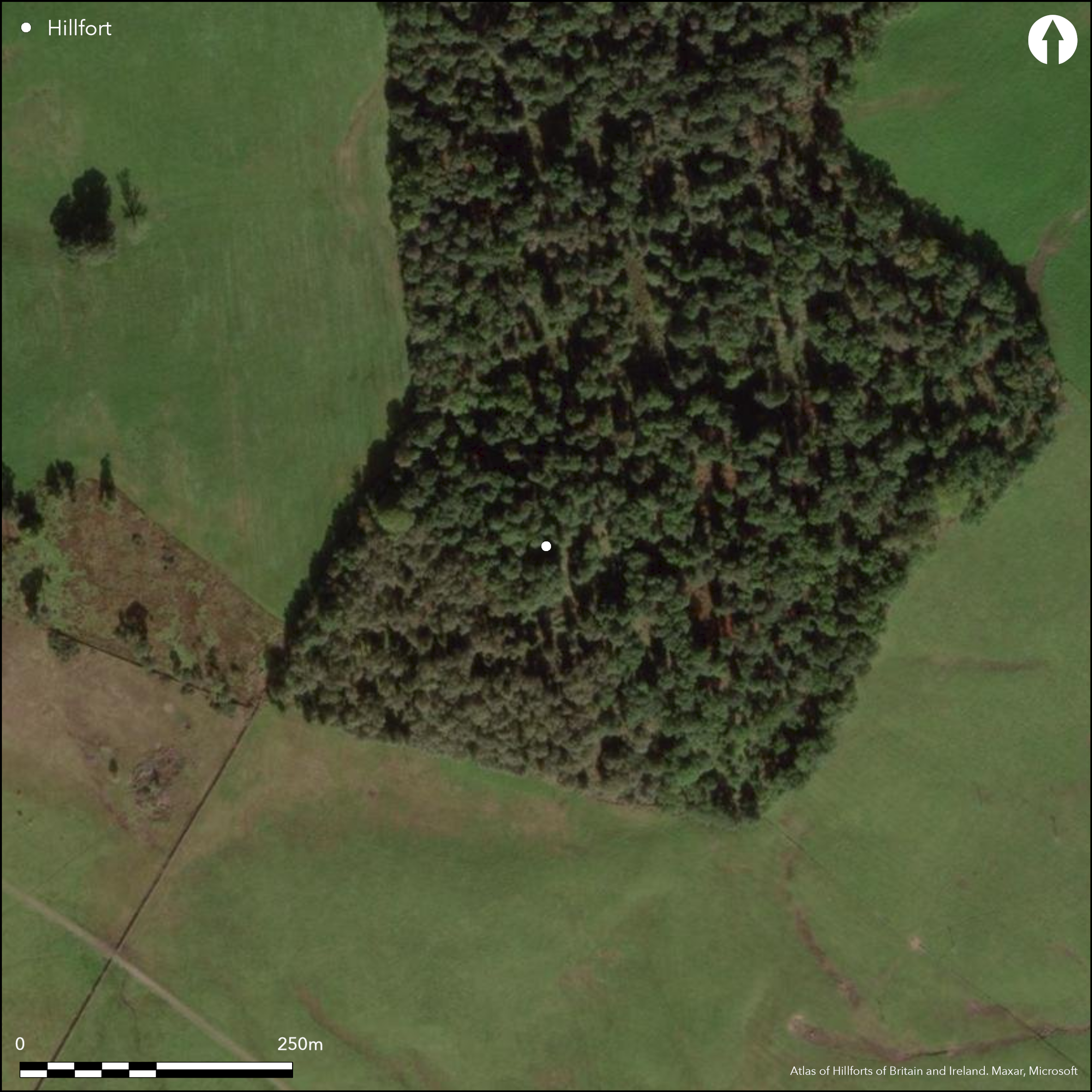
Satellite Imagery
Satellite Imagery
HER: Stirling 482.03 (None)
NMR: NS 48 SE 2 (43449)
SM: 2553
NGR: NS 4875 8490
X: 248750 Y: 684900 (OSGB36)
The remains of what may be a fortified enclosure are situated on the E end of a spur of a low hill in Knockinhaglish Wood. Oval on plan, it measures 65m from ENE to WSW by 51m transversely (0.27ha) within a rampart spread about 6m in thickness but rising little more than 0.3m in height internally. Where best preserved on the NE, however it stands about 1.8m above the bottom of a shallow external ditch up to 4.5m in breadth. A gap in the rampart and ditch on the N is relatively recent, but there are original entrances on the NE and W. The interior is now featureless, but the OS Name Book (Stirlingshire, No.9, p 102), collated about 1860, notes that 'a number of years ago when it was trenched and planted, there were raised several human bones and the foundation of an old building', which probably accounts for its appearance on the 1st edition OS 25-inch map as 'Site of Church' (Stirlingshire 1865, sheet 20.11). This is almost underpins J Guthrie Smith's belief that this was probably the site of a church of St Kessog (Smith 1893, 74), in its turn leading to its inclusion in the County Inventory for Stirlingshire (RCAHMS 1963, 164, no. 160, fig 58) as a cashel or monastic enclosure.
Citizen Science: ✓
Reliability of Data: Confirmed
Reliability of Interpretation: Confirmed
X: -493037 Y: 7565005 (EPSG: 3857)
Longitude: -4.429023945281921 Latitude: 56.033086317913565 (EPSG:4326)
Country: Scotland
Current County or Unitary Authority: Stirling
Historic County: Stirlingshire
Current Parish/Community/Council/Townland: Drymen
None
| Extant | ✓ |
| Cropmark | ✗ |
| Likely Destroyed | ✗ |
None
| Woodland | ✗ |
| Commercial Forestry Plantation | ✓ |
| Parkland | ✗ |
| Pasture (Grazing) | ✗ |
| Arable | ✗ |
| Scrub/Bracken | ✗ |
| Bare Outcrop | ✗ |
| Heather/Moorland | ✗ |
| Heath | ✗ |
| Built-up | ✗ |
| Coastal Grassland | ✗ |
| Other | ✗ |
None
| Contour Fort | ✓ |
| Partial Contour Fort | ✗ |
| Promontory Fort | ✗ |
| Hillslope Fort | ✗ |
| Level Terrain Fort | ✗ |
| Marsh Fort | ✗ |
| Multiple Enclosure Fort | ✗ |
| Hilltop | ✓ |
| Coastal Promontory | ✗ |
| Inland Promontory | ✗ |
| Valley Bottom | ✗ |
| Knoll/Hillock/Outcrop | ✗ |
| Ridge | ✗ |
| Cliff/Plateau-edge/Scarp | ✗ |
| Hillslope | ✗ |
| Lowland | ✗ |
| Spur | ✓ |
Dominant Topographic Feature: None
| North | ✗ |
| Northeast | ✗ |
| East | ✗ |
| Southeast | ✗ |
| South | ✗ |
| Southwest | ✗ |
| West | ✗ |
| Northwest | ✗ |
| Level | ✓ |
Altitude: 120.0m
N/A
In the absence of excavation, there are neither stratified artefacts nor radiocarbon dates to provide a chronology for the defences.
Reliability: D - None
| Pre 1200BC | ✗ |
| 1200BC - 800BC | ✗ |
| 800BC - 400BC | ✗ |
| 400BC - AD50 | ✗ |
| AD50 - AD400 | ✗ |
| AD400 - AD 800 | ✗ |
| Post AD800 | ✗ |
| Unknown | ✓ |
| Pre Hillfort: | None |
| Post Hillfort: | Incorporated into a plantation in the improved landscape |
Shown on the 1st edition OS 25-inch map with a cross and annotated 'Site of Church' (Stirlingshire 1865, sheet 20.11), it was surveyed by RCAHMS in 1952 (RCAHMS 1963, 164, no. 160, fig 58). The OS resurveyed at 1:2500 in 1965 and RCAHMS revisited in 1978, deciding on that occasion that there were no particularly good grounds for separating the earthwork from other Iron Age forts and settlements. It was Scheduled in 1967. In 2014 John Lumley completed a record of the site on behalf of the Hilfort Atlas Project.
| 1st Identified Map Depiction (1861): | Annotated 'Site of Church' on the 1st edition OS 25-inch map (Stirlingshire 1865, sheet 20.11) |
| Earthwork Survey (1952): | Plan and description (RCAHMS 1963, 164, no. 160, fig 58; RCAHMS STD 33/1-3; SC 1331742) |
| Other (1965): | Resurveyed at 1:2500 by the OS |
| Other (1967): | Scheduled |
| Other (1978): | Description by RCAHMS |
| Other (2014): | Visited by John Lumley on behalf of the Atlas Project |
| Other (2014): | Visited by John Lumley for the Hillfort Atlas |
Now featureless, but foundations of a bauilding and bones dug up in the 19th century
None
| None | ✓ |
| Spring | ✗ |
| Stream | ✗ |
| Pool | ✗ |
| Flush | ✗ |
| Well | ✗ |
| Other | ✗ |
None
| No Known Features | ✓ |
| Round Stone Structures | ✗ |
| Rectangular Stone Structures | ✗ |
| Curvilinear Platforms | ✗ |
| Other Roundhouse Evidence | ✗ |
| Pits | ✗ |
| Quarry Hollows | ✗ |
| Other | ✗ |
None
| No Known Excavation | ✓ |
| Pits | ✗ |
| Postholes | ✗ |
| Roundhouses | ✗ |
| Rectangular Structures | ✗ |
| Roads/Tracks | ✗ |
| Quarry Hollows | ✗ |
| Other | ✗ |
| Nothing Found | ✗ |
None
| No Known Geophysics | ✓ |
| Pits | ✗ |
| Roundhouses | ✗ |
| Rectangular Structures | ✗ |
| Roads/Tracks | ✗ |
| Quarry Hollows | ✗ |
| Other | ✗ |
| Nothing Found | ✗ |
Antiquarian discovery
| No Known Finds | ✗ |
| Pottery | ✗ |
| Metal | ✗ |
| Metalworking | ✗ |
| Human Bones | ✓ |
| Animal Bones | ✗ |
| Lithics | ✗ |
| Environmental | ✗ |
| Other | ✗ |
NO APPARENT FEATURES
| APs Not Checked | ✓ |
| None | ✗ |
| Roundhouses | ✗ |
| Rectangular Structures | ✗ |
| Pits | ✗ |
| Postholes | ✗ |
| Roads/Tracks | ✗ |
| Other | ✗ |
See main summary
| 3: | None |
| 2: | None |
Guard Chambers: ✗
Chevaux de Frise: ✗
| 1. Simple Gap (North east): | None |
| 2. Simple Gap (West): | None |
Single earthen rampart and external ditch
| Area 1: | 0.27ha. |
| Total: | 0.27ha. |
Total Footprint Area: Noneha.
None
| ✗ | None |
| ✓ | None |
| NE Quadrant: | 1 |
| SE Quadrant: | 1 |
| SW Quadrant: | 1 |
| NW Quadrant: | 1 |
| Total: | 1 |
| Partial Univallate | ✗ |
| Univallate | ✓ |
| Partial Bivallate | ✗ |
| Bivallate | ✗ |
| Partial Multivallate | ✗ |
| Multivallate | ✗ |
| Unknown | ✗ |
| Partial Univallate | ✗ |
| Univallate | ✗ |
| Partial Bivallate | ✗ |
| Bivallate | ✗ |
| Partial Multivallate | ✗ |
| Multivallate | ✗ |
None
| None | ✗ |
| Earthen Bank | ✓ |
| Stone Wall | ✗ |
| Rubble | ✗ |
| Wall-walk | ✗ |
| Evidence of Timber | ✗ |
| Vitrification | ✗ |
| Other Burning | ✗ |
| Palisade | ✗ |
| Counter Scarp Bank | ✗ |
| Berm | ✗ |
| Unfinished | ✗ |
| Other | ✗ |
None
| None | ✗ |
| Earthen Bank | ✗ |
| Stone Wall | ✗ |
| Murus Duplex | ✗ |
| Timber-framed | ✗ |
| Timber-laced | ✗ |
| Vitrification | ✗ |
| Other Burning | ✗ |
| Palisade | ✗ |
| Counter Scarp Bank | ✗ |
| Berm | ✗ |
| Unfinished | ✗ |
| No Known Excavation | ✓ |
| Other | ✗ |
| ✗ | None |
| ✓ | None |
Number of Ditches: 1
| ✗ | None |
Name Book, Ordnance Survey Object Name Books (6 inch and 1/2500 scale); available https://www.scotlandsplaces.gov.uk/
RCAHMS (1963) The Royal Commission on the Ancient and Historical Monuments of Scotland. Stirlingshire: an inventory of the ancient monuments, 2v Edinburgh
Smith, J G (1896) Strathendrick and its inhabitants from early times: an account of the parishes of Fintry, Balfron, Killearn, Drymen, Buchanan and Kilmaronock. Glasgow
Atlas of Hillforts:
Wikidata:
This work is licensed under CC BY-SA 4.0

 and should be cited as:
Lock, Gary and Ralston, Ian. 2024. Atlas of Hillforts of Britain and Ireland. Available at: https://hillforts.arch.ox.ac.uk
Document Version 1.1