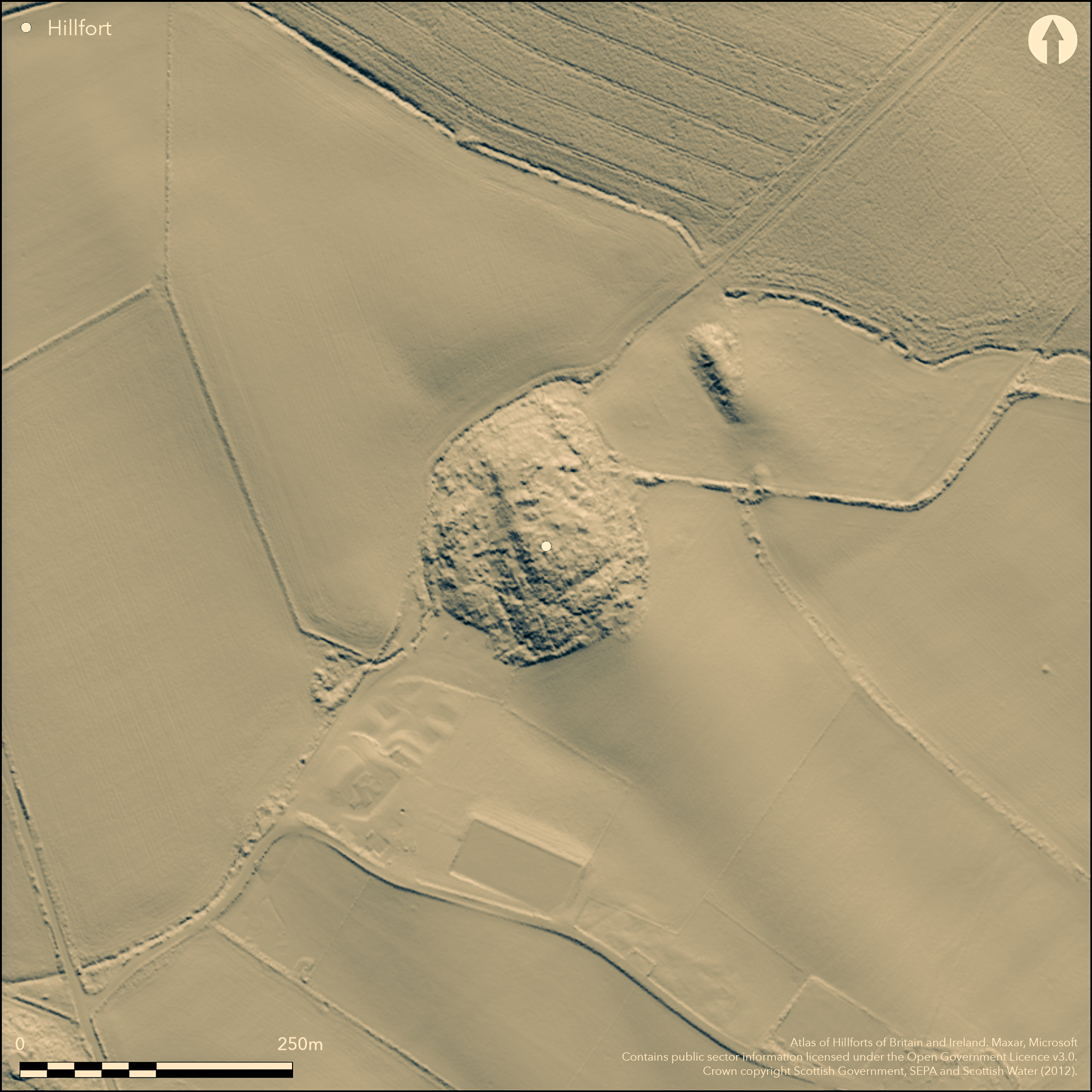
LiDAR 1m DTM Hillshade
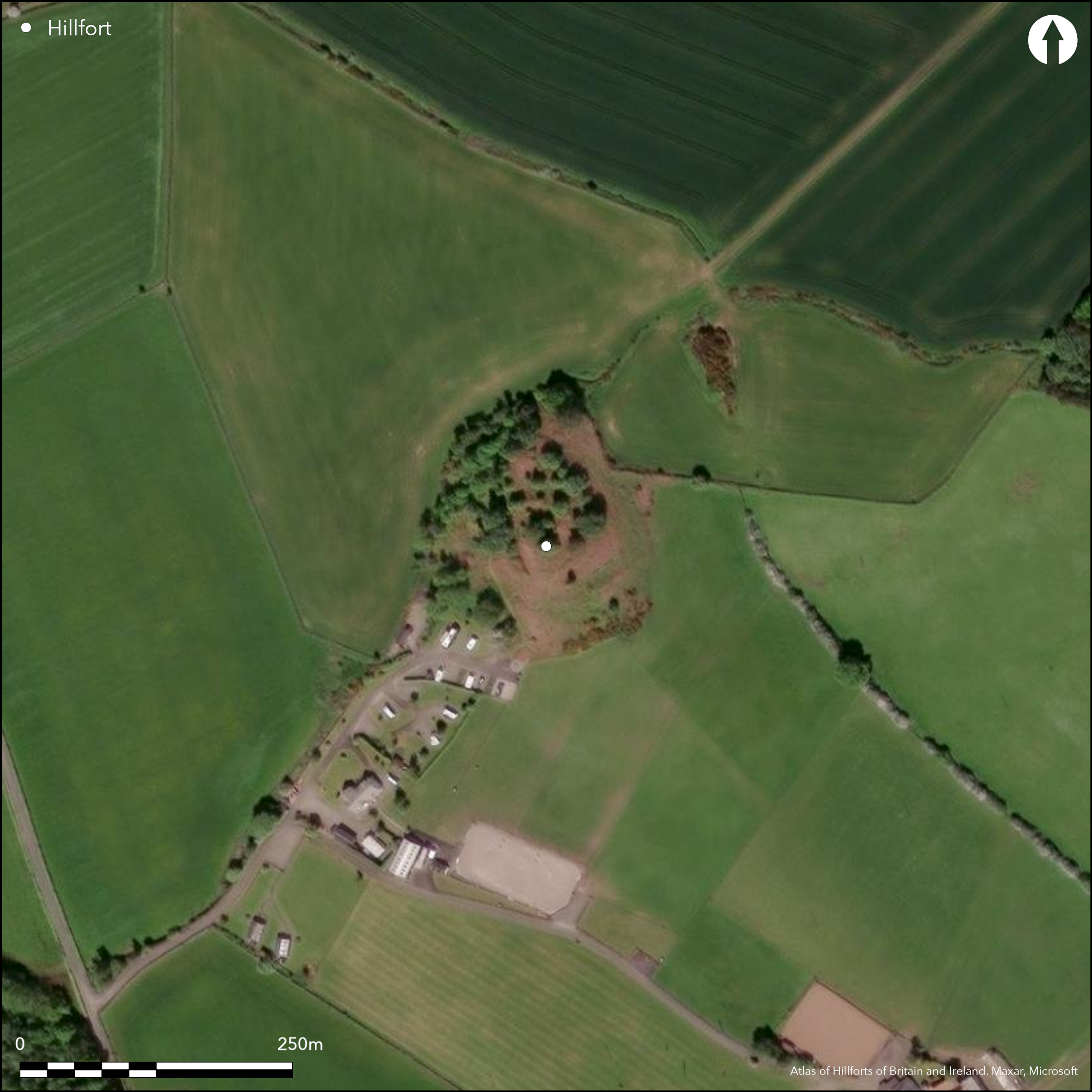
Satellite Imagery
LiDAR 1m DTM Hillshade
Satellite Imagery
Scroll left/right to view further images.
HER: Falkirk Community Trust, Falkirk Sites and Monuments Record 390 (None)
NMR: NS 88 NW 7 (46900)
SM: 1731
NGR: NS 8223 8545
X: 282230 Y: 685450 (OSGB36)
The defences of this small fortification, which is situated on the summit of a low-lying ridge NE of Langlands farm, comprises two elements: an inner walled enclosure; and an outer rampart with an external ditch. The inner enclosure, which measures about 23m in diameter within a ragged stony bank some 3.5m in thickness by 1.3m in external height and has an entrance on the S, is set roughly in the centre of the area enclosed by the outer rampart, but rather than representing some form of outwork to the inner enclosure, it is more likely that this is a fort in its own right. Oval on plan, the interior of this latter measures 44m from NW to SE by 36m transversely (0.12ha), and its rampart forms a bank up to 6m in thickness by 0.7m in internal height and 1.8m and 3m respectively above the bottom of the external ditch 5.5m in breadth that can be seen cutting across the spine of the ridge on the NW and SE quarters. There is little evidence of any defences on the crest of the escarpment forming the WSW margin of the ridge, but the entrance is probably on the S where the rampart peters out short of the edge. The interior of the inner enclosure has evidently been dug over and is almost certainly the scene of a largely unreported antiquarian excavation in the 1860s (Dundas 1866, 259-65).
Citizen Science: ✓
Reliability of Data: Confirmed
Reliability of Interpretation: Confirmed
X: -433290 Y: 7567864 (EPSG: 3857)
Longitude: -3.892312296007941 Latitude: 56.0474312349534 (EPSG:4326)
Country: Scotland
Current County or Unitary Authority: Falkirk
Historic County: Stirlingshire
Current Parish/Community/Council/Townland: Dunipace
None
| Extant | ✓ |
| Cropmark | ✗ |
| Likely Destroyed | ✗ |
None
| Woodland | ✗ |
| Commercial Forestry Plantation | ✗ |
| Parkland | ✗ |
| Pasture (Grazing) | ✗ |
| Arable | ✗ |
| Scrub/Bracken | ✓ |
| Bare Outcrop | ✗ |
| Heather/Moorland | ✗ |
| Heath | ✗ |
| Built-up | ✗ |
| Coastal Grassland | ✗ |
| Other | ✗ |
None
| Contour Fort | ✓ |
| Partial Contour Fort | ✗ |
| Promontory Fort | ✗ |
| Hillslope Fort | ✗ |
| Level Terrain Fort | ✗ |
| Marsh Fort | ✗ |
| Multiple Enclosure Fort | ✗ |
| Hilltop | ✗ |
| Coastal Promontory | ✗ |
| Inland Promontory | ✗ |
| Valley Bottom | ✗ |
| Knoll/Hillock/Outcrop | ✓ |
| Ridge | ✗ |
| Cliff/Plateau-edge/Scarp | ✗ |
| Hillslope | ✗ |
| Lowland | ✗ |
| Spur | ✗ |
Dominant Topographic Feature: None
| North | ✗ |
| Northeast | ✗ |
| East | ✗ |
| Southeast | ✗ |
| South | ✗ |
| Southwest | ✗ |
| West | ✗ |
| Northwest | ✗ |
| Level | ✓ |
Altitude: 90.0m
N/A
In the absence of modern excavation, there are neither stratified artefacts nor radiocarbon dates to provide a chronology for the defences.
Reliability: D - None
| Pre 1200BC | ✗ |
| 1200BC - 800BC | ✗ |
| 800BC - 400BC | ✗ |
| 400BC - AD50 | ✗ |
| AD50 - AD400 | ✗ |
| AD400 - AD 800 | ✗ |
| Post AD800 | ✗ |
| Unknown | ✓ |
| Pre Hillfort: | None |
| Post Hillfort: | Probably the construction of the inner enclosure |
Depicted without annotation on Roy's Map (1747-55), it is later shown in 1861 as a mound on the 1st edition OS 25-inch map (Stirlingshire 1865, sheet 23.8) and annotated 'Tumulus'. It was subsequently investigated by Col Joseph Dundas in the 1860s (Dundas 1866, 265). It was Scheduled in 1949 and surveyed by RCAHMS as part of the Survey of Marginal Lands in 1954 (Feachem 1963, 157), it was included in the County Inventory for Stirlingshire (RCAHMS 1963, 72-4, no.73, fig 12). The OS revised the depiction in 1974 and RCAHMS revisited in 1977.
| 1st Identified Map Depiction (1755): | Roys Map (1747-55) |
| Other (1861): | Annotated Tumulus on the 1st edition OS 25-inch map (Stirlingshire 1865, sheet 23.8) |
| Excavation (1866): | 1860s; Col Joseph Dundas (Dundas 1866, 265) |
| Other (1949): | Scheduled |
| Earthwork Survey (1954): | Description during RCAHMS Survey of Marginal Lands (RCAHMS 1963, 72-4, no.73, fig 12; RCAHMS STD 34/1-3) |
| Other (1974): | Revised at 1:2500 by the OS |
| Other (1977): | Description by RCAHMS |
Featureless apart from the inner enclosure
None
| None | ✓ |
| Spring | ✗ |
| Stream | ✗ |
| Pool | ✗ |
| Flush | ✗ |
| Well | ✗ |
| Other | ✗ |
Large stone built enclosure or dun
| No Known Features | ✗ |
| Round Stone Structures | ✗ |
| Rectangular Stone Structures | ✗ |
| Curvilinear Platforms | ✗ |
| Other Roundhouse Evidence | ✗ |
| Pits | ✗ |
| Quarry Hollows | ✗ |
| Other | ✓ |
None
| No Known Excavation | ✓ |
| Pits | ✗ |
| Postholes | ✗ |
| Roundhouses | ✗ |
| Rectangular Structures | ✗ |
| Roads/Tracks | ✗ |
| Quarry Hollows | ✗ |
| Other | ✗ |
| Nothing Found | ✗ |
None
| No Known Geophysics | ✓ |
| Pits | ✗ |
| Roundhouses | ✗ |
| Rectangular Structures | ✗ |
| Roads/Tracks | ✗ |
| Quarry Hollows | ✗ |
| Other | ✗ |
| Nothing Found | ✗ |
None
| No Known Finds | ✓ |
| Pottery | ✗ |
| Metal | ✗ |
| Metalworking | ✗ |
| Human Bones | ✗ |
| Animal Bones | ✗ |
| Lithics | ✗ |
| Environmental | ✗ |
| Other | ✗ |
NO APPARENT FEATURES
| APs Not Checked | ✗ |
| None | ✓ |
| Roundhouses | ✗ |
| Rectangular Structures | ✗ |
| Pits | ✗ |
| Postholes | ✗ |
| Roads/Tracks | ✗ |
| Other | ✗ |
See main summary
| 1: | None |
| 2: | None |
Guard Chambers: ✗
Chevaux de Frise: ✗
| 1. Simple Gap (South): | None |
Single rampart with external ditch
| Area 1: | 0.12ha. |
| Total: | 0.12ha. |
Total Footprint Area: 0.21ha.
None
| ✗ | None |
| ✗ | The inner enclosure is excluded |
| NE Quadrant: | 1 |
| SE Quadrant: | 1 |
| SW Quadrant: | 0 |
| NW Quadrant: | 1 |
| Total: | 1 |
| Partial Univallate | ✓ |
| Univallate | ✗ |
| Partial Bivallate | ✗ |
| Bivallate | ✗ |
| Partial Multivallate | ✗ |
| Multivallate | ✗ |
| Unknown | ✗ |
| Partial Univallate | ✗ |
| Univallate | ✗ |
| Partial Bivallate | ✗ |
| Bivallate | ✗ |
| Partial Multivallate | ✗ |
| Multivallate | ✗ |
None
| None | ✗ |
| Earthen Bank | ✓ |
| Stone Wall | ✗ |
| Rubble | ✗ |
| Wall-walk | ✗ |
| Evidence of Timber | ✗ |
| Vitrification | ✗ |
| Other Burning | ✗ |
| Palisade | ✗ |
| Counter Scarp Bank | ✗ |
| Berm | ✗ |
| Unfinished | ✗ |
| Other | ✗ |
No records
| None | ✗ |
| Earthen Bank | ✗ |
| Stone Wall | ✗ |
| Murus Duplex | ✗ |
| Timber-framed | ✗ |
| Timber-laced | ✗ |
| Vitrification | ✗ |
| Other Burning | ✗ |
| Palisade | ✗ |
| Counter Scarp Bank | ✗ |
| Berm | ✗ |
| Unfinished | ✗ |
| No Known Excavation | ✗ |
| Other | ✗ |
| ✗ | None |
| ✓ | None |
Number of Ditches: 1
| ✗ | None |
Dundas, J (1868) 'Notes on the excavation of an ancient building at Tapock in the Torwood, Parish of Dunipace, County of Stirling'. Proc Soc Antiq Scot 6 (1864-6), 65
Feachem, R W (1963) Guide to Prehistoric Scotland. Batsford: Edinburgh
RCAHMS (1963) The Royal Commission on the Ancient and Historical Monuments of Scotland. Stirlingshire: an inventory of the ancient monuments, 2v. HMSO: Edinburgh
Atlas of Hillforts:
Wikidata:
This work is licensed under CC BY-SA 4.0

 and should be cited as:
Lock, Gary and Ralston, Ian. 2024. Atlas of Hillforts of Britain and Ireland. Available at: https://hillforts.arch.ox.ac.uk
Document Version 1.1