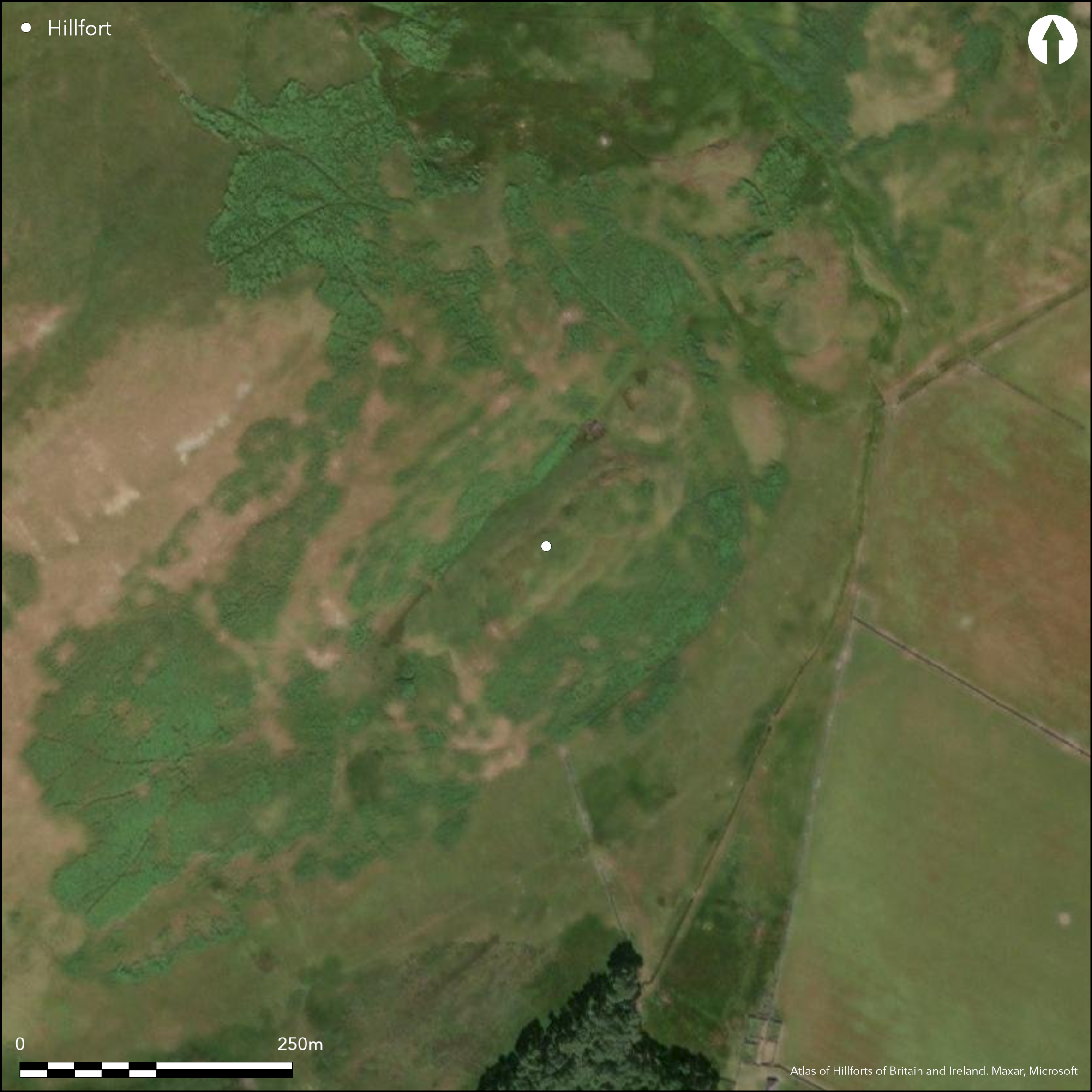
Satellite Imagery
Satellite Imagery
HER: The West of Scotland Archaeology Service 10469 (None)
NMR: NS 92 SE 1 (47384)
SM: 2616
NGR: NS 9517 2187
X: 295170 Y: 621870 (OSGB36)
This fort is situated on an elongated knoll that rises from the foot of the SE flank of the spur named Ritchie Ferry. Oval on plan, it measures 108m from NE to SW by 38m transversely (0.33ha) within a ruinous wall largely reduced to a stony scarp but at either end forming a low bank about 2.4m in thickness. Here and along the NW flank traces of a ditch can be seen, and this has evidently been accompanied by a counterscarp bank on the NE and NW. There are gaps in the rampart on the SW and E, though the RCAHMS investigators who drew up a plan in 1968 only seem to have considered that on the SW to be an original entrance. The interior is featureless, but Professor Gordon Childe excavating in 1939 recovered sherds of coarse, a stone ring, a hone and several small fragments of iron (Proc Prehist Soc 1939, 257).
Citizen Science: ✗
Reliability of Data: Confirmed
Reliability of Interpretation: Confirmed
X: -407454 Y: 7455470 (EPSG: 3857)
Longitude: -3.660224442246735 Latitude: 55.479405086076774 (EPSG:4326)
Country: Scotland
Current County or Unitary Authority: South Lanarkshire
Historic County: Lanarkshire
Current Parish/Community/Council/Townland: Crawford
None
| Extant | ✓ |
| Cropmark | ✗ |
| Likely Destroyed | ✗ |
None
| Woodland | ✗ |
| Commercial Forestry Plantation | ✗ |
| Parkland | ✗ |
| Pasture (Grazing) | ✓ |
| Arable | ✗ |
| Scrub/Bracken | ✗ |
| Bare Outcrop | ✗ |
| Heather/Moorland | ✓ |
| Heath | ✗ |
| Built-up | ✗ |
| Coastal Grassland | ✗ |
| Other | ✗ |
None
| Contour Fort | ✓ |
| Partial Contour Fort | ✗ |
| Promontory Fort | ✗ |
| Hillslope Fort | ✗ |
| Level Terrain Fort | ✗ |
| Marsh Fort | ✗ |
| Multiple Enclosure Fort | ✗ |
| Hilltop | ✗ |
| Coastal Promontory | ✗ |
| Inland Promontory | ✗ |
| Valley Bottom | ✗ |
| Knoll/Hillock/Outcrop | ✓ |
| Ridge | ✗ |
| Cliff/Plateau-edge/Scarp | ✗ |
| Hillslope | ✗ |
| Lowland | ✗ |
| Spur | ✗ |
Dominant Topographic Feature: None
| North | ✗ |
| Northeast | ✗ |
| East | ✗ |
| Southeast | ✗ |
| South | ✗ |
| Southwest | ✗ |
| West | ✗ |
| Northwest | ✗ |
| Level | ✓ |
Altitude: 290.0m
N/A
There are neither stratified artefacts nor radiocarbon dates to provide a chronology for the defences.
Reliability: D - None
| Pre 1200BC | ✗ |
| 1200BC - 800BC | ✗ |
| 800BC - 400BC | ✗ |
| 400BC - AD50 | ✗ |
| AD50 - AD400 | ✗ |
| AD400 - AD 800 | ✗ |
| Post AD800 | ✗ |
| Unknown | ✓ |
| Pre Hillfort: | None |
| Post Hillfort: | None |
First depicted in 1859 on the 1st edition OS 25-inch map (Lanarkshire 1864, sheet 47.2), it was noted by David Christison in 1889 (Christison 1890, 297-8), though he did not measure it, relying on the measurements given by Mr I Irving (Irving 1864). Professor Gordon Childe excavated here in 1939, and it was visited by the OS in 1959. It was visited that same year by RCAHMS, who returned to plan it in 1968, and visited once again in 1975; it is included in the County Inventory for Lanarkshire (RCAHMS 1978, 90-2, no.214, fig 46). It was Scheduled in 1967 and resurveyed at 1:2500 by the OS in 1978. RCAHMS Aerial Survey Programme photographed the fort in 1981 and 2001.
| 1st Identified Map Depiction (1859): | Annotated Camp on the 1st edition OS 25-inch map (Lanarkshire 1864, sheet 47.2) |
| Other (1864): | Noted by George Irving (Irving 1864) |
| Other (1889): | Description David Christison (1890, 297-8) |
| Excavation (1939): | Gordon Childe (Proc Prehist Soc 1939, 257) |
| Other (1959): | Visited by the OS |
| Other (1959): | Visited by RCAHMS |
| Other (1967): | Scheduled |
| Earthwork Survey (1968): | Plan and description (RCAHMS LAD 127/1-2) |
| Other (1975): | Earlier plan and description reviewed (RCAHMS 1978, 90-2, no.214, fig 46) |
| Other (1978): | Resurveyed at 1:2500 by the OS |
Featureless
None
| None | ✓ |
| Spring | ✗ |
| Stream | ✗ |
| Pool | ✗ |
| Flush | ✗ |
| Well | ✗ |
| Other | ✗ |
None
| No Known Features | ✓ |
| Round Stone Structures | ✗ |
| Rectangular Stone Structures | ✗ |
| Curvilinear Platforms | ✗ |
| Other Roundhouse Evidence | ✗ |
| Pits | ✗ |
| Quarry Hollows | ✗ |
| Other | ✗ |
Evidence of occupation in the way of domestic debris
| No Known Excavation | ✗ |
| Pits | ✗ |
| Postholes | ✗ |
| Roundhouses | ✗ |
| Rectangular Structures | ✗ |
| Roads/Tracks | ✗ |
| Quarry Hollows | ✗ |
| Other | ✓ |
| Nothing Found | ✗ |
None
| No Known Geophysics | ✓ |
| Pits | ✗ |
| Roundhouses | ✗ |
| Rectangular Structures | ✗ |
| Roads/Tracks | ✗ |
| Quarry Hollows | ✗ |
| Other | ✗ |
| Nothing Found | ✗ |
Sherds of coarse pottery, a stone ring, a hone and small fragments of iron
| No Known Finds | ✗ |
| Pottery | ✓ |
| Metal | ✓ |
| Metalworking | ✗ |
| Human Bones | ✗ |
| Animal Bones | ✗ |
| Lithics | ✗ |
| Environmental | ✗ |
| Other | ✓ |
NO APPARENT FEATURES
| APs Not Checked | ✗ |
| None | ✓ |
| Roundhouses | ✗ |
| Rectangular Structures | ✗ |
| Pits | ✗ |
| Postholes | ✗ |
| Roads/Tracks | ✗ |
| Other | ✗ |
See main summary
| 2: | None |
| 2: | None |
Guard Chambers: ✗
Chevaux de Frise: ✗
| 1. Simple Gap (East): | None |
| 2. Simple Gap (South west): | None |
Inner rampart with external ditch and counterscarp bank surviving in some sectors
| Area 1: | 0.33ha. |
| Total: | 0.33ha. |
Total Footprint Area: 0.48ha.
None
| ✗ | None |
| ✓ | None |
| NE Quadrant: | 1 |
| SE Quadrant: | 1 |
| SW Quadrant: | 1 |
| NW Quadrant: | 1 |
| Total: | 1 |
| Partial Univallate | ✗ |
| Univallate | ✓ |
| Partial Bivallate | ✗ |
| Bivallate | ✗ |
| Partial Multivallate | ✗ |
| Multivallate | ✗ |
| Unknown | ✗ |
| Partial Univallate | ✗ |
| Univallate | ✗ |
| Partial Bivallate | ✗ |
| Bivallate | ✗ |
| Partial Multivallate | ✗ |
| Multivallate | ✗ |
None
| None | ✗ |
| Earthen Bank | ✗ |
| Stone Wall | ✓ |
| Rubble | ✗ |
| Wall-walk | ✗ |
| Evidence of Timber | ✗ |
| Vitrification | ✗ |
| Other Burning | ✗ |
| Palisade | ✗ |
| Counter Scarp Bank | ✓ |
| Berm | ✗ |
| Unfinished | ✗ |
| Other | ✗ |
None
| None | ✗ |
| Earthen Bank | ✗ |
| Stone Wall | ✓ |
| Murus Duplex | ✗ |
| Timber-framed | ✗ |
| Timber-laced | ✗ |
| Vitrification | ✗ |
| Other Burning | ✗ |
| Palisade | ✗ |
| Counter Scarp Bank | ✗ |
| Berm | ✗ |
| Unfinished | ✗ |
| No Known Excavation | ✗ |
| Other | ✗ |
| ✗ | None |
| ✓ | None |
Number of Ditches: 1
| ✗ | None |
Christison, D (1890) 'Forts, camps, and motes of the Upper Ward of Lanarkshire'. Proc Soc Antiq Scot 24 (1889-90), 281-352
Feachem, R (1963) A guide to prehistoric Scotland. Batsford: London (p 132)
Irving and Murray, G V and A (1864) The upper ward of Lanarkshire described and delineated, 3v Glasgow
Proc Prehist Soc (1939) 'Notes on excavations', Proc Prehist Soc 5 (1939), 257
RCAHMS (1978) The Royal Commission on the Ancient and Historical Monuments of Scotland. Lanarkshire: an inventory of the prehistoric and Roman monuments. HMSO: Edinburgh
Atlas of Hillforts:
Wikidata:
This work is licensed under CC BY-SA 4.0

 and should be cited as:
Lock, Gary and Ralston, Ian. 2024. Atlas of Hillforts of Britain and Ireland. Available at: https://hillforts.arch.ox.ac.uk
Document Version 1.1