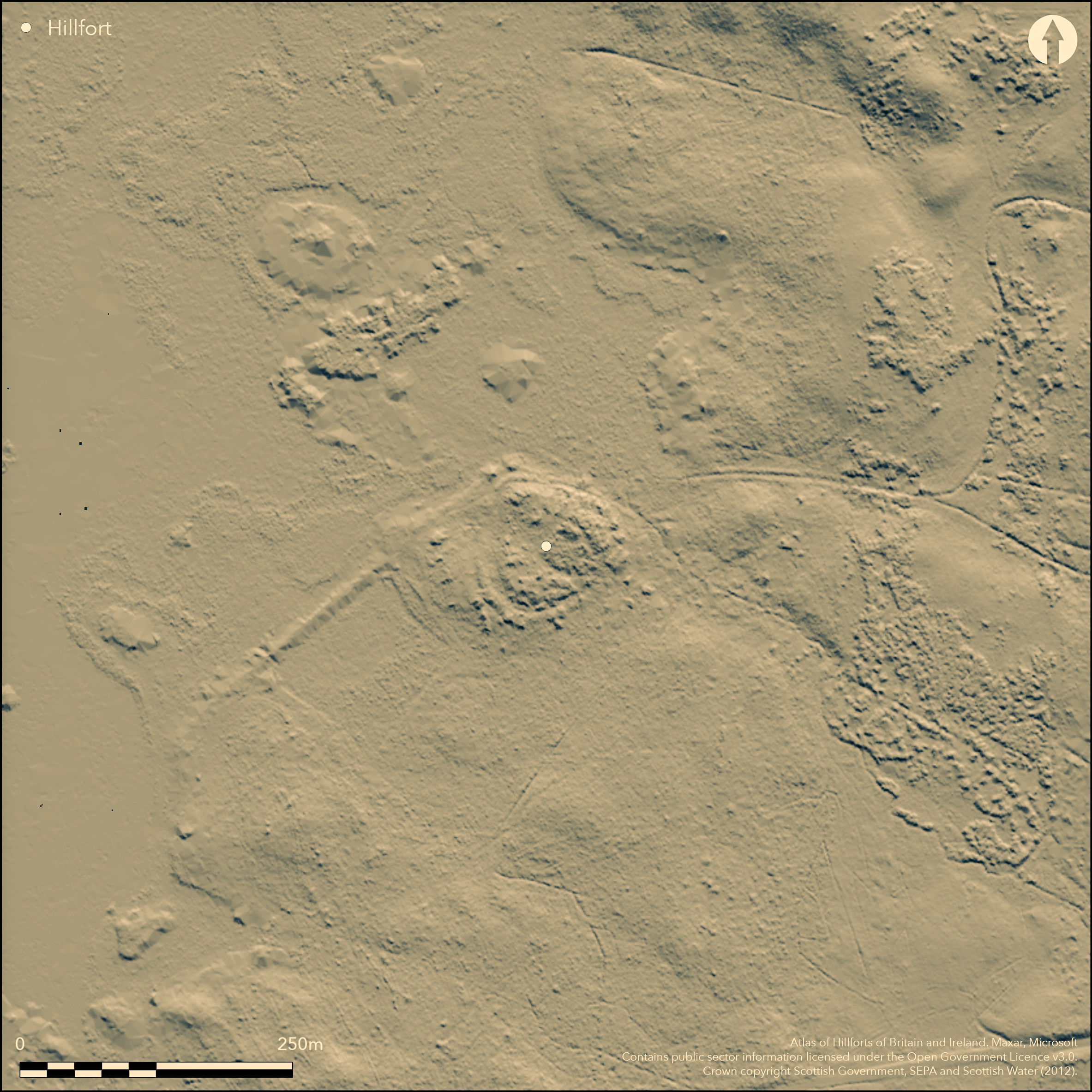
LiDAR 1m DTM Hillshade
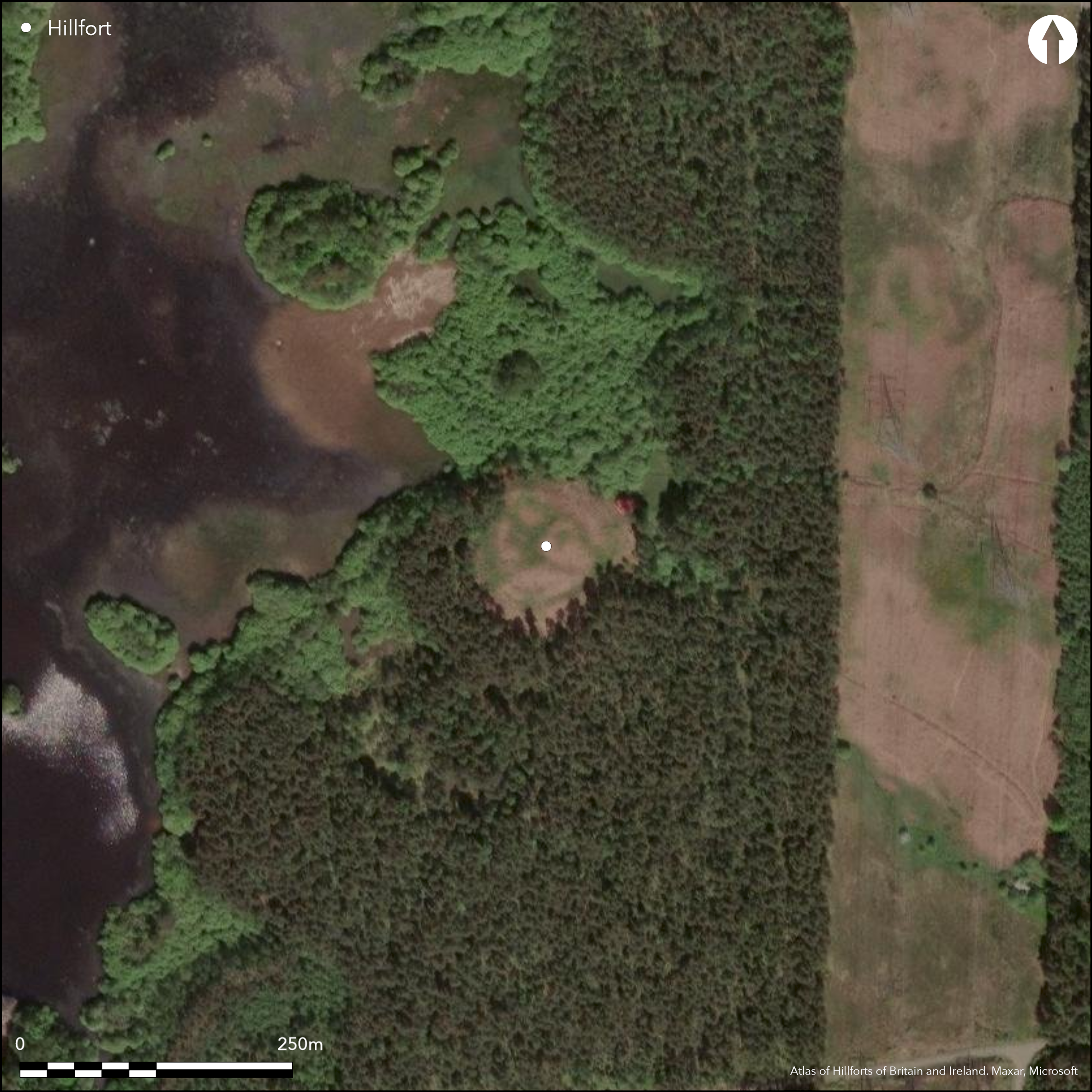
Satellite Imagery
LiDAR 1m DTM Hillshade
Satellite Imagery
Scroll left/right to view further images.
HER: Fife Council None (None)
NMR: NS 98 NW 9 (48127)
SM: 13358
NGR: NS 9464 8822
X: 294640 Y: 688220 (OSGB36)
This fort occupies a low hillock on the SE shore of the artificial loch NE of Tulliallan Castle. Pear-shaped on plan, the interior measures about 55m from NW to SE by 55m transversely (0.2ha). The defences comprise a belt of two ramparts and ditches, accompanied where best-preserved on the SW by a counterscarp bank, but the inner rampart has been reduced to little more than a scarp dropping into the inner ditch, which varies from 6m to 9m in breadth. There is no evidence of an entrance, and the interior, which has been under trees, is featureless. Three evaluation trenches were excavated in 2012, but no detailed information from this work is yet available.
Citizen Science: ✗
Reliability of Data: Confirmed
Reliability of Interpretation: Confirmed
X: -411244 Y: 7573401 (EPSG: 3857)
Longitude: -3.6942701351707057 Latitude: 56.07520171279148 (EPSG:4326)
Country: Scotland
Current County or Unitary Authority: Fife
Historic County: Fife
Current Parish/Community/Council/Townland: Culross
None
| Extant | ✓ |
| Cropmark | ✗ |
| Likely Destroyed | ✗ |
None
| Woodland | ✓ |
| Commercial Forestry Plantation | ✗ |
| Parkland | ✗ |
| Pasture (Grazing) | ✗ |
| Arable | ✗ |
| Scrub/Bracken | ✗ |
| Bare Outcrop | ✗ |
| Heather/Moorland | ✗ |
| Heath | ✗ |
| Built-up | ✗ |
| Coastal Grassland | ✗ |
| Other | ✗ |
None
| Contour Fort | ✓ |
| Partial Contour Fort | ✗ |
| Promontory Fort | ✗ |
| Hillslope Fort | ✗ |
| Level Terrain Fort | ✗ |
| Marsh Fort | ✗ |
| Multiple Enclosure Fort | ✗ |
| Hilltop | ✗ |
| Coastal Promontory | ✗ |
| Inland Promontory | ✗ |
| Valley Bottom | ✗ |
| Knoll/Hillock/Outcrop | ✓ |
| Ridge | ✗ |
| Cliff/Plateau-edge/Scarp | ✗ |
| Hillslope | ✗ |
| Lowland | ✗ |
| Spur | ✗ |
Dominant Topographic Feature: None
| North | ✗ |
| Northeast | ✗ |
| East | ✗ |
| Southeast | ✗ |
| South | ✗ |
| Southwest | ✗ |
| West | ✗ |
| Northwest | ✗ |
| Level | ✓ |
Altitude: 45.0m
N/A
There are no reported dates to provide a chronology for the defences.
Reliability: D - None
| Pre 1200BC | ✗ |
| 1200BC - 800BC | ✗ |
| 800BC - 400BC | ✗ |
| 400BC - AD50 | ✗ |
| AD50 - AD400 | ✗ |
| AD400 - AD 800 | ✗ |
| Post AD800 | ✗ |
| Unknown | ✓ |
| Pre Hillfort: | None |
| Post Hillfort: | Incorporated into woodland |
First depicted in 1783 on James Stobie's map of The Counties of Perth and Clackmannan (1783), in 1861 it appeared on the 1st edition OS 25-inch map (Perth and Clackmannan 1866, sheet 140.14), where it is a crude hachured ring annotated 'Fort (supposed Danish)'. The revised edition of the map (Fifeshire 1896, sheet 37.3) provides a more faithful rendering. It was visited in 1925 by RCAHMS during the preparation of the County Inventory for Fifeshire (RCAHMS 1933, 85, no.160), and revisited and planned in 1952 as part of the Survey of Marginal Lands. It was visited by the OS in 1953 and 1974. A programme of survey and evaluation was carried out in 2011 (Shaw and Edwards 2011) and 2012 (CFA Archaeology), and it was Scheduled in 2013.
| 1st Identified Map Depiction (1783): | James Stobie, The Counties of Perth and Clackmannan (1783) |
| Other (1861): | Annotated Fort on the 1st edition OS 25-inch map (Perth and Clackmannan 1866, sheet 140.14) |
| Other (1925): | Description (RCAHMS 1933, 85, no.160) |
| Earthwork Survey (1952): | Plan and description during RCAHMS Survey of Marginal Lands (RCAHMS FID 3/1-2) |
| Other (1953): | Visited by the OS |
| Other (1974): | Visited by the OS |
| Excavation (2012): | Evaluation by CFA Archaeology |
| Other (2013): | Scheduled |
Featureless
None
| None | ✓ |
| Spring | ✗ |
| Stream | ✗ |
| Pool | ✗ |
| Flush | ✗ |
| Well | ✗ |
| Other | ✗ |
None
| No Known Features | ✓ |
| Round Stone Structures | ✗ |
| Rectangular Stone Structures | ✗ |
| Curvilinear Platforms | ✗ |
| Other Roundhouse Evidence | ✗ |
| Pits | ✗ |
| Quarry Hollows | ✗ |
| Other | ✗ |
None
| No Known Excavation | ✓ |
| Pits | ✗ |
| Postholes | ✗ |
| Roundhouses | ✗ |
| Rectangular Structures | ✗ |
| Roads/Tracks | ✗ |
| Quarry Hollows | ✗ |
| Other | ✗ |
| Nothing Found | ✗ |
None
| No Known Geophysics | ✓ |
| Pits | ✗ |
| Roundhouses | ✗ |
| Rectangular Structures | ✗ |
| Roads/Tracks | ✗ |
| Quarry Hollows | ✗ |
| Other | ✗ |
| Nothing Found | ✗ |
None
| No Known Finds | ✓ |
| Pottery | ✗ |
| Metal | ✗ |
| Metalworking | ✗ |
| Human Bones | ✗ |
| Animal Bones | ✗ |
| Lithics | ✗ |
| Environmental | ✗ |
| Other | ✗ |
Obscured by trees
| APs Not Checked | ✗ |
| None | ✓ |
| Roundhouses | ✗ |
| Rectangular Structures | ✗ |
| Pits | ✗ |
| Postholes | ✗ |
| Roads/Tracks | ✗ |
| Other | ✗ |
None known
| 0: | None |
| 2: | No breaks observed |
Guard Chambers: ✗
Chevaux de Frise: ✗
Two ramparts and ditches, accompanied by an outer counterscarp bank
| Area 1: | 0.2ha. |
| Total: | 0.2ha. |
Total Footprint Area: 0.6ha.
None
| ✗ | None |
| ✓ | None |
| NE Quadrant: | 2 |
| SE Quadrant: | 2 |
| SW Quadrant: | 2 |
| NW Quadrant: | 2 |
| Total: | 2 |
| Partial Univallate | ✗ |
| Univallate | ✗ |
| Partial Bivallate | ✗ |
| Bivallate | ✓ |
| Partial Multivallate | ✗ |
| Multivallate | ✗ |
| Unknown | ✗ |
| Partial Univallate | ✗ |
| Univallate | ✗ |
| Partial Bivallate | ✗ |
| Bivallate | ✗ |
| Partial Multivallate | ✗ |
| Multivallate | ✗ |
None
| None | ✗ |
| Earthen Bank | ✓ |
| Stone Wall | ✗ |
| Rubble | ✗ |
| Wall-walk | ✗ |
| Evidence of Timber | ✗ |
| Vitrification | ✗ |
| Other Burning | ✗ |
| Palisade | ✗ |
| Counter Scarp Bank | ✓ |
| Berm | ✗ |
| Unfinished | ✗ |
| Other | ✗ |
None
| None | ✓ |
| Earthen Bank | ✗ |
| Stone Wall | ✗ |
| Murus Duplex | ✗ |
| Timber-framed | ✗ |
| Timber-laced | ✗ |
| Vitrification | ✗ |
| Other Burning | ✗ |
| Palisade | ✗ |
| Counter Scarp Bank | ✗ |
| Berm | ✗ |
| Unfinished | ✗ |
| No Known Excavation | ✗ |
| Other | ✗ |
| ✗ | None |
| ✓ | None |
Number of Ditches: 2
| ✗ | None |
RCAHMS (1933) The Royal Commission on the Ancient and Historical Monuments and Constructions of Scotland. Eleventh report with inventory of monuments and constructions in the counties of Fife, Kinross, and Clackmannan. HMSO: Edinburgh
Shaw and Edwards, R and B (2011) 'Keir Plantation / Castlehill Wood / Callendar Wood, Falkirk and Fife (Falkirk and Culross parishes), survey', Disc Exc Scot, New Ser 12 (2011), 84
Atlas of Hillforts:
Wikidata:
This work is licensed under CC BY-SA 4.0

 and should be cited as:
Lock, Gary and Ralston, Ian. 2024. Atlas of Hillforts of Britain and Ireland. Available at: https://hillforts.arch.ox.ac.uk
Document Version 1.1