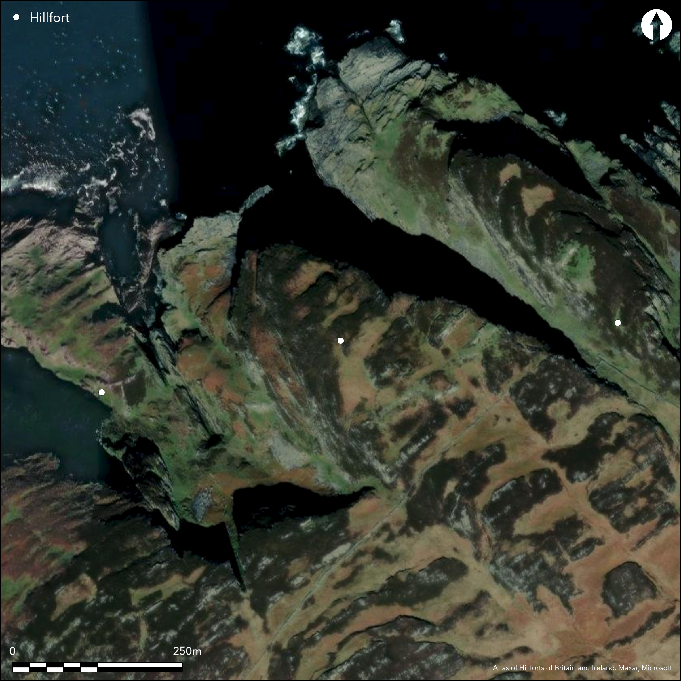
Satellite Imagery
Satellite Imagery
HER: The West of Scotland Archaeology Service 2129 & 2116 (None)
NMR: NR 27 SW 5 (37526)
SM: 13213
NGR: NR 2205 7118
X: 122050 Y: 671180 (OSGB36)
The remains of a promontory fort can be seen crowning the summit of a large promontory on the NW coast of Islay named Beinn a'Chaisteal, with an additional wall at the foot of the cliff on the W cutting off access to a lower shelf on the seaward side. The upper part of the fort on the summit of the promontory extends to about 1.3ha and is defended by a single wall, which can be traced across the rock outcrops on the SE. About 3m in thickness, the inner face only survives in two places, but fragments of the outer can be seen throughout its course, which dog legs sharply to take in a rectangular boss of outcrop on the crest of the promontory. The wall is heavily robbed and no certain evidence of an entrance can be identified, though access to the summit area is easily gained from the slope below the SW terminal of the wall. The wall at the foot of the cliff on the W, which was regarded by RCAHMS investigators as a separate enclosure, effectively cuts off a broad shelf on the seaward end of the promontory; it is 2m in thickness and retains a lintelled entrance passage 0.75m wide. Several stone structures can be seen immediately in its rear, at least one of which is evidently later in date than the wall, and there are a series of other stone structures scattered across the terrace to the N, including one with a corbelled roof; these are likely to relate to later usage of the area for pasture or fowling. The addition of this lower terrace gives the fort an overall area of 3.23ha
Citizen Science: ✗
Reliability of Data: Confirmed
Reliability of Interpretation: Confirmed
X: -717233 Y: 7529306 (EPSG: 3857)
Longitude: -6.4430149499330716 Latitude: 55.85349464495327 (EPSG:4326)
Country: Scotland
Current County or Unitary Authority: Argyll & Bute
Historic County: Argyll
Current Parish/Community/Council/Townland: Kilchoman
None
| Extant | ✓ |
| Cropmark | ✗ |
| Likely Destroyed | ✗ |
None
| Woodland | ✗ |
| Commercial Forestry Plantation | ✗ |
| Parkland | ✗ |
| Pasture (Grazing) | ✓ |
| Arable | ✗ |
| Scrub/Bracken | ✗ |
| Bare Outcrop | ✗ |
| Heather/Moorland | ✓ |
| Heath | ✗ |
| Built-up | ✗ |
| Coastal Grassland | ✓ |
| Other | ✗ |
None
| Contour Fort | ✗ |
| Partial Contour Fort | ✗ |
| Promontory Fort | ✓ |
| Hillslope Fort | ✗ |
| Level Terrain Fort | ✗ |
| Marsh Fort | ✗ |
| Multiple Enclosure Fort | ✗ |
| Hilltop | ✗ |
| Coastal Promontory | ✓ |
| Inland Promontory | ✗ |
| Valley Bottom | ✗ |
| Knoll/Hillock/Outcrop | ✗ |
| Ridge | ✗ |
| Cliff/Plateau-edge/Scarp | ✗ |
| Hillslope | ✗ |
| Lowland | ✗ |
| Spur | ✗ |
Dominant Topographic Feature: None
| North | ✗ |
| Northeast | ✗ |
| East | ✗ |
| Southeast | ✗ |
| South | ✗ |
| Southwest | ✗ |
| West | ✗ |
| Northwest | ✗ |
| Level | ✓ |
Altitude: 125.0m
N/A
In the absence of excavation, there are neither stratified artefacts nor radiocarbon dates to provide a chronology for the defences.
Reliability: D - None
| Pre 1200BC | ✗ |
| 1200BC - 800BC | ✗ |
| 800BC - 400BC | ✗ |
| 400BC - AD50 | ✗ |
| AD50 - AD400 | ✗ |
| AD400 - AD 800 | ✗ |
| Post AD800 | ✗ |
| Unknown | ✓ |
| Pre Hillfort: | None |
| Post Hillfort: | The various stone structures and the corbelled structure on the lower terrace are likely to be later in date. |
First discovered in 1965 by Frank Newall (Newall 1965), it was visited by the OS in 1978 and surveyed by RCAHMS for the County Inventory of Argyll in 1979 (RCAHMS 1984, 77-81, no.131). It ws photographed from the air by RCAHMS in 2005, 2010 and 2011. It was Scheduled in 2013.
| 1st Identified Written Reference (1965): | Discovered by Frank Newall (Newall 1965) |
| 1st Identified Map Depiction (1978): | Surveyed at 1:10.000 by the OS |
| Earthwork Survey (1979): | Description and plans (RCAHMS 1984, 77-81, no.131; RCAHMS DC111-16 & 185) |
| Other (2007): | Visited by the Hill-Fort Study Group |
| Other (2013): | Scheduled |
Lower terrace occupied by a cluster of stone structures that are likely to be of later date
None
| None | ✓ |
| Spring | ✗ |
| Stream | ✗ |
| Pool | ✗ |
| Flush | ✗ |
| Well | ✗ |
| Other | ✗ |
Series of stone structures that tend to be oval, set amongst the screes, and including one with a corbelled roof intact
| No Known Features | ✗ |
| Round Stone Structures | ✗ |
| Rectangular Stone Structures | ✗ |
| Curvilinear Platforms | ✗ |
| Other Roundhouse Evidence | ✗ |
| Pits | ✗ |
| Quarry Hollows | ✗ |
| Other | ✓ |
None
| No Known Excavation | ✓ |
| Pits | ✗ |
| Postholes | ✗ |
| Roundhouses | ✗ |
| Rectangular Structures | ✗ |
| Roads/Tracks | ✗ |
| Quarry Hollows | ✗ |
| Other | ✗ |
| Nothing Found | ✗ |
None
| No Known Geophysics | ✓ |
| Pits | ✗ |
| Roundhouses | ✗ |
| Rectangular Structures | ✗ |
| Roads/Tracks | ✗ |
| Quarry Hollows | ✗ |
| Other | ✗ |
| Nothing Found | ✗ |
None
| No Known Finds | ✓ |
| Pottery | ✗ |
| Metal | ✗ |
| Metalworking | ✗ |
| Human Bones | ✗ |
| Animal Bones | ✗ |
| Lithics | ✗ |
| Environmental | ✗ |
| Other | ✗ |
Series of stone structures that tend to be oval, set amongst the screes, and including one with a corbelled roof intact
| APs Not Checked | ✗ |
| None | ✗ |
| Roundhouses | ✗ |
| Rectangular Structures | ✗ |
| Pits | ✗ |
| Postholes | ✗ |
| Roads/Tracks | ✗ |
| Other | ✓ |
See main summary
| 1: | None |
| 2: | None |
Guard Chambers: ✗
Chevaux de Frise: ✗
| 1. Simple Gap (South): | Lintelled passage |
Single wall cutting off promontory
| Area 1: | 1.3ha. |
| Total: | 1.3ha. |
Total Footprint Area: 3.23ha.
None
| ✗ | None |
| ✗ | None |
| NE Quadrant: | 0 |
| SE Quadrant: | 1 |
| SW Quadrant: | 1 |
| NW Quadrant: | 0 |
| Total: | 1 |
| Partial Univallate | ✓ |
| Univallate | ✗ |
| Partial Bivallate | ✗ |
| Bivallate | ✗ |
| Partial Multivallate | ✗ |
| Multivallate | ✗ |
| Unknown | ✗ |
| Partial Univallate | ✗ |
| Univallate | ✗ |
| Partial Bivallate | ✗ |
| Bivallate | ✗ |
| Partial Multivallate | ✗ |
| Multivallate | ✗ |
None
| None | ✗ |
| Earthen Bank | ✗ |
| Stone Wall | ✓ |
| Rubble | ✗ |
| Wall-walk | ✗ |
| Evidence of Timber | ✗ |
| Vitrification | ✗ |
| Other Burning | ✗ |
| Palisade | ✗ |
| Counter Scarp Bank | ✗ |
| Berm | ✗ |
| Unfinished | ✗ |
| Other | ✗ |
None
| None | ✗ |
| Earthen Bank | ✗ |
| Stone Wall | ✗ |
| Murus Duplex | ✗ |
| Timber-framed | ✗ |
| Timber-laced | ✗ |
| Vitrification | ✗ |
| Other Burning | ✗ |
| Palisade | ✗ |
| Counter Scarp Bank | ✗ |
| Berm | ✗ |
| Unfinished | ✗ |
| No Known Excavation | ✓ |
| Other | ✗ |
| ✗ | None |
| ✗ | None |
Number of Ditches: None
| ✗ | The lower terrace might be regarded as an annexe |
Newall, F (1965) 'Beinn a Chaisteil'. Disc Exc Scot 1965, 10
RCAHMS (1984) The Royal Commission on the Ancient and Historical Monuments of Scotland. Argyll: an inventory of the monuments volume 5: Islay, Jura, Colonsay and Oronsay. HMSO: Edinburgh
Atlas of Hillforts:
Wikidata:
This work is licensed under CC BY-SA 4.0

 and should be cited as:
Lock, Gary and Ralston, Ian. 2024. Atlas of Hillforts of Britain and Ireland. Available at: https://hillforts.arch.ox.ac.uk
Document Version 1.1