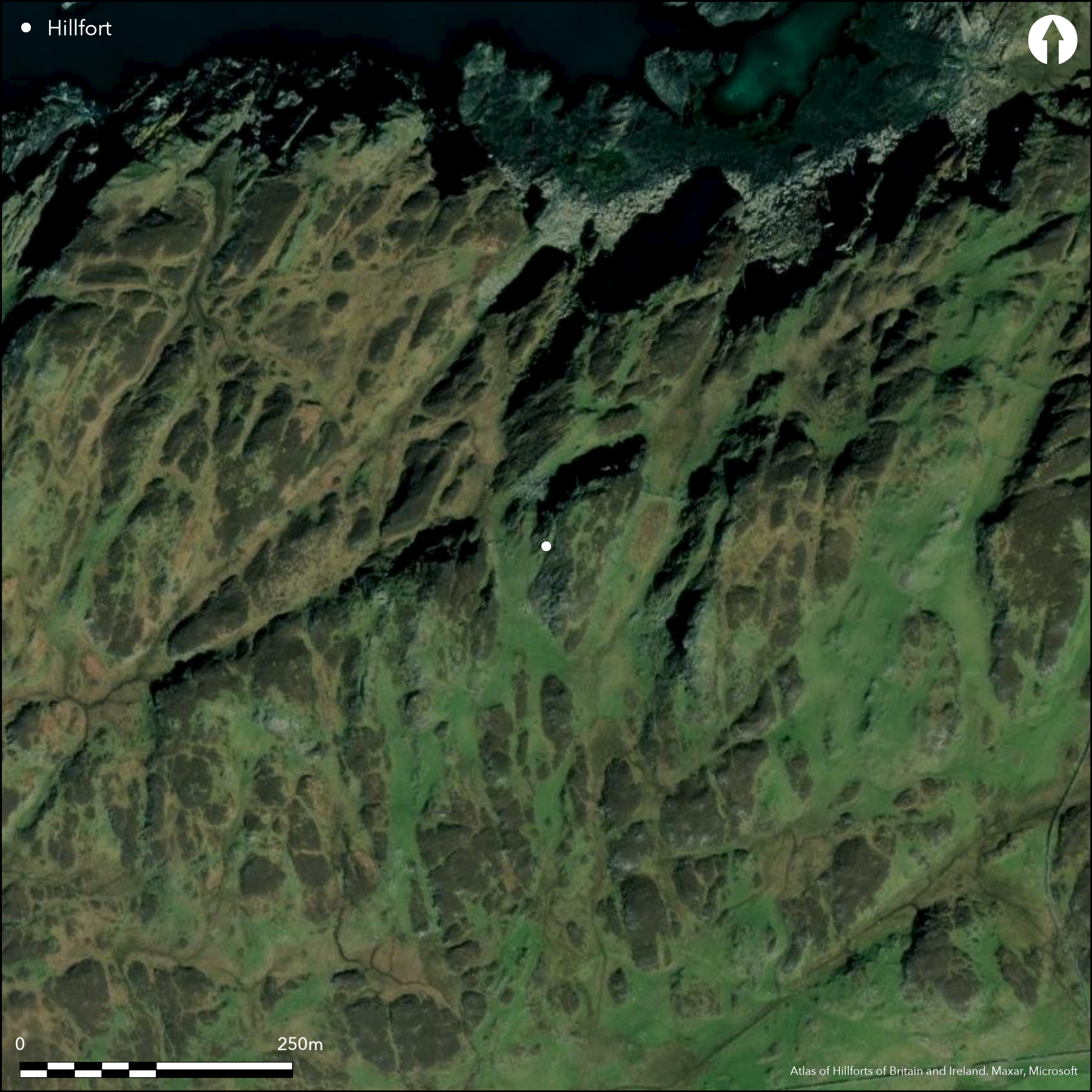
Satellite Imagery
Satellite Imagery
HER: The West of Scotland Archaeology Service 2797 (None)
NMR: NR 49 NW 4 (38204)
SM: None
NGR: NR 4145 9999
X: 141450 Y: 699990 (OSGB36)
This small fort occupies a rocky ridge in broken moorland N of Balnahard. Irregular on plan, the wall follows the margin of the ridge, but it has been heavily robbed and reduced to an intermittent band of rubble, along which the line of the outer face can be traced along the E flank and on the NW. The interior is rough and uneven, measuring internally about 50m from N to S by 20m transversely (0.08ha), and the only features visible are the tumbled walls of three conjoined rectangular structures that appear to overlie the defences on the NW. The entrance is not visible, though the topography on the W offers the only easy access, but a gap in the wall on the N opens into a small triangular annexe enclosing a sloping terrace on the NE; the annexe measures about 40m from N to S by a maximum of 20m transversely within a wall following the lip of the outcrops making up this side of the ridge.
Citizen Science: ✗
Reliability of Data: Confirmed
Reliability of Interpretation: Confirmed
X: -685912 Y: 7582832 (EPSG: 3857)
Longitude: -6.1616488955539275 Latitude: 56.12245867607018 (EPSG:4326)
Country: Scotland
Current County or Unitary Authority: Argyll & Bute
Historic County: Argyll
Current Parish/Community/Council/Townland: Colonsay And Oronsay
None
| Extant | ✓ |
| Cropmark | ✗ |
| Likely Destroyed | ✗ |
None
| Woodland | ✗ |
| Commercial Forestry Plantation | ✗ |
| Parkland | ✗ |
| Pasture (Grazing) | ✓ |
| Arable | ✗ |
| Scrub/Bracken | ✗ |
| Bare Outcrop | ✗ |
| Heather/Moorland | ✓ |
| Heath | ✗ |
| Built-up | ✗ |
| Coastal Grassland | ✗ |
| Other | ✗ |
None
| Contour Fort | ✓ |
| Partial Contour Fort | ✗ |
| Promontory Fort | ✗ |
| Hillslope Fort | ✗ |
| Level Terrain Fort | ✗ |
| Marsh Fort | ✗ |
| Multiple Enclosure Fort | ✗ |
| Hilltop | ✓ |
| Coastal Promontory | ✗ |
| Inland Promontory | ✗ |
| Valley Bottom | ✗ |
| Knoll/Hillock/Outcrop | ✗ |
| Ridge | ✗ |
| Cliff/Plateau-edge/Scarp | ✗ |
| Hillslope | ✗ |
| Lowland | ✗ |
| Spur | ✗ |
Dominant Topographic Feature: None
| North | ✗ |
| Northeast | ✗ |
| East | ✗ |
| Southeast | ✗ |
| South | ✗ |
| Southwest | ✗ |
| West | ✗ |
| Northwest | ✗ |
| Level | ✓ |
Altitude: 45.0m
N/A
In the absence of excavation, there are neither stratified artefacts nor radiocarbon dates to provide a chronology for the defences.
Reliability: D - None
| Pre 1200BC | ✗ |
| 1200BC - 800BC | ✗ |
| 800BC - 400BC | ✗ |
| 400BC - AD50 | ✗ |
| AD50 - AD400 | ✗ |
| AD400 - AD 800 | ✗ |
| Post AD800 | ✗ |
| Unknown | ✓ |
| Pre Hillfort: | None |
| Post Hillfort: | Three conjoined huts overlie the fort wall |
Grieve notes that: 'About the year 1862, rabbits scraped out of a burrow at the foot of this dun two small metal cups, believed to be of copper or bronze, and two plates of the same material, each about the size of a tea-saucer; also a knife and fork of iron.'
| 1st Identified Written Reference (1923): | Noted (Grieve 1923, ii, 262) |
| Other (1944): | Description (Piggott and Piggott 1946, 87) |
| 1st Identified Map Depiction (1974): | Surveyed at 1:10,000 by the OS |
| Earthwork Survey (1976): | Plan and description (RCAHMS 1984, 92-3, no.153; RCAHMS DC156) |
Featureless apart from three conjoined sub-rectangular or oval huts built out of the rubble from the wall on the W
None
| None | ✓ |
| Spring | ✗ |
| Stream | ✗ |
| Pool | ✗ |
| Flush | ✗ |
| Well | ✗ |
| Other | ✗ |
None
| No Known Features | ✗ |
| Round Stone Structures | ✗ |
| Rectangular Stone Structures | ✓ |
| Curvilinear Platforms | ✗ |
| Other Roundhouse Evidence | ✗ |
| Pits | ✗ |
| Quarry Hollows | ✗ |
| Other | ✗ |
None
| No Known Excavation | ✓ |
| Pits | ✗ |
| Postholes | ✗ |
| Roundhouses | ✗ |
| Rectangular Structures | ✗ |
| Roads/Tracks | ✗ |
| Quarry Hollows | ✗ |
| Other | ✗ |
| Nothing Found | ✗ |
None
| No Known Geophysics | ✓ |
| Pits | ✗ |
| Roundhouses | ✗ |
| Rectangular Structures | ✗ |
| Roads/Tracks | ✗ |
| Quarry Hollows | ✗ |
| Other | ✗ |
| Nothing Found | ✗ |
None
| No Known Finds | ✓ |
| Pottery | ✗ |
| Metal | ✗ |
| Metalworking | ✗ |
| Human Bones | ✗ |
| Animal Bones | ✗ |
| Lithics | ✗ |
| Environmental | ✗ |
| Other | ✗ |
NO APPARENT FEATURES
| APs Not Checked | ✗ |
| None | ✓ |
| Roundhouses | ✗ |
| Rectangular Structures | ✗ |
| Pits | ✗ |
| Postholes | ✗ |
| Roads/Tracks | ✗ |
| Other | ✗ |
See main summary
| 0: | Large gaps in the circuit |
| 2: | No entrance visible but the only easy access is from the W |
Guard Chambers: ✗
Chevaux de Frise: ✗
Single wall heavily robbed but with several runs of outer face, which can be traced round parts of the summit
| Area 1: | 0.08ha. |
| Total: | 0.08ha. |
Total Footprint Area: Noneha.
None
| ✗ | None |
| ✗ | None |
| NE Quadrant: | 1 |
| SE Quadrant: | 1 |
| SW Quadrant: | 0 |
| NW Quadrant: | 1 |
| Total: | 1 |
| Partial Univallate | ✓ |
| Univallate | ✗ |
| Partial Bivallate | ✗ |
| Bivallate | ✗ |
| Partial Multivallate | ✗ |
| Multivallate | ✗ |
| Unknown | ✗ |
| Partial Univallate | ✗ |
| Univallate | ✗ |
| Partial Bivallate | ✗ |
| Bivallate | ✗ |
| Partial Multivallate | ✗ |
| Multivallate | ✗ |
None
| None | ✗ |
| Earthen Bank | ✗ |
| Stone Wall | ✓ |
| Rubble | ✗ |
| Wall-walk | ✗ |
| Evidence of Timber | ✗ |
| Vitrification | ✗ |
| Other Burning | ✗ |
| Palisade | ✗ |
| Counter Scarp Bank | ✗ |
| Berm | ✗ |
| Unfinished | ✗ |
| Other | ✗ |
None
| None | ✗ |
| Earthen Bank | ✗ |
| Stone Wall | ✗ |
| Murus Duplex | ✗ |
| Timber-framed | ✗ |
| Timber-laced | ✗ |
| Vitrification | ✗ |
| Other Burning | ✗ |
| Palisade | ✗ |
| Counter Scarp Bank | ✗ |
| Berm | ✗ |
| Unfinished | ✗ |
| No Known Excavation | ✓ |
| Other | ✗ |
| ✗ | None |
| ✗ | None |
Number of Ditches: None
| ✓ | Small triangular annexe taking in an area of 0.05ha on a lower terrace on the E |
Grieve, S (1923) The book of Colonsay and Oronsay: forty-four years of research and discovery in early Scoto-Irish, Norse and Danish history, 2v. Edinburgh
Piggott and Piggott, S and C M (1948) 'Field work on Colonsay and Islay, 1944-45'. Proc Soc Antiq Scot 80 (1945-6), 83-103
RCAHMS (1984) The Royal Commission on the Ancient and Historical Monuments of Scotland. Argyll: an inventory of the monuments volume 5: Islay, Jura, Colonsay and Oronsay. HMSO: Edinburgh
Atlas of Hillforts:
Wikidata:
This work is licensed under CC BY-SA 4.0

 and should be cited as:
Lock, Gary and Ralston, Ian. 2024. Atlas of Hillforts of Britain and Ireland. Available at: https://hillforts.arch.ox.ac.uk
Document Version 1.1