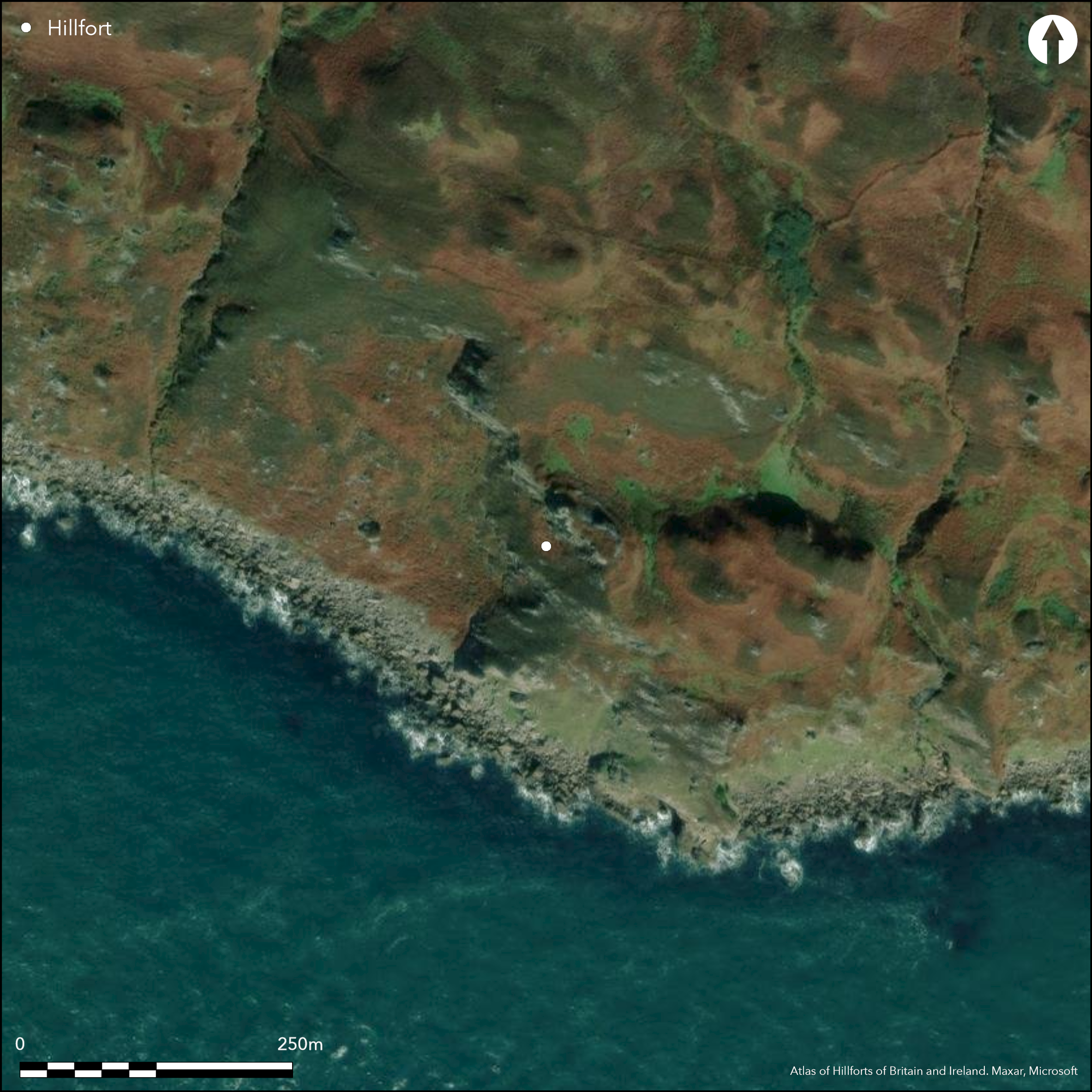
Satellite Imagery
Satellite Imagery
HER: The West of Scotland Archaeology Service 2900 (None)
NMR: NR 60 NW 1 (38308)
SM: 3748
NGR: NR 6119 0603
X: 161190 Y: 606030 (OSGB36)
This small fort occupies a rocky knoll backing onto the cliffs of the coastal escarpment on the SW flank of the Mull of Kintyre. Irregular on plan, the interior measures a maximum of 32m from ESE to WNW by 13m transversely (0.034ha), though this includes a large rocky boss surmounted by the inner wall at the western end. The defences comprise no less than three walls, the inner, some 3.7m thick, following the crest of the knoll around the N and E, and the two outer ones, 2.1m and 1.5m thick respectively, around its foot. Extensive runs of the inner and outer faces survive on all the walls, the middle one being exceptionally well preserved with an outer face some 1.5m high. The entrance is on the E, and while the gaps in the inner and middle walls have opposed terminals to either side, in the outer wall they are staggered to expose the right-hand side of anyone attempting to penetrate the defences. The interior, which may have been eroded along the cliff-edge forming its SW margin, is featureless, apart from a later wall that has been inserted to create a stock pen immediately within the entrance.
Citizen Science: ✗
Reliability of Data: Confirmed
Reliability of Interpretation: Confirmed
X: -641523 Y: 7418421 (EPSG: 3857)
Longitude: -5.762901923359883 Latitude: 55.29034243099007 (EPSG:4326)
Country: Scotland
Current County or Unitary Authority: Argyll & Bute
Historic County: Argyll
Current Parish/Community/Council/Townland: Southend
None
| Extant | ✓ |
| Cropmark | ✗ |
| Likely Destroyed | ✗ |
None
| Woodland | ✗ |
| Commercial Forestry Plantation | ✗ |
| Parkland | ✗ |
| Pasture (Grazing) | ✓ |
| Arable | ✗ |
| Scrub/Bracken | ✓ |
| Bare Outcrop | ✗ |
| Heather/Moorland | ✓ |
| Heath | ✗ |
| Built-up | ✗ |
| Coastal Grassland | ✗ |
| Other | ✗ |
None
| Contour Fort | ✓ |
| Partial Contour Fort | ✗ |
| Promontory Fort | ✗ |
| Hillslope Fort | ✗ |
| Level Terrain Fort | ✗ |
| Marsh Fort | ✗ |
| Multiple Enclosure Fort | ✗ |
| Hilltop | ✗ |
| Coastal Promontory | ✗ |
| Inland Promontory | ✗ |
| Valley Bottom | ✗ |
| Knoll/Hillock/Outcrop | ✓ |
| Ridge | ✗ |
| Cliff/Plateau-edge/Scarp | ✓ |
| Hillslope | ✗ |
| Lowland | ✗ |
| Spur | ✗ |
Dominant Topographic Feature: None
| North | ✗ |
| Northeast | ✗ |
| East | ✗ |
| Southeast | ✗ |
| South | ✗ |
| Southwest | ✗ |
| West | ✗ |
| Northwest | ✗ |
| Level | ✓ |
Altitude: 75.0m
N/A
In the absence of excavation, there are neither stratified artefacts nor radiocarbon dates to provide a chronology for the defences.
Reliability: D - None
| Pre 1200BC | ✗ |
| 1200BC - 800BC | ✗ |
| 800BC - 400BC | ✗ |
| 400BC - AD50 | ✗ |
| AD50 - AD400 | ✗ |
| AD400 - AD 800 | ✗ |
| Post AD800 | ✗ |
| Unknown | ✓ |
| Pre Hillfort: | None |
| Post Hillfort: | Later enclosure formed by collapsed wall immediately inside the entrance |
First mentioned in the Statistical Account (Stat Acct 3, 1792, 365) and described in the New Statistical Account (NSA, 7, Argyllshire, 429), it is depicted on the 1st edition OS 6-inch map in 1866 (Argyll and Bute 1869, sheet 264). A sketch plan and description were drawn up with photographs in 1902 by John Fleming. Visited during the RCAHMS Survey of Marginal Lands in 1955, it was subsequently surveyed in 1960 for the County Inventory of Argyll (RCAHMS 1971, 76-7, no.176, fig 55), and subsequently visited by the OS in 1977. The Scheduled area extended in 2013. It has been photographed from the air by RCAHMS in 2008.
| 1st Identified Written Reference (1792): | Noted (Stat Acct 3, 1792, 365) |
| Other (1843): | Noted (NSA, 7, Argyllshire, 429) |
| 1st Identified Map Depiction (1866): | Annotated Fort on the 1st edition OS 6-inch map (Argyll and Bute 1869, sheet 264) |
| Earthwork Survey (1902): | Sketch plan and description (Fleming 1903, 360, fig 1; RCAHMS MS28/327) |
| Other (1955): | Description RCAHMS Survey of Marginal Lands |
| Earthwork Survey (1960): | Plan and description (RCAHMS 1971, 76-7, no.176, fig 55; RCAHMS AGD 300/1-2) |
| Other (1964): | Scheduled |
| Other (1977): | Surveyed at 1:10.000 by the OS |
| Other (2013): | Re-Scheduled |
Featureless apart from a later wall forming an animal enclosure immediately inside the entrance.
None
| None | ✓ |
| Spring | ✗ |
| Stream | ✗ |
| Pool | ✗ |
| Flush | ✗ |
| Well | ✗ |
| Other | ✗ |
None
| No Known Features | ✓ |
| Round Stone Structures | ✗ |
| Rectangular Stone Structures | ✗ |
| Curvilinear Platforms | ✗ |
| Other Roundhouse Evidence | ✗ |
| Pits | ✗ |
| Quarry Hollows | ✗ |
| Other | ✗ |
None
| No Known Excavation | ✓ |
| Pits | ✗ |
| Postholes | ✗ |
| Roundhouses | ✗ |
| Rectangular Structures | ✗ |
| Roads/Tracks | ✗ |
| Quarry Hollows | ✗ |
| Other | ✗ |
| Nothing Found | ✗ |
None
| No Known Geophysics | ✓ |
| Pits | ✗ |
| Roundhouses | ✗ |
| Rectangular Structures | ✗ |
| Roads/Tracks | ✗ |
| Quarry Hollows | ✗ |
| Other | ✗ |
| Nothing Found | ✗ |
None
| No Known Finds | ✓ |
| Pottery | ✗ |
| Metal | ✗ |
| Metalworking | ✗ |
| Human Bones | ✗ |
| Animal Bones | ✗ |
| Lithics | ✗ |
| Environmental | ✗ |
| Other | ✗ |
NO APPARENT FEATURES
| APs Not Checked | ✗ |
| None | ✓ |
| Roundhouses | ✗ |
| Rectangular Structures | ✗ |
| Pits | ✗ |
| Postholes | ✗ |
| Roads/Tracks | ✗ |
| Other | ✗ |
See main summary
| 1: | None |
| 2: | None |
Guard Chambers: ✗
Chevaux de Frise: ✗
| 1. Simple Gap (East): | through inner and middle wall |
| 1. Over-lapping (East): | Through outermost wall, exposing the visitor's right side |
Three walls forming an enclosure round a knoll backing onto the cliff-edge
| Area 1: | 0.03ha. |
| Total: | 0.03ha. |
Total Footprint Area: 0.22ha.
None
| ✗ | None |
| ✗ | None |
| NE Quadrant: | 3 |
| SE Quadrant: | 3 |
| SW Quadrant: | 0 |
| NW Quadrant: | 0 |
| Total: | 3 |
| Partial Univallate | ✗ |
| Univallate | ✗ |
| Partial Bivallate | ✗ |
| Bivallate | ✗ |
| Partial Multivallate | ✓ |
| Multivallate | ✗ |
| Unknown | ✗ |
| Partial Univallate | ✗ |
| Univallate | ✗ |
| Partial Bivallate | ✗ |
| Bivallate | ✗ |
| Partial Multivallate | ✗ |
| Multivallate | ✗ |
None
| None | ✗ |
| Earthen Bank | ✗ |
| Stone Wall | ✓ |
| Rubble | ✗ |
| Wall-walk | ✗ |
| Evidence of Timber | ✗ |
| Vitrification | ✗ |
| Other Burning | ✗ |
| Palisade | ✗ |
| Counter Scarp Bank | ✗ |
| Berm | ✗ |
| Unfinished | ✗ |
| Other | ✗ |
None
| None | ✗ |
| Earthen Bank | ✗ |
| Stone Wall | ✗ |
| Murus Duplex | ✗ |
| Timber-framed | ✗ |
| Timber-laced | ✗ |
| Vitrification | ✗ |
| Other Burning | ✗ |
| Palisade | ✗ |
| Counter Scarp Bank | ✗ |
| Berm | ✗ |
| Unfinished | ✗ |
| No Known Excavation | ✓ |
| Other | ✗ |
| ✗ | None |
| ✗ | None |
Number of Ditches: None
| ✗ | None |
Fleming, J 1903 Notices of three Stone Forts in Kintyre. Proc Soc Antiq Scot, 37 (1902-3), 360-5
NSA (1834-1845) The new statistical account of Scotland by the ministers of the respective parishes under the superintendence of a committee of the society for the benefit of the sons and daughters of the clergy.
RCAHMS (1971) The Royal Commission on the Ancient and Historical Monuments of Scotland. Argyll: an inventory of the ancient monuments, volume 1: Kintyre. HMSO; Edinburgh
Stat Acct (date) Statistical Account of Scotland: Drawn up from the Communications of the Ministers of the Different Parishes (Sinclair, J ed), 1791-99
Atlas of Hillforts:
Wikidata:
This work is licensed under CC BY-SA 4.0

 and should be cited as:
Lock, Gary and Ralston, Ian. 2024. Atlas of Hillforts of Britain and Ireland. Available at: https://hillforts.arch.ox.ac.uk
Document Version 1.1