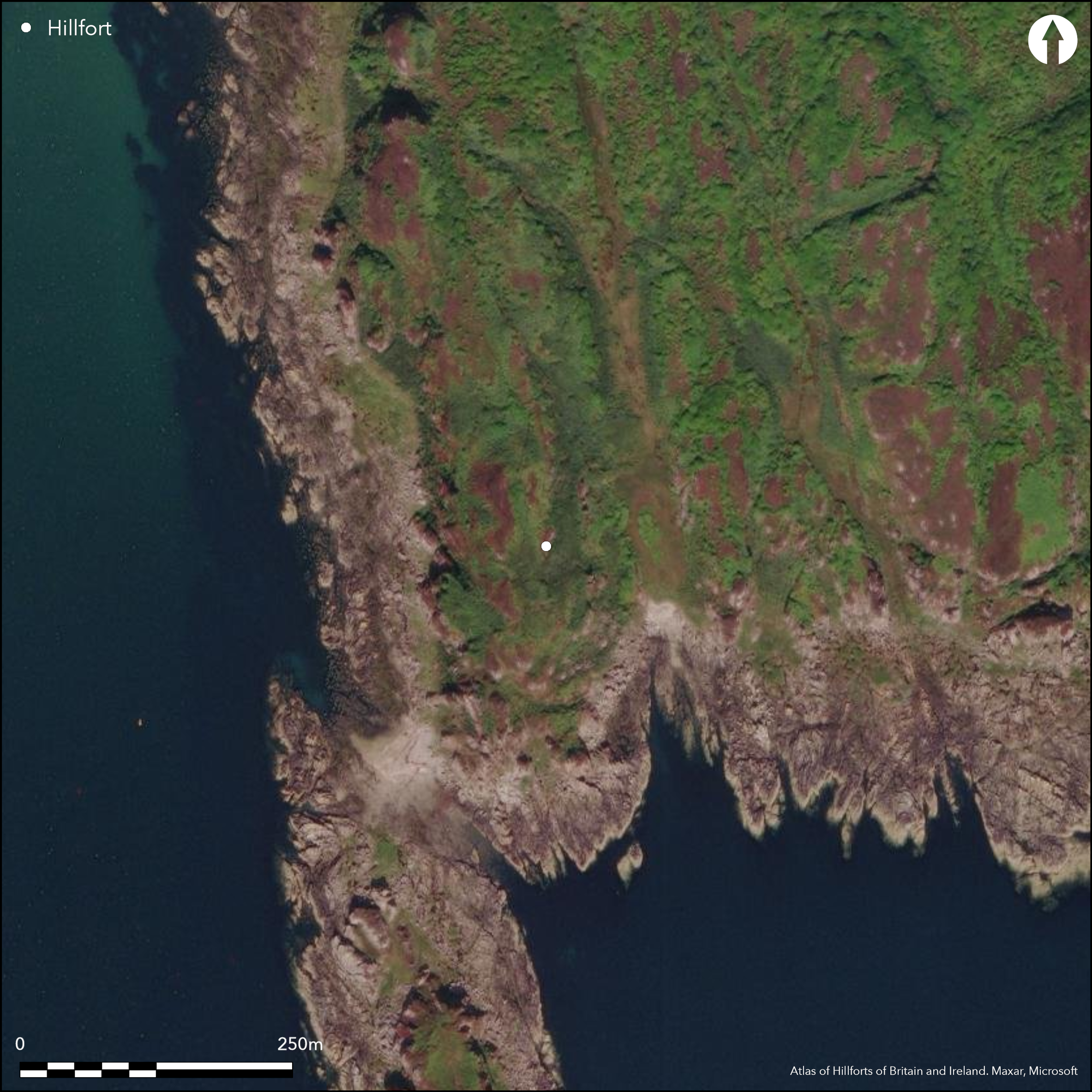
Satellite Imagery
Satellite Imagery
HER: The West of Scotland Archaeology Service No record found (None)
NMR: NR 83 NW 21 (350122)
SM: None
NGR: NR 8157 3681
X: 181576 Y: 636817 (OSGB36)
The remains of a fort are situated on the rugged tip of the spur of higher ground that projects southwards to the tidal isthmus separating the mainland from the islet that forms Carradale Point. The spur is rough and uneven, comprising a series of rocky spines, cliffs and terraces that trend south to terminate in the cliffs above the isthmus. Along the W flank the spur falls away sharply down to the E shore of Carradale Bay, while on the E the ground descends in two precipitous steps, the upper falling up to 7m, and the lower, with a natural wall of outcrop along its lip, dropping some 10m. The summit area of the spur is made up of three heather-clad spines of rock, and though the easternmost is little more than the lip of the cliff forming the upper step on this side, the westernmost provides a natural rampart running the length of the W side of the fort. Indeed, there is little sign that the thick wall that turns onto it at the N end of the fort, spanning the flat-bottomed gully on its E side, was ever carried southwards along its crest. This wall is one of two that can be seen barring access onto the summit area from the N, which is the only easy line of approach. It crosses first to the next spine of outcrop, and then across the terrace beyond it to the lip of the cliff forming the upper step on the E side; from the foot of this cliff it is drawn in an arc to butt onto the wall of outcrop forming the lower step. Here the outer face still stands 1m high in three courses, while on the summit, on the E side of the flat-bottomed gully, the face survives 0.7m high in two courses of massive boulders and is backed by a mound of rubble up to 3.5m in thickness by 1m in height. At the edge of the upper step on the E this wall has probably butted onto a raised lip of outcrop extending northwards along the edge of the cliff. The outer wall, which lies some 11m to the N but has been reduced to little more than two runs of outer facing-stones set in the leading edge of a stony terrace. Westwards this terrace appears to peter out on the increasingly steep slope, though there are possible traces of a wall at this level blocking a shallow gully that obliquely mounts the western flank of the spur on the NW. Eastwards it too probably extended from the foot of the upper step to the lip of the lower, its line marked by a large block set on edge in a low mound of rubble. The area on the summit enclosed by these defences measures at least 88m from N to S by 40m transversely, but may also include a lower terrace at the S end where the outcrops form another natural wall along the top of the cliff. A trackway winds down off the crest of the spur across this terrace and round the foot of the outcrops to drop obliquely down the slope south-westwards towards the shore. This certainly gives the impression of a well-used entrance way through a natural cleft in the rocks, though it might equally be a later route from the mainland to Carradale Point, leading via the shallow gully on the crest of the spur. The inner wall is also pierced by a gap in that flat-bottomed gully at the N end of the summit, and if a block protruding through the turf on its E side is a facing-stone then this is probably an original entrance; access from the N to the lower step on the E side of the fort is also provided by a ragged gap in the line of the inner wall.
Citizen Science: ✗
Reliability of Data: Confirmed
Reliability of Interpretation: Confirmed
X: -608543 Y: 7474457 (EPSG: 3857)
Longitude: -5.466637184229489 Latitude: 55.575945038883575 (EPSG:4326)
Country: Scotland
Current County or Unitary Authority: Argyll & Bute
Historic County: Argyll
Current Parish/Community/Council/Townland: Saddell And Skipness
None
| Extant | ✓ |
| Cropmark | ✗ |
| Likely Destroyed | ✗ |
None
| Woodland | ✗ |
| Commercial Forestry Plantation | ✗ |
| Parkland | ✗ |
| Pasture (Grazing) | ✓ |
| Arable | ✗ |
| Scrub/Bracken | ✗ |
| Bare Outcrop | ✗ |
| Heather/Moorland | ✓ |
| Heath | ✗ |
| Built-up | ✗ |
| Coastal Grassland | ✗ |
| Other | ✗ |
None
| Contour Fort | ✗ |
| Partial Contour Fort | ✗ |
| Promontory Fort | ✓ |
| Hillslope Fort | ✗ |
| Level Terrain Fort | ✗ |
| Marsh Fort | ✗ |
| Multiple Enclosure Fort | ✗ |
| Hilltop | ✗ |
| Coastal Promontory | ✓ |
| Inland Promontory | ✗ |
| Valley Bottom | ✗ |
| Knoll/Hillock/Outcrop | ✗ |
| Ridge | ✗ |
| Cliff/Plateau-edge/Scarp | ✗ |
| Hillslope | ✗ |
| Lowland | ✗ |
| Spur | ✗ |
Dominant Topographic Feature: None
| North | ✗ |
| Northeast | ✗ |
| East | ✗ |
| Southeast | ✗ |
| South | ✗ |
| Southwest | ✗ |
| West | ✗ |
| Northwest | ✗ |
| Level | ✓ |
Altitude: 30.0m
N/A
In the absence of excavation, there are neither stratified artefacts nor radiocarbon dates to provide a chronology for the defences.
Reliability: D - None
| Pre 1200BC | ✗ |
| 1200BC - 800BC | ✗ |
| 800BC - 400BC | ✗ |
| 400BC - AD50 | ✗ |
| AD50 - AD400 | ✗ |
| AD400 - AD 800 | ✗ |
| Post AD800 | ✗ |
| Unknown | ✓ |
| Pre Hillfort: | None |
| Post Hillfort: | None |
None
| Other (2009): | First located by fieldwork in 2009 by S Halliday |
| Other (2015): | Description in the field by S Halliday |
Featureless
None
| None | ✓ |
| Spring | ✗ |
| Stream | ✗ |
| Pool | ✗ |
| Flush | ✗ |
| Well | ✗ |
| Other | ✗ |
None
| No Known Features | ✓ |
| Round Stone Structures | ✗ |
| Rectangular Stone Structures | ✗ |
| Curvilinear Platforms | ✗ |
| Other Roundhouse Evidence | ✗ |
| Pits | ✗ |
| Quarry Hollows | ✗ |
| Other | ✗ |
None
| No Known Excavation | ✓ |
| Pits | ✗ |
| Postholes | ✗ |
| Roundhouses | ✗ |
| Rectangular Structures | ✗ |
| Roads/Tracks | ✗ |
| Quarry Hollows | ✗ |
| Other | ✗ |
| Nothing Found | ✗ |
None
| No Known Geophysics | ✓ |
| Pits | ✗ |
| Roundhouses | ✗ |
| Rectangular Structures | ✗ |
| Roads/Tracks | ✗ |
| Quarry Hollows | ✗ |
| Other | ✗ |
| Nothing Found | ✗ |
None
| No Known Finds | ✓ |
| Pottery | ✗ |
| Metal | ✗ |
| Metalworking | ✗ |
| Human Bones | ✗ |
| Animal Bones | ✗ |
| Lithics | ✗ |
| Environmental | ✗ |
| Other | ✗ |
NO APPARENT FEATURES
| APs Not Checked | ✗ |
| None | ✓ |
| Roundhouses | ✗ |
| Rectangular Structures | ✗ |
| Pits | ✗ |
| Postholes | ✗ |
| Roads/Tracks | ✗ |
| Other | ✗ |
See main summary
| 3: | Heavily robbed and an incomplete circuit |
| 2: | None |
Guard Chambers: ✗
Chevaux de Frise: ✗
| 1. Simple Gap (North): | Gap in a shallow gully giving access along the crest of the spur |
| 2. Simple Gap (North): | Ragged gap giving access to the lower terrace on the E |
| 3. Simple Gap (South): | Trackway mounts the slope |
Two walls across the northern approaches
| Area 1: | 0.5ha. |
| Total: | 0.5ha. |
Total Footprint Area: Noneha.
None
| ✗ | None |
| ✗ | None |
| NE Quadrant: | 2 |
| SE Quadrant: | 0 |
| SW Quadrant: | 0 |
| NW Quadrant: | 2 |
| Total: | 2 |
| Partial Univallate | ✗ |
| Univallate | ✗ |
| Partial Bivallate | ✓ |
| Bivallate | ✗ |
| Partial Multivallate | ✗ |
| Multivallate | ✗ |
| Unknown | ✗ |
| Partial Univallate | ✗ |
| Univallate | ✗ |
| Partial Bivallate | ✗ |
| Bivallate | ✗ |
| Partial Multivallate | ✗ |
| Multivallate | ✗ |
None
| None | ✗ |
| Earthen Bank | ✗ |
| Stone Wall | ✓ |
| Rubble | ✗ |
| Wall-walk | ✗ |
| Evidence of Timber | ✗ |
| Vitrification | ✗ |
| Other Burning | ✗ |
| Palisade | ✗ |
| Counter Scarp Bank | ✗ |
| Berm | ✗ |
| Unfinished | ✗ |
| Other | ✗ |
None
| None | ✗ |
| Earthen Bank | ✗ |
| Stone Wall | ✗ |
| Murus Duplex | ✗ |
| Timber-framed | ✗ |
| Timber-laced | ✗ |
| Vitrification | ✗ |
| Other Burning | ✗ |
| Palisade | ✗ |
| Counter Scarp Bank | ✗ |
| Berm | ✗ |
| Unfinished | ✗ |
| No Known Excavation | ✓ |
| Other | ✗ |
| ✗ | None |
| ✗ | None |
Number of Ditches: None
| ✗ | None |
No related records
Atlas of Hillforts:
Wikidata:
This work is licensed under CC BY-SA 4.0

 and should be cited as:
Lock, Gary and Ralston, Ian. 2024. Atlas of Hillforts of Britain and Ireland. Available at: https://hillforts.arch.ox.ac.uk
Document Version 1.1