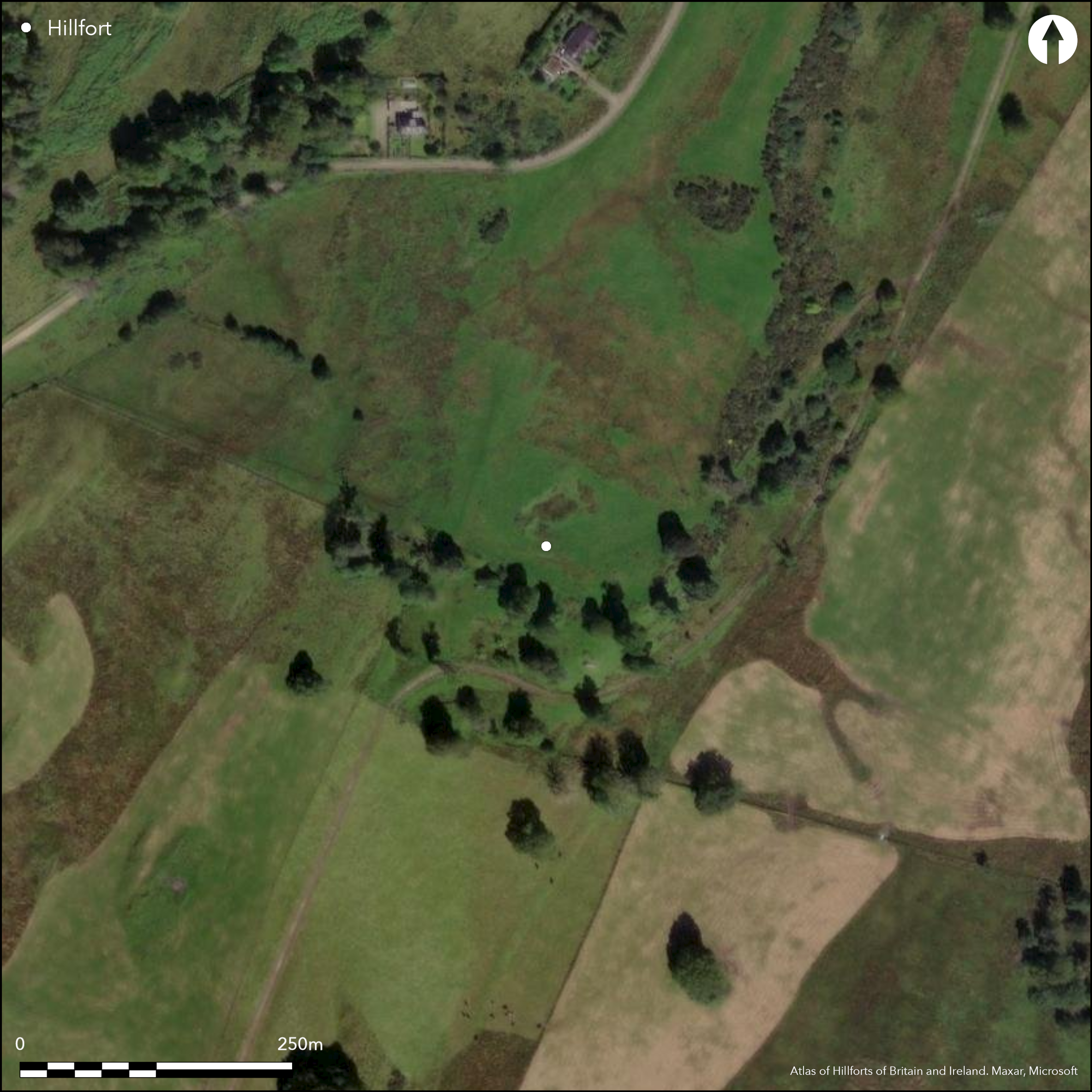
Satellite Imagery
Satellite Imagery
HER: The West of Scotland Archaeology Service 4041 (None)
NMR: NR 89 NW 11 (39451)
SM: None
NGR: NR 8203 9719
X: 182030 Y: 697190 (OSGB36)
Excavation in advance of gravel extraction 1960-62 revealed evidence of a ditched enclosure apparently cutting off a promontory at the southern end of a fluvio-glacial terrace. Originally conceived by the excavator as a double-ditched earthwork, more recent analysis prior to publication (Abernethy 2009) suggests that only one ditch was ever open at any one time, but that it had been recut on at least four occasions and on slightly different lines; in its separate phases it varied from 3m to 4.5m in breadth by 1.5m in depth below the level of the subsoil. The ditch was traced for some 70m in an arc extending from the E margin of the promontory round towards the W and may have cut off an area measuring up to 80m across (0.5ha), within which there was evidence of at least two round-houses and several large cooking pits, in addition to evidence of later use for a cemetery and for occupation in the early medieval period.
Citizen Science: ✗
Reliability of Data: Confirmed
Reliability of Interpretation: Confirmed
X: -613140 Y: 7581863 (EPSG: 3857)
Longitude: -5.507934767134674 Latitude: 56.1176020578462 (EPSG:4326)
Country: Scotland
Current County or Unitary Authority: Argyll & Bute
Historic County: Argyll
Current Parish/Community/Council/Townland: Kilmartin
Removed by gravel quarrying
| Extant | ✗ |
| Cropmark | ✗ |
| Likely Destroyed | ✓ |
None
| Woodland | ✗ |
| Commercial Forestry Plantation | ✗ |
| Parkland | ✗ |
| Pasture (Grazing) | ✓ |
| Arable | ✓ |
| Scrub/Bracken | ✗ |
| Bare Outcrop | ✗ |
| Heather/Moorland | ✗ |
| Heath | ✗ |
| Built-up | ✗ |
| Coastal Grassland | ✗ |
| Other | ✗ |
None
| Contour Fort | ✗ |
| Partial Contour Fort | ✗ |
| Promontory Fort | ✓ |
| Hillslope Fort | ✗ |
| Level Terrain Fort | ✓ |
| Marsh Fort | ✗ |
| Multiple Enclosure Fort | ✗ |
| Hilltop | ✗ |
| Coastal Promontory | ✗ |
| Inland Promontory | ✓ |
| Valley Bottom | ✗ |
| Knoll/Hillock/Outcrop | ✗ |
| Ridge | ✗ |
| Cliff/Plateau-edge/Scarp | ✓ |
| Hillslope | ✗ |
| Lowland | ✗ |
| Spur | ✗ |
Dominant Topographic Feature: None
| North | ✗ |
| Northeast | ✗ |
| East | ✗ |
| Southeast | ✗ |
| South | ✗ |
| Southwest | ✗ |
| West | ✗ |
| Northwest | ✗ |
| Level | ✓ |
Altitude: 20.0m
N/A
Six dates, five of which form a tight cluster in the Late Iron Age. A mould fragment and two glass beads, a carved motif piece, fragments of three crucibles, and fifty-six iron objects including knives and punches, fittings and nails, and a double loop pin, are probably of early medieval date.
Reliability: B - Medium
| Pre 1200BC | ✗ |
| 1200BC - 800BC | ✗ |
| 800BC - 400BC | ✗ |
| 400BC - AD50 | ✓ |
| AD50 - AD400 | ✗ |
| AD400 - AD 800 | ✓ |
| Post AD800 | ✓ |
| Unknown | ✗ |
| Pre Hillfort: | None |
| Post Hillfort: | None |
| Artefactual: | Material dating to the early medieval period from the later occupation |
| C14: | Six dates |
Both Bronze Age and long cists had previously been found on the site (see RCAHMS 1988, 80-3, no.104).
| 1st Identified Written Reference (1959): | Discovered by Eric Cregeen |
| Excavation (1960): | Cregeen 1960; Abernethy 2009 |
| Excavation (1961): | Cregeen 1961; Abernethy 2009 |
| Excavation (1962): | Cregeen 1962; Abernethy 2009 |
Cooking pits, two post-rings, post-holes, hearths and pits and paving
None
| None | ✓ |
| Spring | ✗ |
| Stream | ✗ |
| Pool | ✗ |
| Flush | ✗ |
| Well | ✗ |
| Other | ✗ |
None
| No Known Features | ✓ |
| Round Stone Structures | ✗ |
| Rectangular Stone Structures | ✗ |
| Curvilinear Platforms | ✗ |
| Other Roundhouse Evidence | ✗ |
| Pits | ✗ |
| Quarry Hollows | ✗ |
| Other | ✗ |
Hearths
| No Known Excavation | ✗ |
| Pits | ✓ |
| Postholes | ✓ |
| Roundhouses | ✓ |
| Rectangular Structures | ✗ |
| Roads/Tracks | ✗ |
| Quarry Hollows | ✗ |
| Other | ✓ |
| Nothing Found | ✗ |
None
| No Known Geophysics | ✓ |
| Pits | ✗ |
| Roundhouses | ✗ |
| Rectangular Structures | ✗ |
| Roads/Tracks | ✗ |
| Quarry Hollows | ✗ |
| Other | ✗ |
| Nothing Found | ✗ |
A small number of coarse stone tools, including a rotary quern upper stone, and part of a shale bracelet. Earlier lithics. Also a mould fragment and two glass beads of early medieval date, a carved motif piece and fragments of three crucibles, and fifty-six iron objects including knives and punches, fittings and nails, and a double loop pin, all probably of similar date. Twenty sherds of medieval pottery.
| No Known Finds | ✗ |
| Pottery | ✗ |
| Metal | ✓ |
| Metalworking | ✗ |
| Human Bones | ✗ |
| Animal Bones | ✗ |
| Lithics | ✓ |
| Environmental | ✗ |
| Other | ✗ |
Destroyed
| APs Not Checked | ✓ |
| None | ✗ |
| Roundhouses | ✗ |
| Rectangular Structures | ✗ |
| Pits | ✗ |
| Postholes | ✗ |
| Roads/Tracks | ✗ |
| Other | ✗ |
None known
| 0: | Ploughed flat |
| 2: | None recorded |
Guard Chambers: ✗
Chevaux de Frise: ✗
single ditch, presumably with upcast banks, traces of which may have survived in the 1930s
| Area 1: | 0.5ha. |
| Total: | 0.5ha. |
Total Footprint Area: Noneha.
None
| ✗ | None |
| ✗ | None |
| NE Quadrant: | 1 |
| SE Quadrant: | 0 |
| SW Quadrant: | 0 |
| NW Quadrant: | 1 |
| Total: | 1 |
| Partial Univallate | ✓ |
| Univallate | ✗ |
| Partial Bivallate | ✗ |
| Bivallate | ✗ |
| Partial Multivallate | ✗ |
| Multivallate | ✗ |
| Unknown | ✗ |
| Partial Univallate | ✗ |
| Univallate | ✗ |
| Partial Bivallate | ✗ |
| Bivallate | ✗ |
| Partial Multivallate | ✗ |
| Multivallate | ✗ |
None
| None | ✓ |
| Earthen Bank | ✗ |
| Stone Wall | ✗ |
| Rubble | ✗ |
| Wall-walk | ✗ |
| Evidence of Timber | ✗ |
| Vitrification | ✗ |
| Other Burning | ✗ |
| Palisade | ✗ |
| Counter Scarp Bank | ✗ |
| Berm | ✗ |
| Unfinished | ✗ |
| Other | ✗ |
Ditches
| None | ✓ |
| Earthen Bank | ✗ |
| Stone Wall | ✗ |
| Murus Duplex | ✗ |
| Timber-framed | ✗ |
| Timber-laced | ✗ |
| Vitrification | ✗ |
| Other Burning | ✗ |
| Palisade | ✗ |
| Counter Scarp Bank | ✗ |
| Berm | ✗ |
| Unfinished | ✗ |
| No Known Excavation | ✗ |
| Other | ✓ |
| ✗ | None |
| ✓ | With multiple recuts |
Number of Ditches: 1
| ✗ | None |
Abernethy, D 2009 Bruach An Druimein, Poltalloch, Argyll: excavations directed by the late Eric Cregeen, 1960-62. Scottish Archaeological Internet Reports 27
Cregeen, E R (1960) 'Poltalloch'. Disc Exc Scot 1960, 10-11
Cregeen, E R (1962) 'Poltalloch'. Disc Exc Scot 1962, 9-10
Cregeen and Cregeen, E R and S (1961) 'Poltalloch'. Disc Exc Scot 1961, 10-11
RCAHMS (1988) The Royal Commission on the Ancient and Historical Monuments of Scotland. Argyll: an inventory of the monuments volume 6: Mid-Argyll and Cowal, prehistoric and early historic monuments. HMSO: Edinburgh
Atlas of Hillforts:
Wikidata:
This work is licensed under CC BY-SA 4.0

 and should be cited as:
Lock, Gary and Ralston, Ian. 2024. Atlas of Hillforts of Britain and Ireland. Available at: https://hillforts.arch.ox.ac.uk
Document Version 1.1